• Home
  • FP
  • UP4001-3
  • Urban Transformation Of Amberi Through Local Planning

Tanya Kaushik

UP4001-3

Urban Transformation Of Amberi Through Local Planning

The Amberi Land Pooling and Urban Development Project in Udaipur envisions transforming the ecologically sensitive area into a sustainable, tourism-driven growth center. Covering 3.5 sq. km near NH-27 and NH-58, the project integrates eco-tourism, mixed-use development, and ecological preservation. Key proposals include consolidating fragmented lands under the Rajasthan Land Pooling Scheme, a mechanism ensuring equitable land reconstitution for comprehensive planning. The plan emphasizes blue-green networks, contour-aligned roads, and compact urban design inspired by global best practices. It harmonizes environmental sensitivity with economic growth, creating a vibrant hub for tourism, hospitality, and sustainable urban expansion while enhancing connectivity and livability.
Report Content

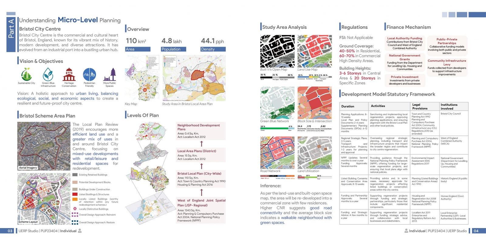
It covers understanding micro-level planning mechanism for Bristol, a city in the UK. The Local Plan Review (2019) encourages more efficient land use and a greater mix of uses in and around Bristol City Centre. The hierarchy of plans illustrates planning scales from the regional level (West of England Joint Spatial Plan) for strategic policy to the city-wide (Bristol Local Plan), district/local area plans, and finally neighborhood development plans, each addressing progressively smaller areas with specific legislative frameworks.

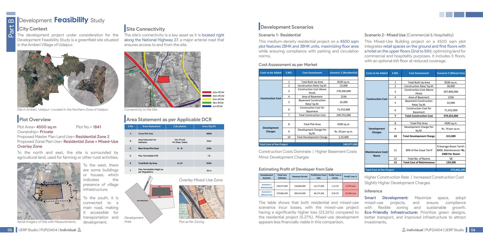
As a part of the studio exercises, a feasibility study was done for a 4500 sq. m plot in Amberi, Udaipur, analyzing development scenarios for residential and mixed-use (commercial and hospitality) projects. It evaluates costs, profits, and site context, showing that both scenarios incur losses, with residential being slightly more viable due to lower construction costs.

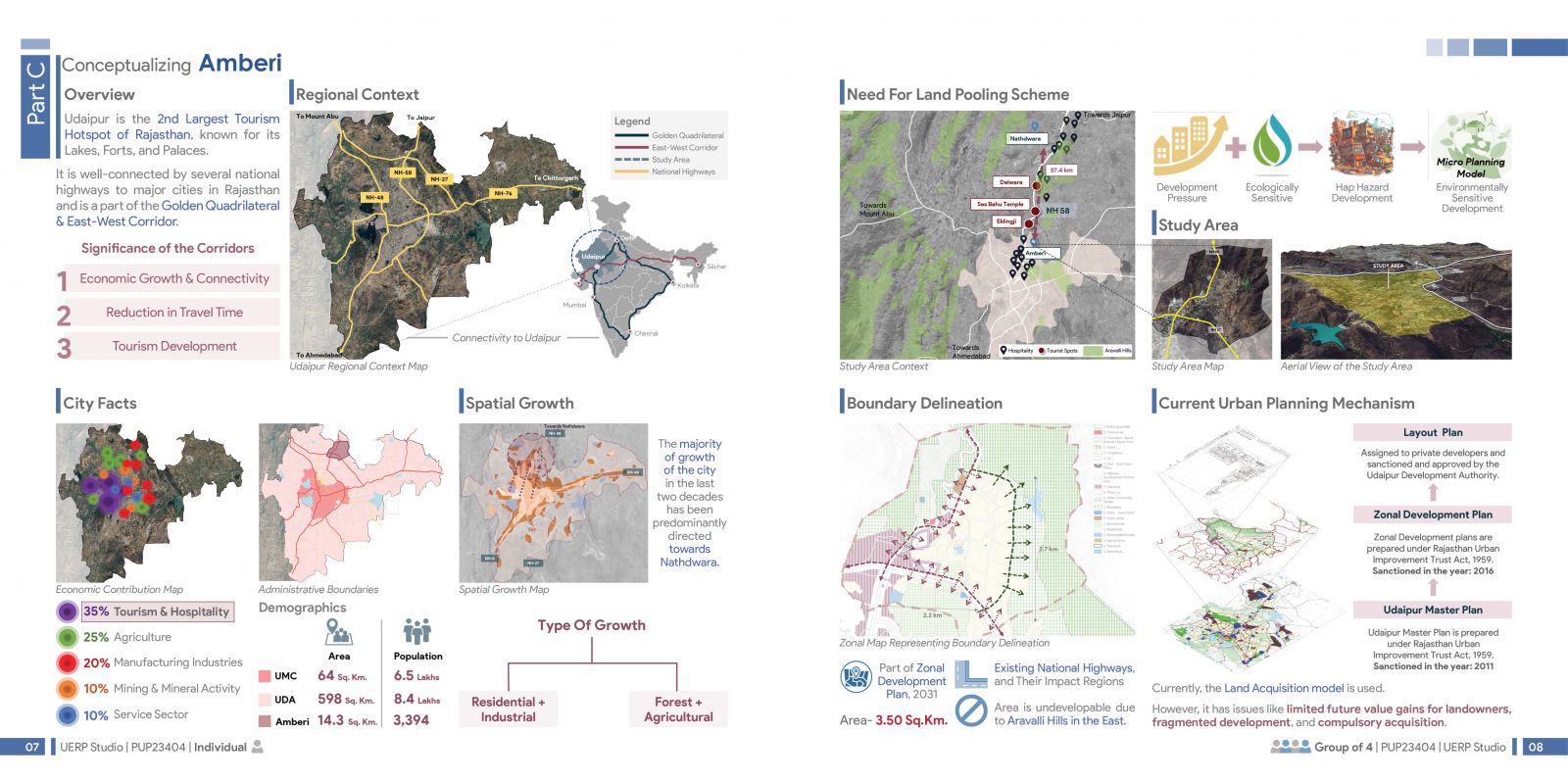
The data illustrates the planning and development strategy for Amberi, near Udaipur, emphasizing its role as a key tourism hub in Rajasthan. It highlights regional connectivity, spatial growth, land pooling needs, and urban planning mechanisms within the context of sustainable development and economic expansion.

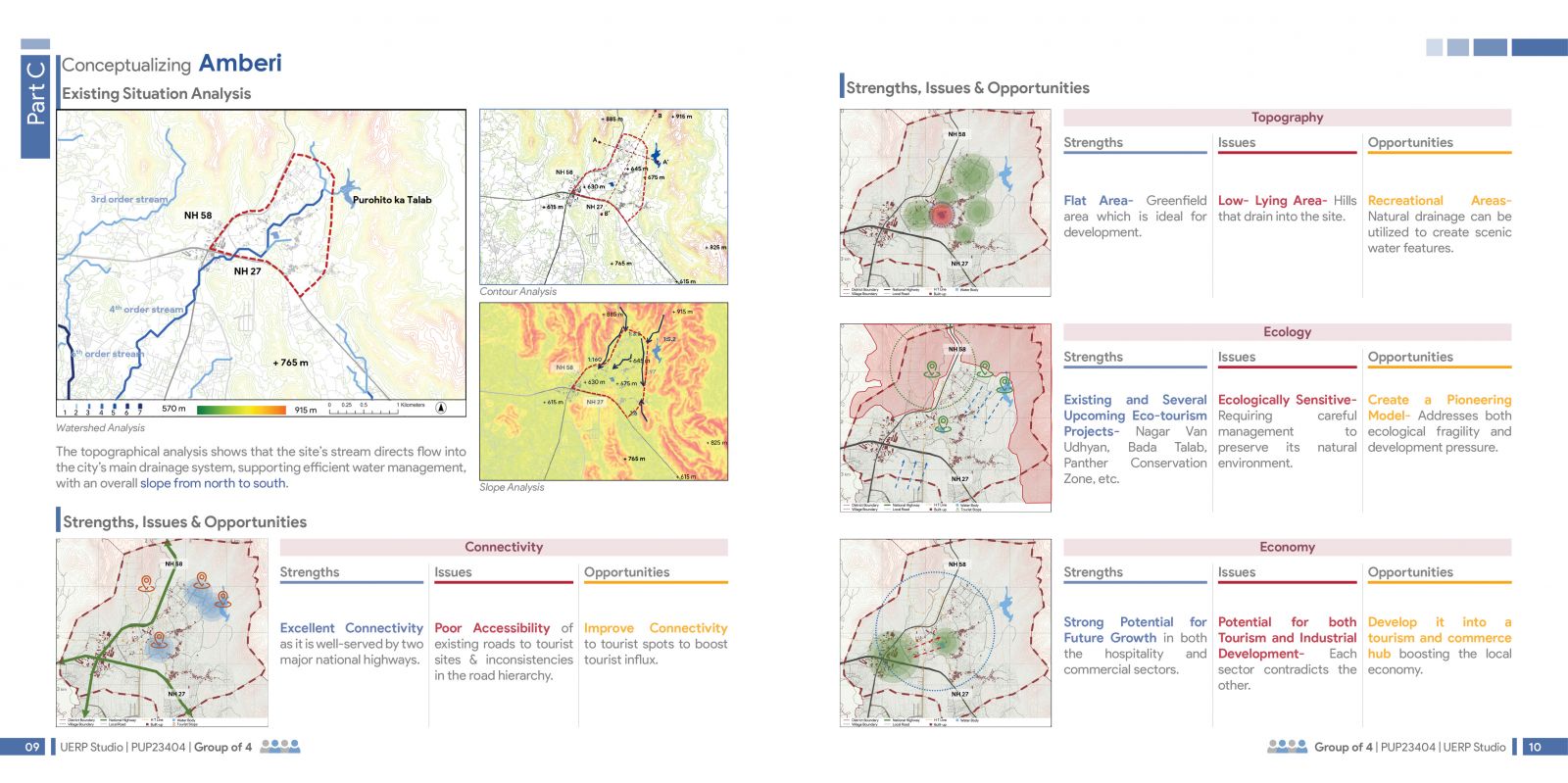
The analysis focuses on Amberi's watershed, topography, ecology, and connectivity, identifying strengths like eco-tourism potential and excellent infrastructure. It highlights issues such as ecological sensitivity and poor accessibility, while proposing opportunities for sustainable tourism and development.

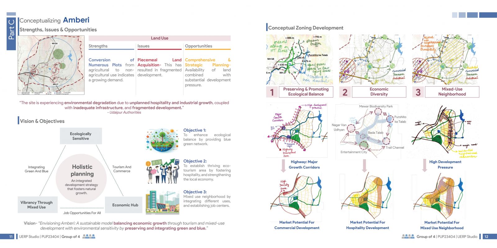
The plan envisions Amberi as a sustainable development model, addressing unplanned growth through holistic zoning strategies. It aims to balance ecological sensitivity, economic diversity, and vibrant mixed-use neighborhoods while fostering tourism and local commerce.

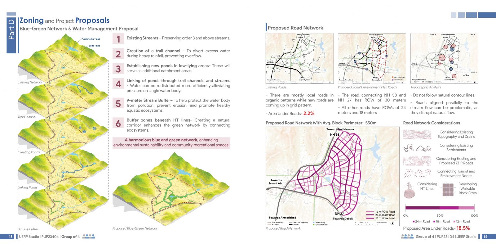
The proposal emphasizes a Blue-Green Network integrating water management and road planning. It focuses on preserving natural streams, creating buffer zones, and linking ponds, alongside a road network that respects topography and sustainable urban development.

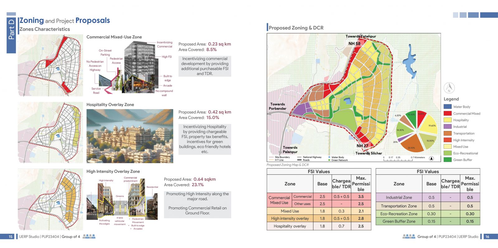
The zoning proposal delineates Commercial Mixed-Use, Hospitality, and High-Intensity Overlay Zones to incentivize sustainable development. It promotes density, mixed-use spaces, and hospitality through tailored FSI values and development control regulations (DCR).

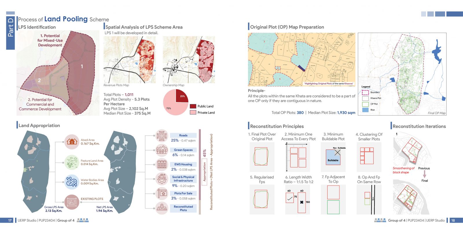
The Land Pooling Scheme identifies areas for mixed-use and commercial development, integrating public and private land ownership. It follows reconstitution principles to ensure equitable plot allocation, access, and optimal use of land for infrastructure, green spaces, and EWS housing.

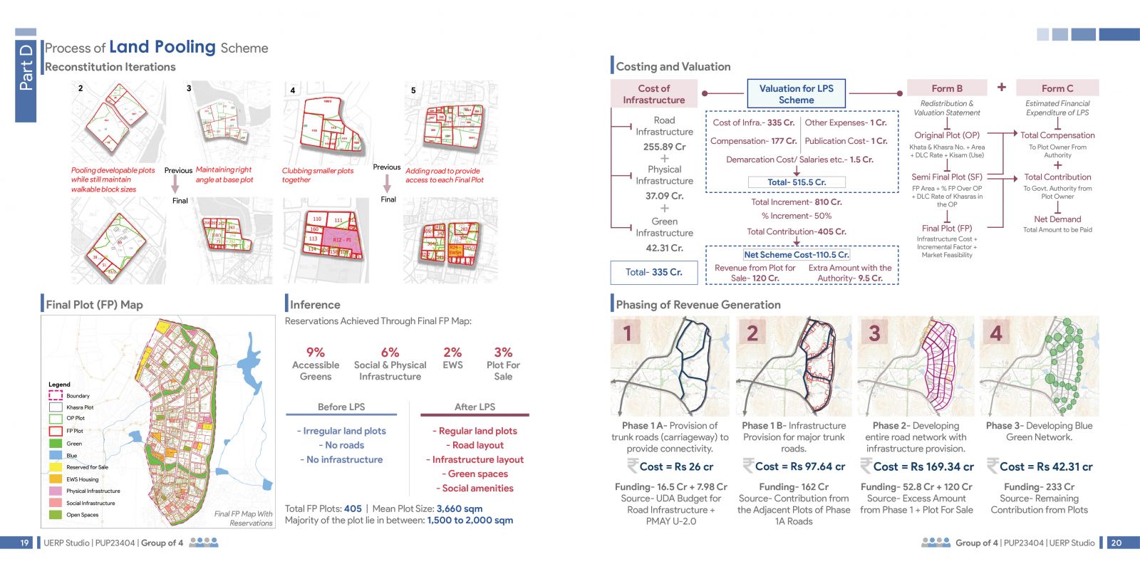
The data outlines the process of a Land Pooling Scheme, detailing plot reconstitution, cost estimation, revenue generation, and phasing of infrastructure development. It highlights improvements in land use, road connectivity, and green infrastructure, emphasizing financial feasibility and urban planning outcomes.

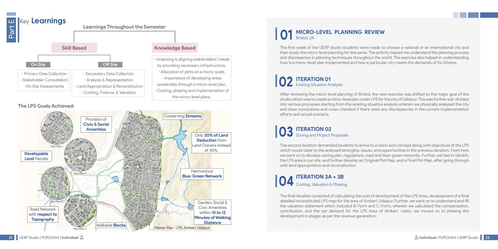
The data highlights semester learnings on micro-level planning through a Land Pooling Scheme, emphasizing skill-based activities like data collection and valuation, and knowledge-based insights into sustainable development and stakeholder alignment. Key outcomes include creating a harmonious blue-green network, conserving streams, and achieving accessible civic amenities with minimal land deduction.