Your browser is out-of-date!
For a richer surfing experience on our website, please update your browser. Update my browser now!
For a richer surfing experience on our website, please update your browser. Update my browser now!
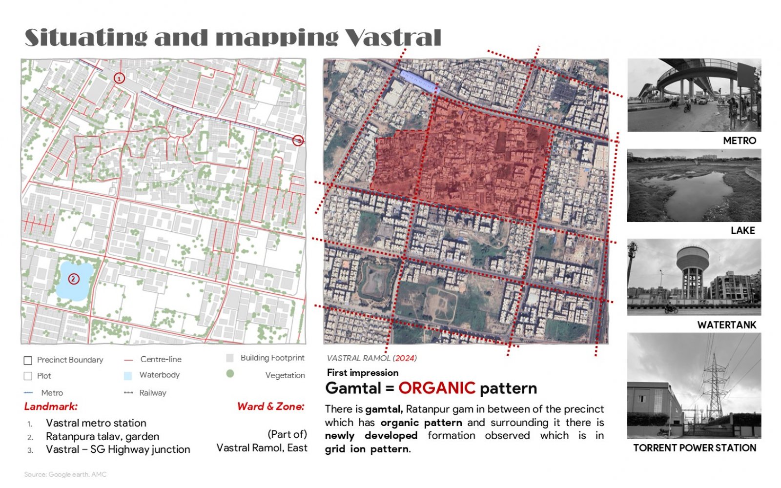
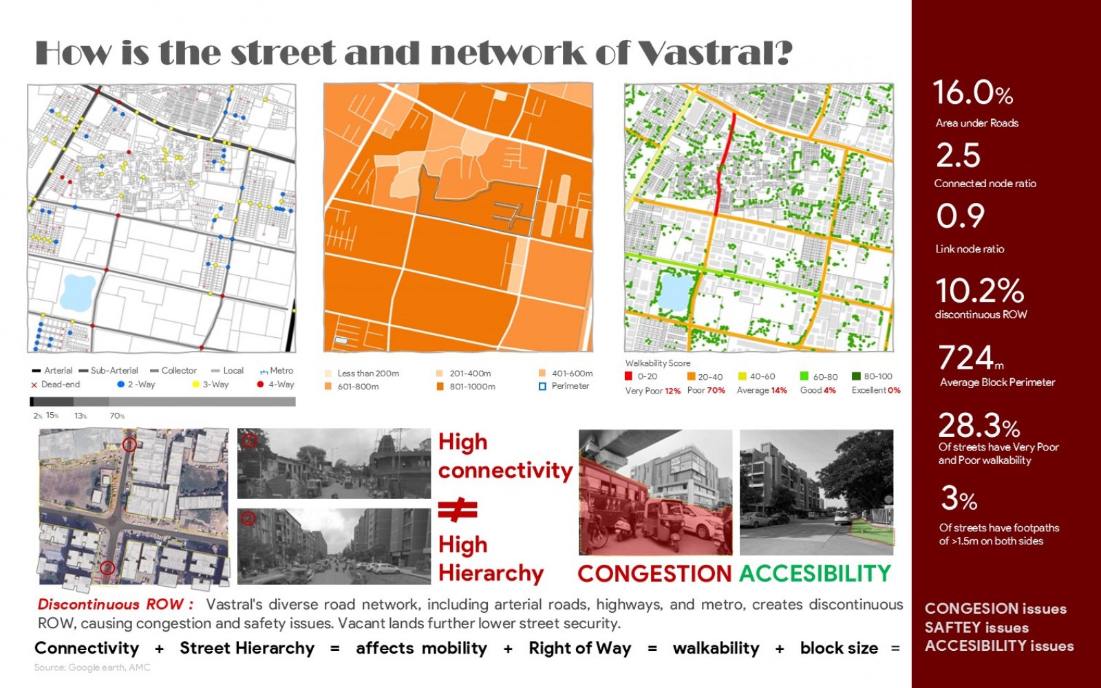
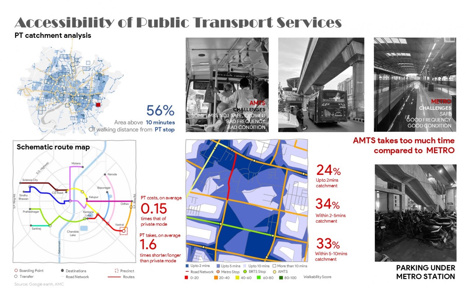
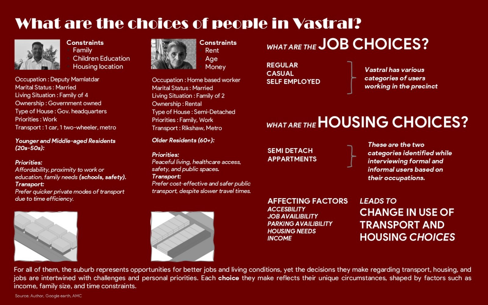
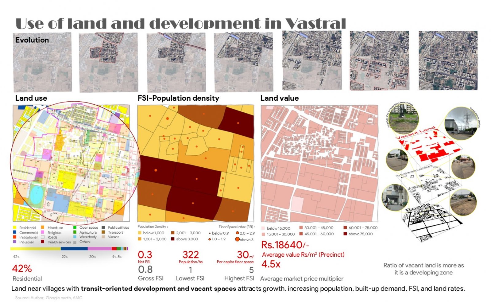
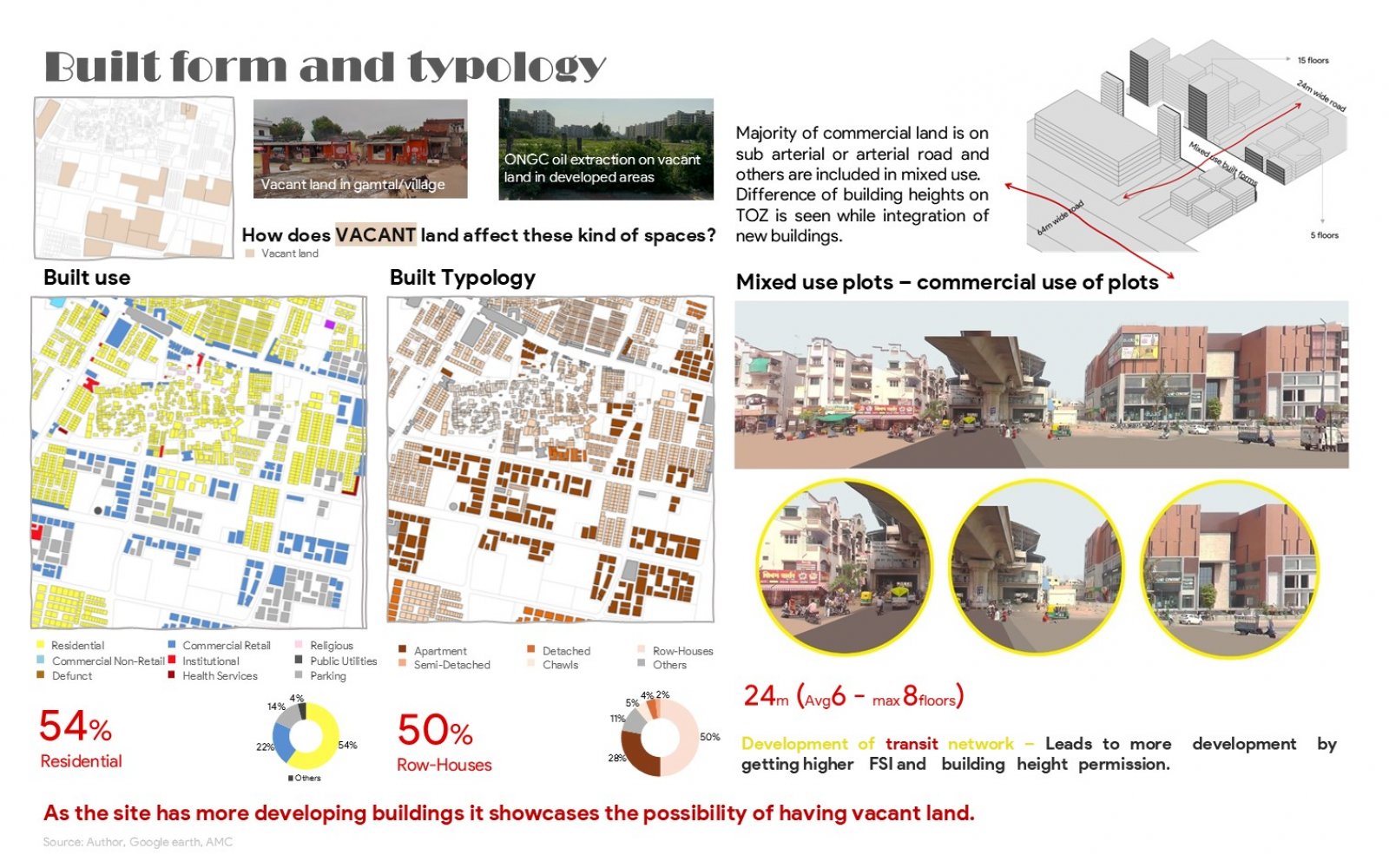
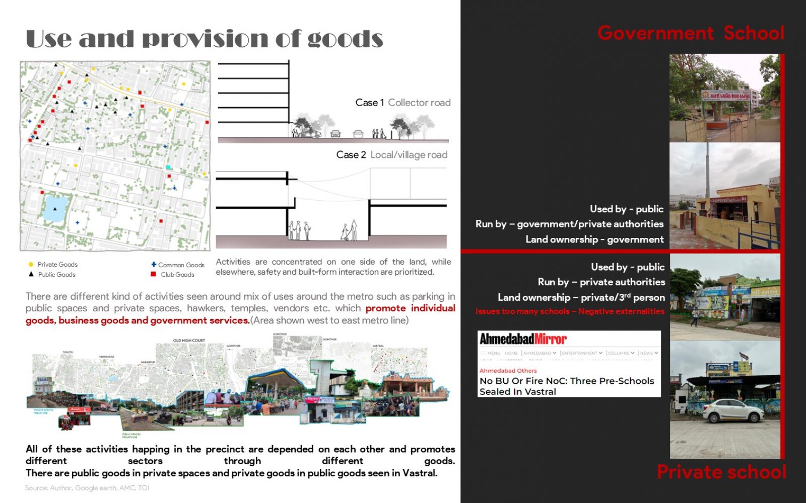
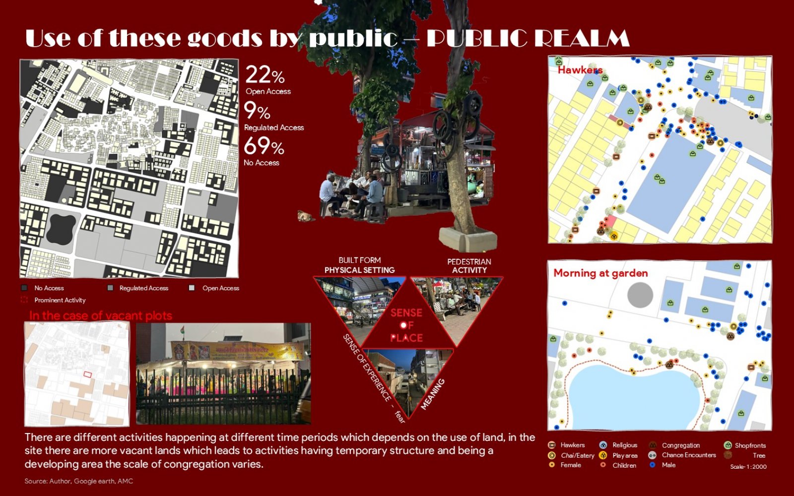
Vastral, a developing area, is characterized by a mix of arterial roads, the SP Highway, local gamtal roads, and metro connectivity, which boosts mobility but leads to congestion and safety concerns due to discontinuous rights-of-way. The area’s activities, influenced by varying land uses, promote interdependent sectors, with public goods in private spaces and vice versa. Commercial land is primarily along sub-arterial and arterial roads, with mixed-use zones elsewhere. The integration of new buildings in the TOD zone results in varying building heights. Vacant land near villages, combined with transit-oriented development, attracts growth, increasing population, built-up demand, FSI, and land rates.
