Your browser is out-of-date!
For a richer surfing experience on our website, please update your browser. Update my browser now!
For a richer surfing experience on our website, please update your browser. Update my browser now!
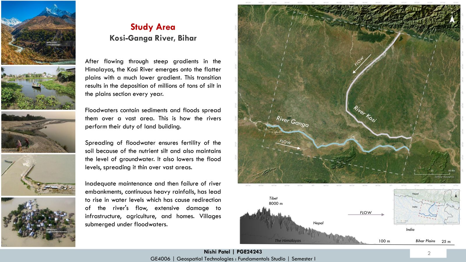
"Where Kosi meets Ganga"
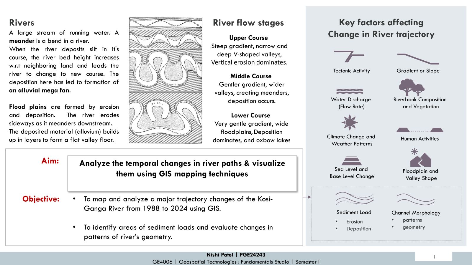
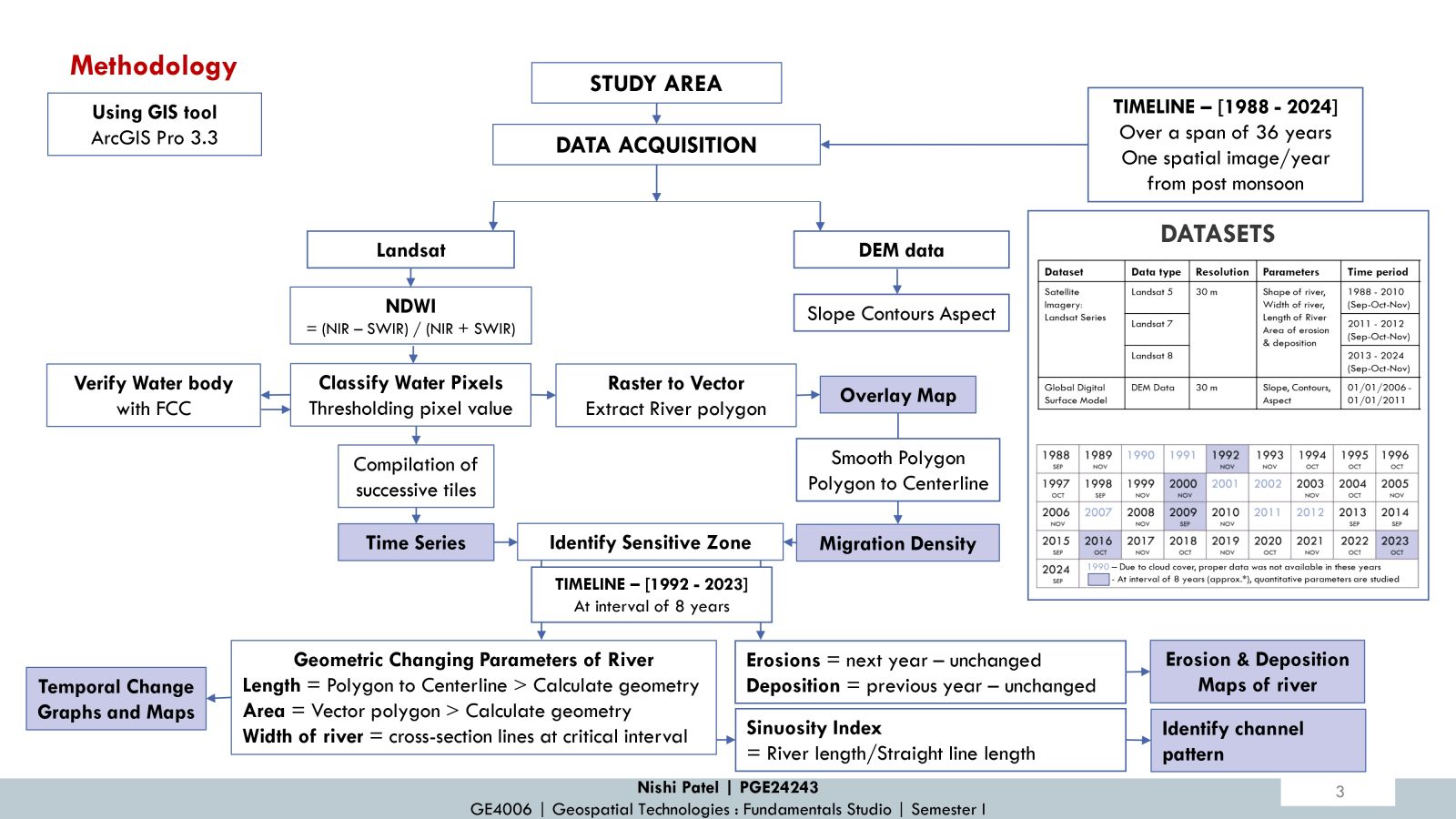
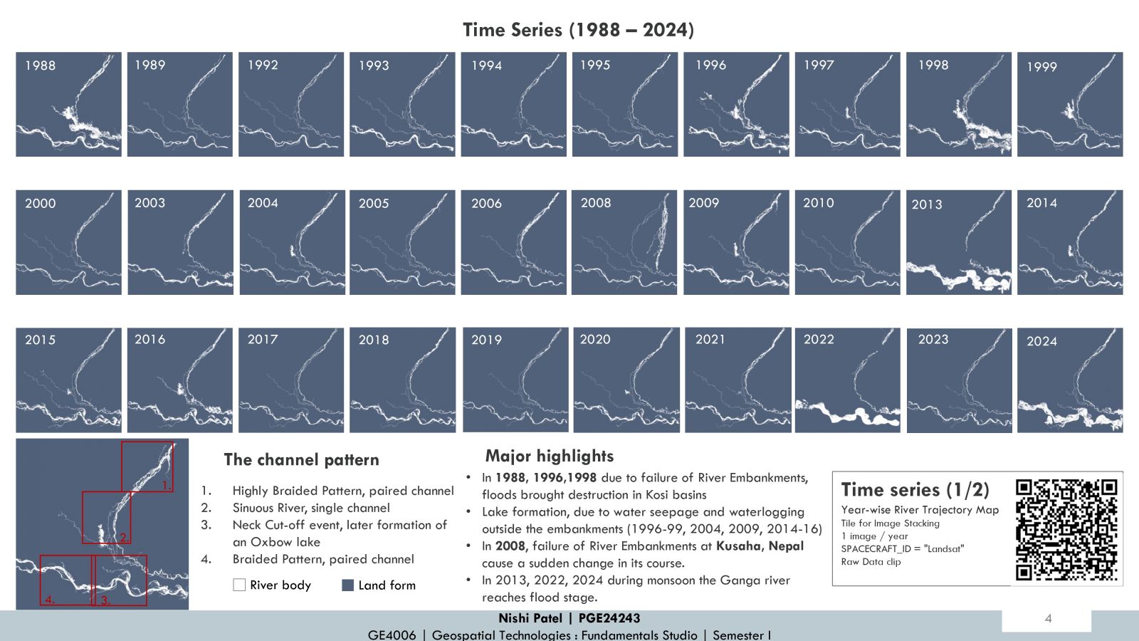
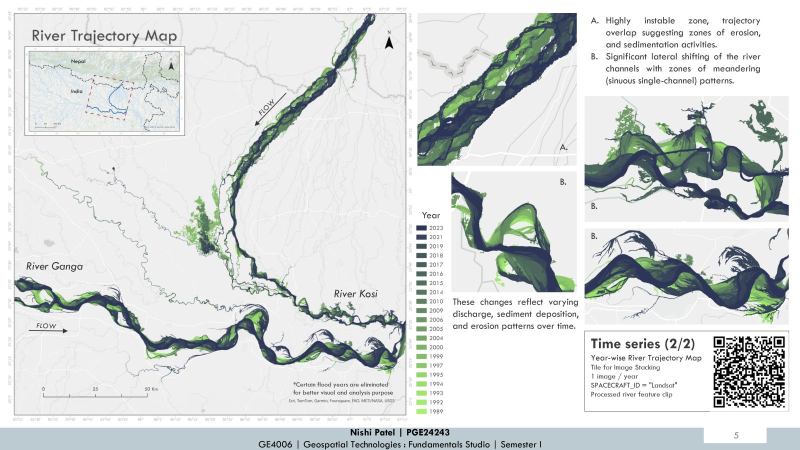
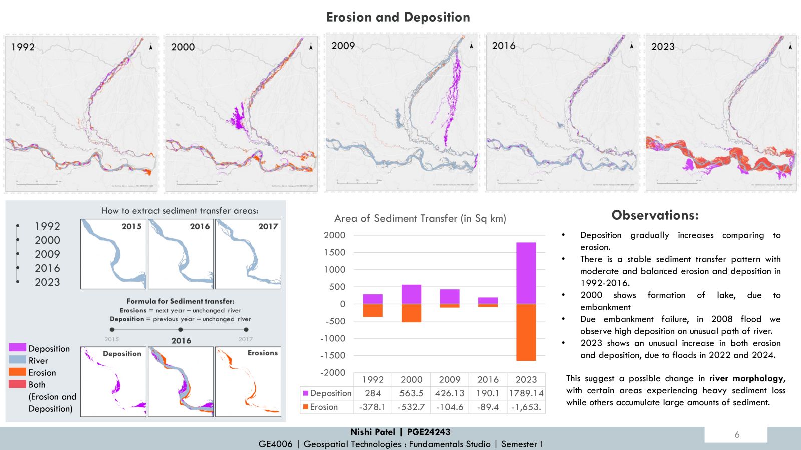
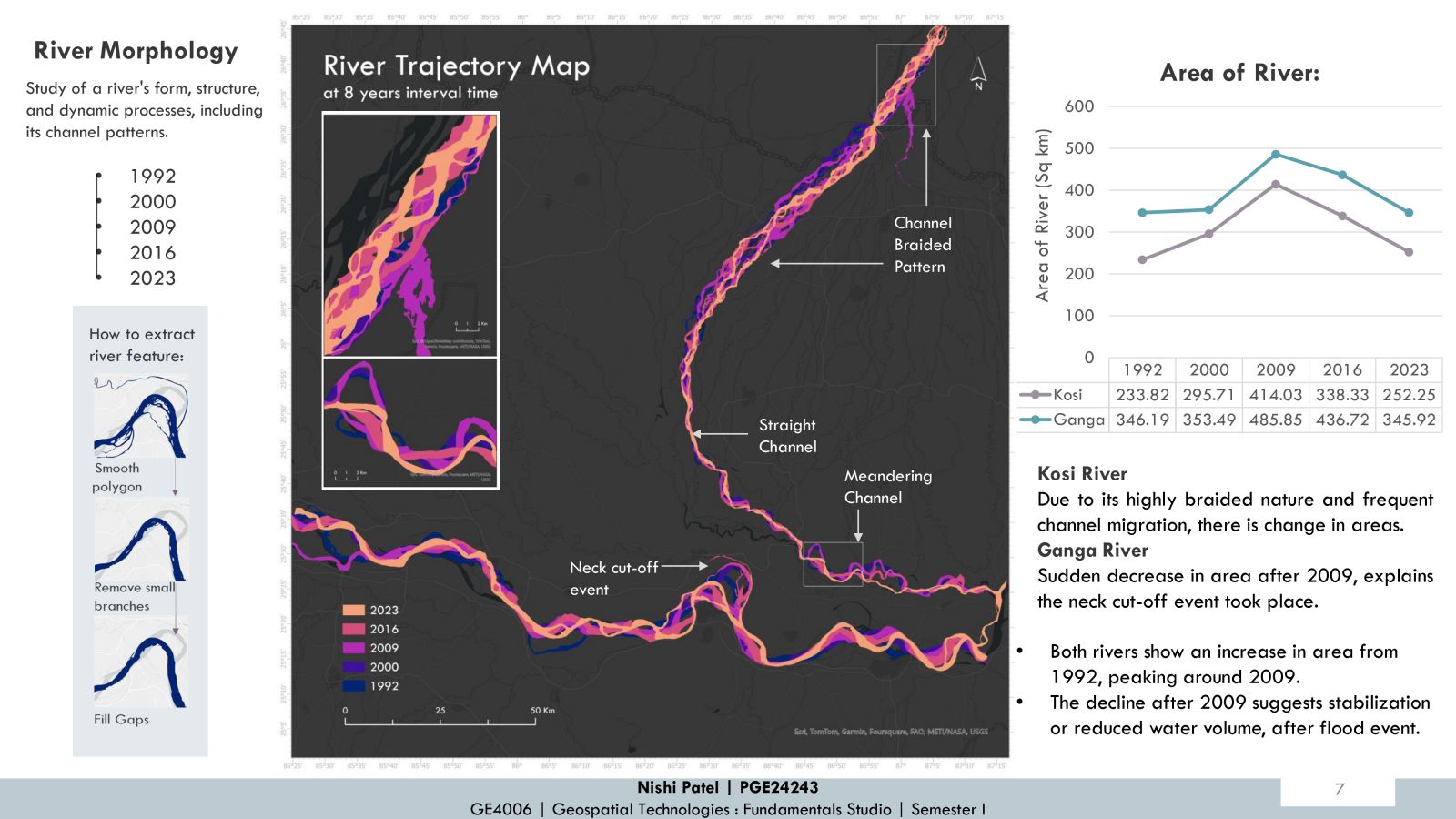
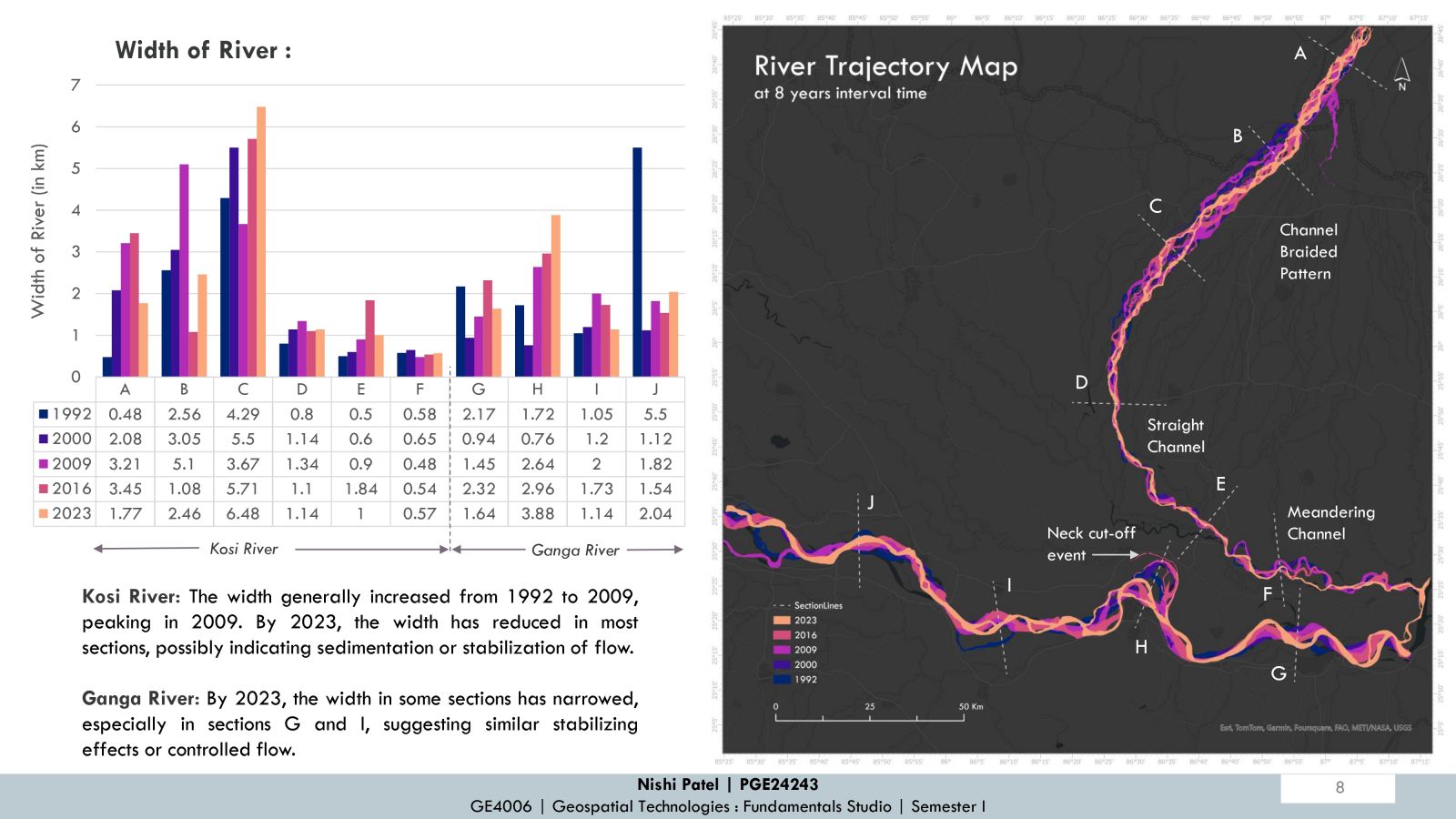
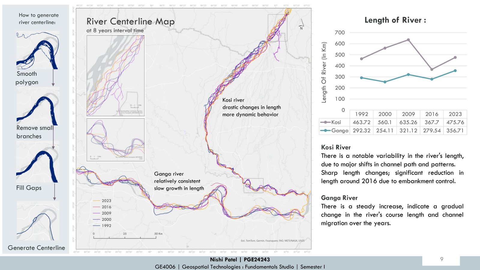
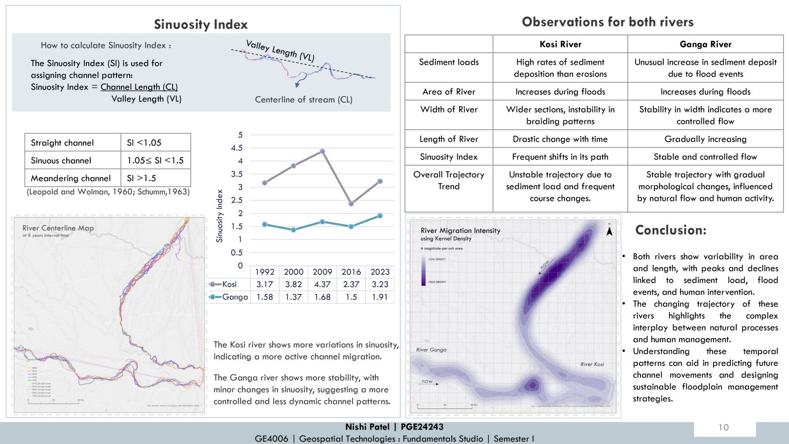
This project investigates the dynamic changes in the morphology and trajectory of the Kosi and Ganga Rivers over time. By analyzing satellite imagery, time-series maps, and key metrics like the sinuosity index and width variations, river centerlines and area of the river. The study highlights significant alterations in river behavior due to natural and anthropogenic influences. Observations reveal channel shifting, neck cut-offs, oxbow lake formation, and braided patterns. These findings emphasize the impact of flood events, sediment deposition, and human interventions.
