Your browser is out-of-date!
For a richer surfing experience on our website, please update your browser. Update my browser now!
For a richer surfing experience on our website, please update your browser. Update my browser now!
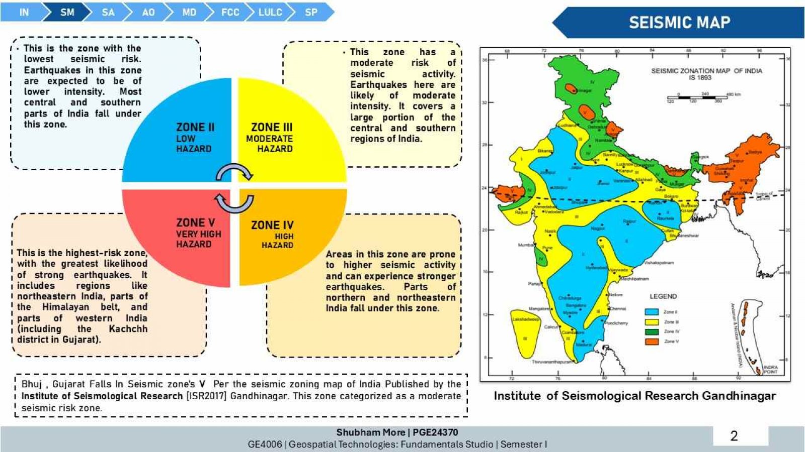
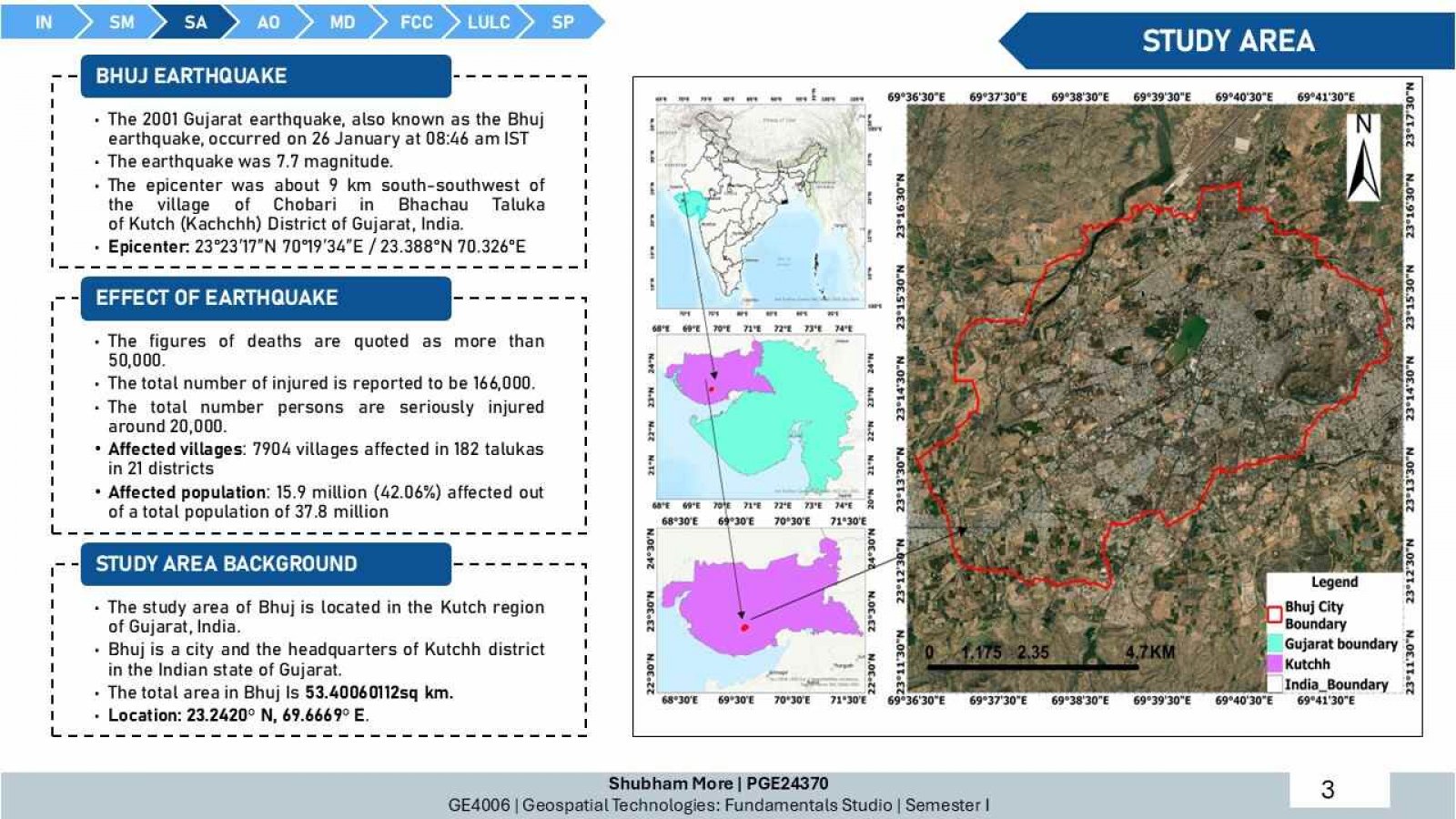
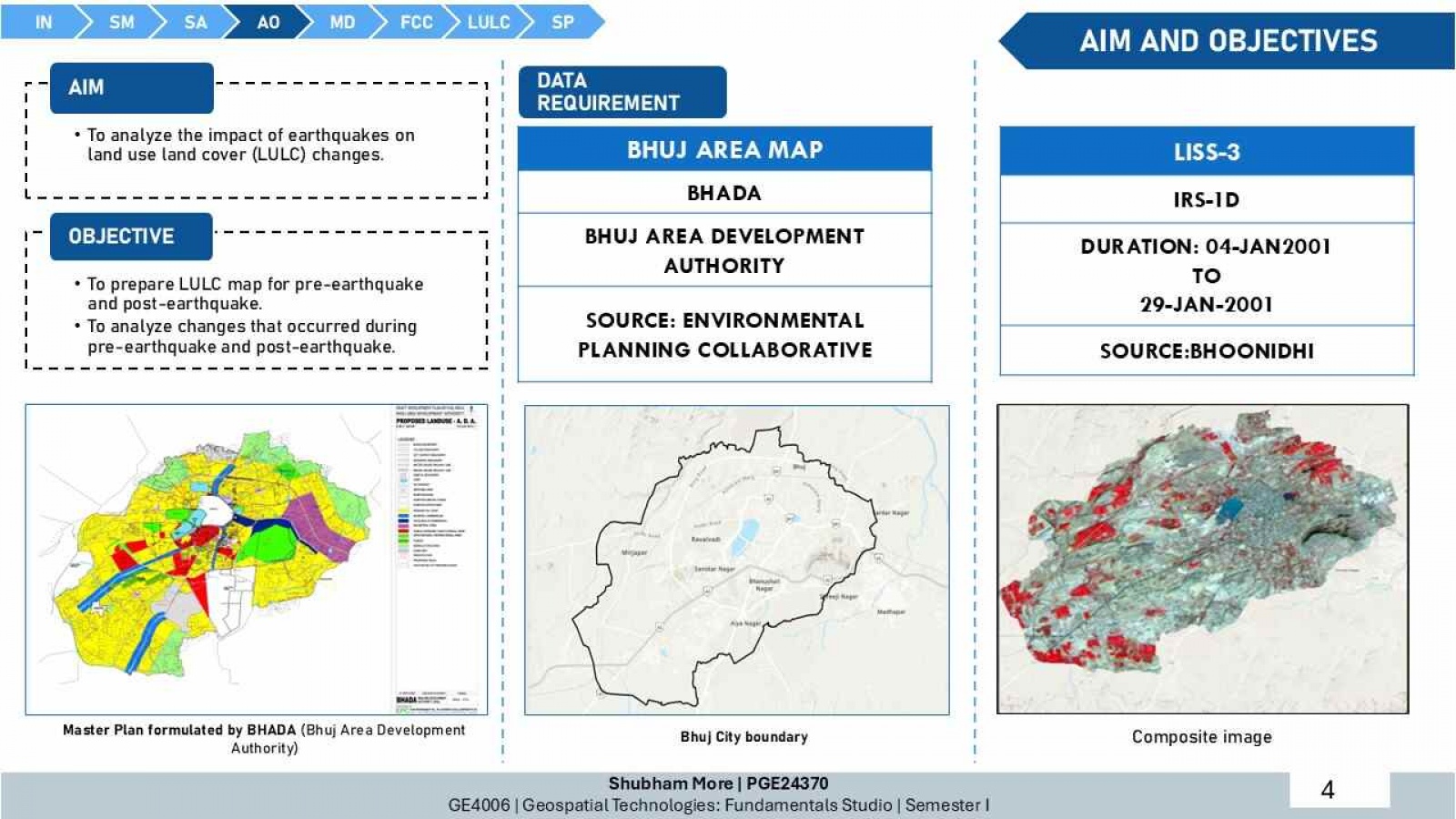
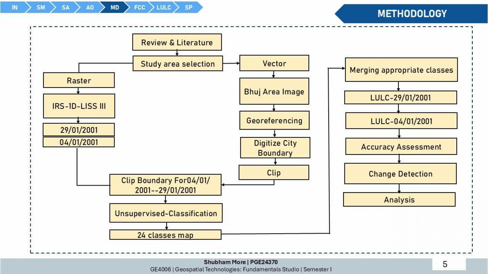
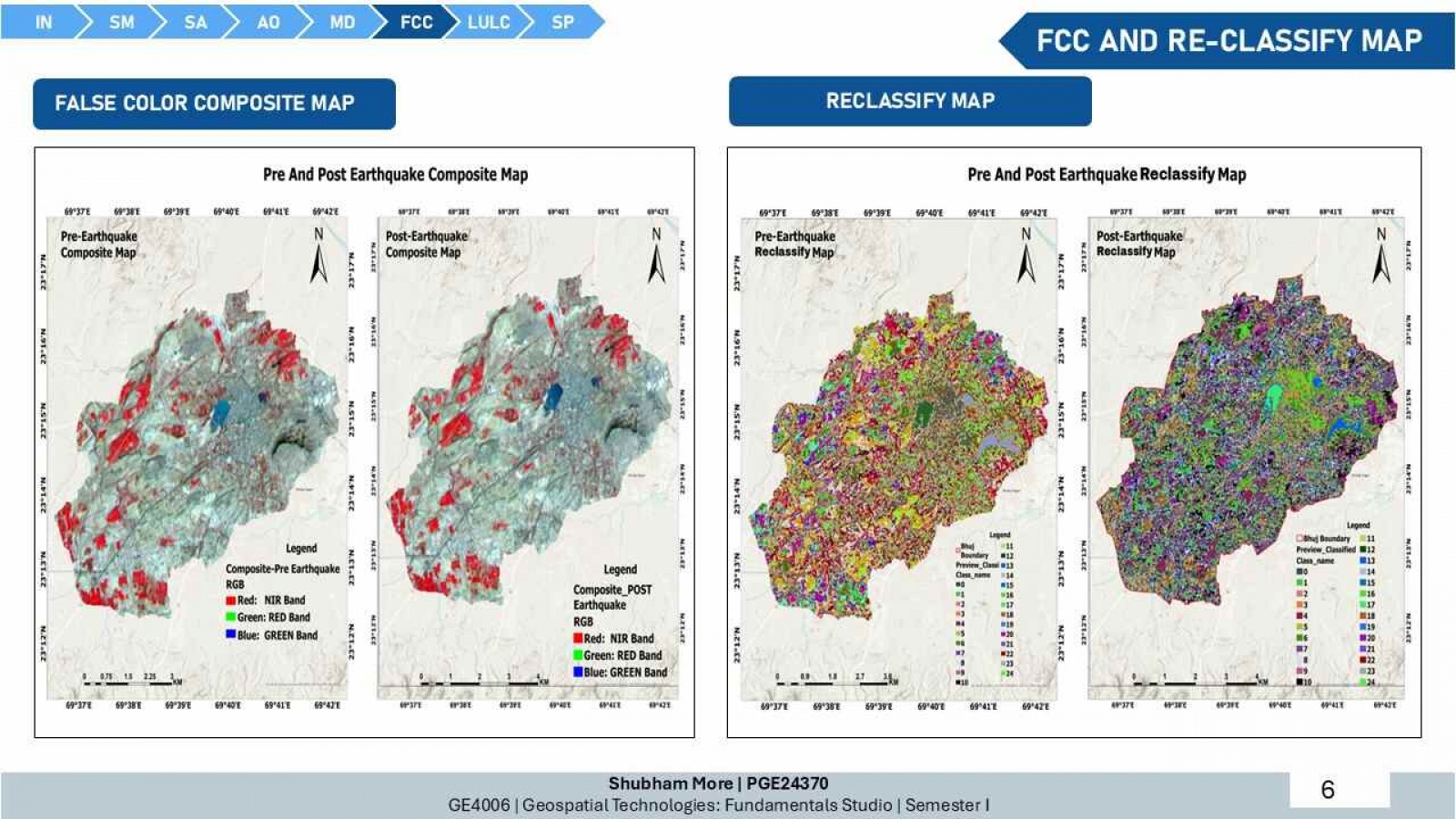
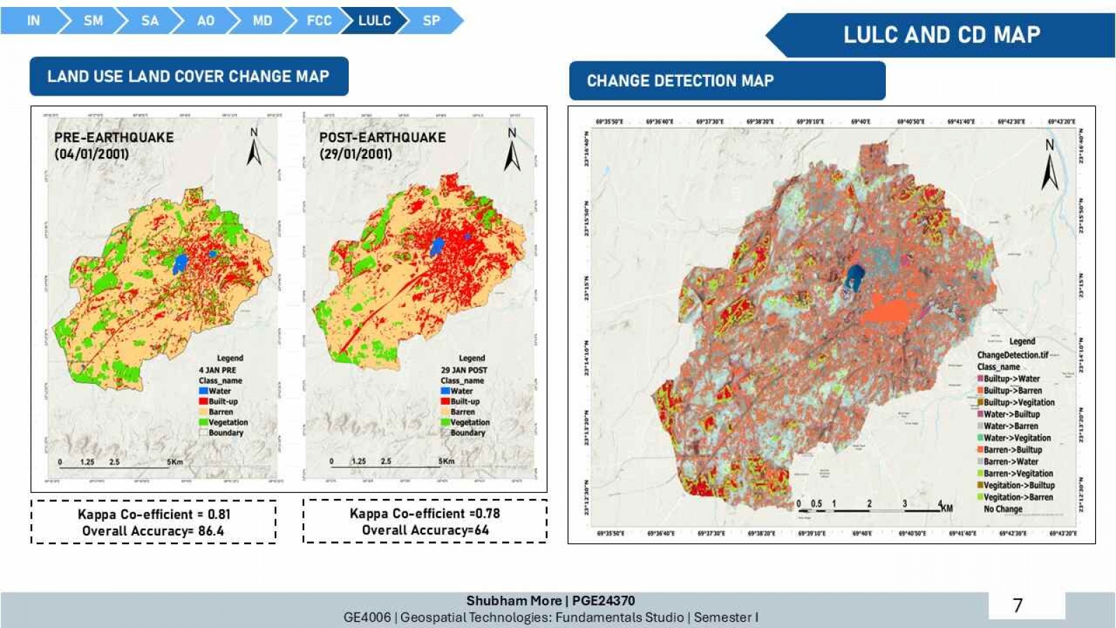
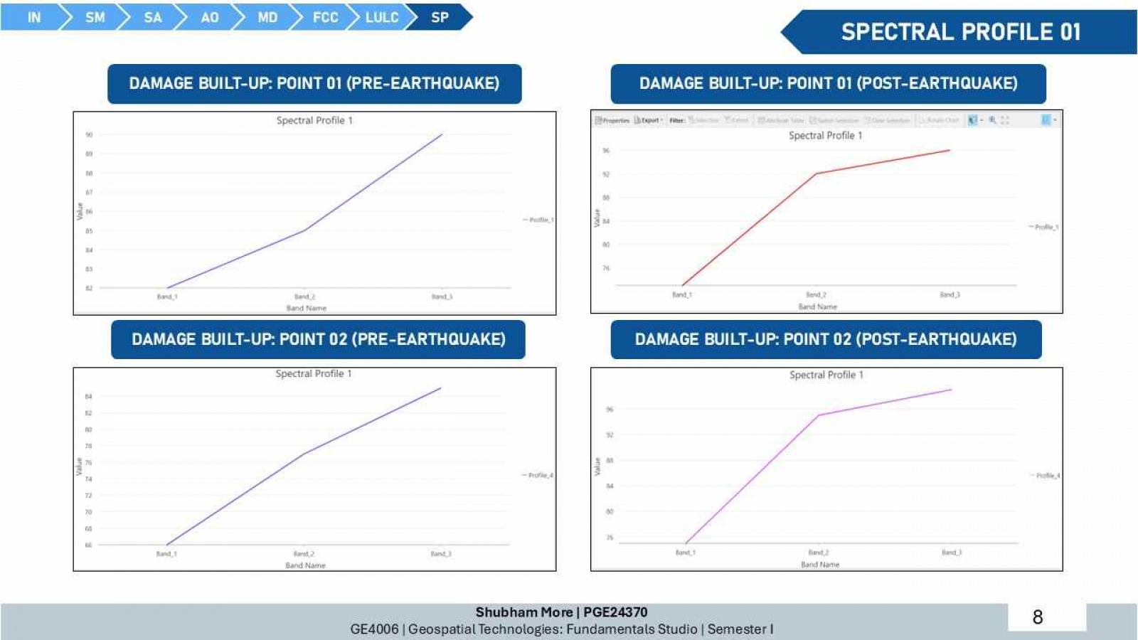
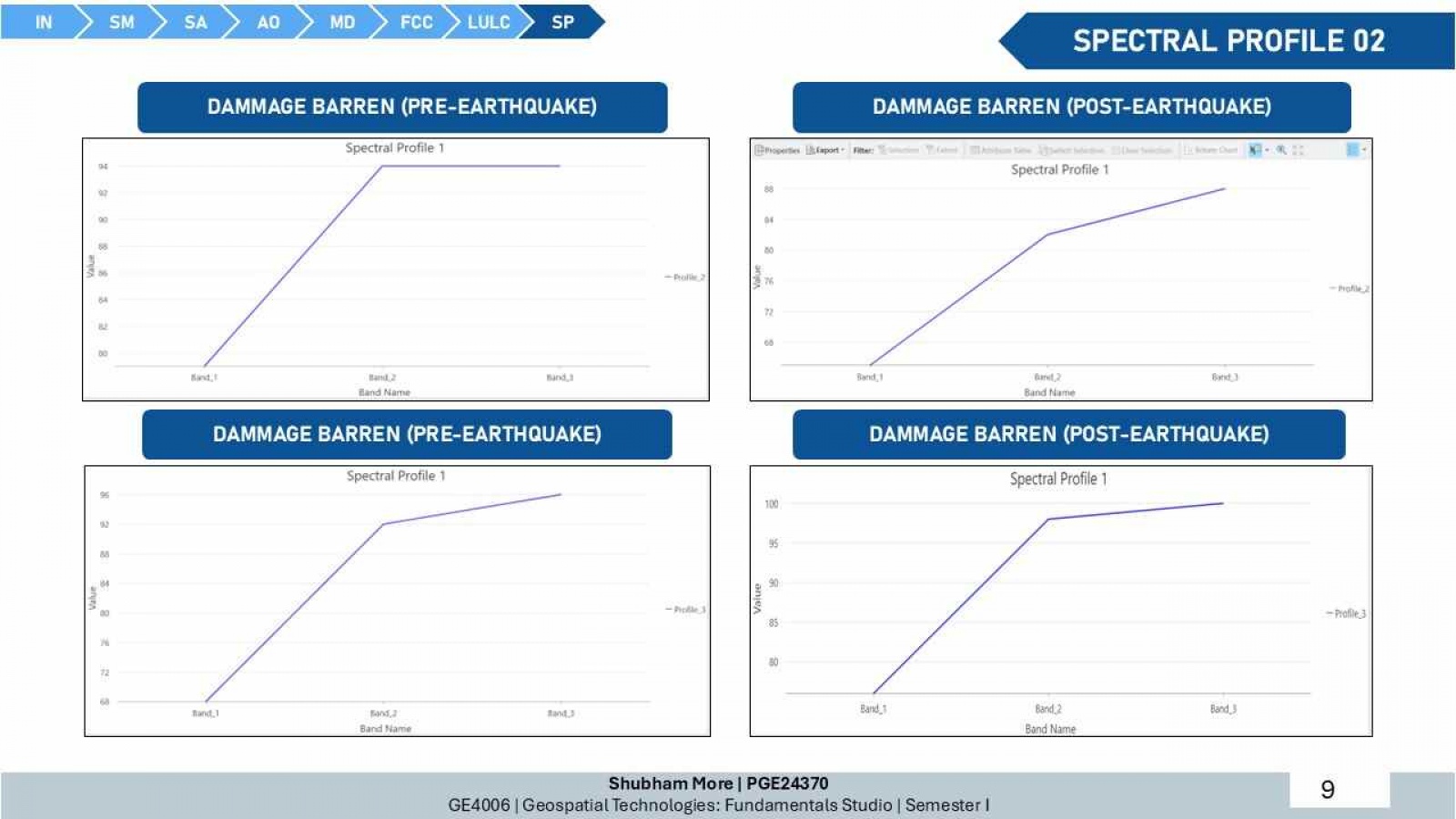
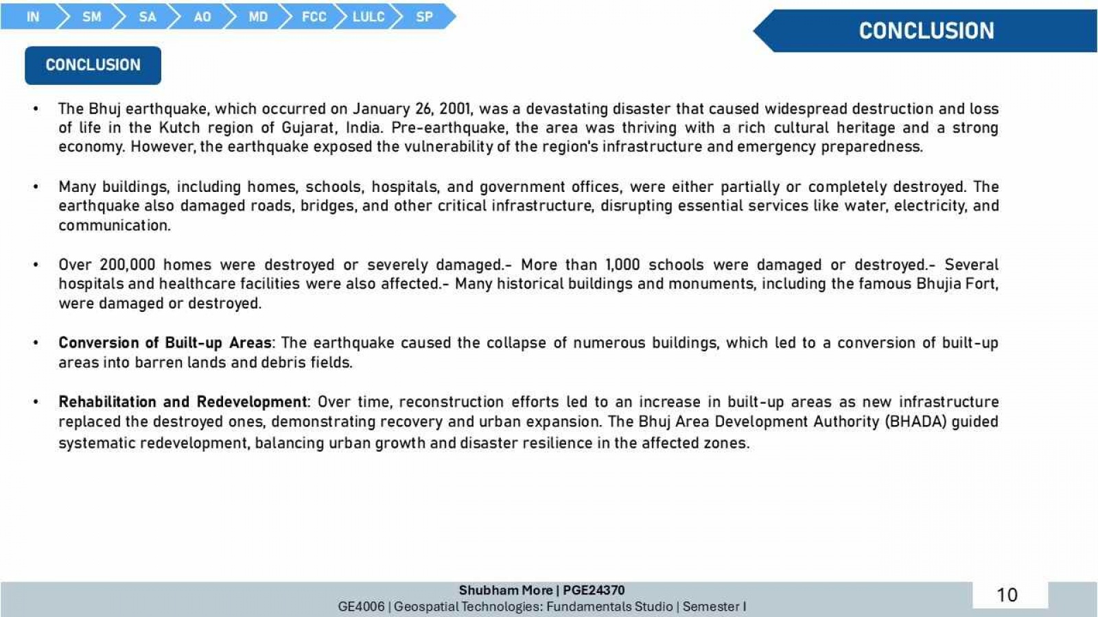
This project aims to analyze the impact of earthquakes on built-up areas through spectral profile analysis and geospatial techniques, focusing on the Bhuj area in Gujarat, India, a region severely impacted by the 2001 earthquake. By comparing pre- and post-earthquake satellite imagery and land use/land cover (LULC) maps, the project will identify damage patterns, quantify the transformation of urban areas, and assess recovery and redevelopment efforts. The study will utilize data such as IRS-1D LISS III satellite imagery and seismic maps, employing methodologies including georeferencing, unsupervised classification, and change detection analysis. Expected outcomes include detailed damage assessment, insights into urban resilience, and recommendations for incorporating spectral analysis into disaster management and urban planning frameworks, ultimately contributing to enhanced disaster preparedness and sustainable redevelopment in seismically active areas.
