Your browser is out-of-date!
For a richer surfing experience on our website, please update your browser. Update my browser now!
For a richer surfing experience on our website, please update your browser. Update my browser now!
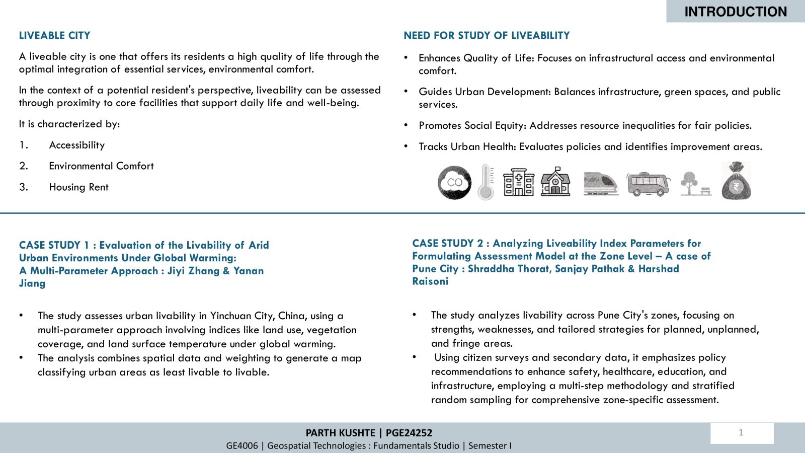
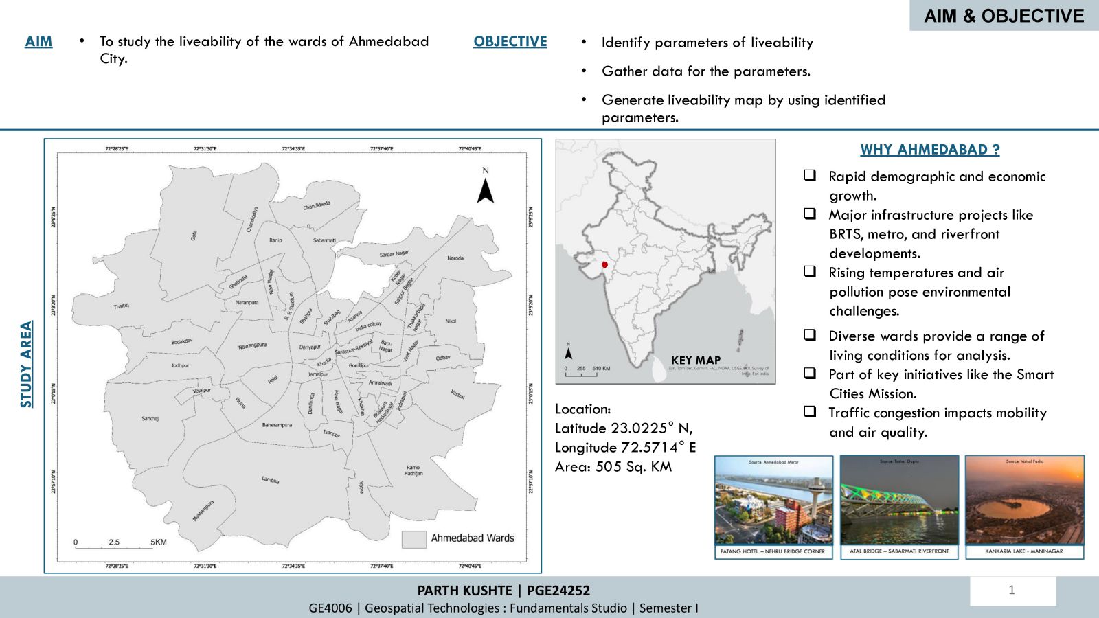
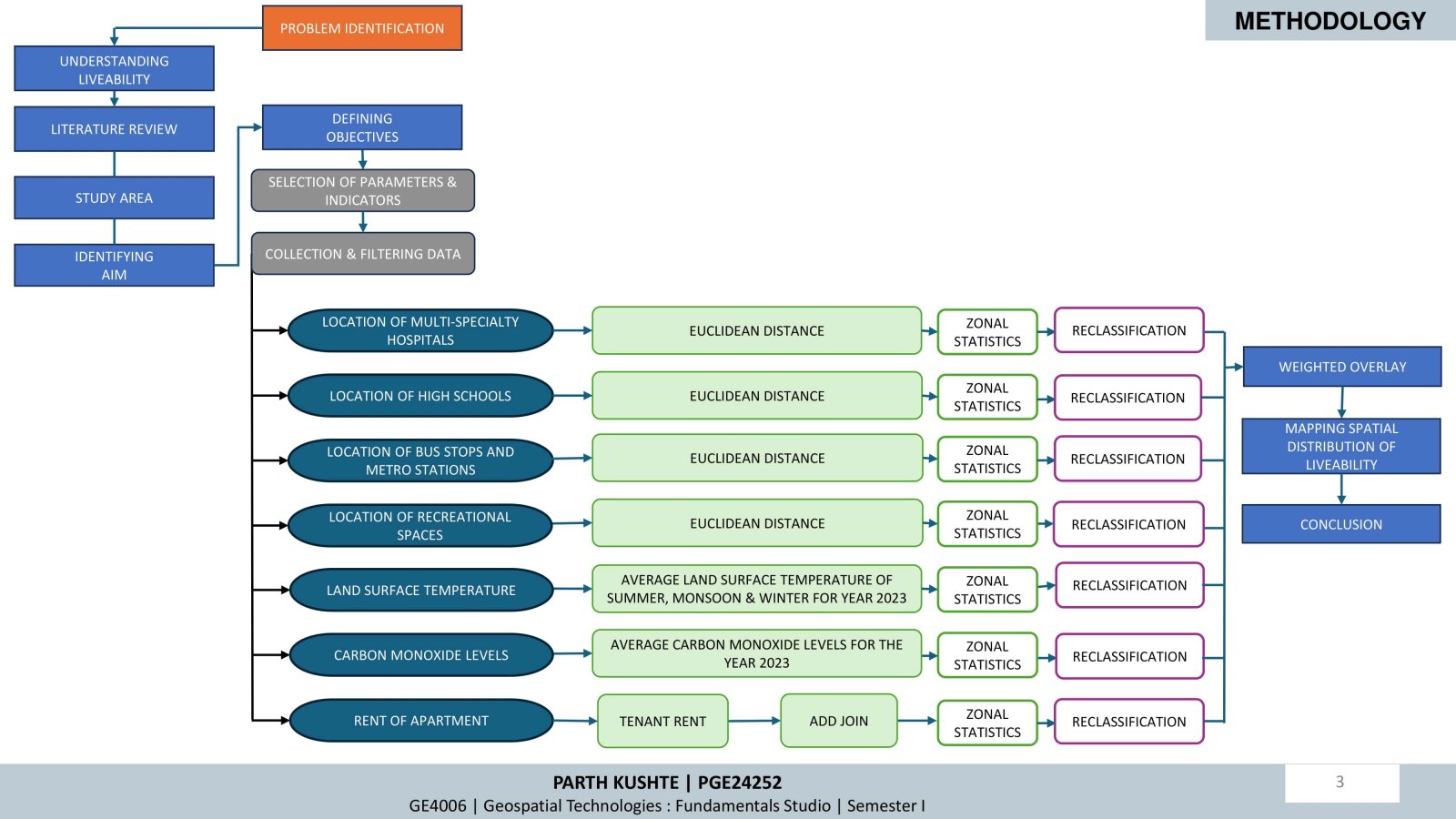
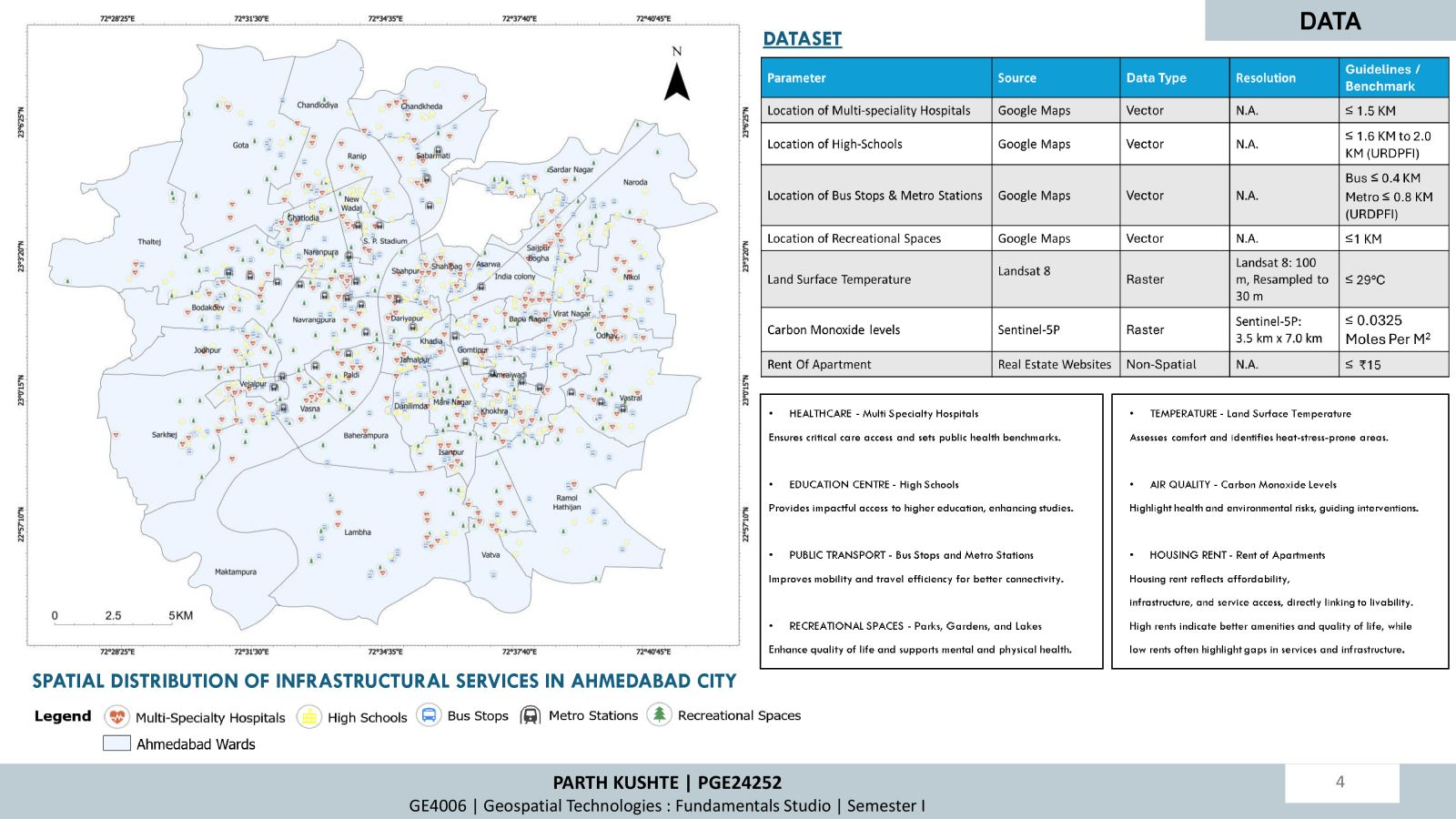
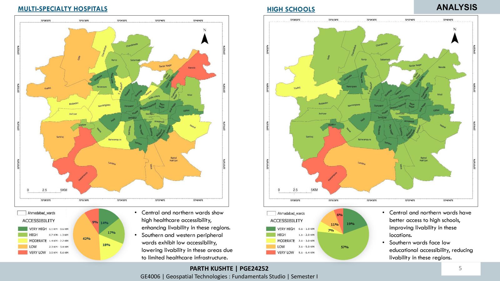
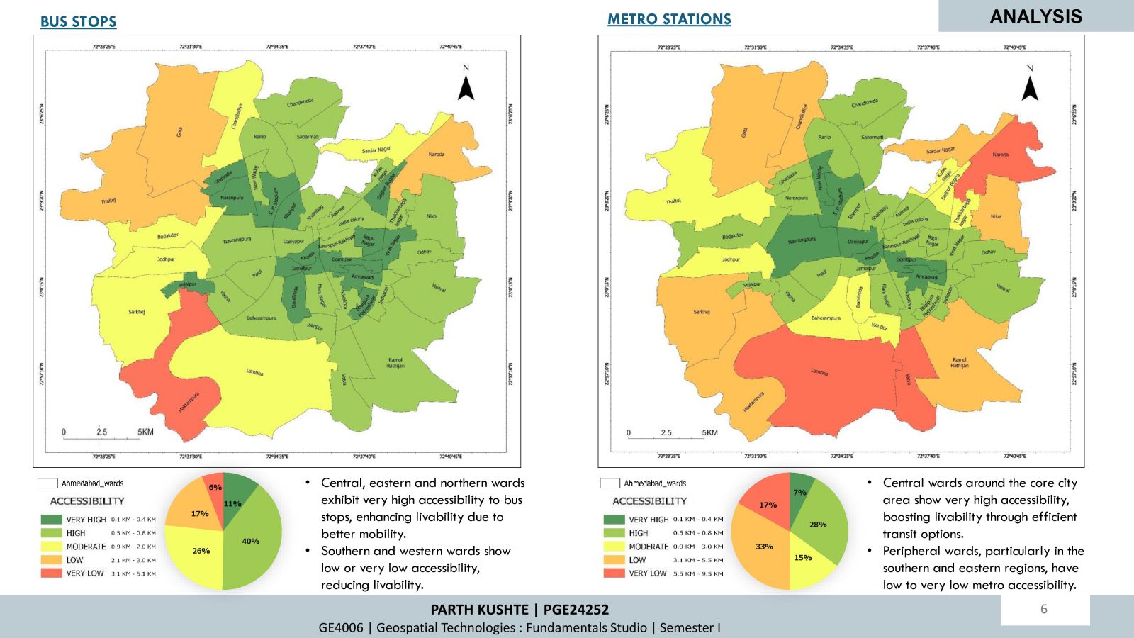
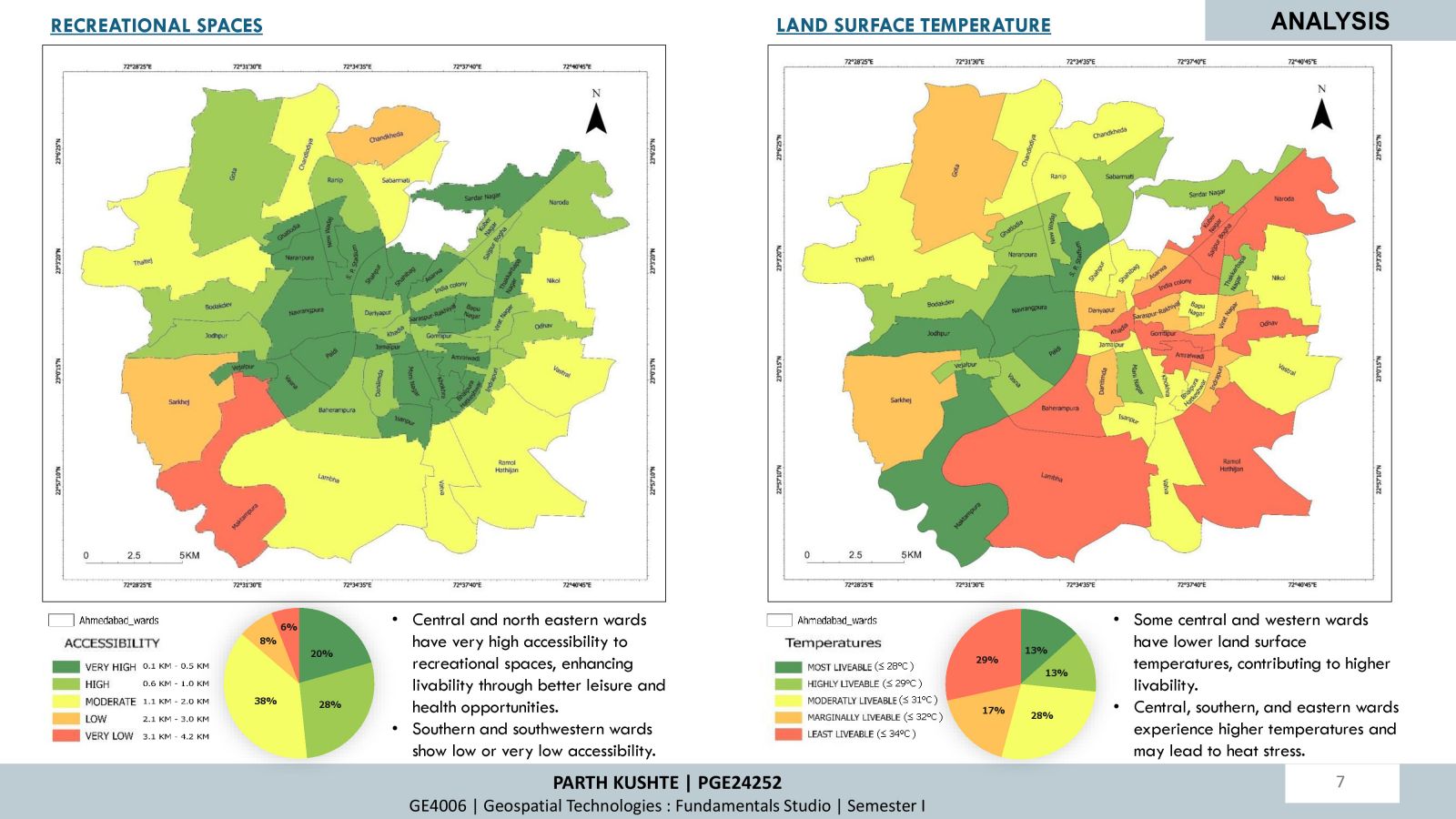
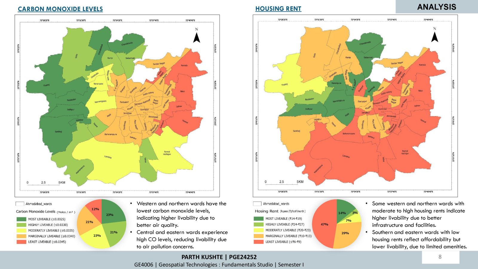
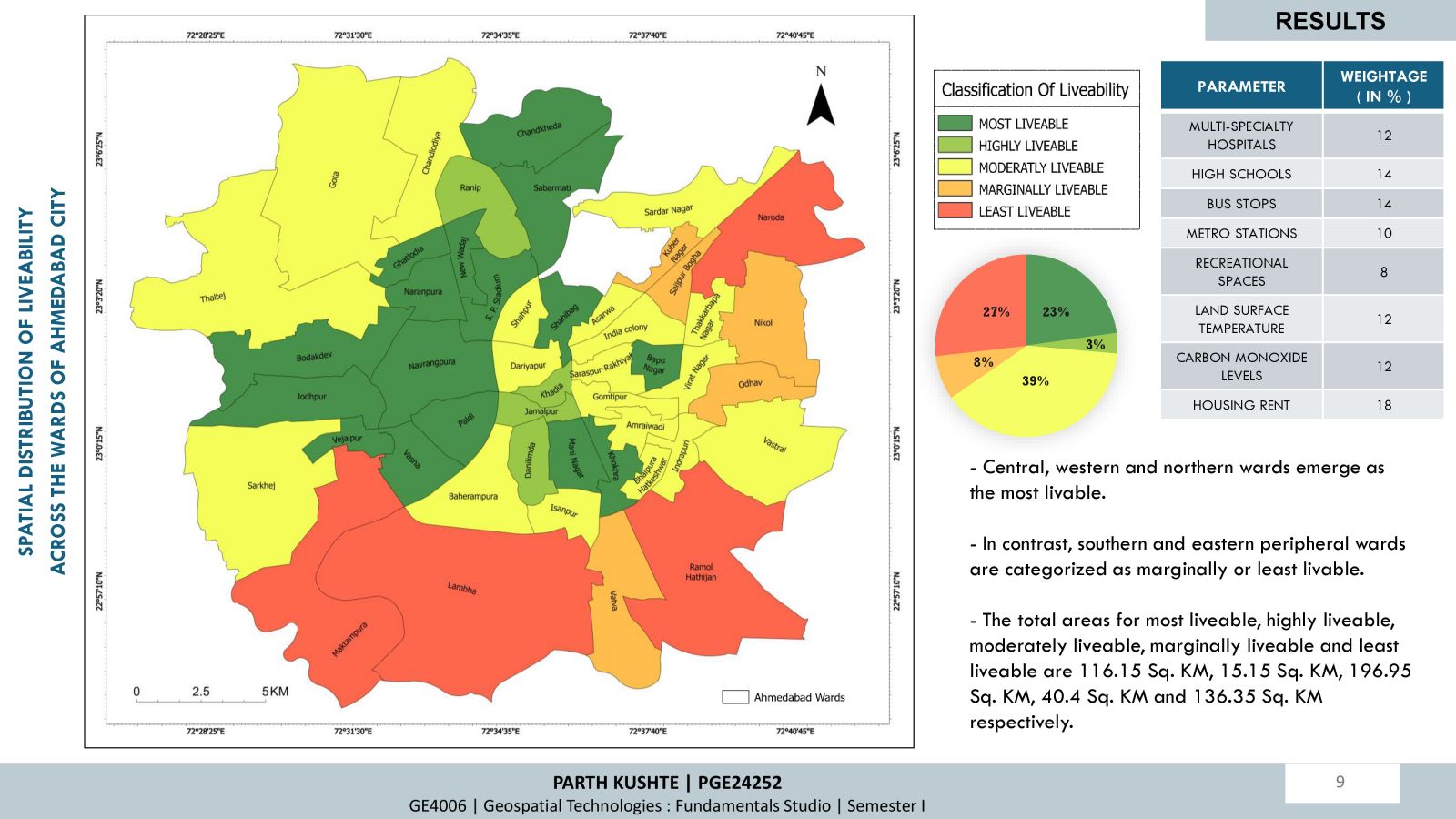
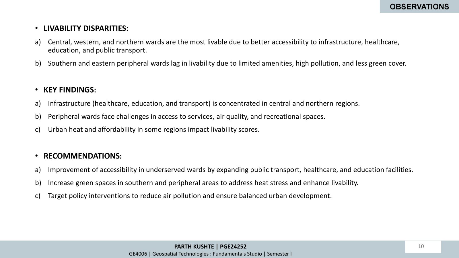
The project examines Ahmedabad City's liveability through a comprehensive evaluation of key parameters, including healthcare accessibility, educational facilities, transportation infrastructure, recreational spaces, and environmental conditions. Using spatial and non-spatial data with multi-parameter geospatial analysis, a liveability map is generated to classify wards across a spectrum from most to least liveable. Recommendations include expanding infrastructure in underserved areas and addressing pollution challenges to ensure equitable urban development and improved quality of life for all residents across the wards.
