Your browser is out-of-date!
For a richer surfing experience on our website, please update your browser. Update my browser now!
For a richer surfing experience on our website, please update your browser. Update my browser now!
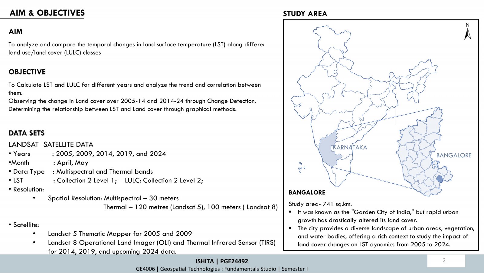
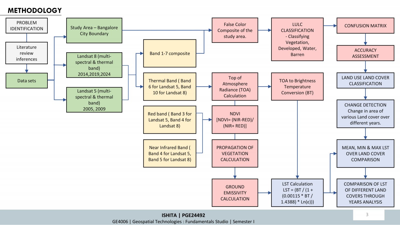
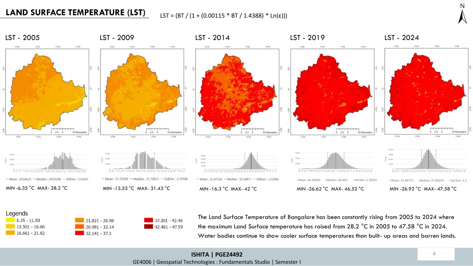
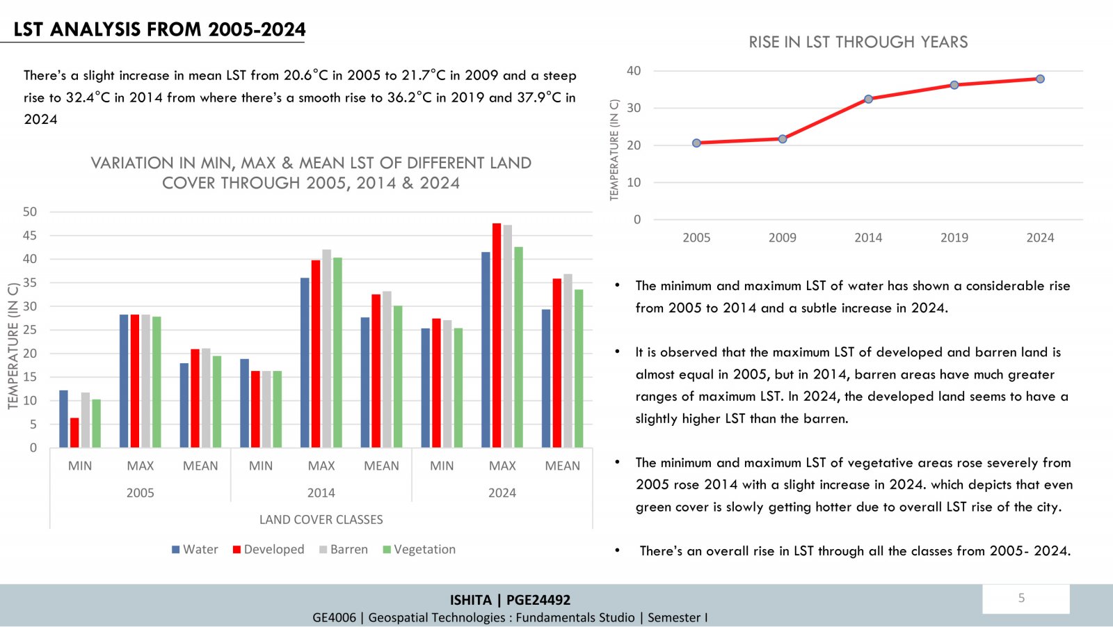
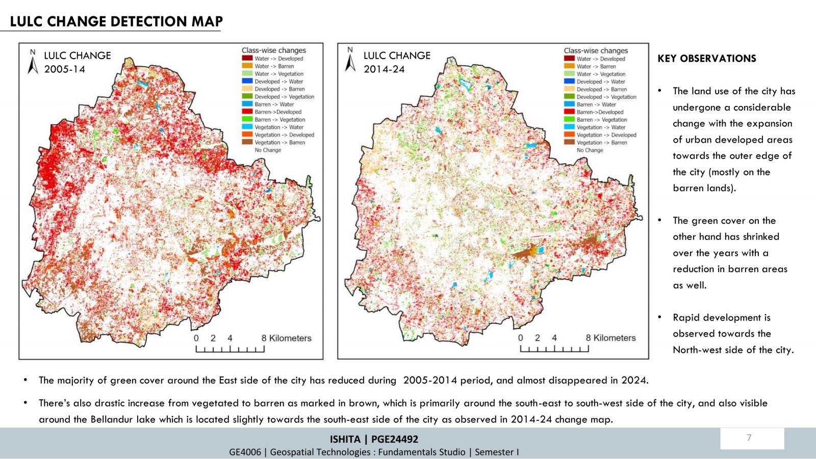
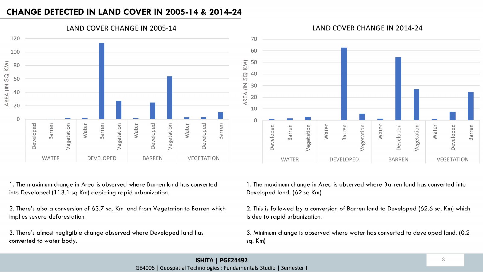
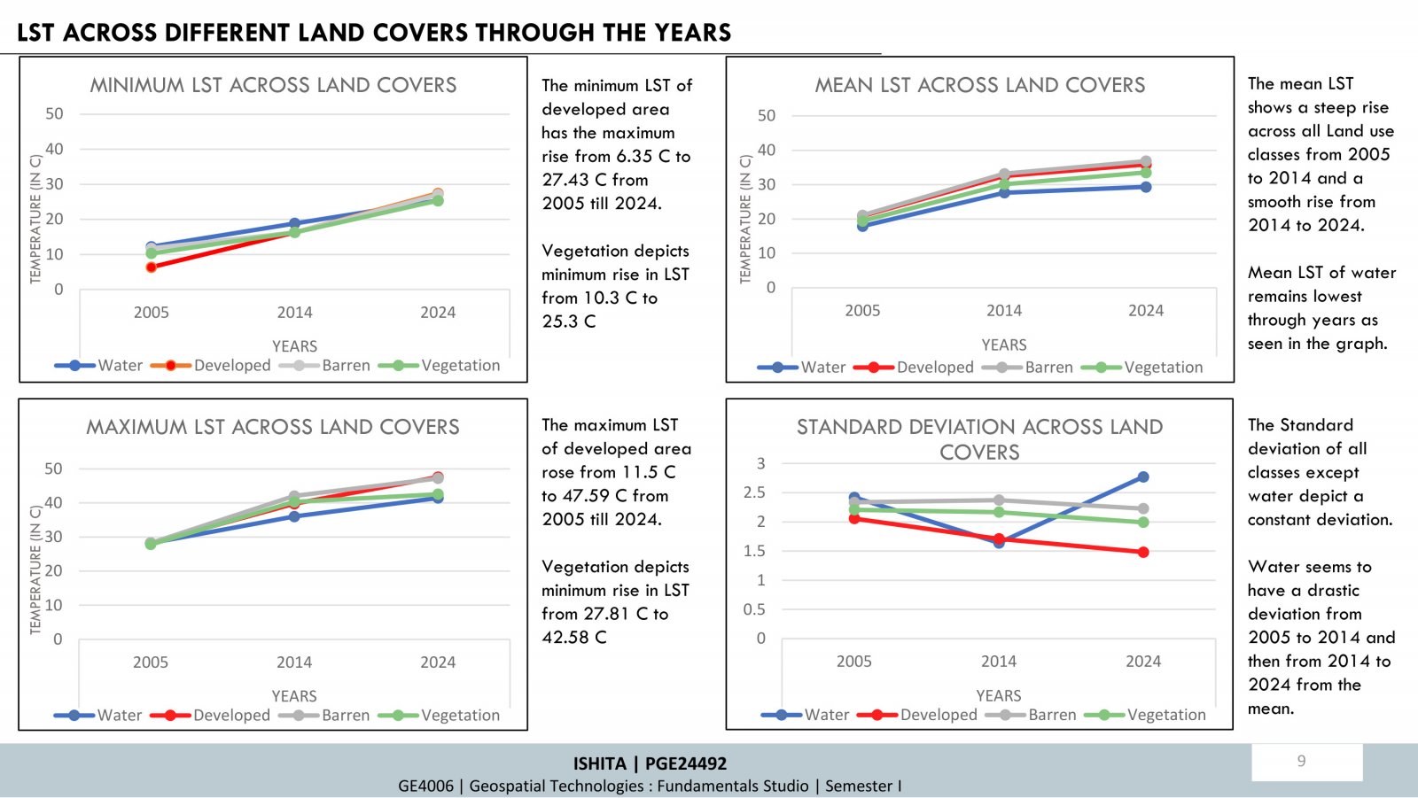
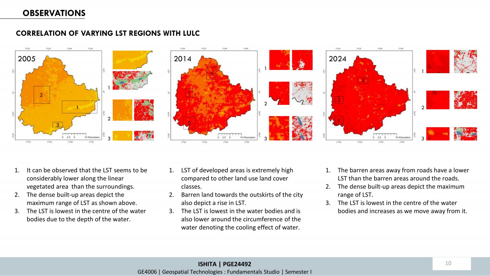
The varying effects of surface temperature worldwide emphasize the importance of studying Land Surface Temperature (LST) trends. Understanding Land Use Land Cover (LULC) changes over time using GIS reveals how these variables are interlinked, influencing LST across classes like developed, vegetation, water bodies, and barren land. The study employs supervised classification, change detection techniques, and correlating LST across LULC through the years (2005 to 2024). It highlights significant urban expansion, reduced vegetation, and rising LST, with built-up areas experiencing the highest temperatures. The research underscores the role of geospatial technologies and remote sensing in sustainable urban planning and environmental management.

