Your browser is out-of-date!
For a richer surfing experience on our website, please update your browser. Update my browser now!
For a richer surfing experience on our website, please update your browser. Update my browser now!
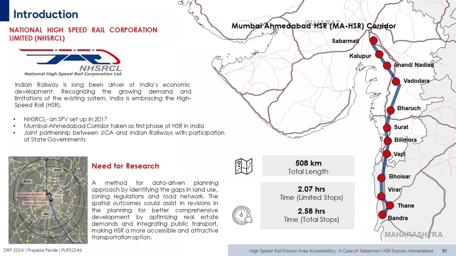
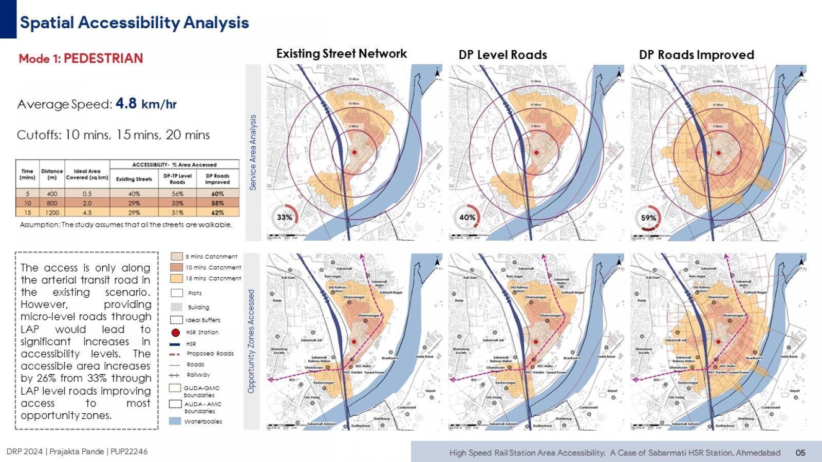
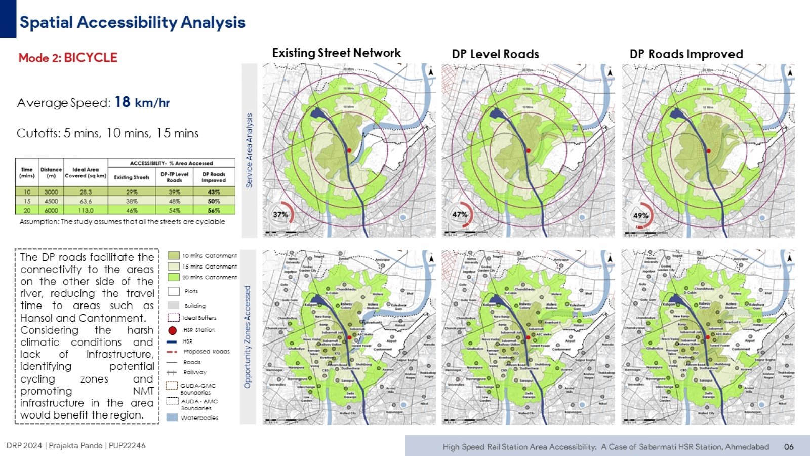
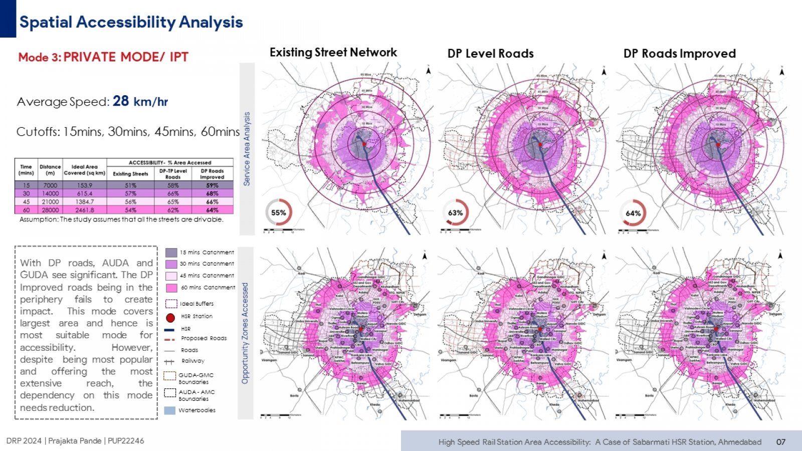
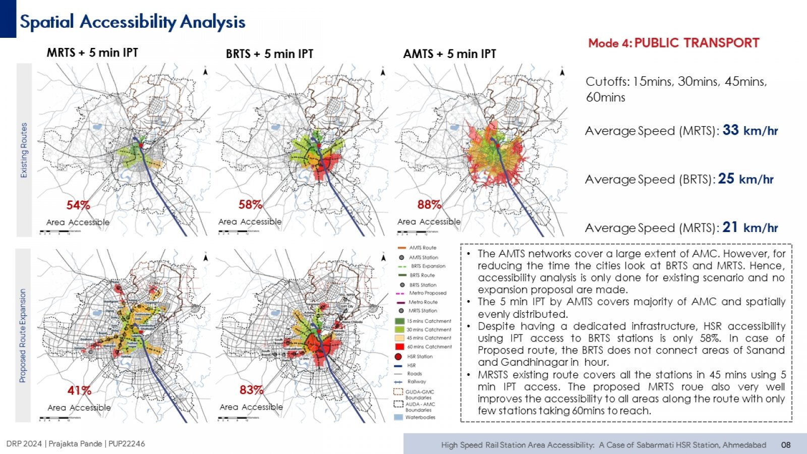
India's mega infrastructure projects like the Mumbai-Ahmedabad HSR corridor will transform the urban landscape. This research uses GIS tools to measure accessibility for fortravel modes in the region under various road network scenarios. By comparing achieved accessibility with ideal case, the study identifies areas with potential for improvement. It also maps opportunity zones that benefit from increased accessibility. Ultimately, this research aims to provide data-driven insights for efficient planning by identifying gaps in land use, zoning, and roads. The resultant overall sustainable and inclusive planning would make HSR a more accessible and attractive transportation option.