Your browser is out-of-date!
For a richer surfing experience on our website, please update your browser. Update my browser now!
For a richer surfing experience on our website, please update your browser. Update my browser now!
Urbanisation of Shyamal-Vejalpur and its Impact
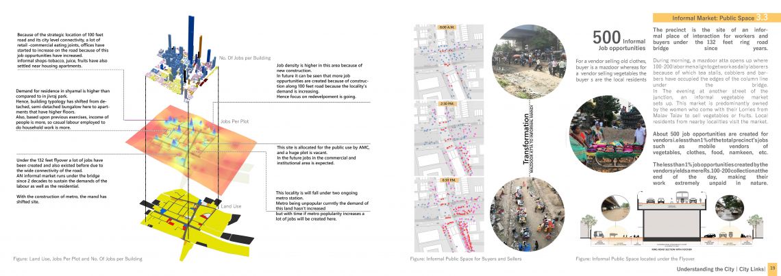
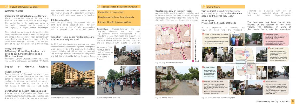
Ahmedabad, one of the key emerging urban centres of the country was an important trade centre and today has a strong industrial base of manufacturing. Hence, the city has grown in the form of circular ring road network around the walled city area which is traditional central business district. Ahmedabad’s transportation system is predominantly dependent on roadway systems (Service Level Benchmark, Ministry of Urban Transport), therefore, all precincts along the ring roads are seamlessly connected with the rest of the city and have high infrastructure growth factor as the growing concentration of people in urban areas has and will demand for more housing/work areas along these precincts to save transportation costs as well as first and last mile connectivity.
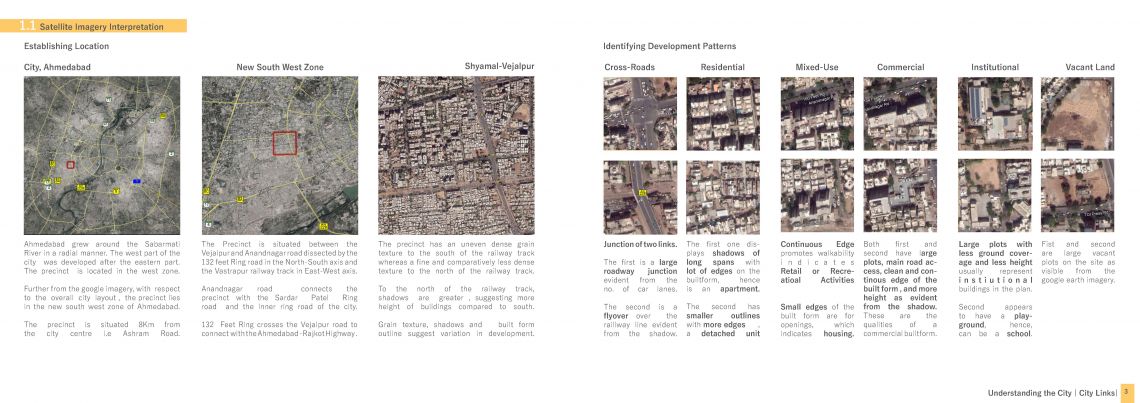
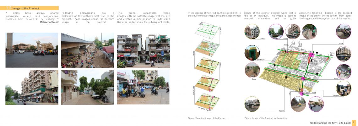
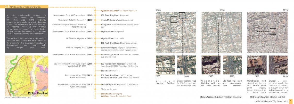
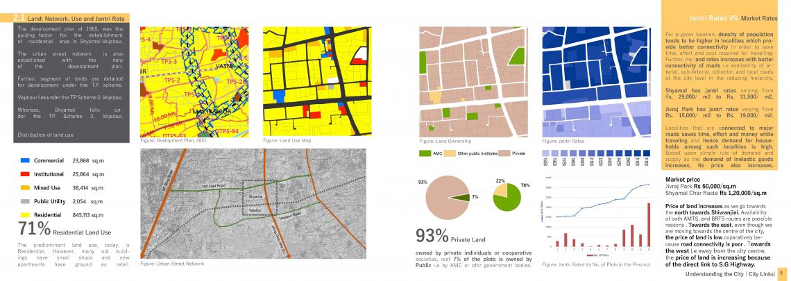
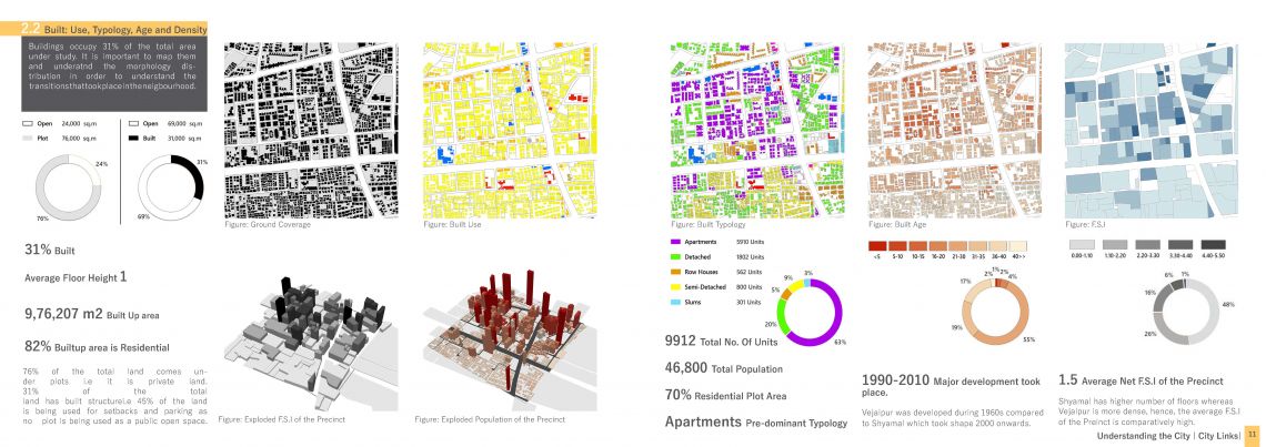
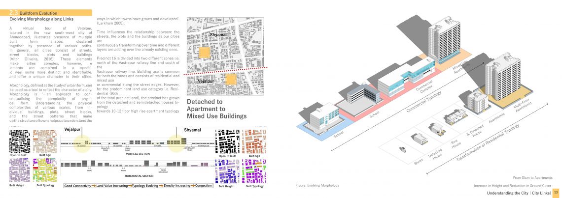
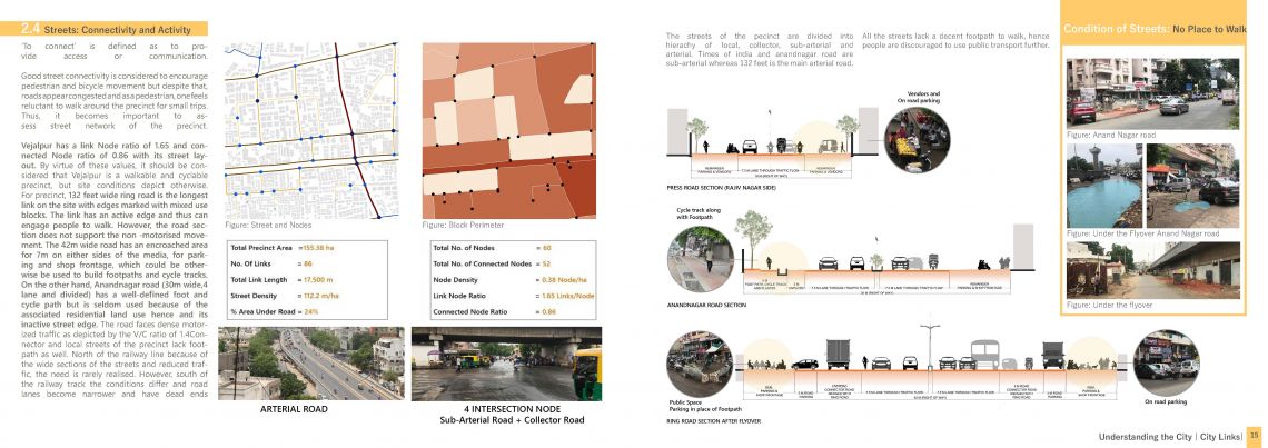
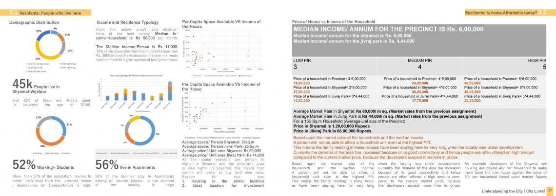
From the Satellite Imagery, Shyamal-Vejalpur lying between the Vejalpur and Anandnagar road dissected by the 132 feet Ring road in the N-S axis and the Vastrapur railway track in E-W axis. This portfolio will discuss the impact of road network in the transformation of Shyamal-Vejalpur from agricultural land in the 1950s to a densely built neighbourhood. This portfolio is structured under 3 divisions: road network and the transformation of the precinct in the presence of arterial and sub-arterial roads, followed by the present urban and social structure of the precinct and lastly the distribution of living or working individuals in Shyamal-Vejalpur. As a conclusion the future Growth and obstacles i.e the expected impact of the proposed and on-going infrastructure works due to urban policies guiding the precinct will be discussed.
