Your browser is out-of-date!
For a richer surfing experience on our website, please update your browser. Update my browser now!
For a richer surfing experience on our website, please update your browser. Update my browser now!
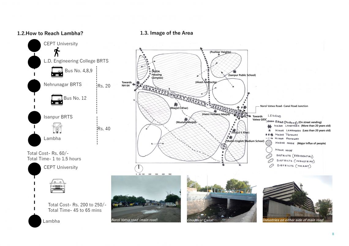
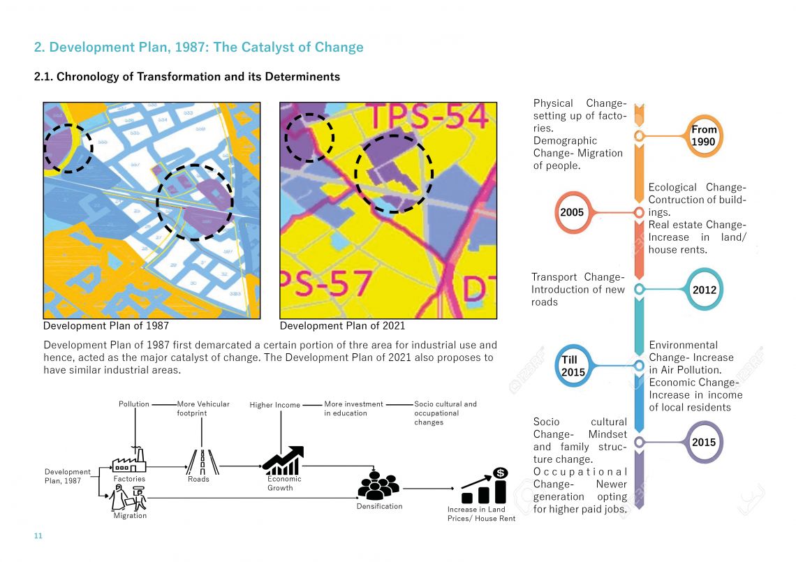
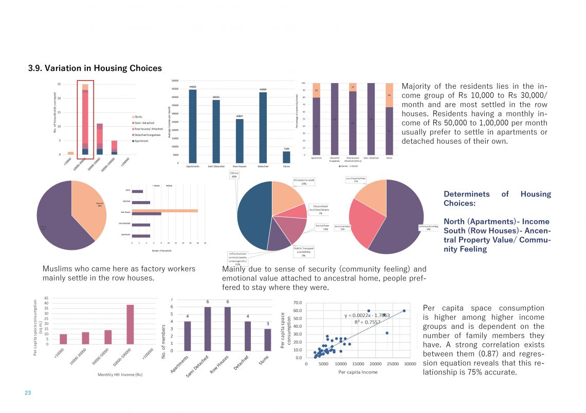
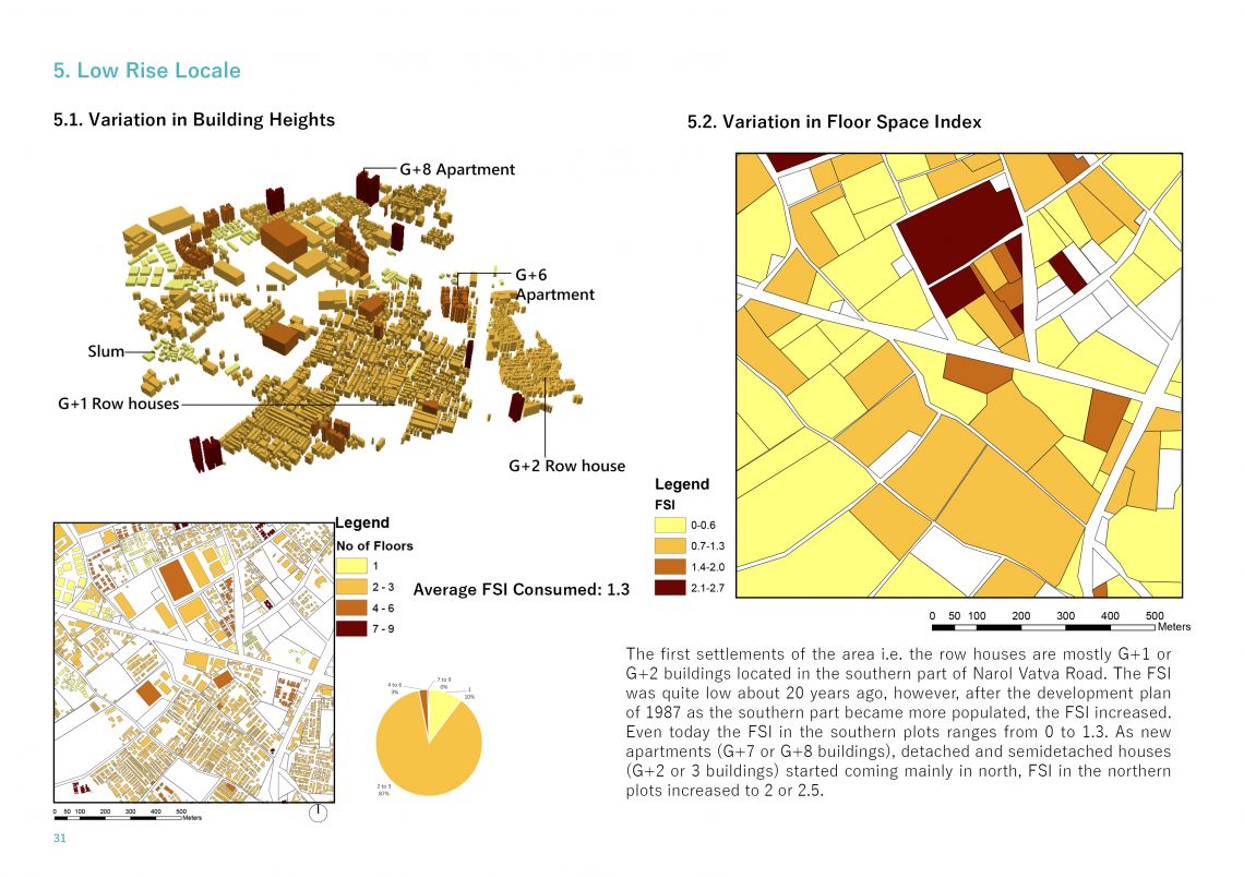
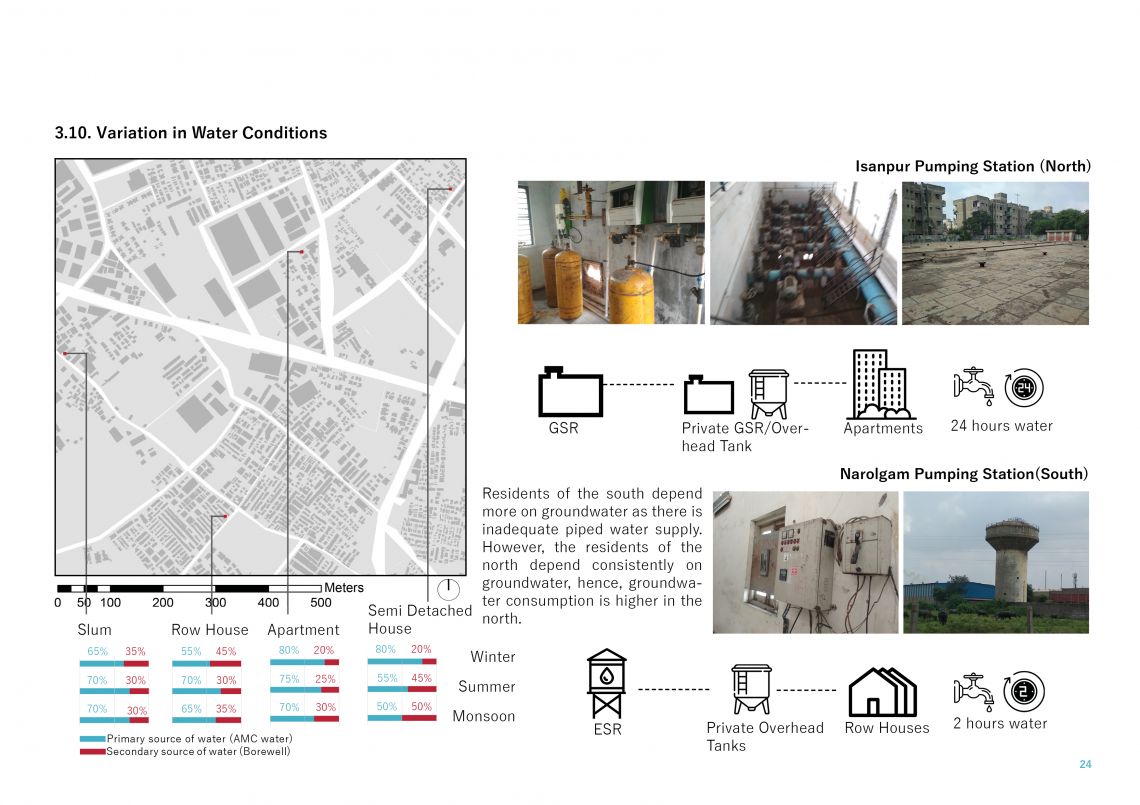
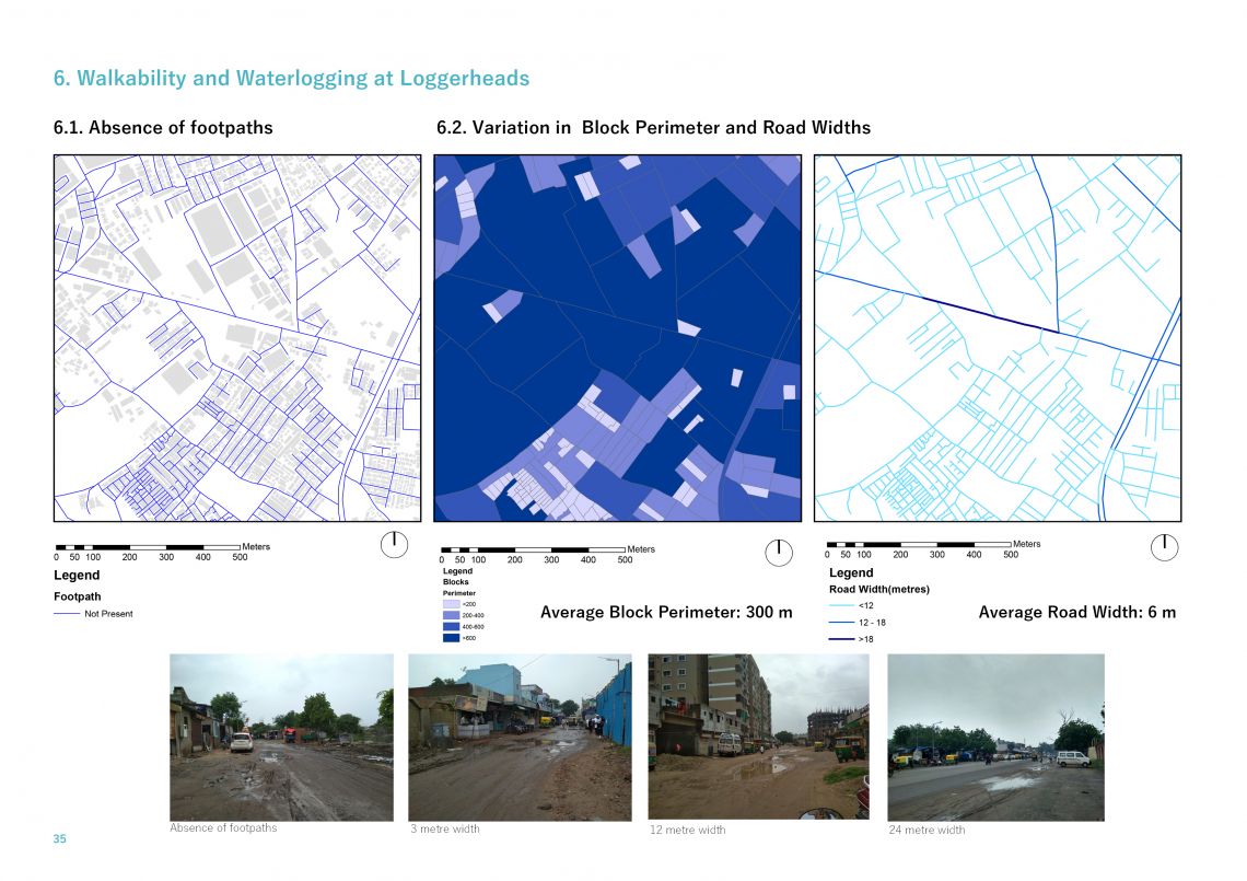
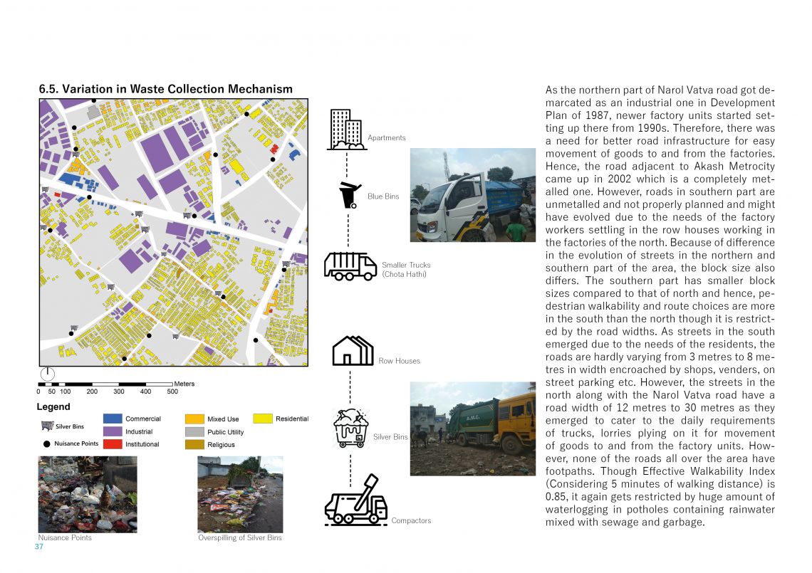
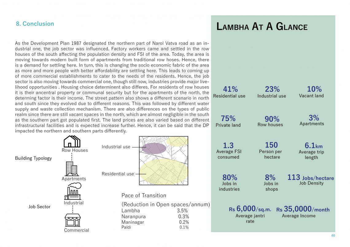
The city of Ahmedabad, located on the banks of Sabarmati river in the state of Gujarat is the only city to be declared as a heritage city. The eastern side of Sabarmati has an organic growth compared to the planned growth in western side. Therefore, different types of fabric whether physical or social co-exists on either side of the same city. Lambha, located in the south eastern part of the city is a mixed residential and industrial neighbourhood. This identity of the area has emerged due to the evolution of the area initiated by the Development Plan of 1987 which demarcated the northern part of Narol Vatva road as an industrial one. With the help of various primary surveys conducted over a period of 3 months, it has been found that this demarcation has led to differential development of northern and southern parts of Narol Vatva road in terms of land use, choices of people, built fabric, population density, road infrastructure, storm water, sewerage, waste collection and water supply infrastructure, land prices etc. This publication looks at the area from the lens of evolution and how the Development Plan impacted the northern and southern parts differently.
