Your browser is out-of-date!
For a richer surfing experience on our website, please update your browser. Update my browser now!
For a richer surfing experience on our website, please update your browser. Update my browser now!
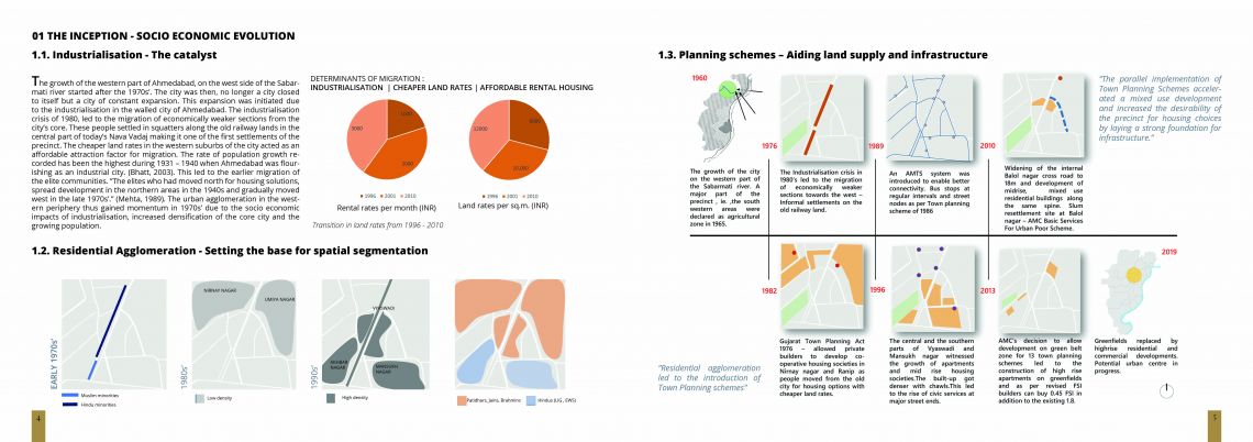
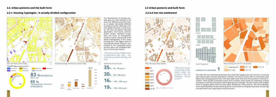
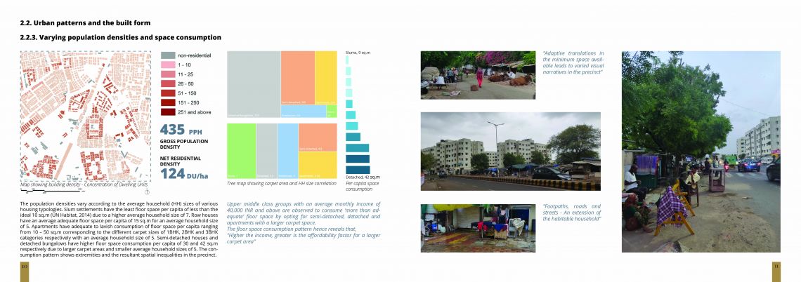
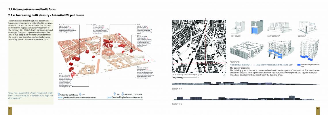
Cities are urban communities that exhibit complexity and heterogeneity. They establish and re-establish identities over time as they are constantly changing. Any given city can be marked based on its territories, class or economy. The city of Ahmedabad originally formed as a spatially segmented city based on a defined social structure. The city has travelled through various narratives from the earliest housing developments of chawls built by low income workers of the mills to the increase in present day vertical developments where masses of diverse religions and communities co-exist. A city is often an image of power, with spontaneous competitions at simple places. Ahmedabad has seen a major transition from its initial growth as a trading centre to an urbanised industrial centre and now the commercial capital of the state. The studio “Understanding the City” involved the studying of the 150 precincts across the city of Ahmedabad, each of area 1 square kilometre under various layers that make the city. In correspondence to the city, a precinct of area 1 square kilometre can also be delineated based on various socio economic aspects that make the area. The precinct of Nava Vadaj that has been documented in this publication comprises of 4 localities namely, Vyaswadi, Nirnay Nagar, Ranip and Umiya Nagar. These localities are spatially segmented based on socio-economic class differences. The social segregation reflects on the building typology, spatial character of streets, nature of jobs and quality of life that define these segmented pockets. In a glance, the locality of Ranip with semi-detached and detached bungalows with tree lined thoroughfares reflect a distinct socio economic and socio spatial type when compared to Vyaswadi accommodating informal settlements and row houses, wherein the streets are a physical extension of the households and the activities based in them. The hierarchical evolution of the precinct across this social heterogeneity, the growing population, the rising densities, mixed land uses are seen to be in line with the town planning schemes. All these characteristics that contribute to the precinct, functioning as a people made residential city within the widened territory of the city at large, have been studied and analysed to understand the future development they are proceeding towards.
