Your browser is out-of-date!
For a richer surfing experience on our website, please update your browser. Update my browser now!
For a richer surfing experience on our website, please update your browser. Update my browser now!
City planning- this has evolved from the term urban morphology which refers to the study of forms of human settlements and the process of their formation and transformation. It seeks to understand the spatial structure and character of a metropolitan area, city, town or village by examining the patterns of its component parts along with the ownership or control and occupation. Each city has its own unique identity and a history of all these characters which leads to the present.
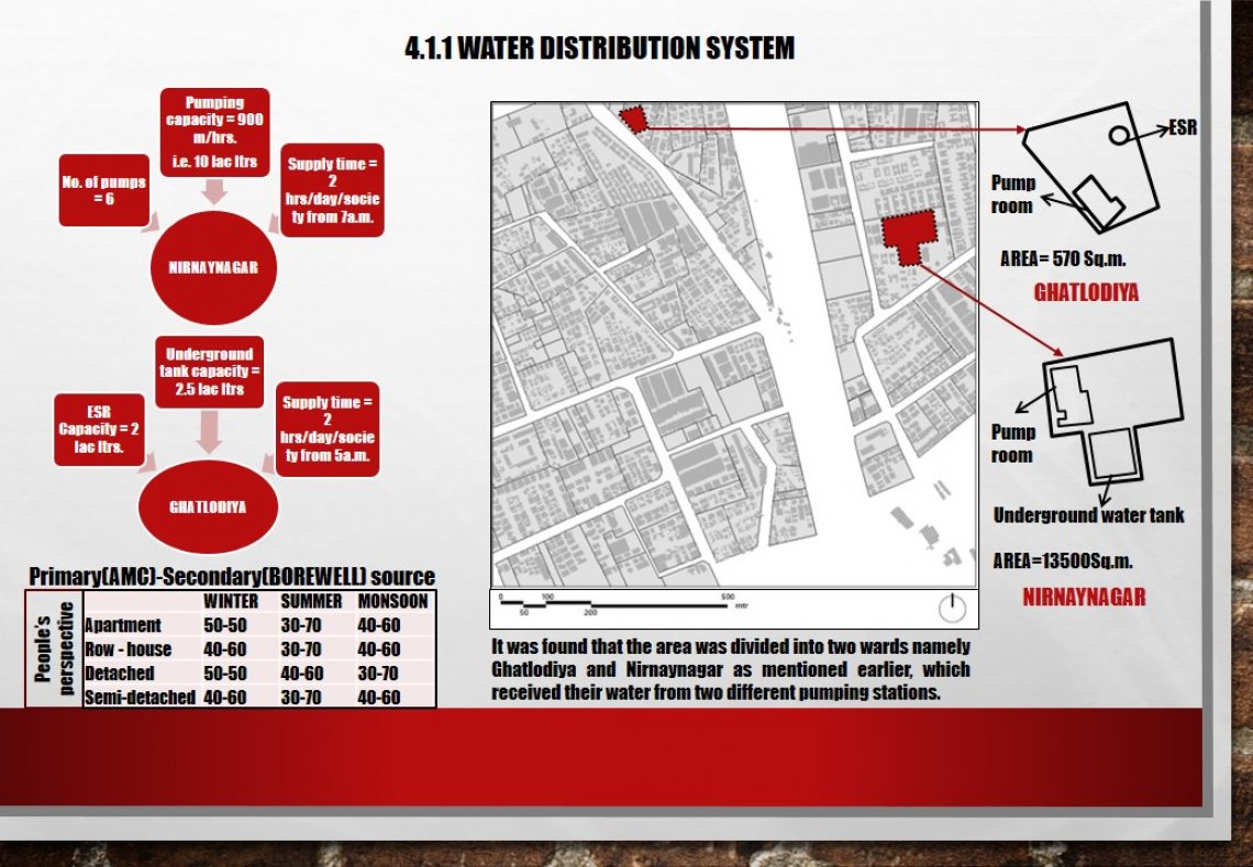
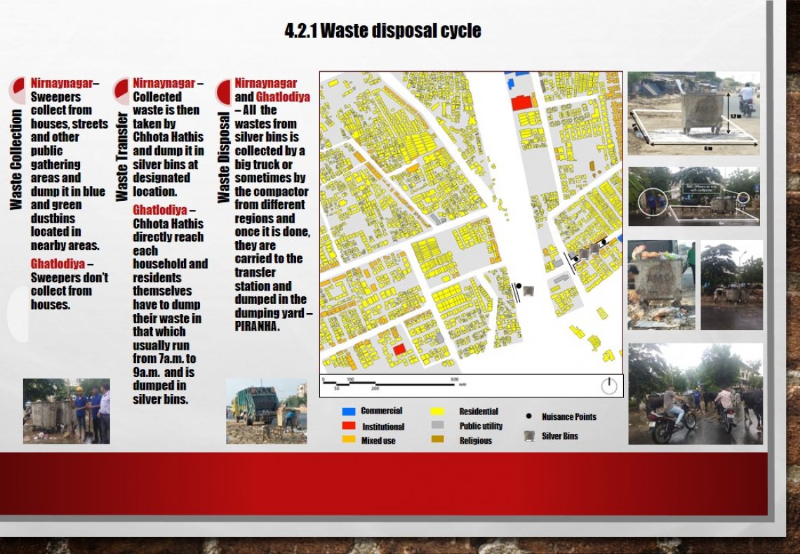
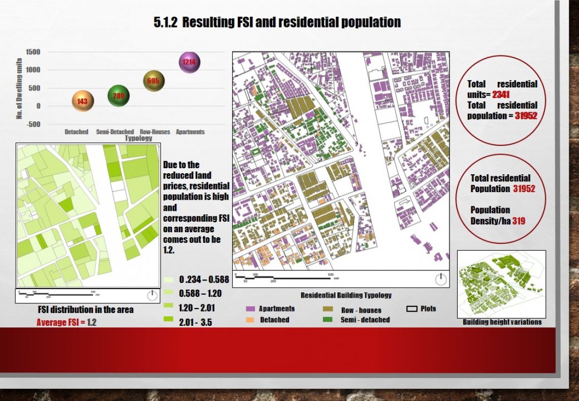
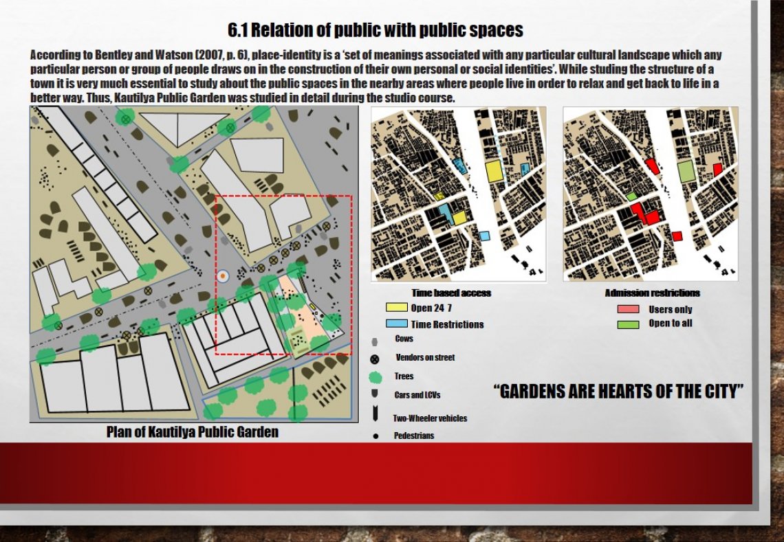
Ahmedabad is located on the banks of river Sabarmati which divides the city in two regions namely east and west. Study of all the building typologies, densities, infrastructure and other functional elements of these areas was the prime concern of ‘Understanding The City”, MUP Foundation 2019 studio at CEPT university. Each student was given a square kilometre of land to be studied on these various aspects.
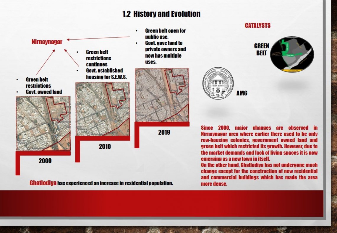
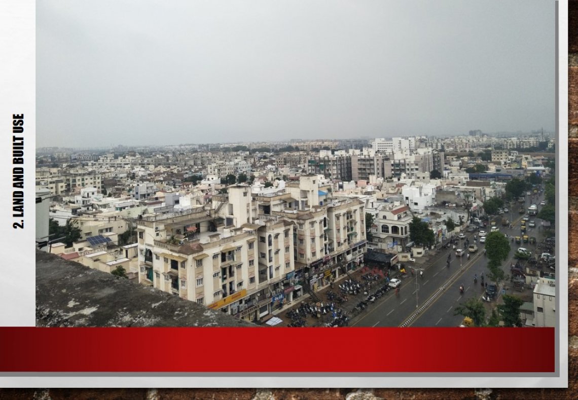
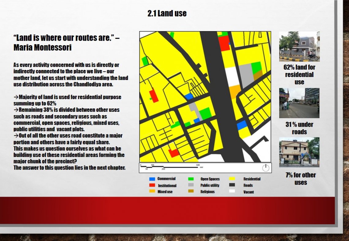
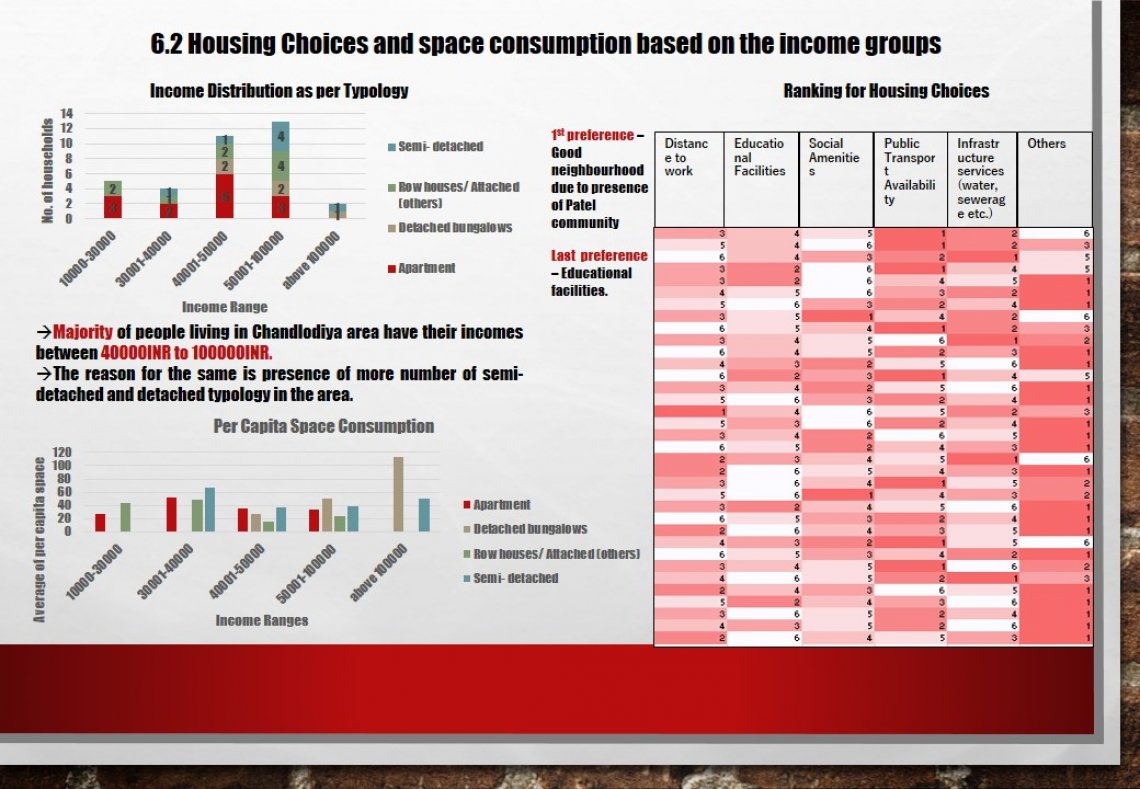
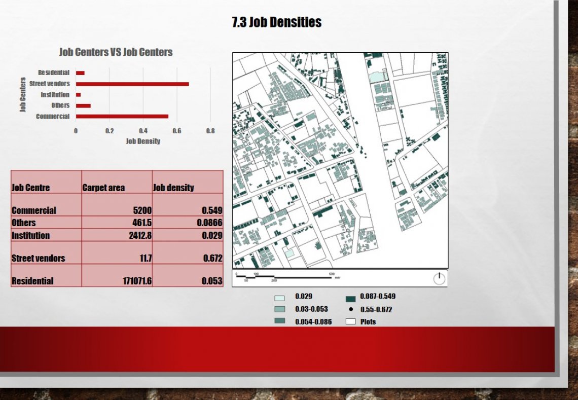
The precinct of study in this publication is Chandlodiya which is further divided into two areas- Ghatlodiya and Nirnaynagar in the west of Ahmedabad and is located approximately 4 kms from the CEPT University. It visualizes the precinct from the its evolutionary history to the present how it has transformed into a new chapter and what effect it had on the lives of people as well as market. Nirnaynagar area in particular has experienced tremendous change in the last decade and has transformed into a new area altogether. All these changes and the way it has affected the society by means of various case studies, semi-structured interviews and analytical data is reflected in the portfolio.
