Your browser is out-of-date!
For a richer surfing experience on our website, please update your browser. Update my browser now!
For a richer surfing experience on our website, please update your browser. Update my browser now!
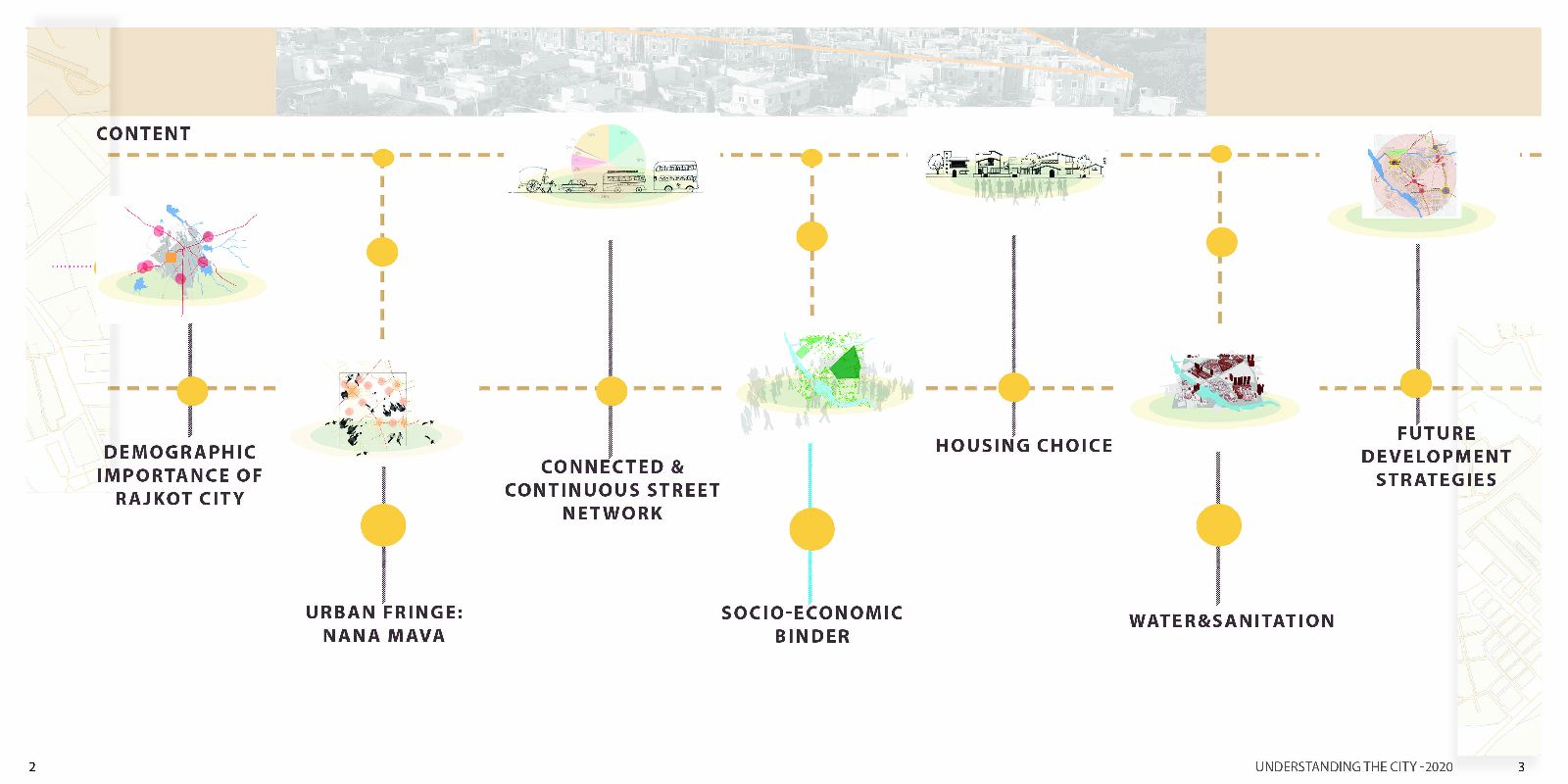
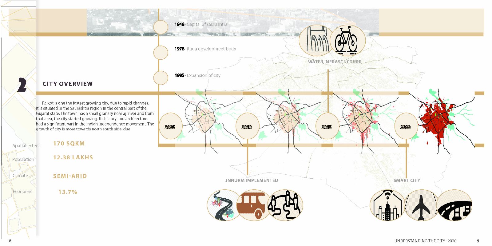
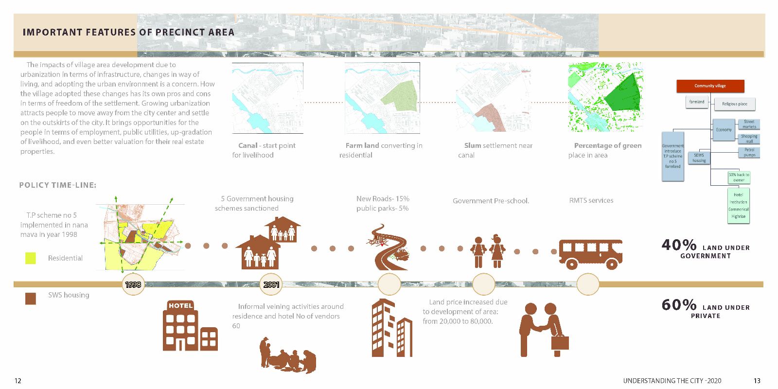
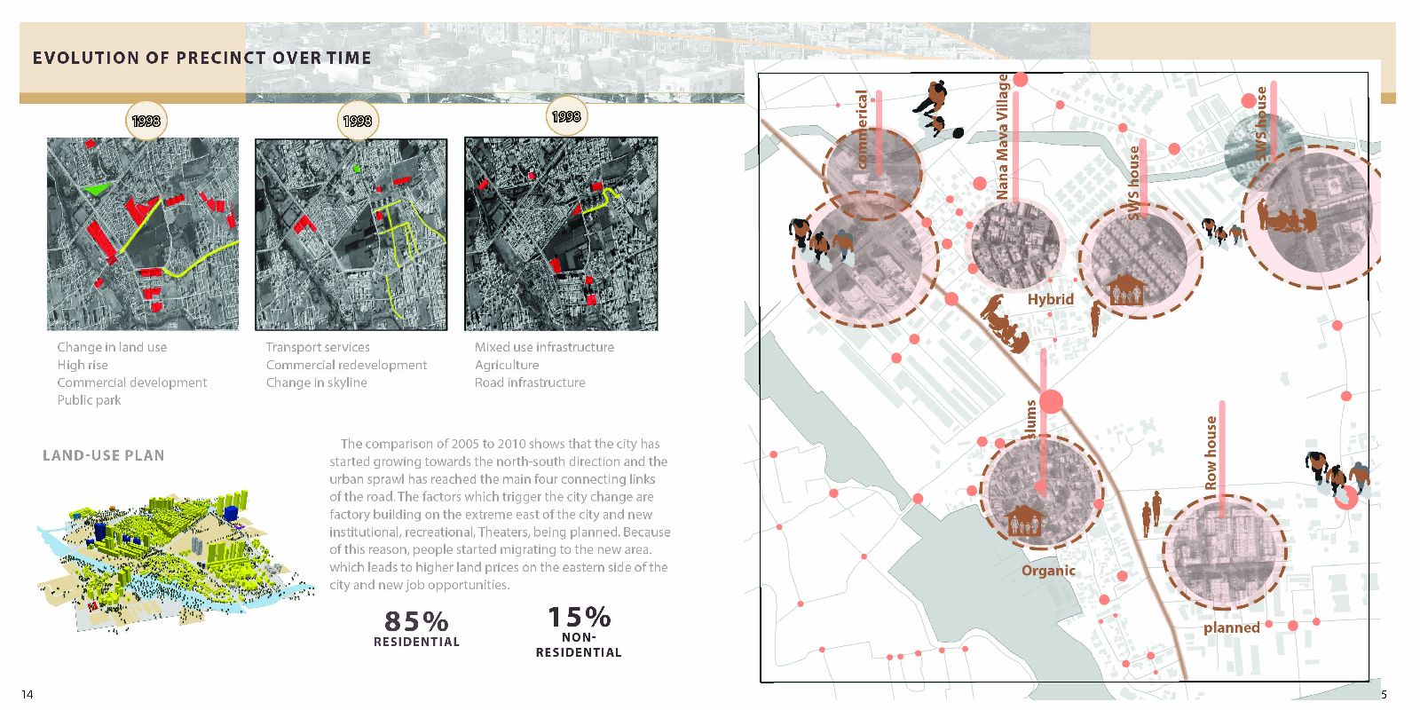
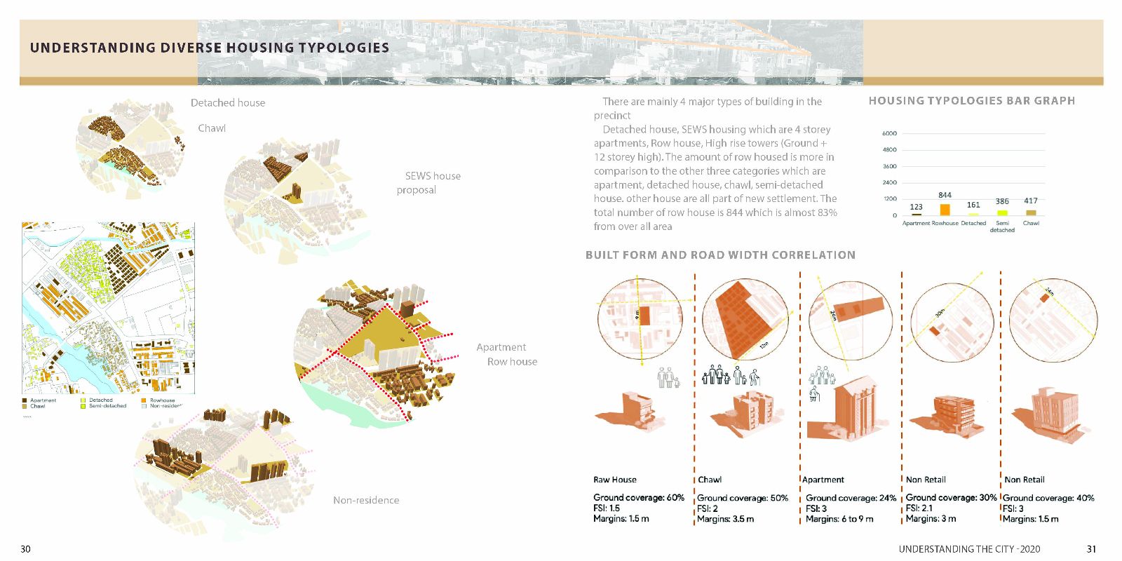
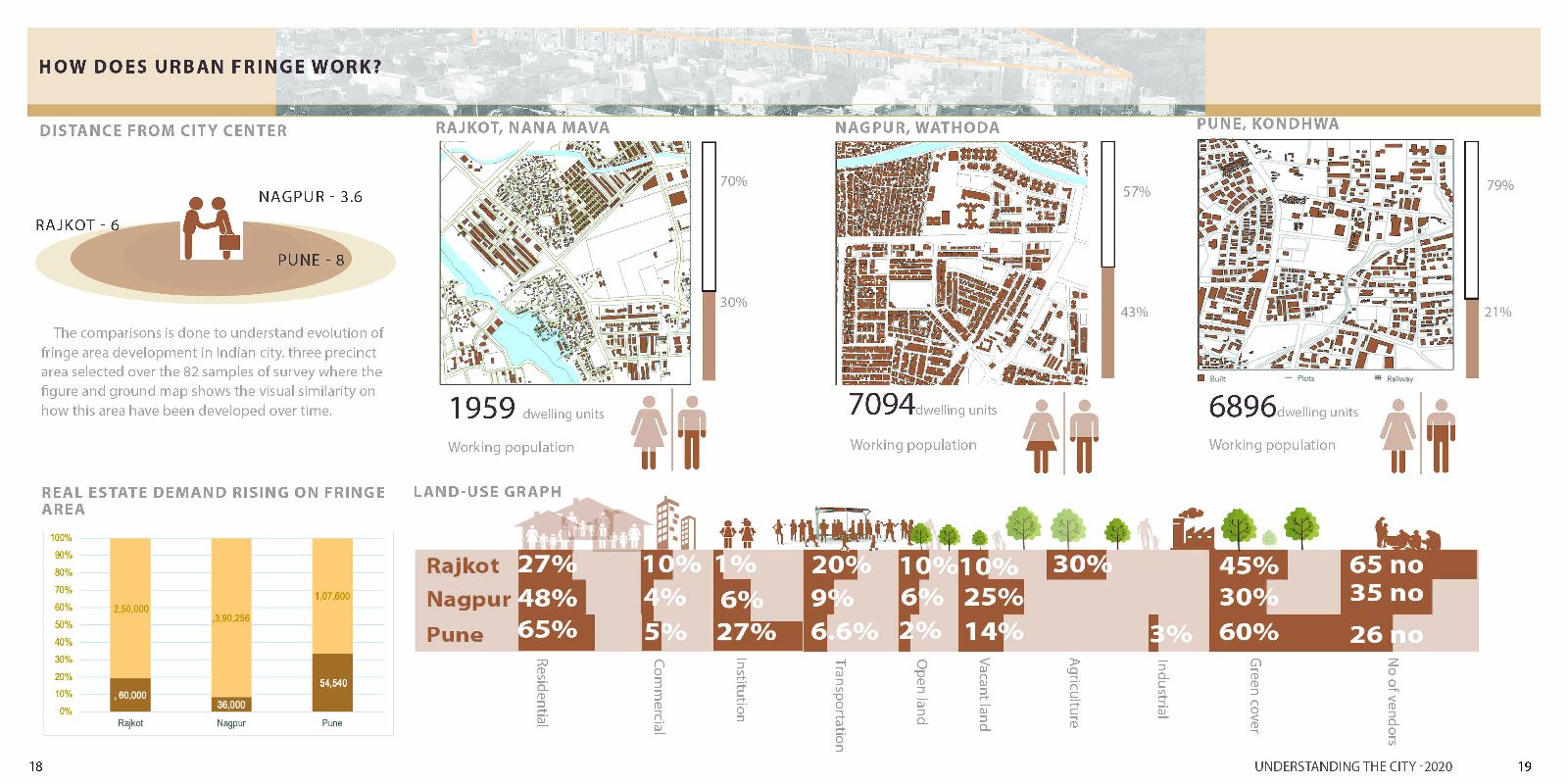
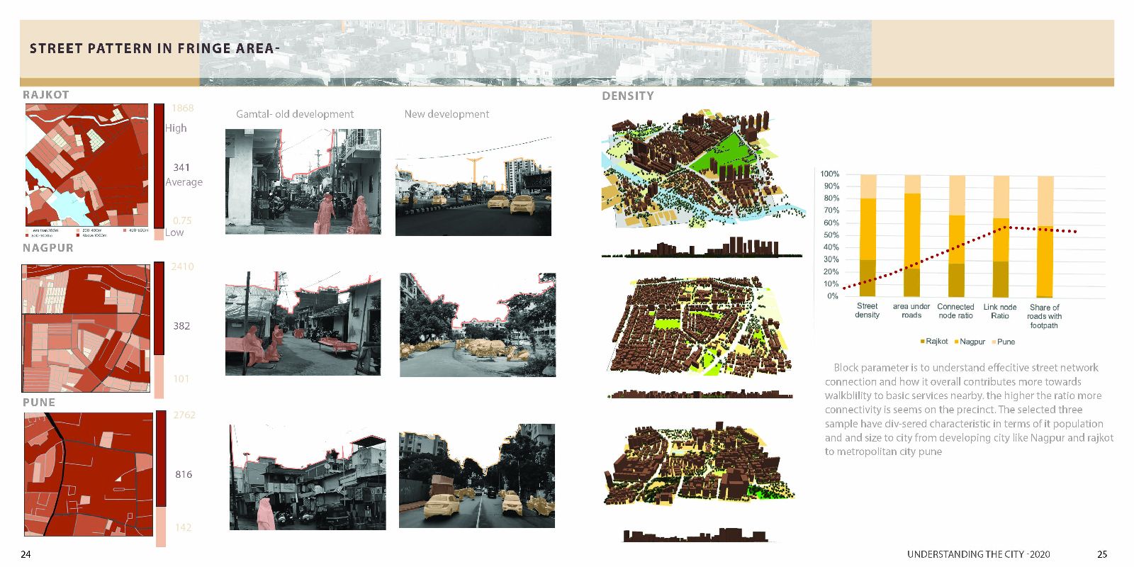
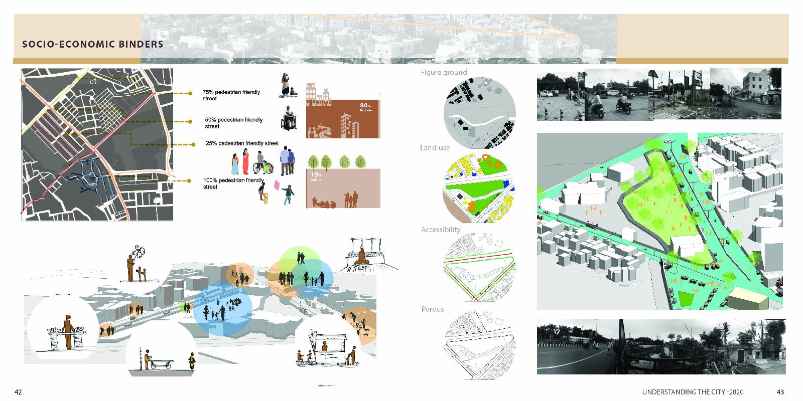
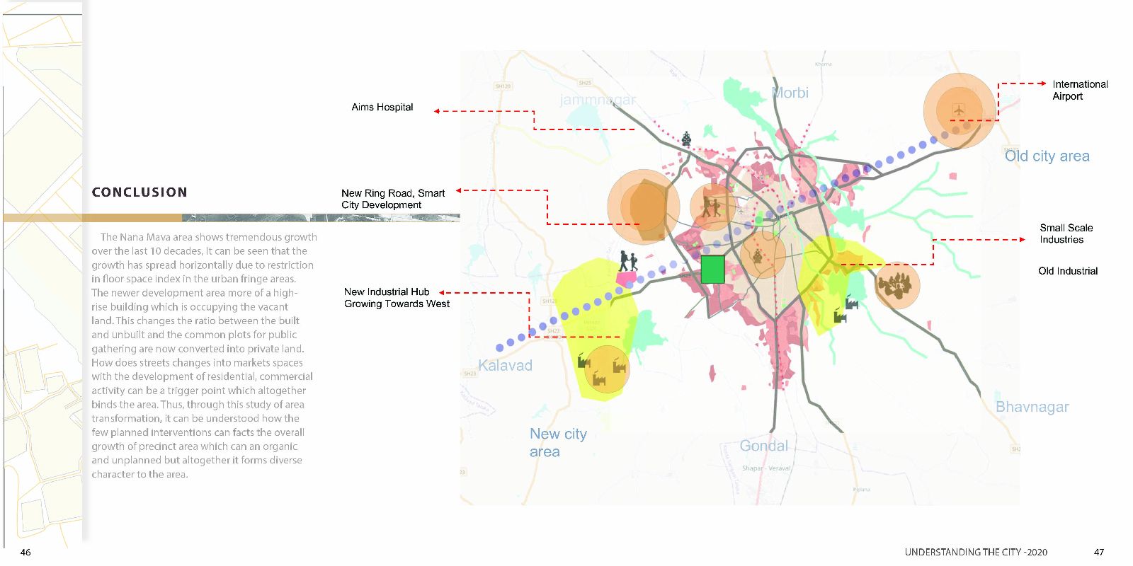
Rajkot is one the fastest growing city, due to rapid changes in the city, The report comprises of key factors which help to understand city morphology. It briefly describes city networks, form, and patterns, public spaces. the report is based on preliminary observation which is derived from satellite imagery. (Goggle earth). and decode the layers based on theories of urban planning, the layers are analyzed based on Understanding history, street networks, land use and city density, public realm on where people go for there leisure time after work, where do children play?. As the precinct area is a great example of urban fringe development this study helps to on how the street is expanding towards the existing city area and forming into a bigger city as a whole in a radial pattern. the Nana Mava area, which is an urban fringe, the village area that became part of the city. So the observation is mainly based on how does this area transformed due to government intervention and what are the positives and negative aspects for the same. The analysis is done on preliminary observation by the author, which has been put together to find interpretation from the existing site conditions. The precinct area has been studies to understand how does green filed agriculture land changes to mix and use. What are the major triggers which lead to the transformation of the precinct area, how does people’s livelihood, built environment, are affected, The Analysis done more micro to macro analysis where the precinct is analyzed from the satellite image to understand the built footprint and relation to built typology.
