Your browser is out-of-date!
For a richer surfing experience on our website, please update your browser. Update my browser now!
For a richer surfing experience on our website, please update your browser. Update my browser now!
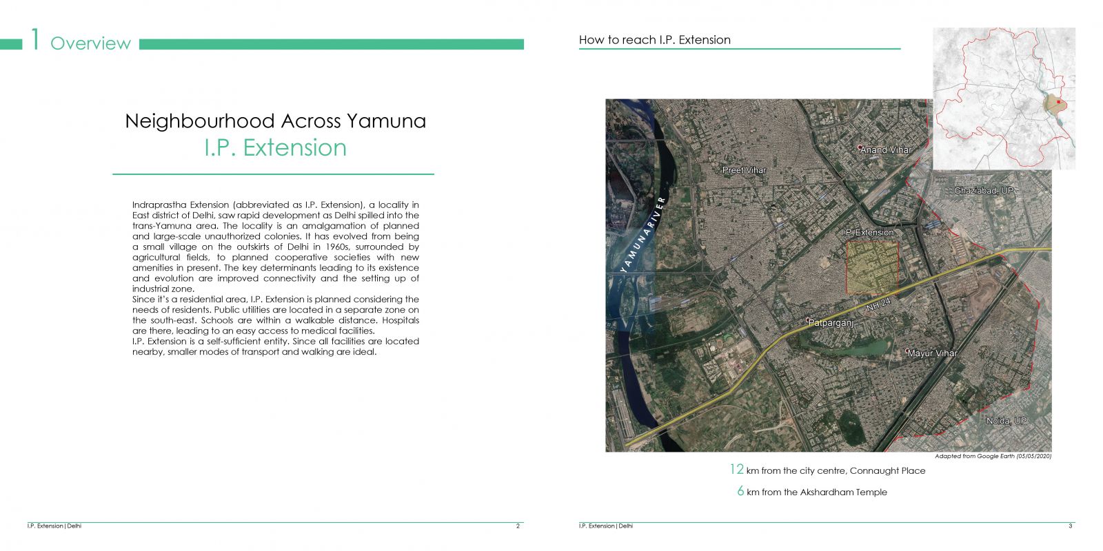
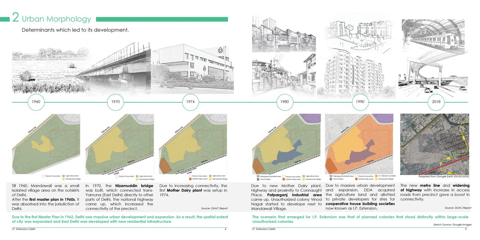
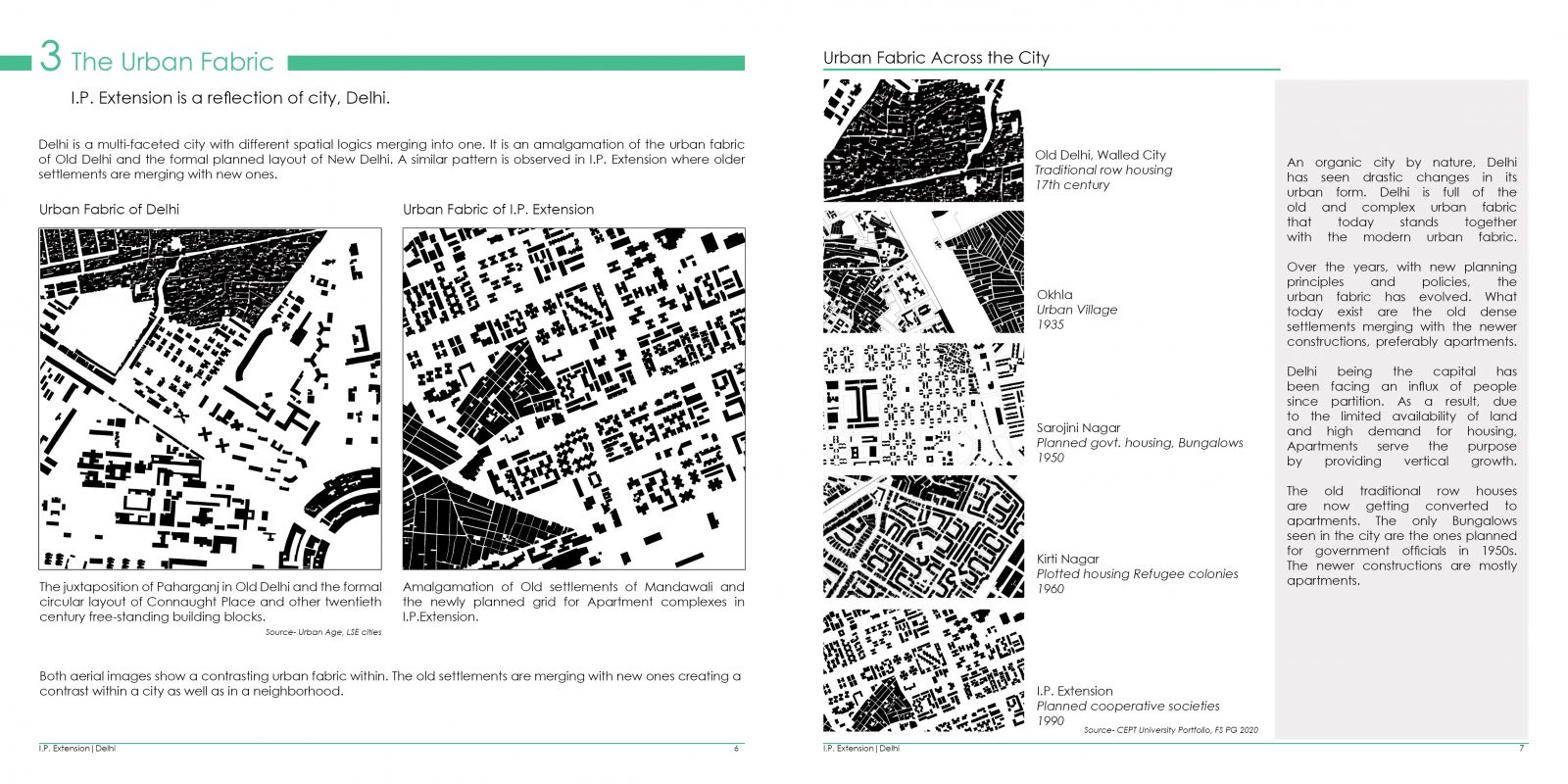
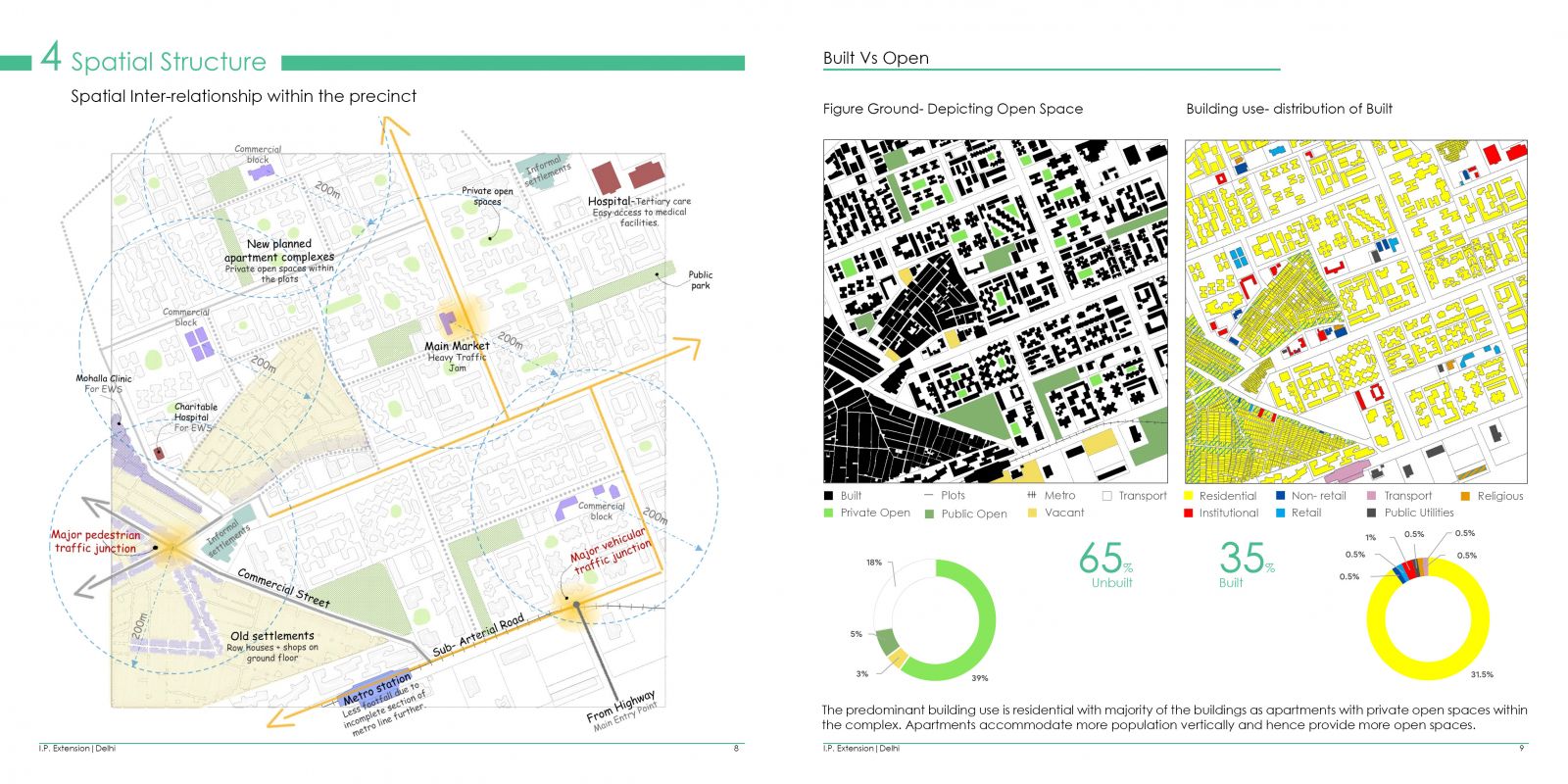
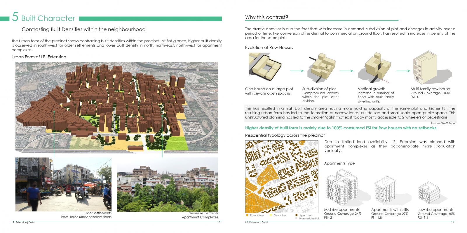
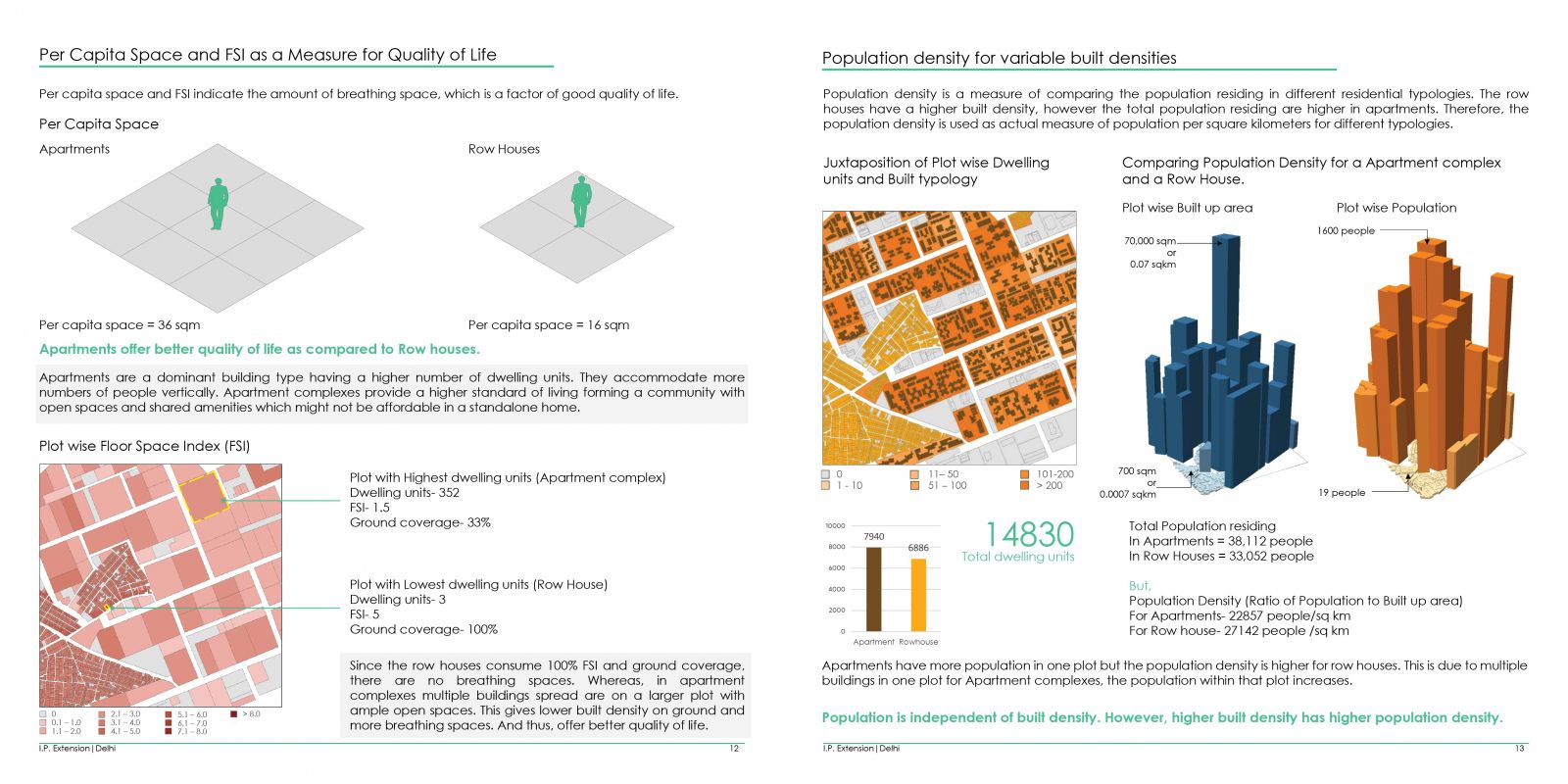
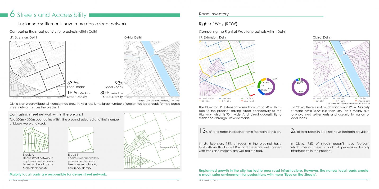
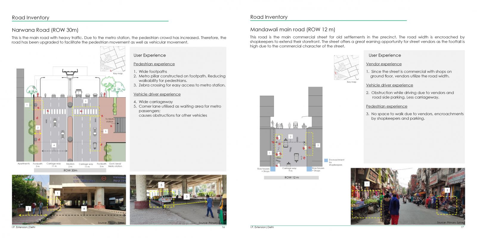
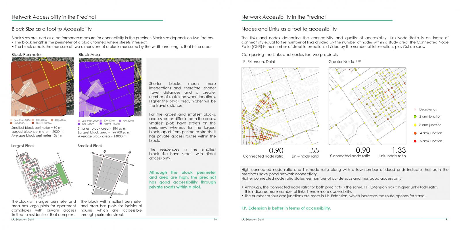
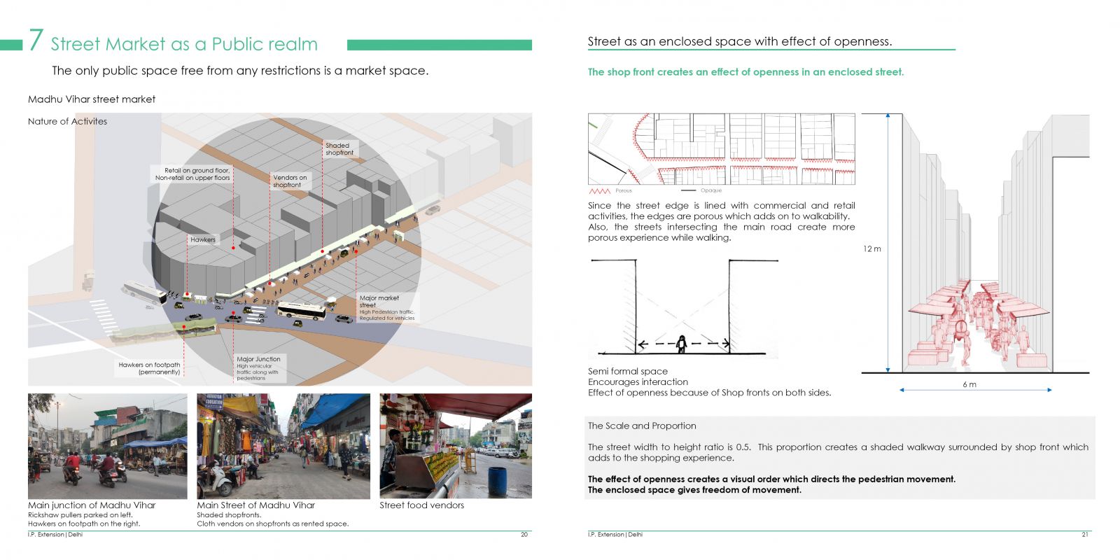
The study focuses on understanding and analysing the development and evolution of a neighbourhood, I.P. Extension, a 1km by 1km stretch in Eastern district of Delhi. It focuses on an evidence-based approach for framing and analyzing complex urban situations and problems. It gives an overview of the contrasting building types within the precinct and their interaction with the existing and new infrastructural developments and explores why these built forms came up. The key determinants of transformations are identified and mapped out, and their impact is analysed, based on interviews with the residents, aerial imagery analysis and secondary surveys. The interrelationship between vehicles and pedestrians is analysed focusing on the measure of connectivity at precinct level through road hierarchy, accessibility and the physical features of streets.
