• Home
  • FP
  • UD4001-3
  • Urban Serenity (Integrated Residential Township Shahpur)

Patel Tejendrakumar Prakashchandra

UD4001-3

Urban Serenity (Integrated Residential Township Shahpur)

The studio focuses on designing large greenfield developments near GIFT City (Shahpur) to meet the expansion demands of rapidly growing urban centers. Two key development mechanisms, Integrated Township Policy (developer-driven) and Town Planning Schemes (government-driven), shape street networks, public spaces, and infrastructure, defining the urban character. Emphasizing livability, the studio creates urban design master plans exploring future living concepts, with a focus on enhancing urban character through sensitivity in public spaces. The design process includes case studies, three-dimensional plans, street and block strategies, public amenities, transportation integration, and phasing strategies. The studio outcome features effective representation graphics and persuasive communication strategies for the design projects.

View Additional Work
Report Content

This exercise is designed to develop a strategic understanding of various attributes regarding townships and their components – vision, objectives, design process, strategies , building types, streets and urban open spaces, and building massing. The idea behind the exercise is to identify and represent the prevailing township in close proximity to cities and develop skills to draw these blocks and their three-dimensional forms that abstract the character of the blocks and representation.

This exercise explains a comprehensive exploration of the site’s current conditions and the envisioned future. Subsequently, it candidly addresses the challenges, providing an insightful analysis of regulatory, environmental, and landscape constraints. A conceptual framework is developed to guide the design and development process, encompassing land use, architecture, and community engagement.

This exercise further explores landscape and zoning strategies, detailing how the physical environment will be optimized to align with the vision. Overall, this chapter serves as a road map for Shahpur’s development, intertwining existing context, scale of building massing, theoretical principles and a visionary conceptual outlook to inform subsequent stages of the project.

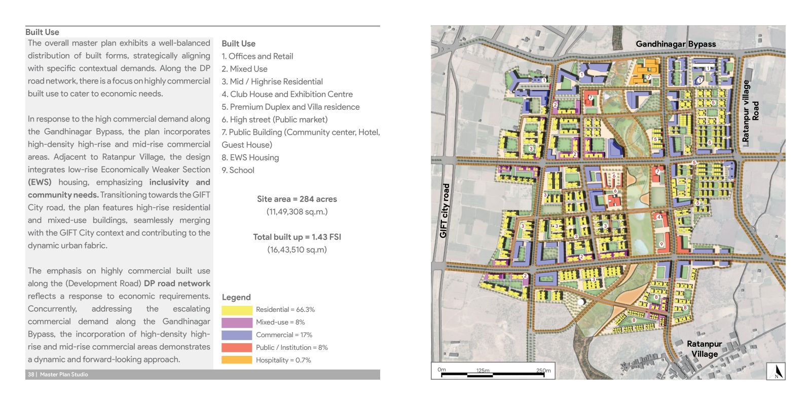
This exercise is divided into three key aspects that shape the spatial organization of our envisioned community. Beginning with exploring the Hierarchy of street networks and built form, emphasizing the structural order of our streets and the corresponding built environment. In the second part, scrutinize the Master Plan and Built Use, detailing the allocation and integration of various functions within the urban fabric.

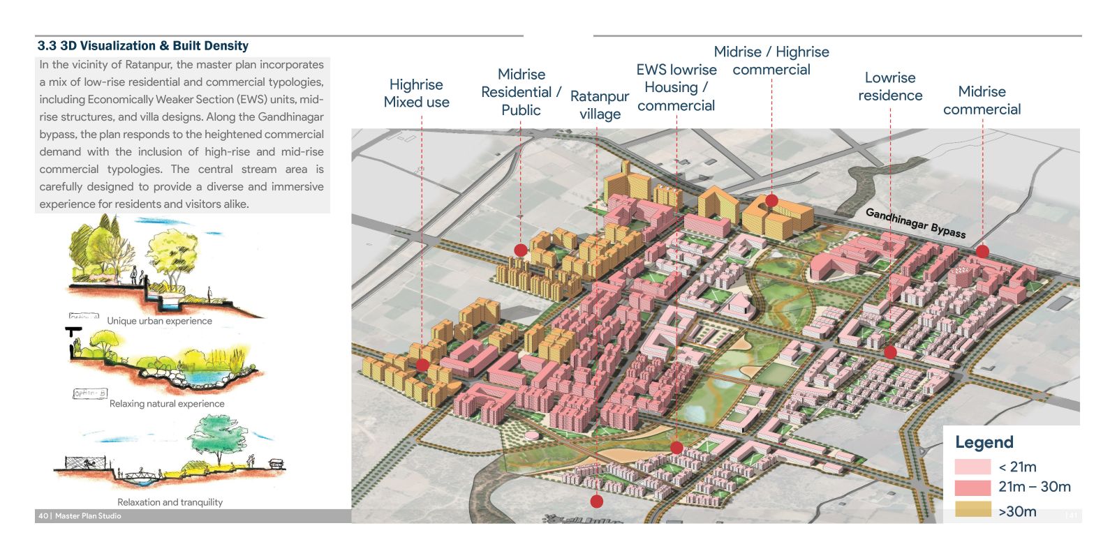
In this part, focuses on 3D Visualization - isometric view and built density, providing a visual narrative of the proposed urban form and the density it accommodates. Finally, distill the insights gained throughout the process into key learnings that inform and refine our approach to master planning and urban design for the township.

This exercise delves into the intricate design principles of urban blocks and public spaces, spotlighting the deliberate integration of three open space types within the urban fabric. From the strategic placement of commercial nodes to the nuanced consideration of average perimeters, the narrative unfolds, showcasing a comprehensive approach that fosters community engagement, addresses diverse needs, and cultivates a vibrant and well-rounded urban core

This exercise unveils a design ethos dedicated to crafting a lively and dynamic urban environment. At its epicenter lies the main street junction, a vibrant hub adorned with a striking mixed-use and commercial node, serving as the nexus for heightened urban activity and an elevated overall urban experience.

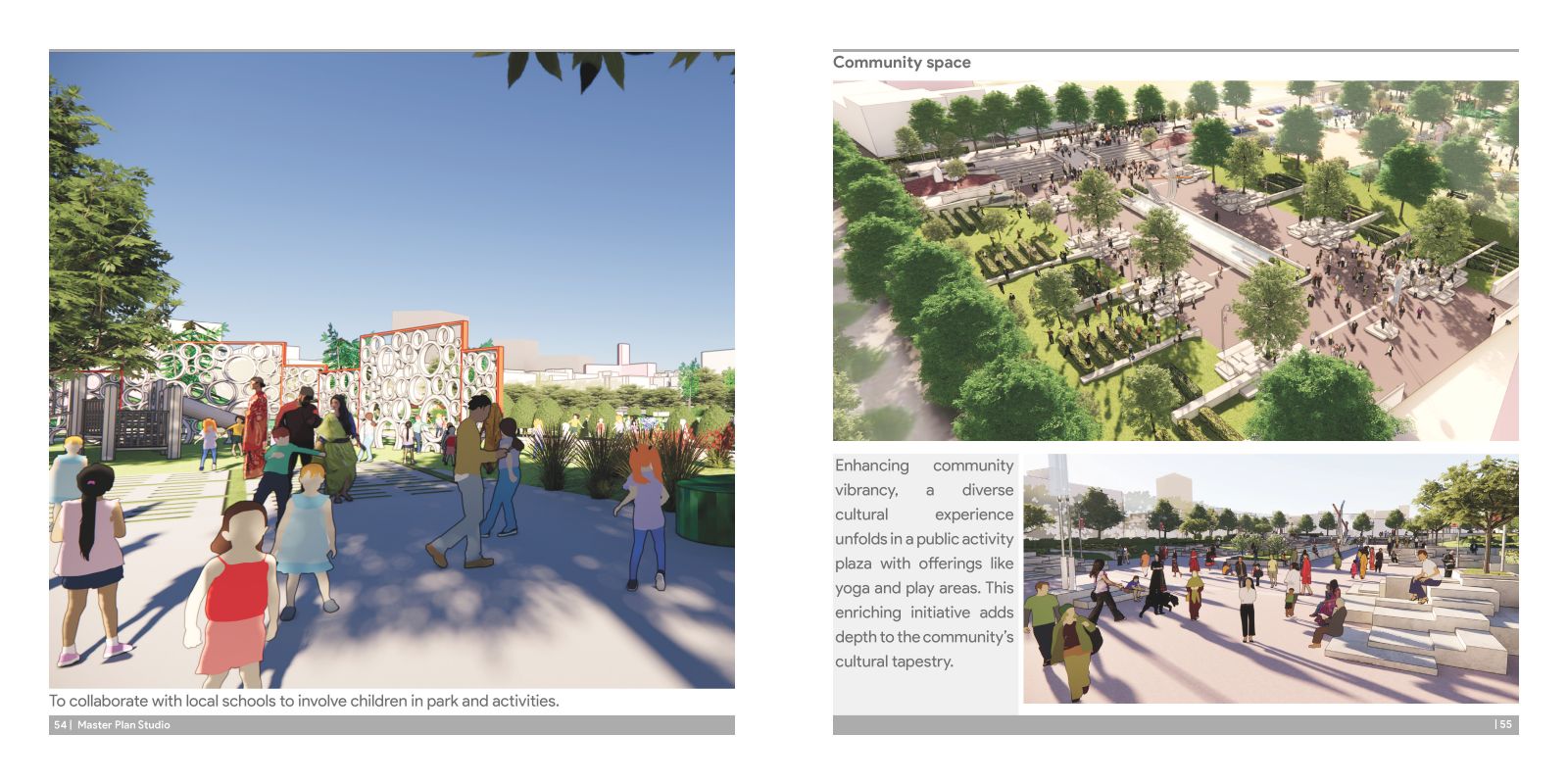
Enhancing community vibrancy, a diverse cultural experience unfolds in a public activity plaza with offerings like yoga and play areas. This enriching initiative adds depth to the community’s cultural tapestry.

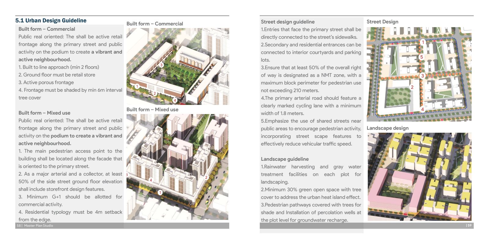
The Urban design guidelines are crafted to shape a vibrant and sustainable community. Emphasizing public realm orientation, the guidelines advocate for active retail frontages and podium-based public activities, fostering a dynamic neighborhood. These principles extend to mixed-use and residential areas, promoting connectivity, porous boundaries, and green spaces for an inclusive and visually appealing environment.

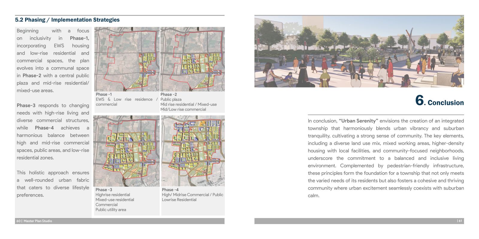
The strategic phasing plan unfolds in four stages, seamlessly integrating diverse elements like Economically Weaker Section (EWS) housing, commercial zones, public plazas, and high-rise structures. The preface reflects a commitment to creating a well-designed, resilient urban fabric that evolves in harmony with the community’s needs and aspirations.