Your browser is out-of-date!
For a richer surfing experience on our website, please update your browser. Update my browser now!
For a richer surfing experience on our website, please update your browser. Update my browser now!
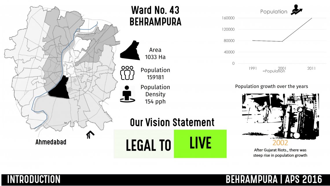
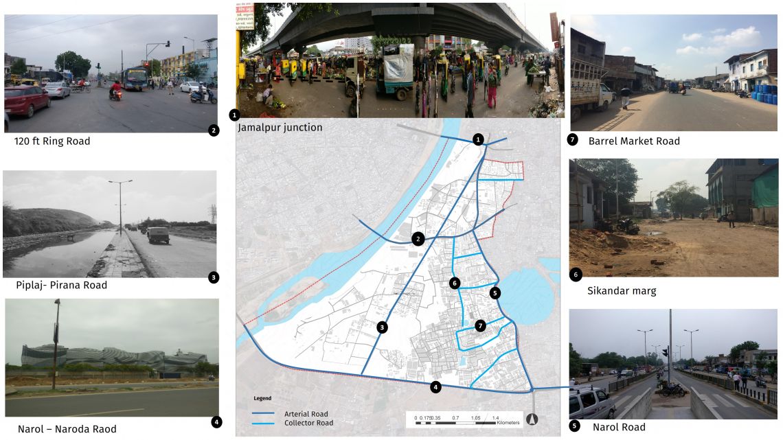
Behrampura (Ward no 43), lies to the south east of Sabarmati River in Ahmedabad. It has an area of 1033 hectare residing 159181 population (Census 2011). It has a gross density of 154 pph which is greater than the average density of Ahmedabad, i.e., 120pph. The ward is predominantly industrial followed by residential. Industrial and residential areas lie in close proximity to each other which creates health issues for the residents. The internal connectivity in ward is poor leading to inaccessible spaces.There is City level Dumping site 'PIRANA' which pollutes the soil, air and water in the nearby region.