Your browser is out-of-date!
For a richer surfing experience on our website, please update your browser. Update my browser now!
For a richer surfing experience on our website, please update your browser. Update my browser now!
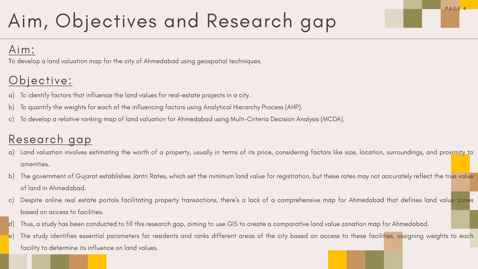
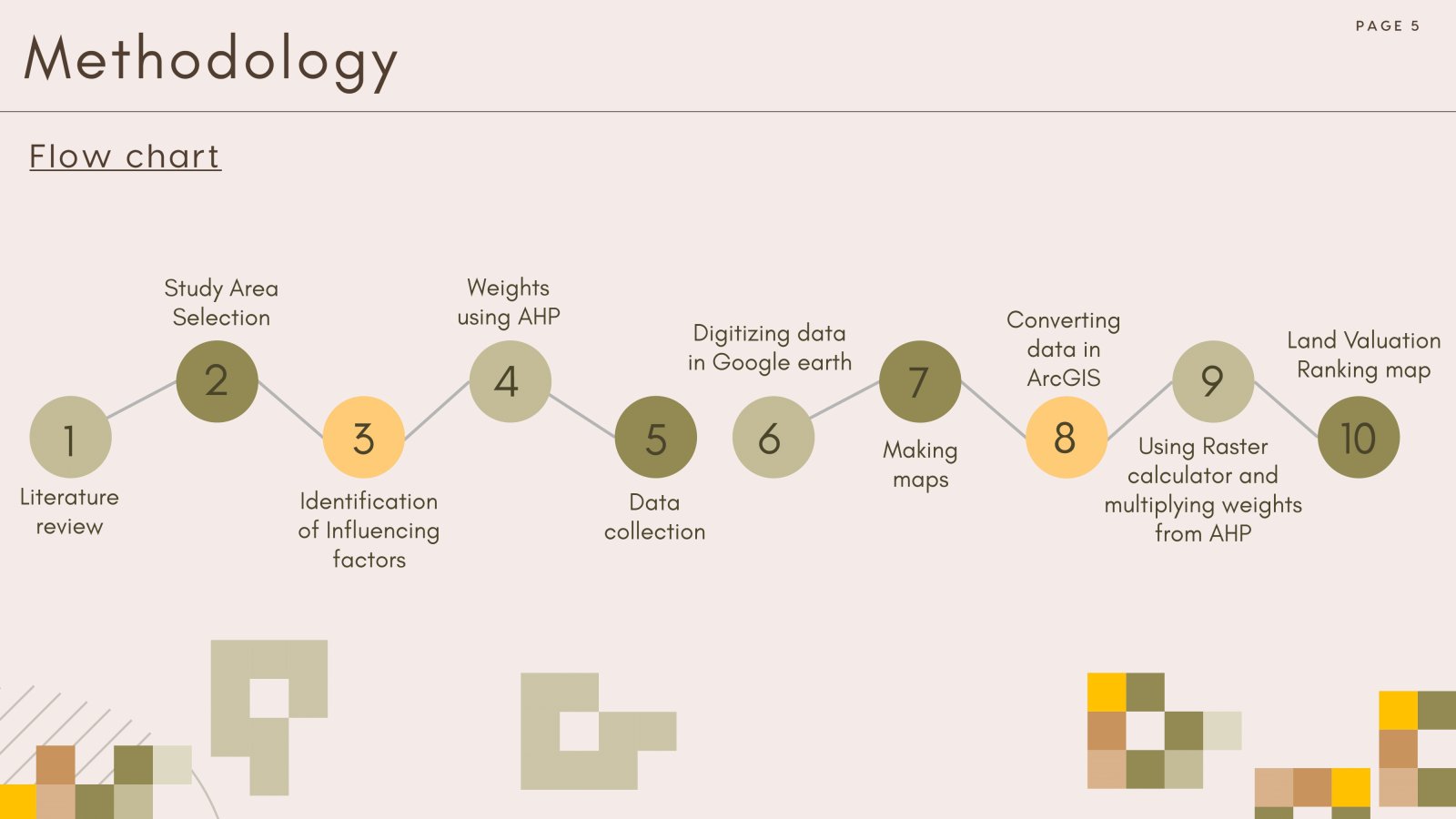
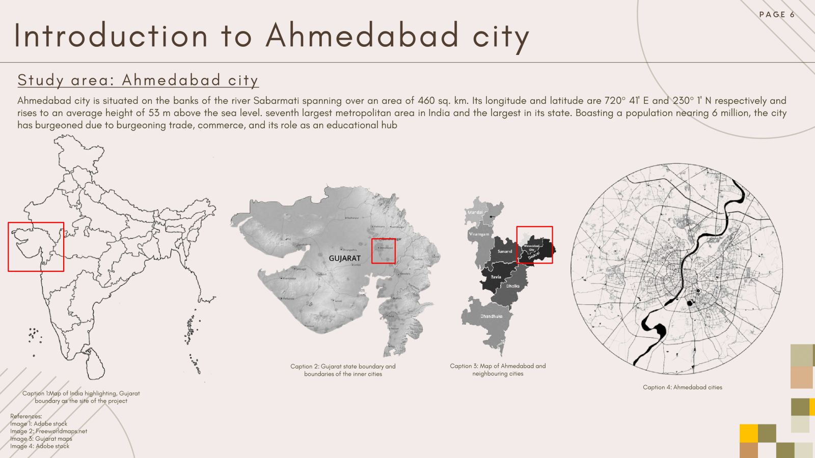
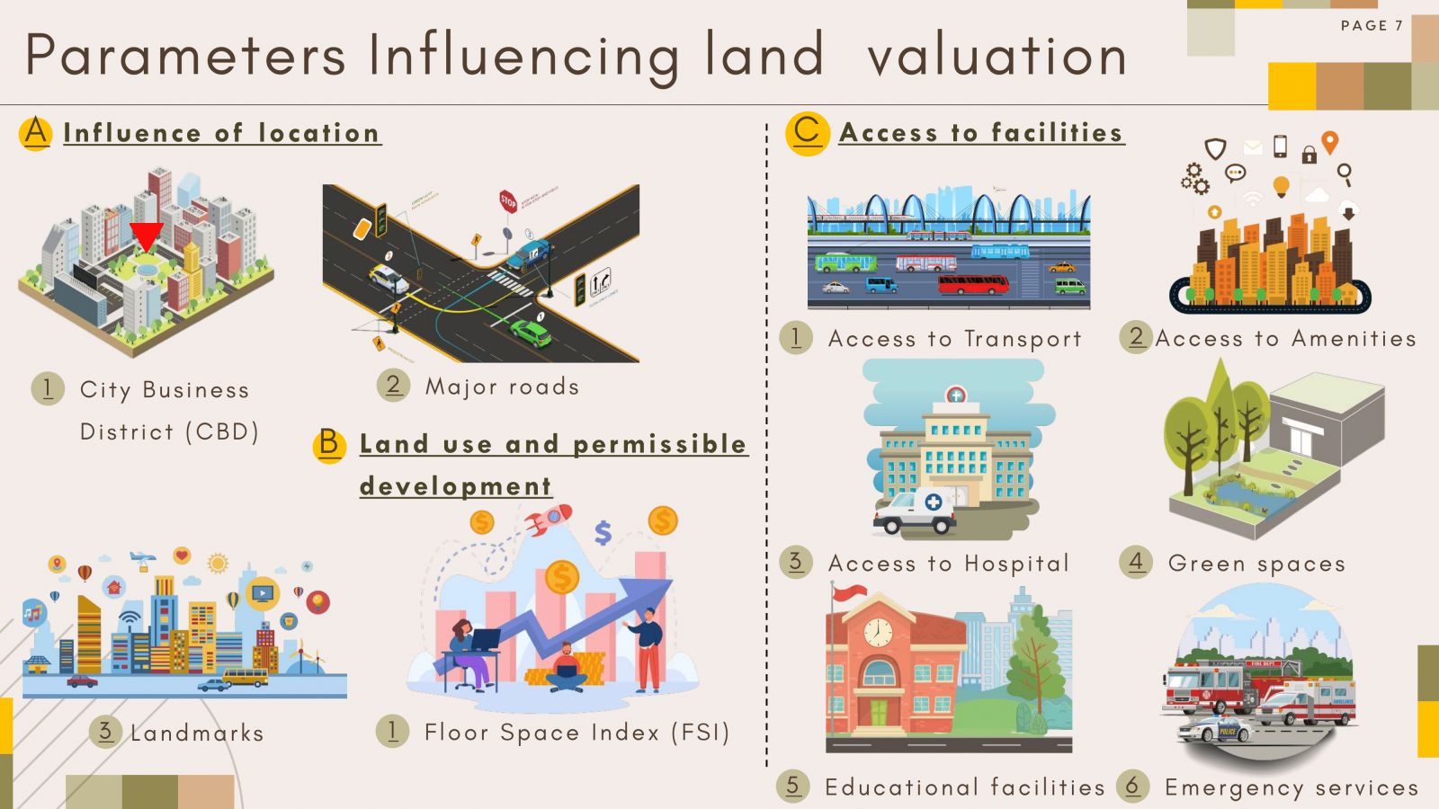
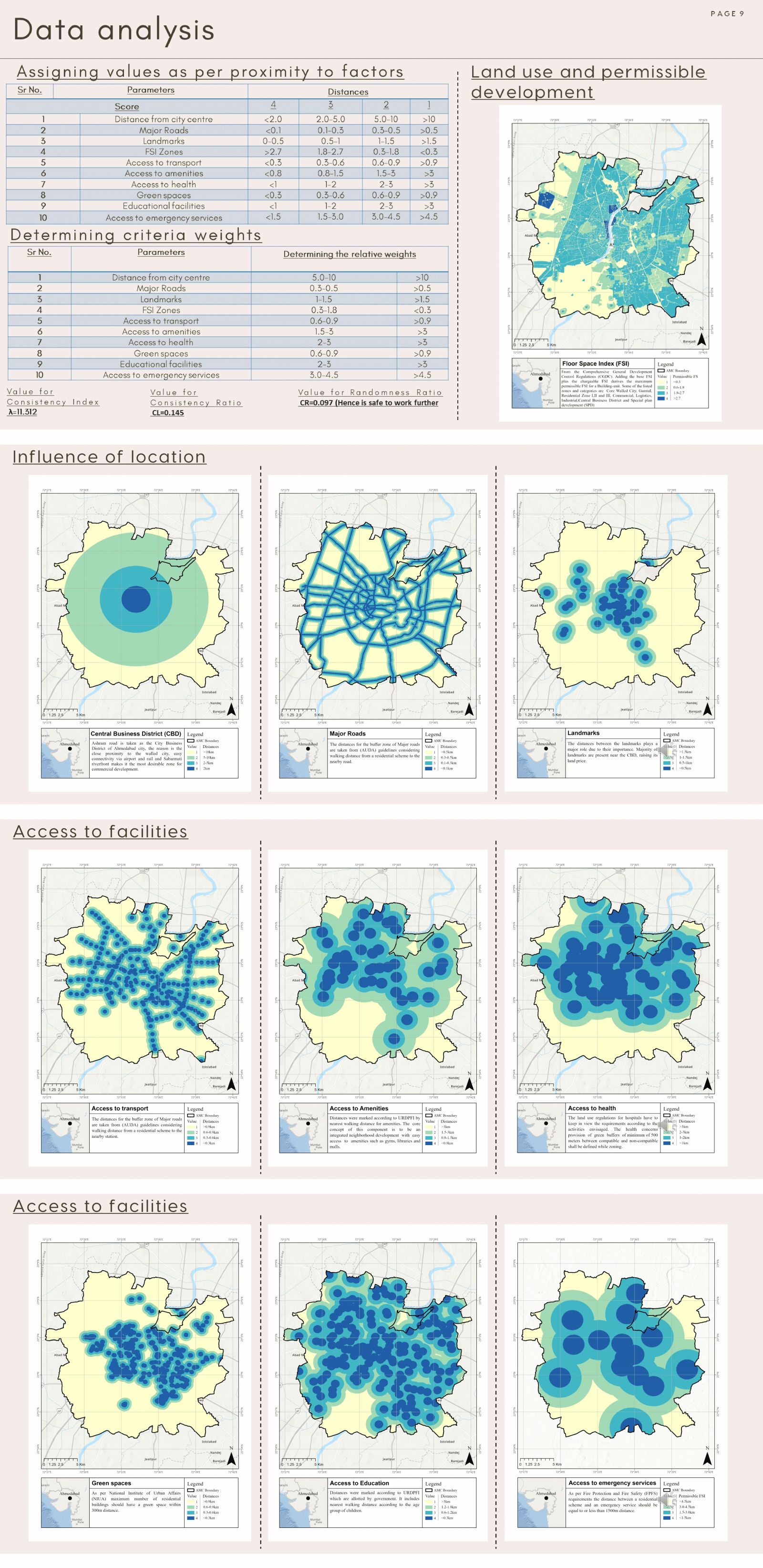
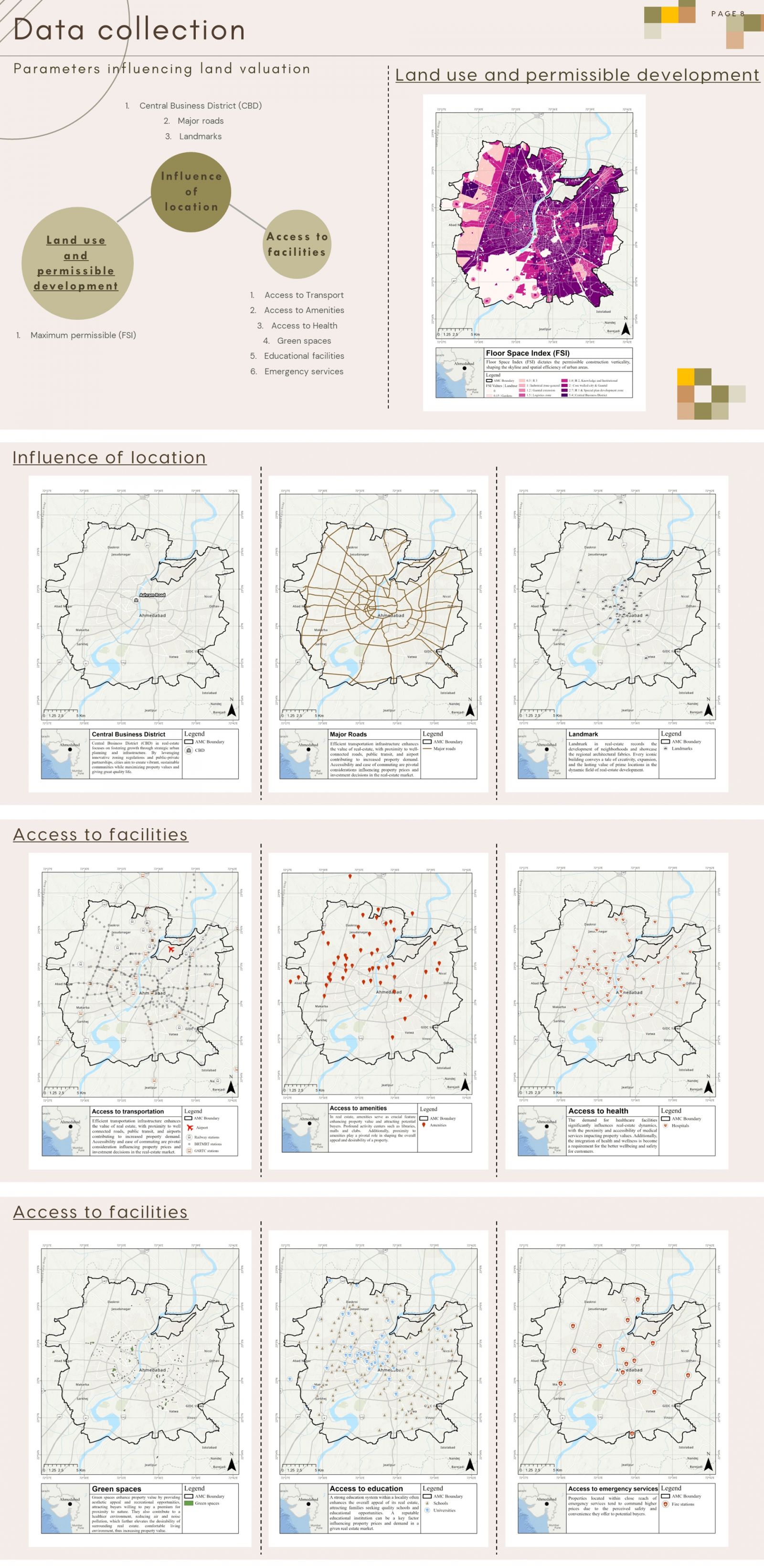
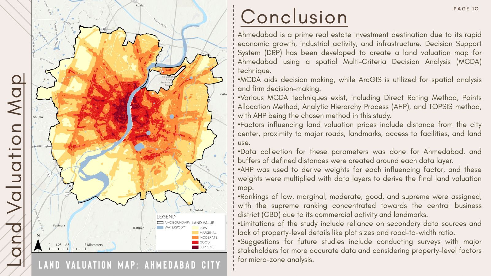
Land valuation can be defined as a process by which the worth of a property can be estimated, and generally, it is determined in terms of its price. In Ahmedabad, there's currently no map available showing the value of different land areas. Therefore, the present study aims to identify factors influencing land values and derive a relative land value map for Ahmedabad. Spatial MCDA using GIS-based analysis has been employed for the same. A list of influential factors was mapped, and a rank value for different proximity ranges to the facility was assigned. These layers were then multiplied with their respective weights derived using a pair-wise comparison matrix. Finally, a relative land value zonation map for Ahmedabad has been prepared. The central part of the city is categorized as having a premium valuation, while the southwestern part of Ahmedabad is observed to have a low valuation. The majority of Ahmedabad is being assessed at marginal and moderate valuations. This study can be useful to urban planners for future planning, builders for future projects and redevelopment potential, common residents who can plan their real estate investments, etc.
View Additional Work