Your browser is out-of-date!
For a richer surfing experience on our website, please update your browser. Update my browser now!
For a richer surfing experience on our website, please update your browser. Update my browser now!
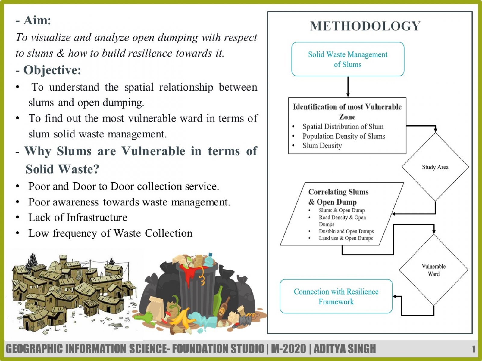
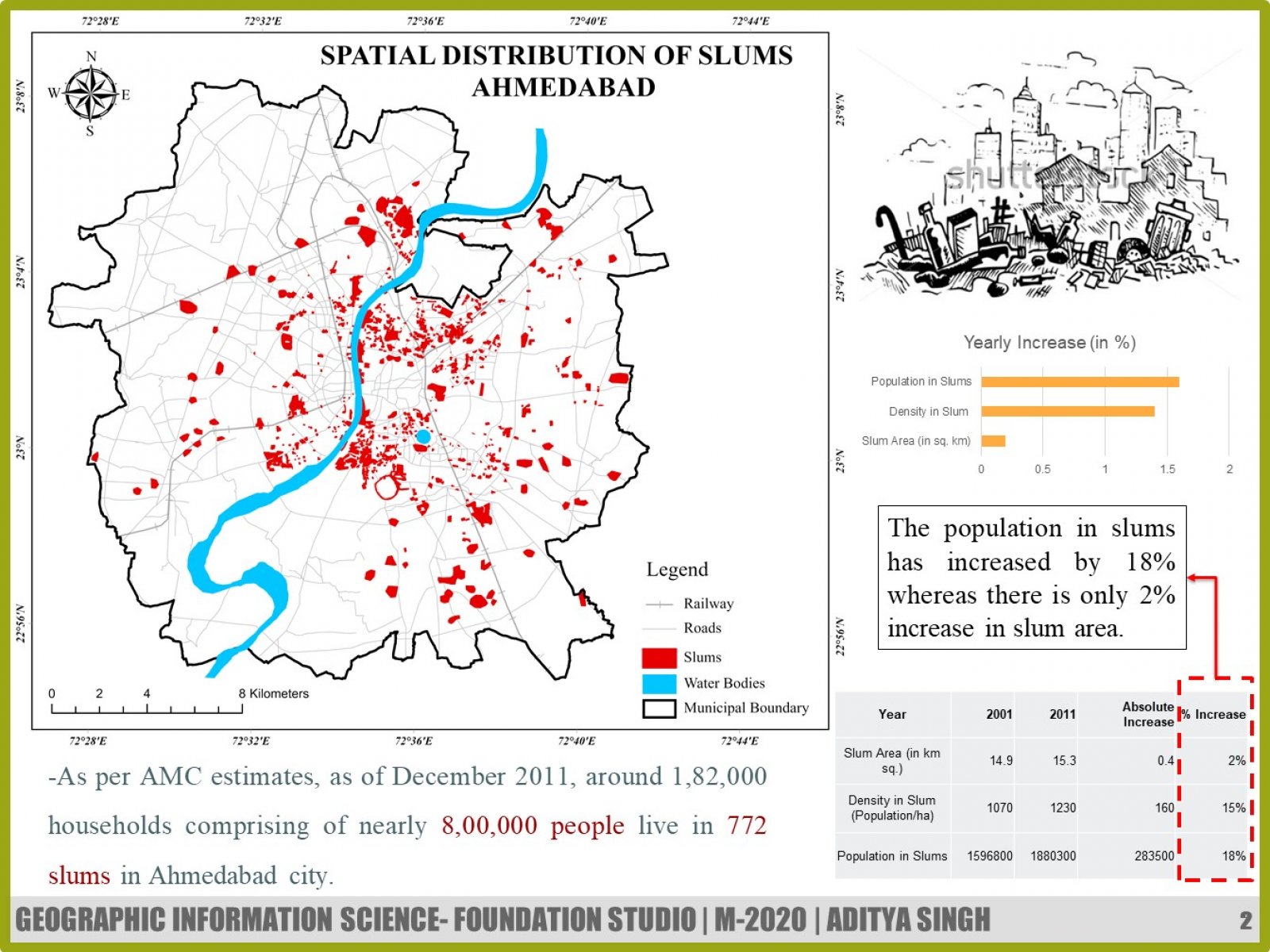
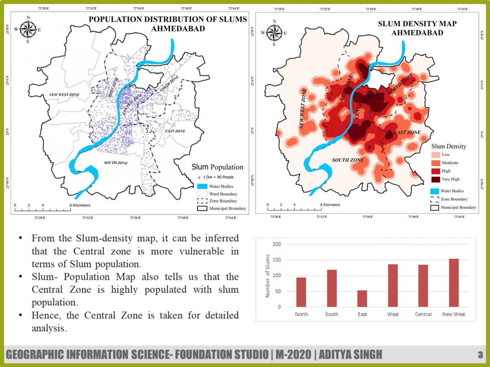
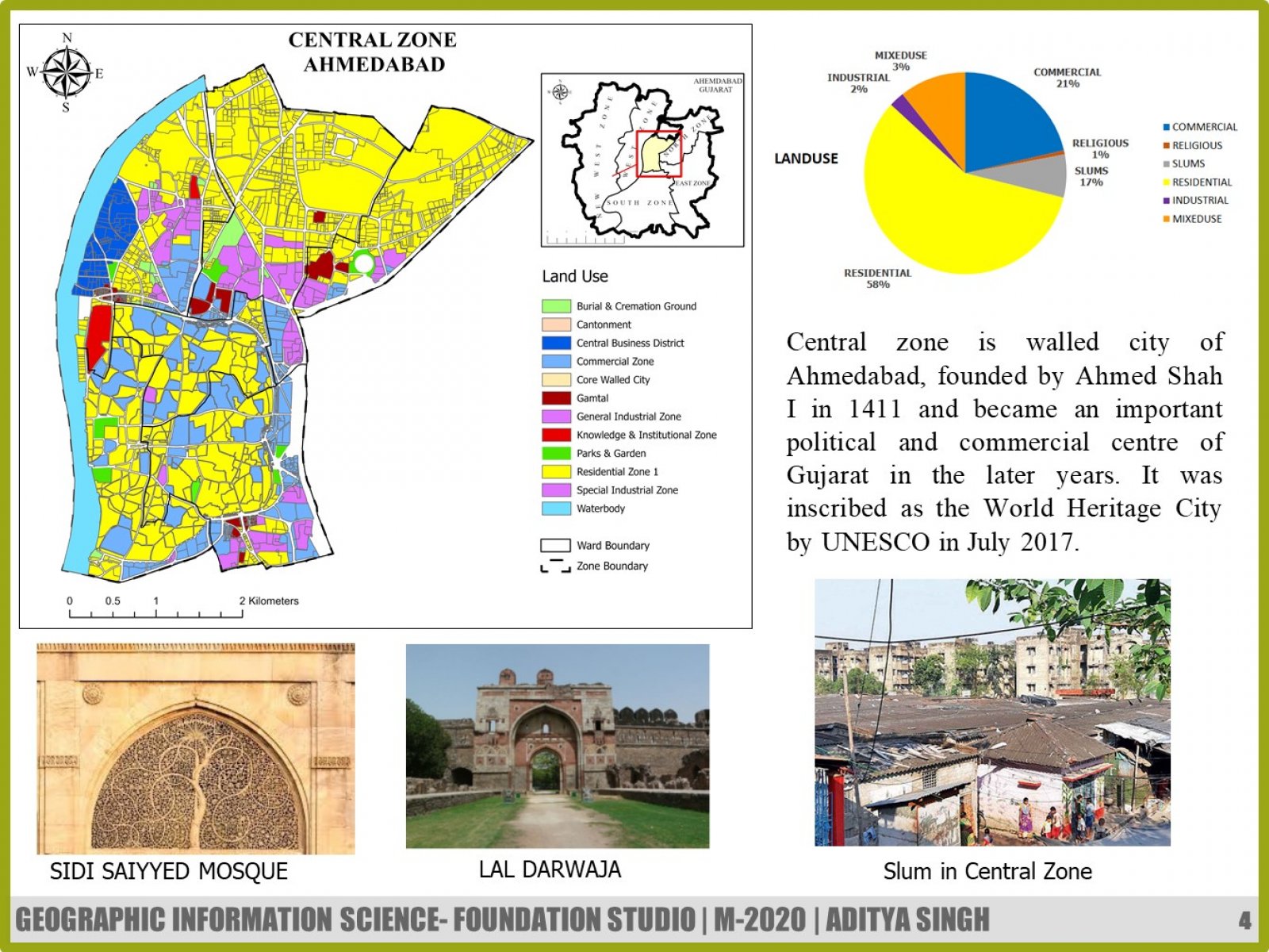
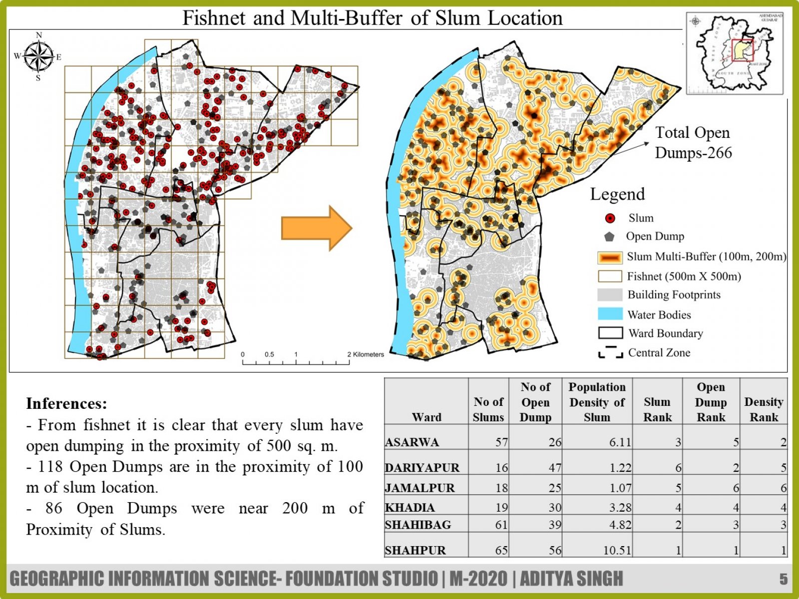
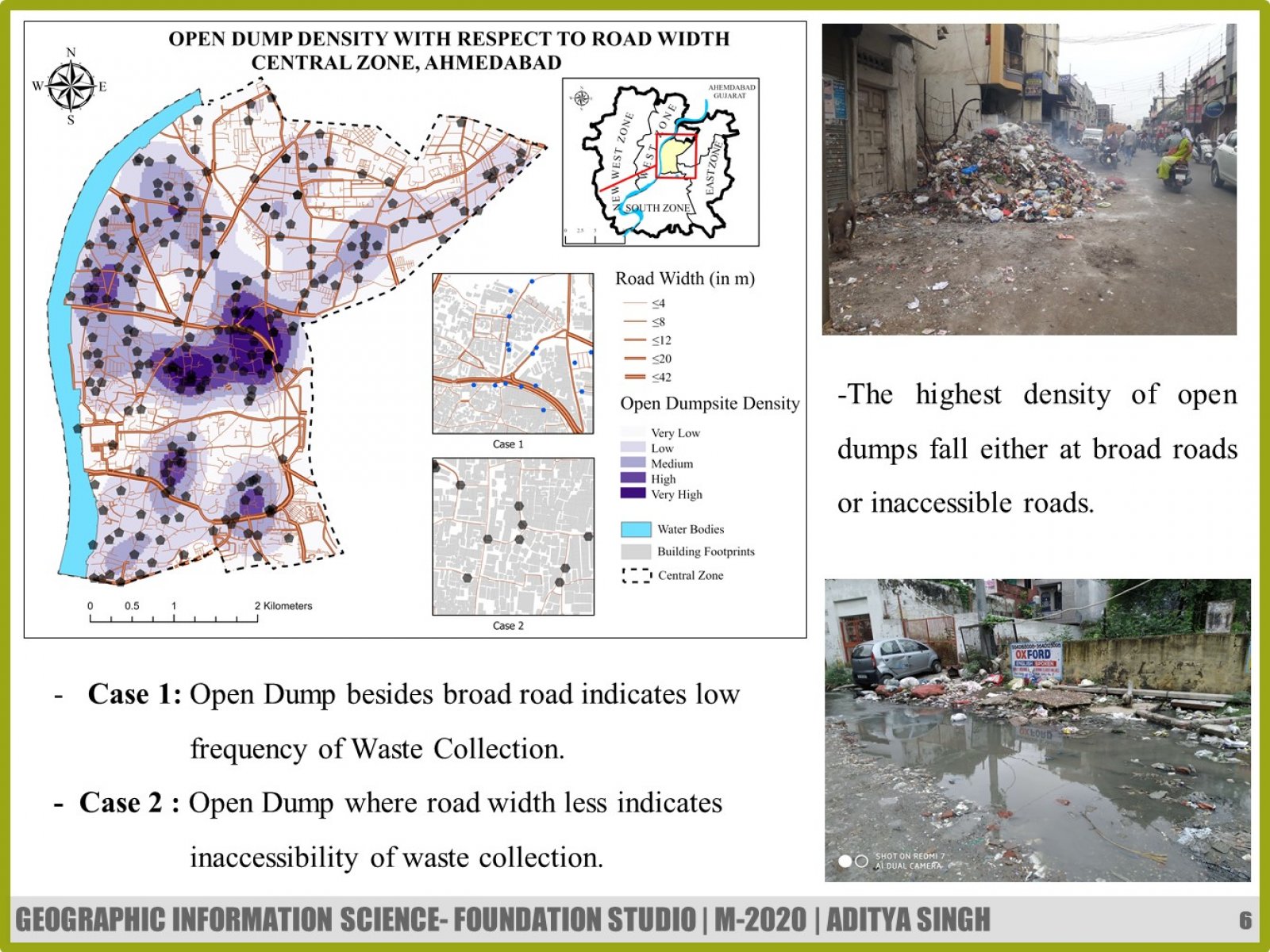
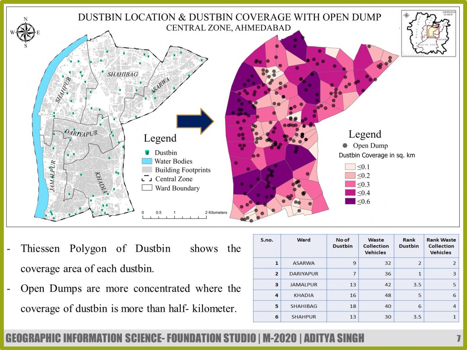
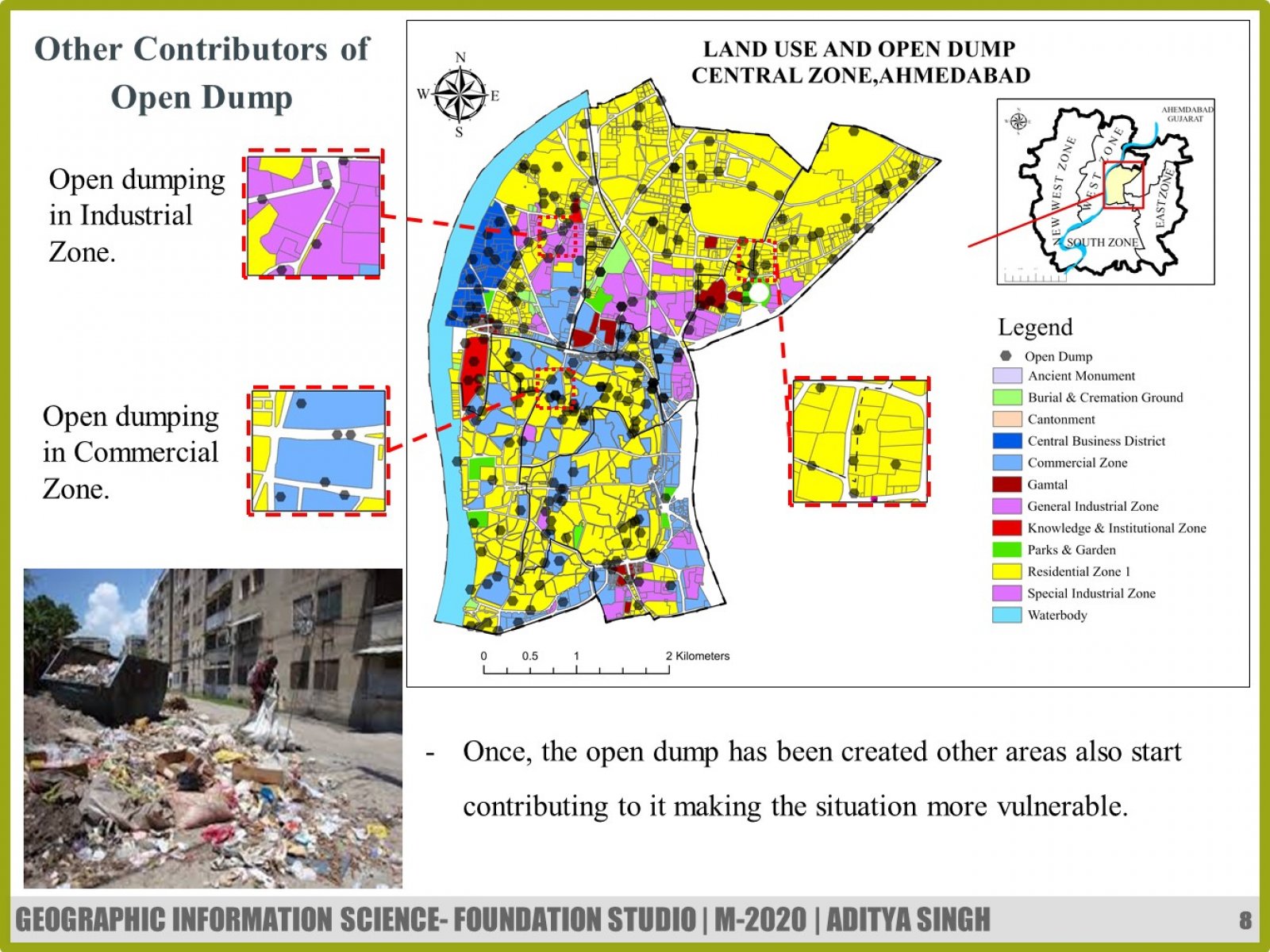
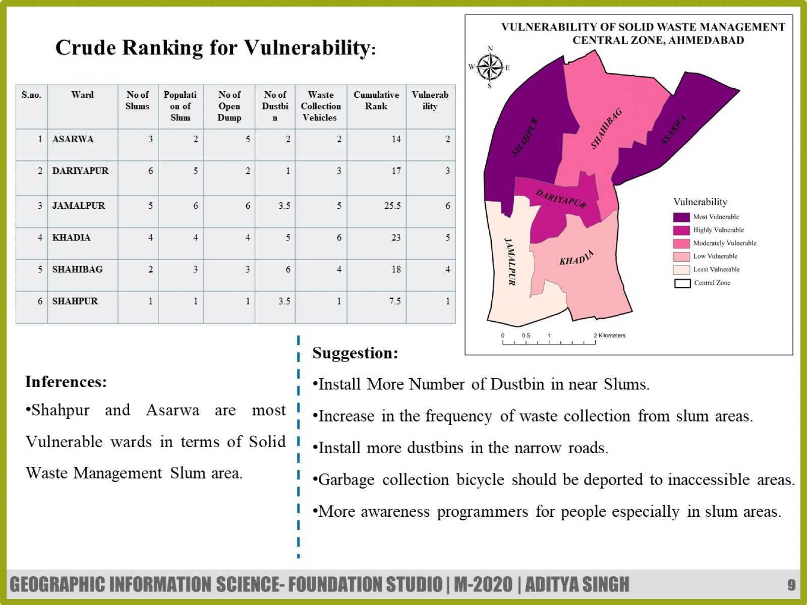
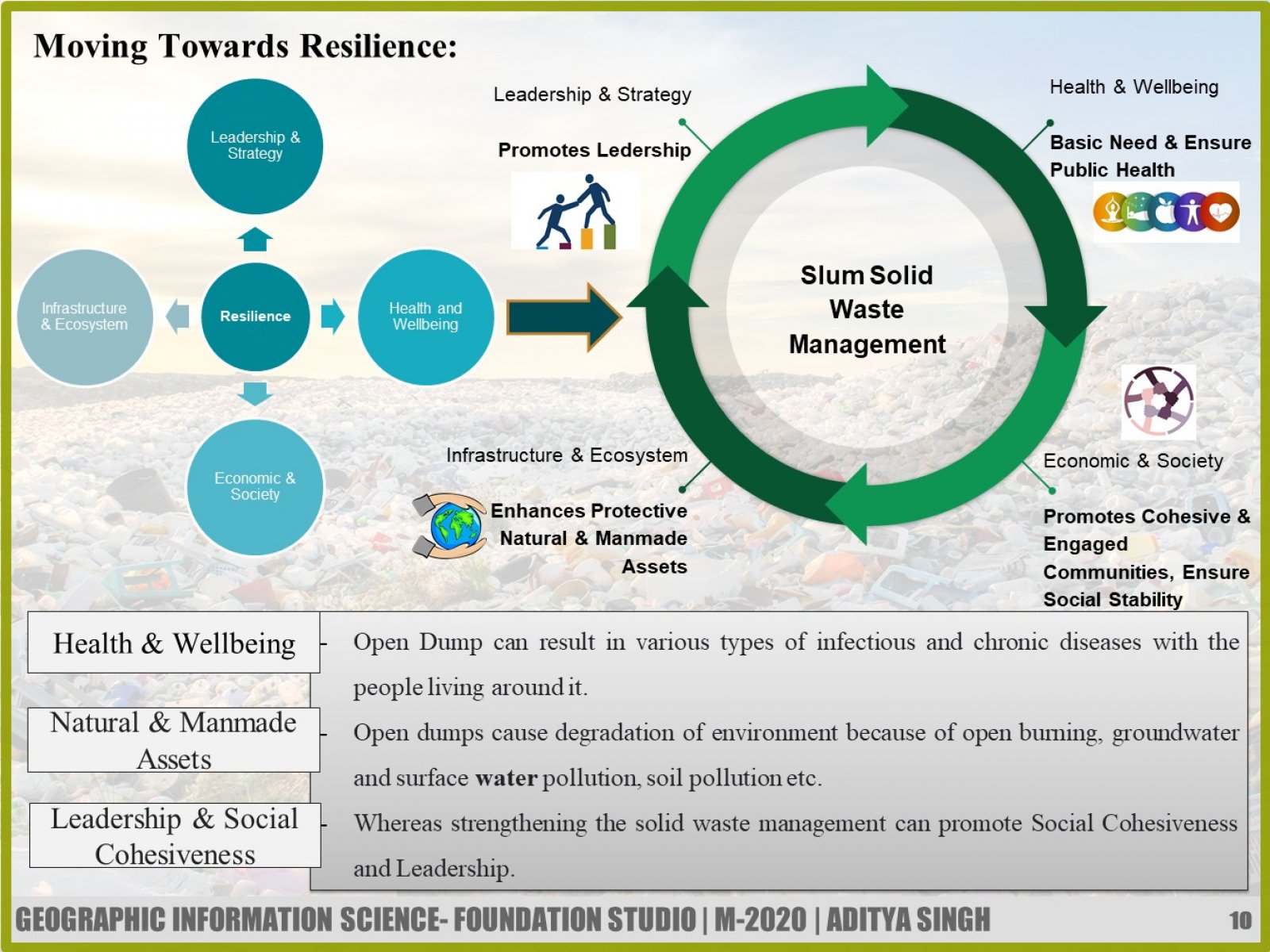
The main theme of the studio is Geo-Visualization under the framework of Resilient cities. The Study aims for highlighting the spatial relationship between the most vulnerable group of the urban area & open dumps. The urban slums have characteristic of high population density & the low level of infrastructure, which makes them the most vulnerable group. The Study also deduces the most vulnerable ward of the central zone by using appropriate Geo-Visualization tools and Crude Ranking method. Lastly, it points out the pillars of Resilience Framework which will be affected if by open dumping, taking Solid waste Management towards resilience.
View Additional Work