Your browser is out-of-date!
For a richer surfing experience on our website, please update your browser. Update my browser now!
For a richer surfing experience on our website, please update your browser. Update my browser now!
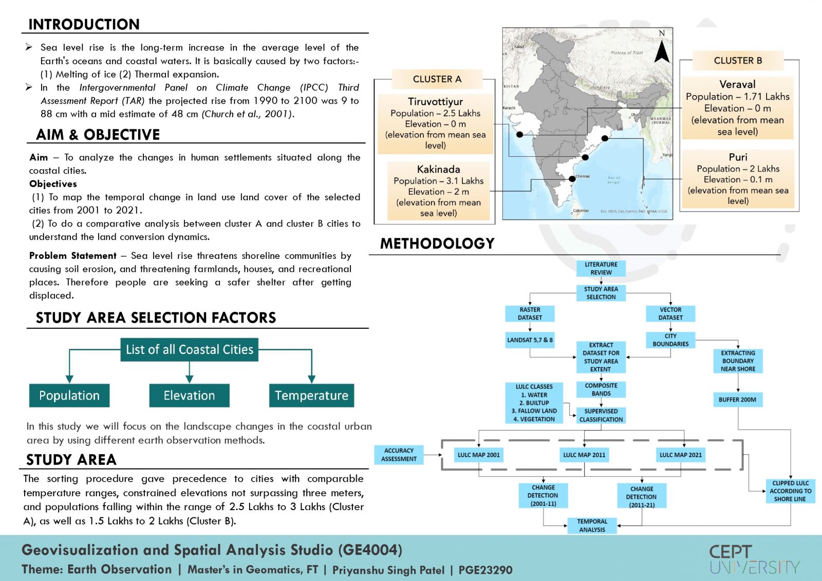
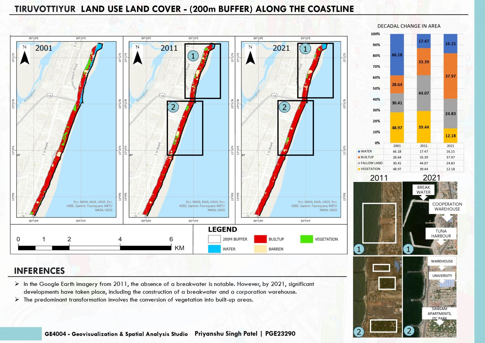
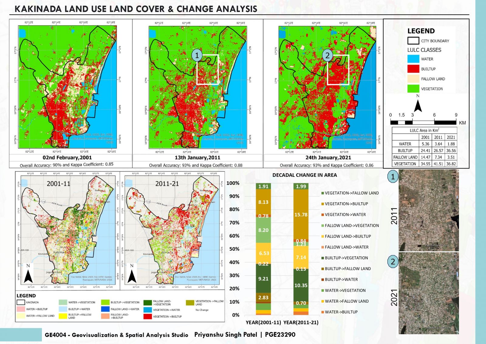
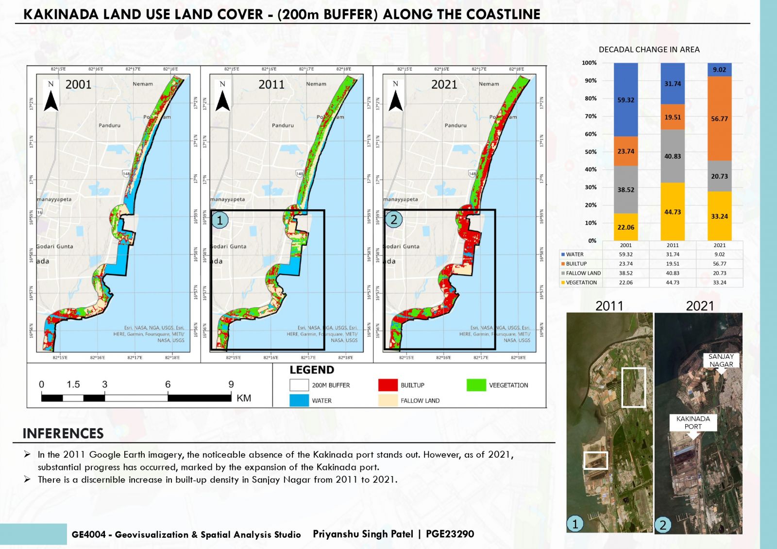
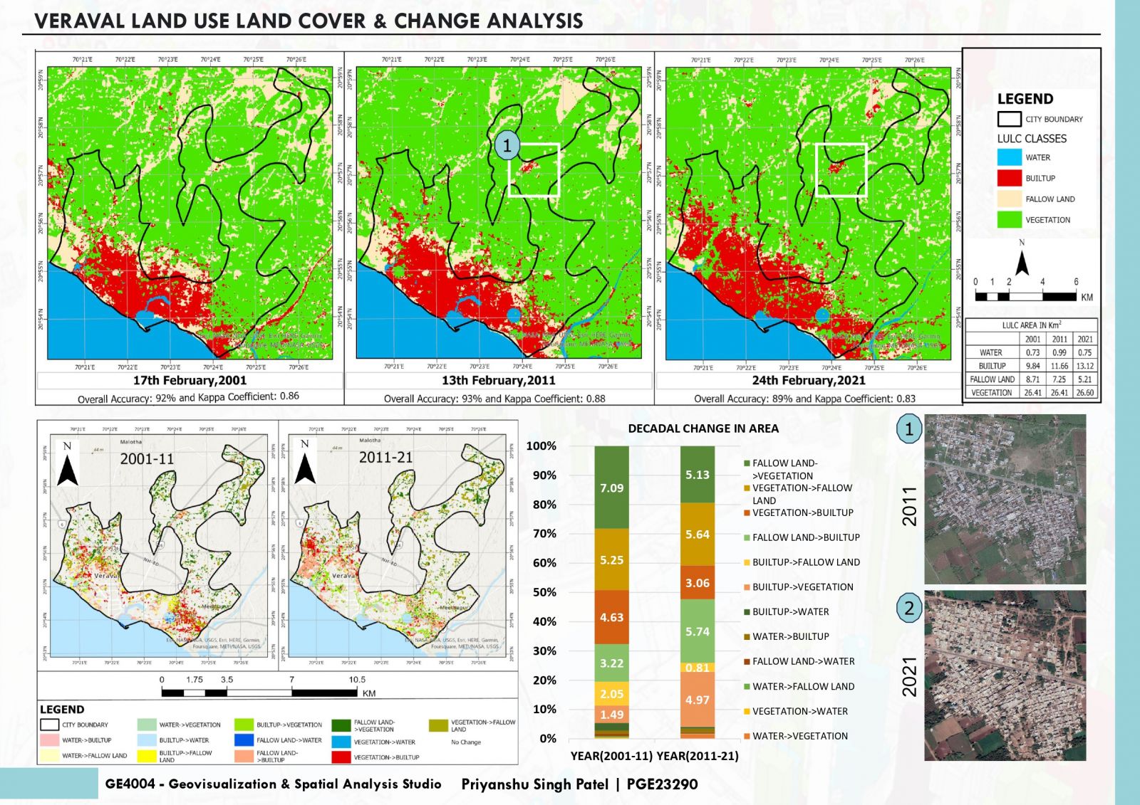
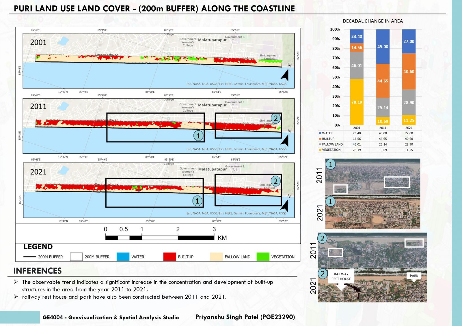
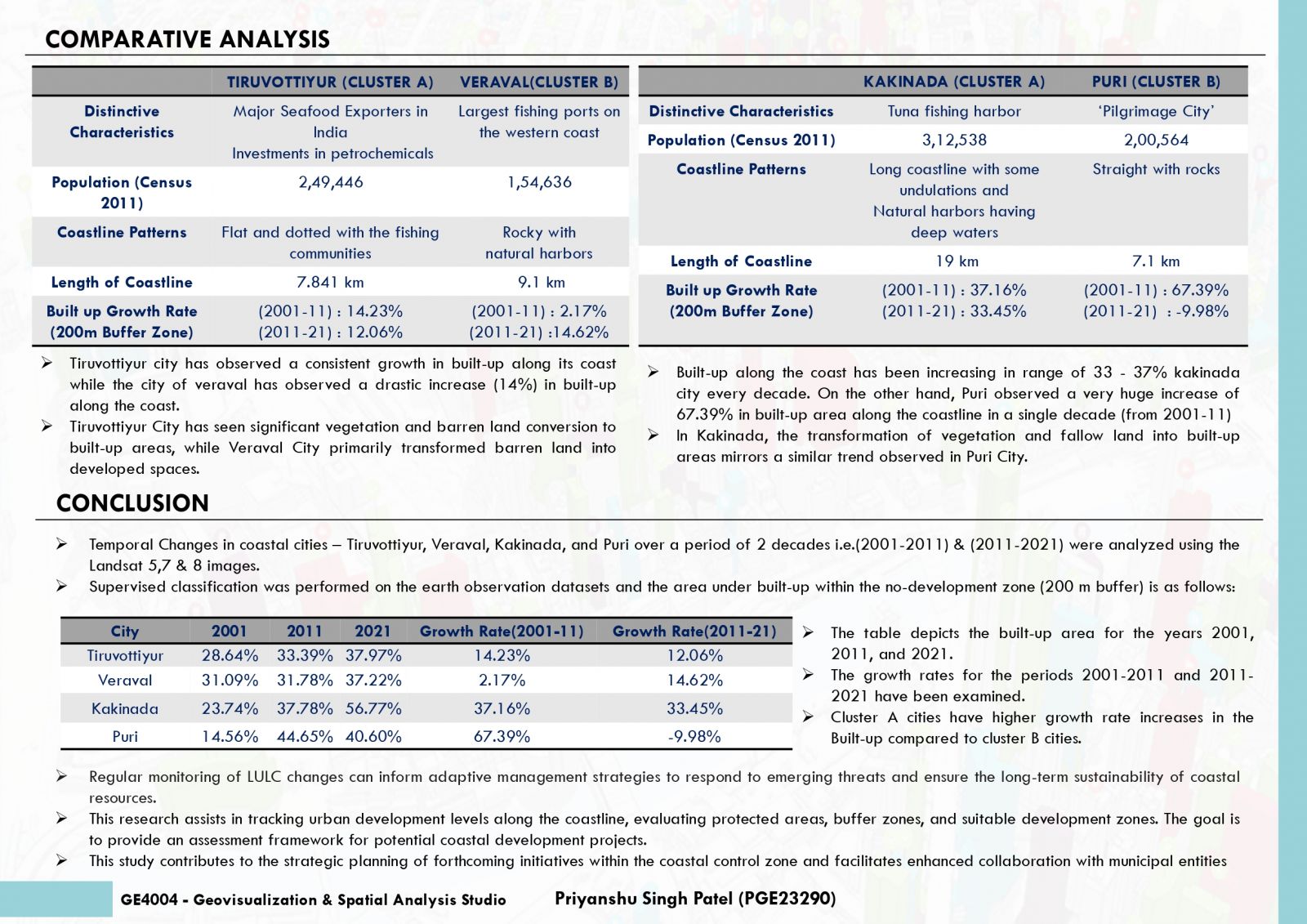
This project aims to analyze the temporal evolution of land use/land cover (LULC) in coastal cities from 2001 to 2021. Employing advanced remote sensing and GIS, the study focuses on mapping LULC changes. Additionally, a comparative analysis between Cluster A and B cities will uncover distinct land conversion dynamics, shedding light on urbanization patterns.
