Your browser is out-of-date!
For a richer surfing experience on our website, please update your browser. Update my browser now!
For a richer surfing experience on our website, please update your browser. Update my browser now!
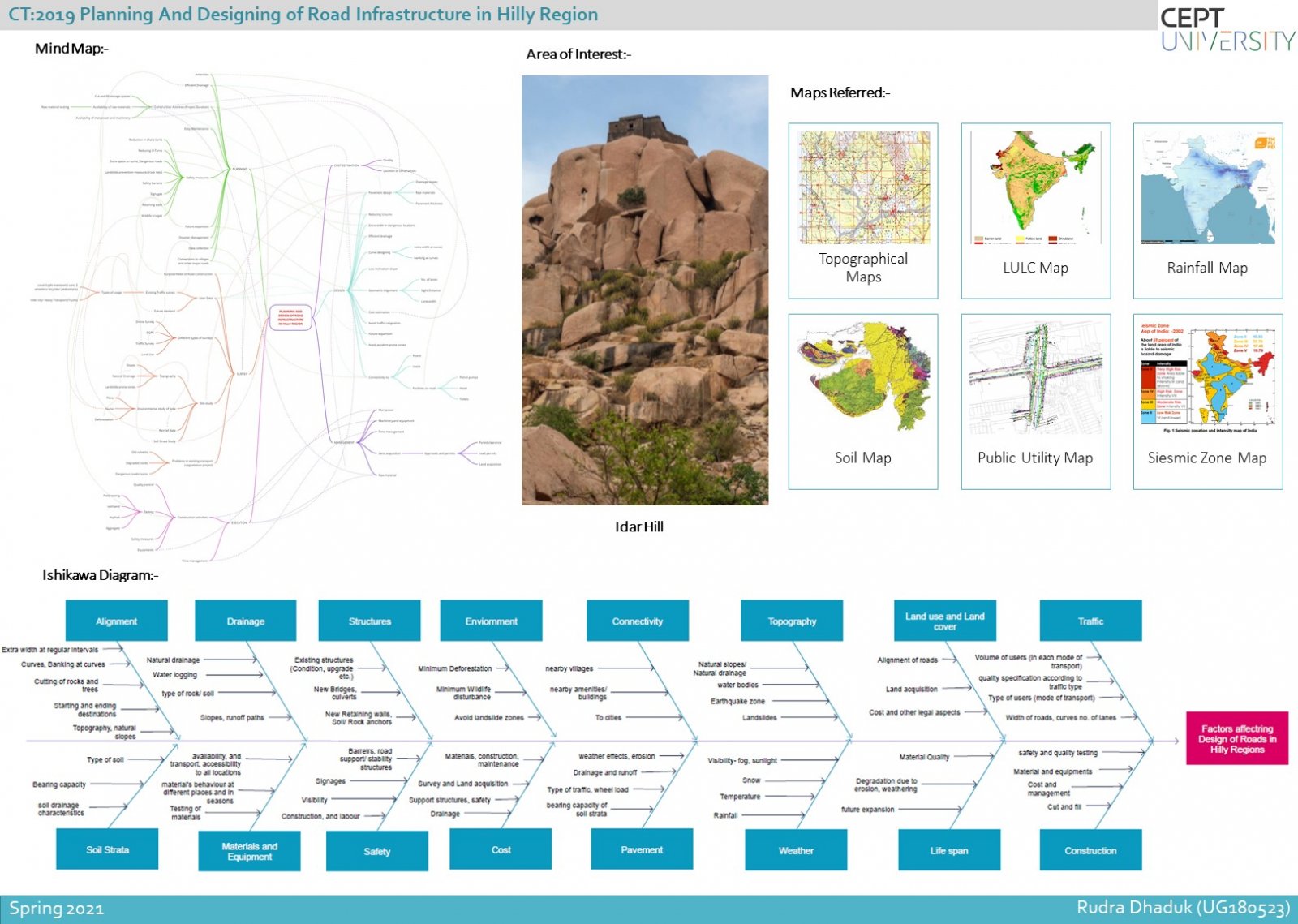
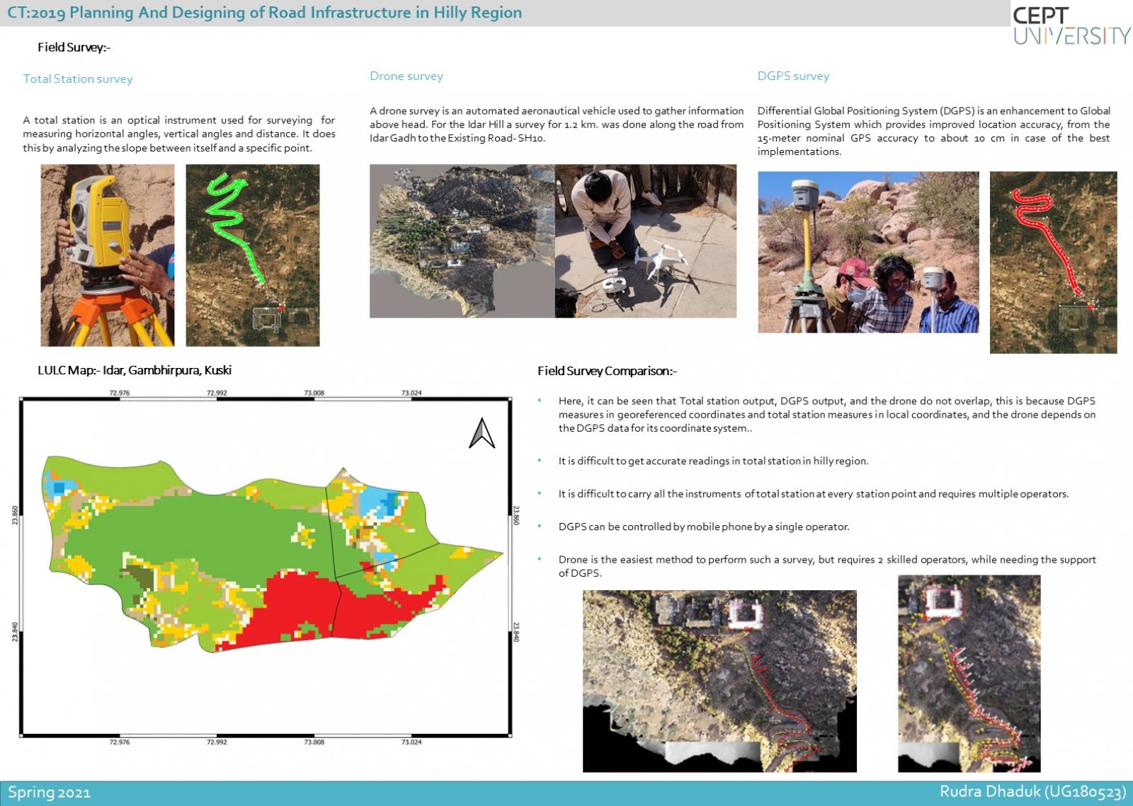
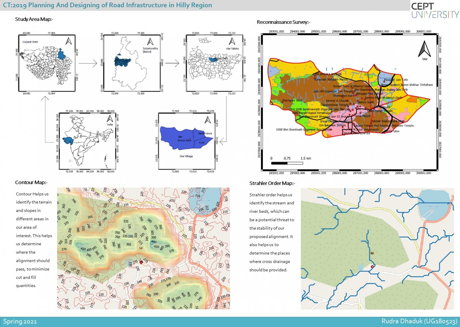
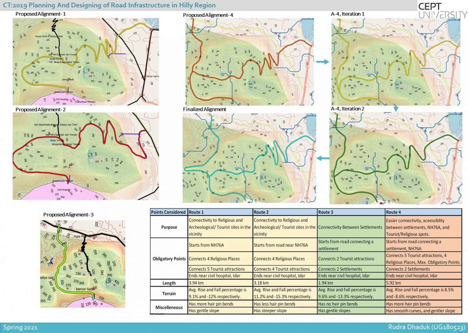
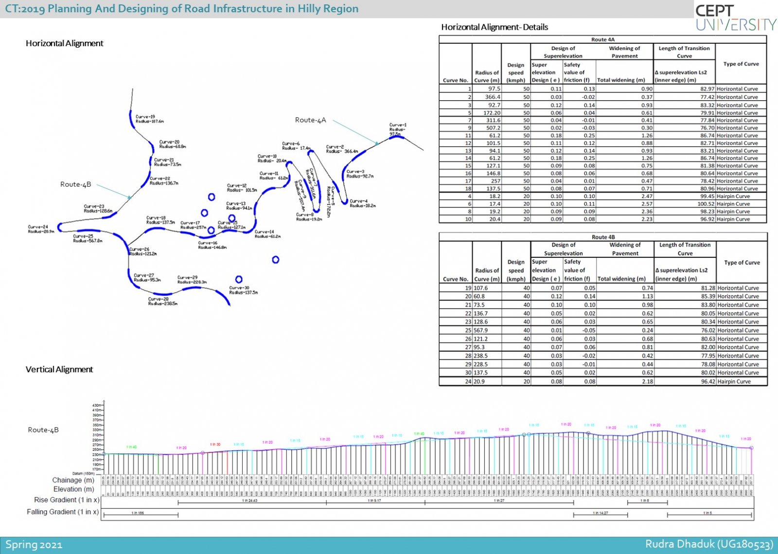
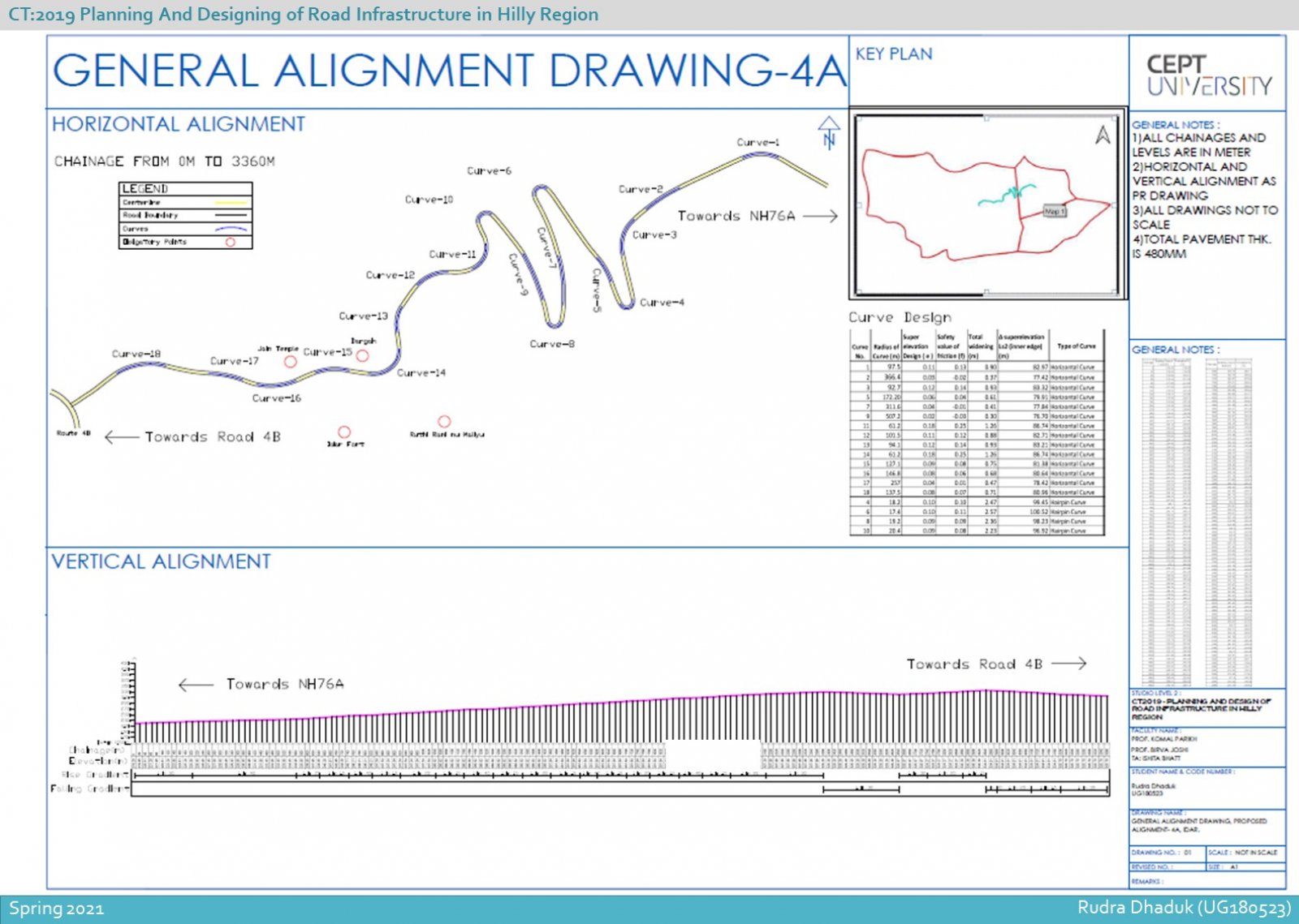
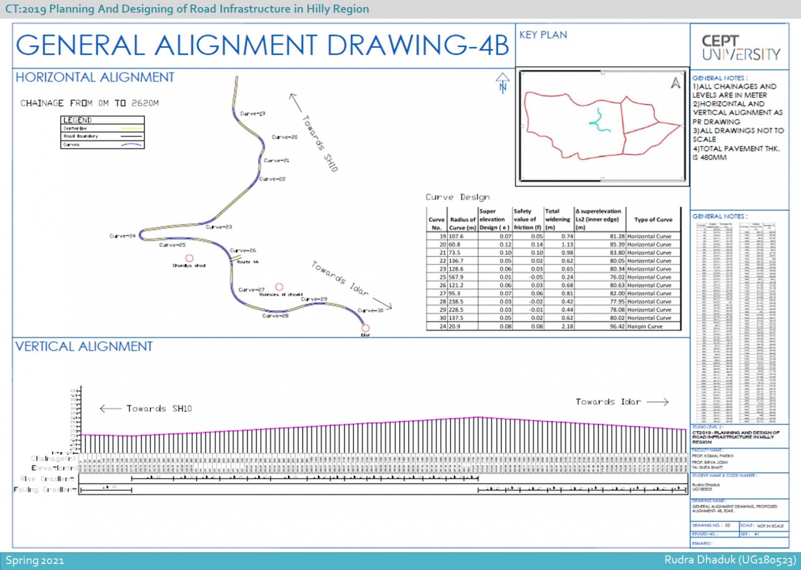
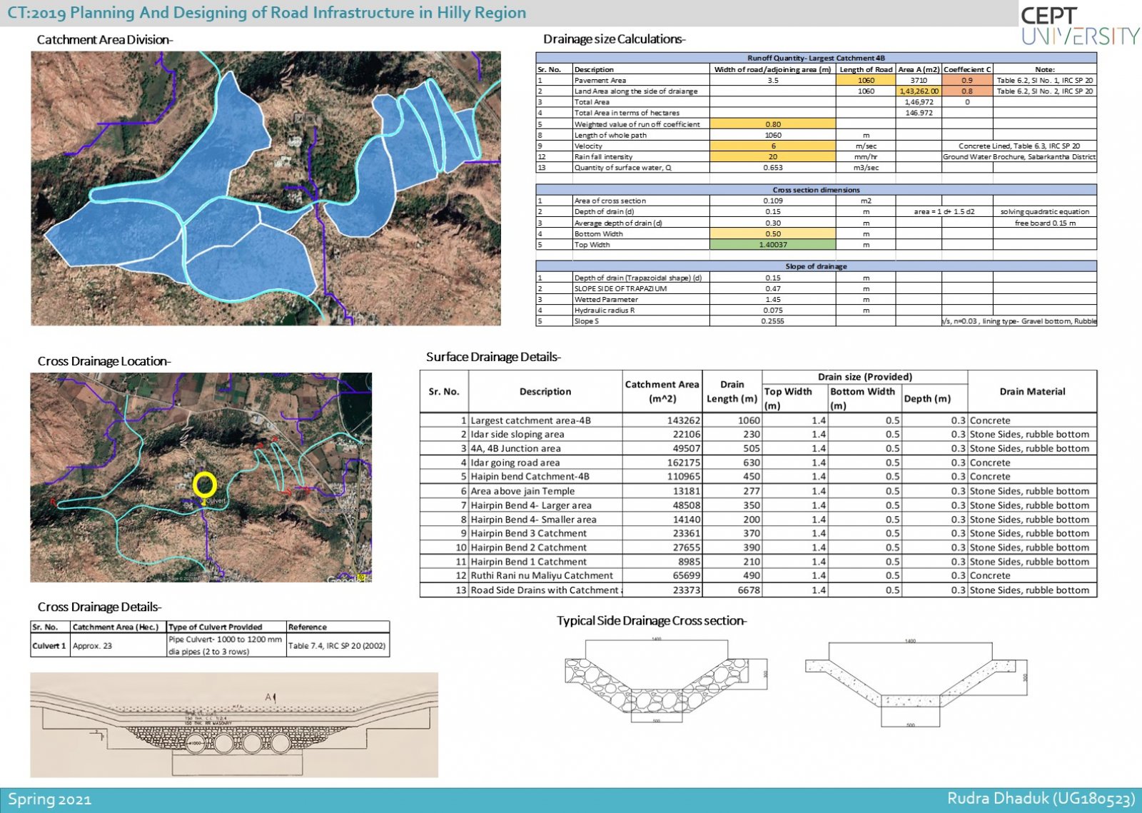
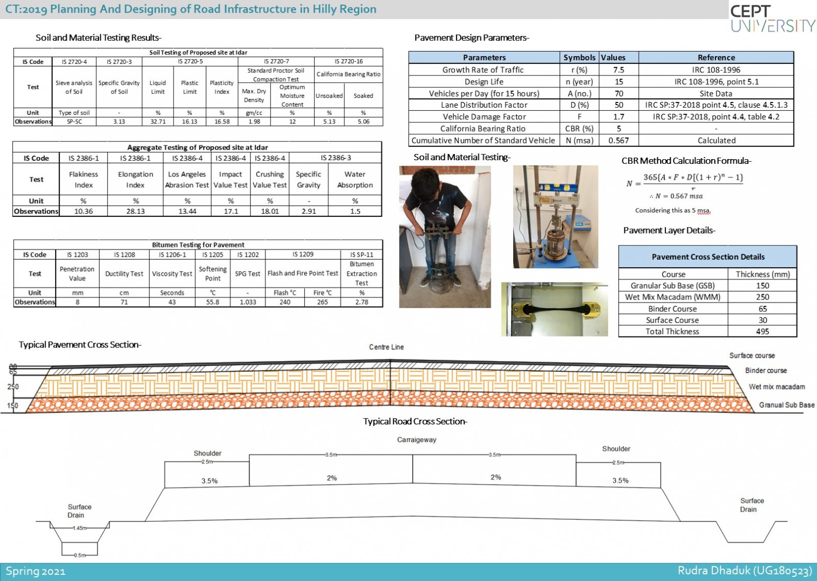
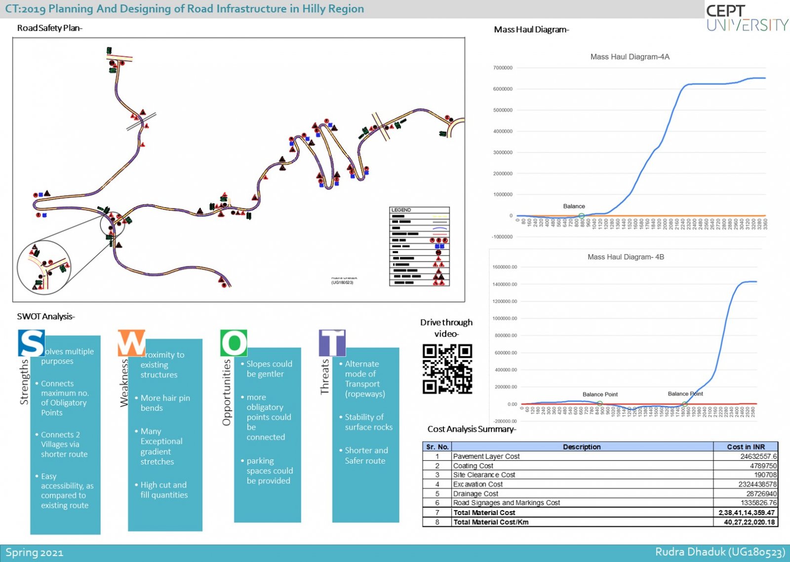
Studio focuses on planning and designing a Road in hilly region and the process required to do it Road design requires an understanding of the frequently conflicting needs of diverse users from slow moving, pedestrians, cyclists and animals, to fast moving vehicles of many kinds Understanding the user’s requirements testing and selection of route alignments based on civil and highway engineering principles, techniques and codes technical specification design of its elements, quantity calculations parametric studies and road safety analysis using advanced design tools such as Open Road, Bentley reality modeling, Google Earth and QGIS.
View Additional Work