Your browser is out-of-date!
For a richer surfing experience on our website, please update your browser. Update my browser now!
For a richer surfing experience on our website, please update your browser. Update my browser now!
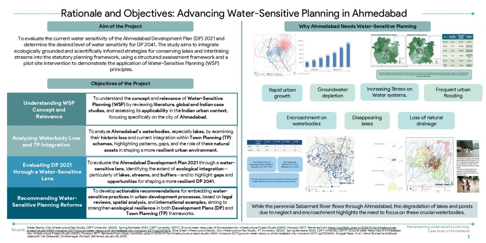
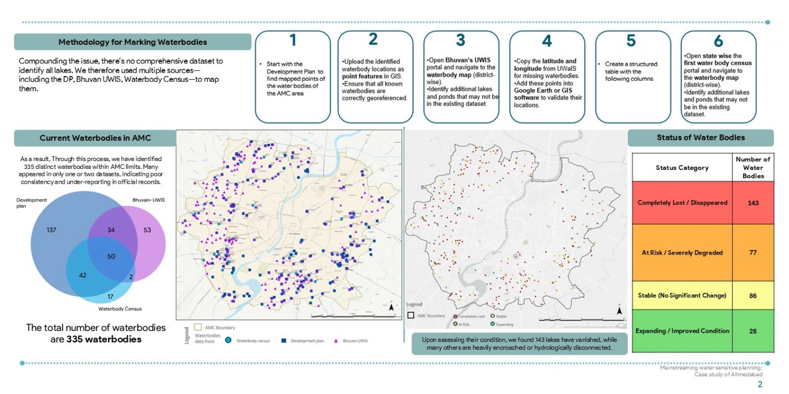
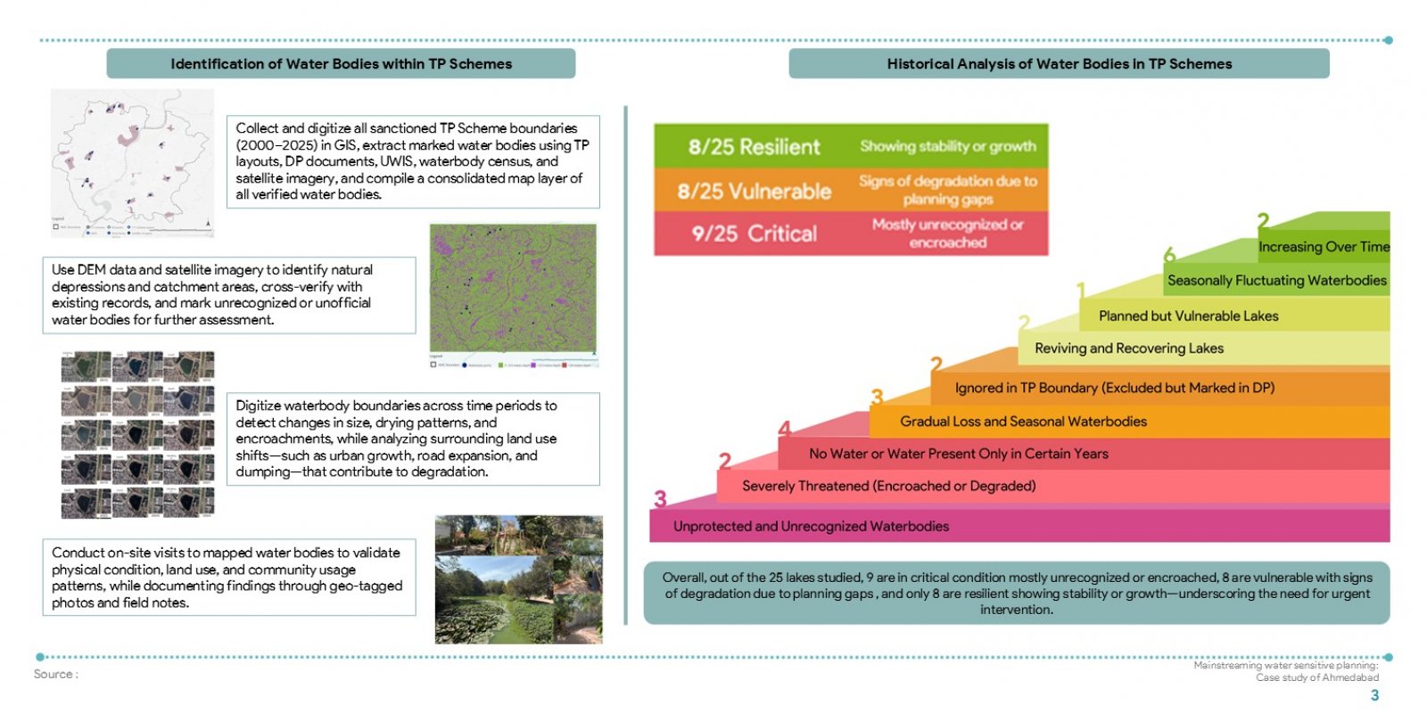
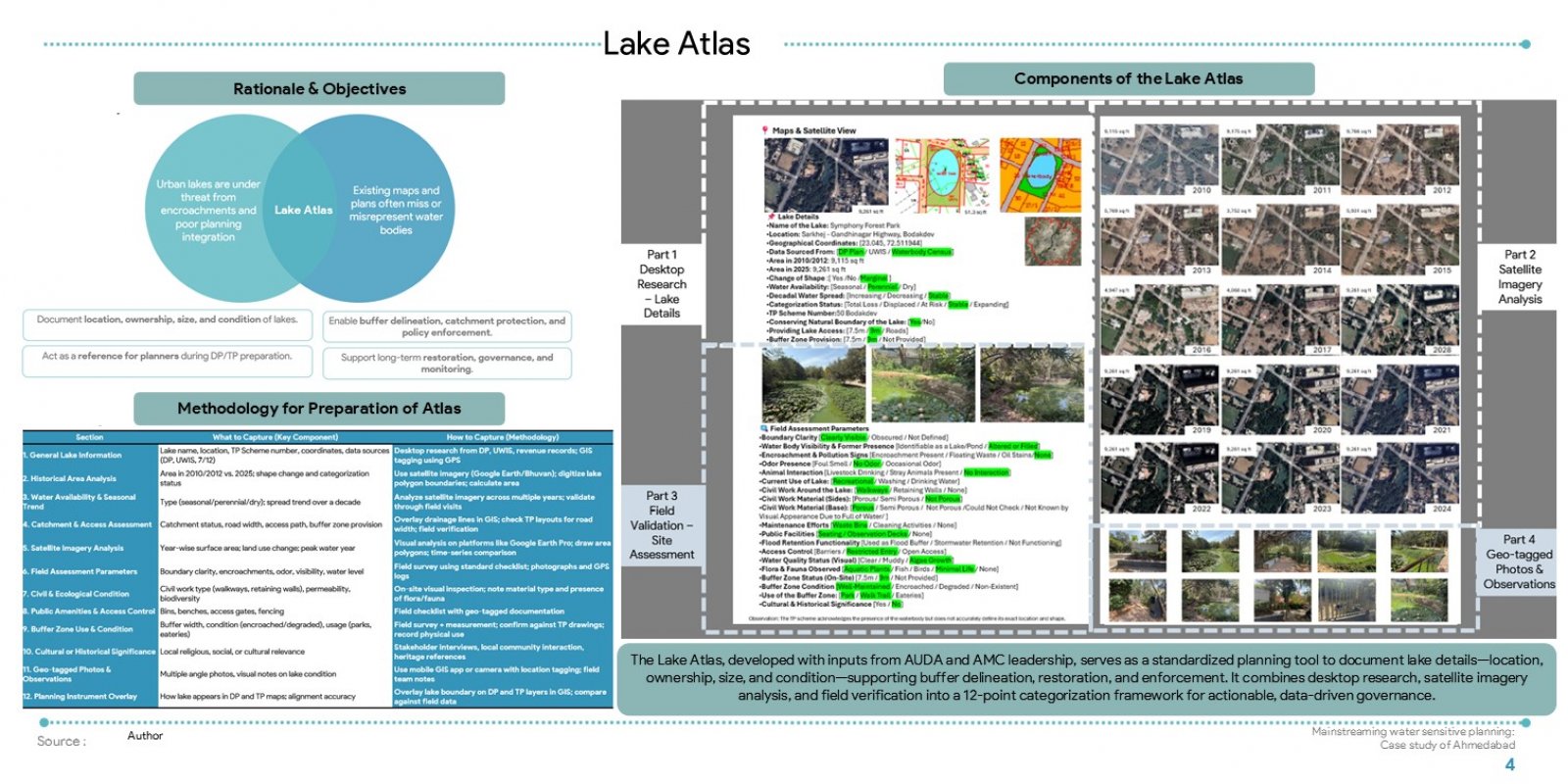
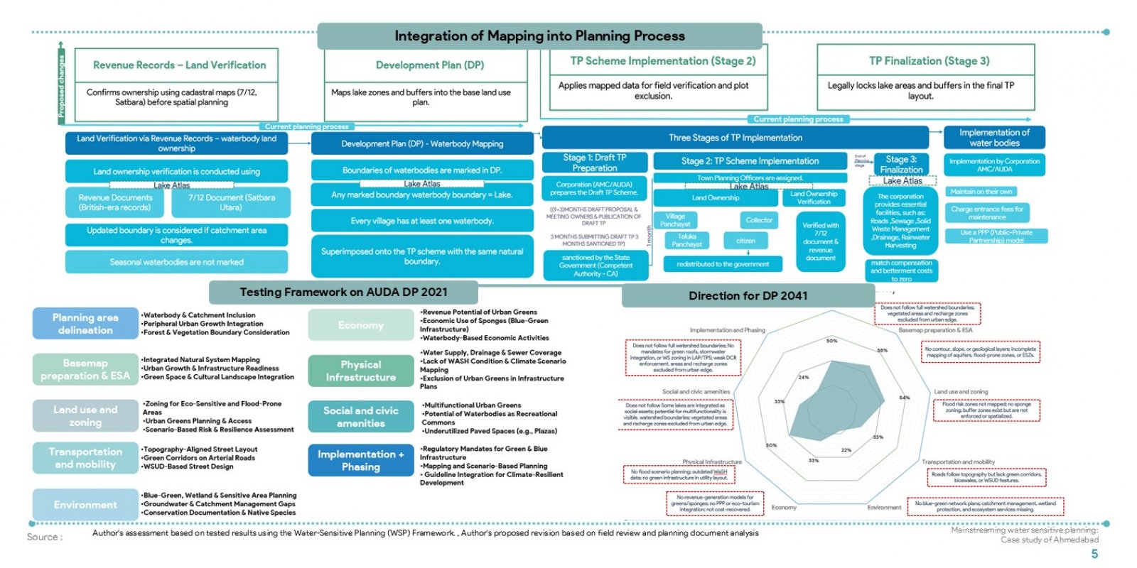
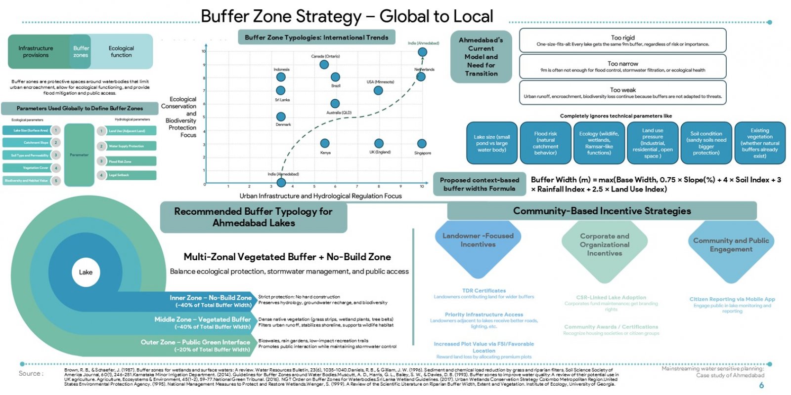
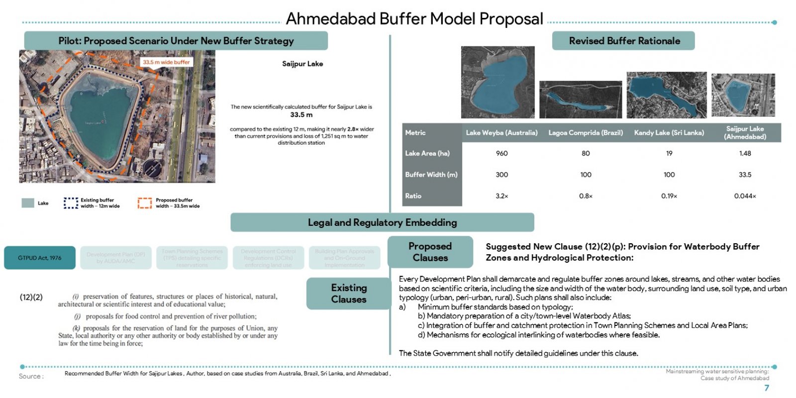
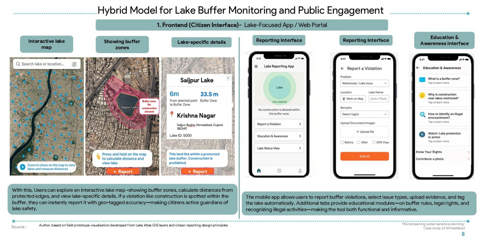
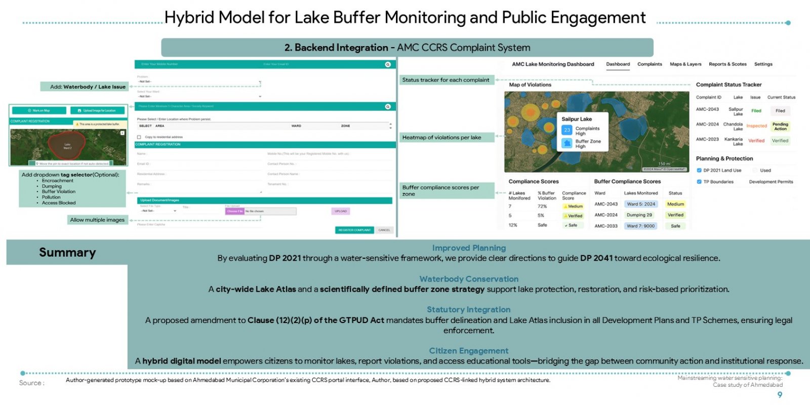
This project assesses how effectively Ahmedabad’s DP 2021 integrates waterbodies into statutory planning. Using spatial analysis, legal review, and ground verification of 25 lakes from 2024, the study identifies major gaps in stream protection, buffer enforcement, and ecological integration. It proposes a citywide Lake Atlas and a dynamic buffer strategy as planning tools, alongside a mobile interface for citizen engagement. The goal is to guide DP 2041 toward more water-sensitive, climate-resilient, and ecologically sustainable urban development.