Your browser is out-of-date!
For a richer surfing experience on our website, please update your browser. Update my browser now!
For a richer surfing experience on our website, please update your browser. Update my browser now!
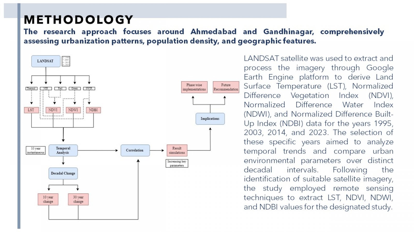
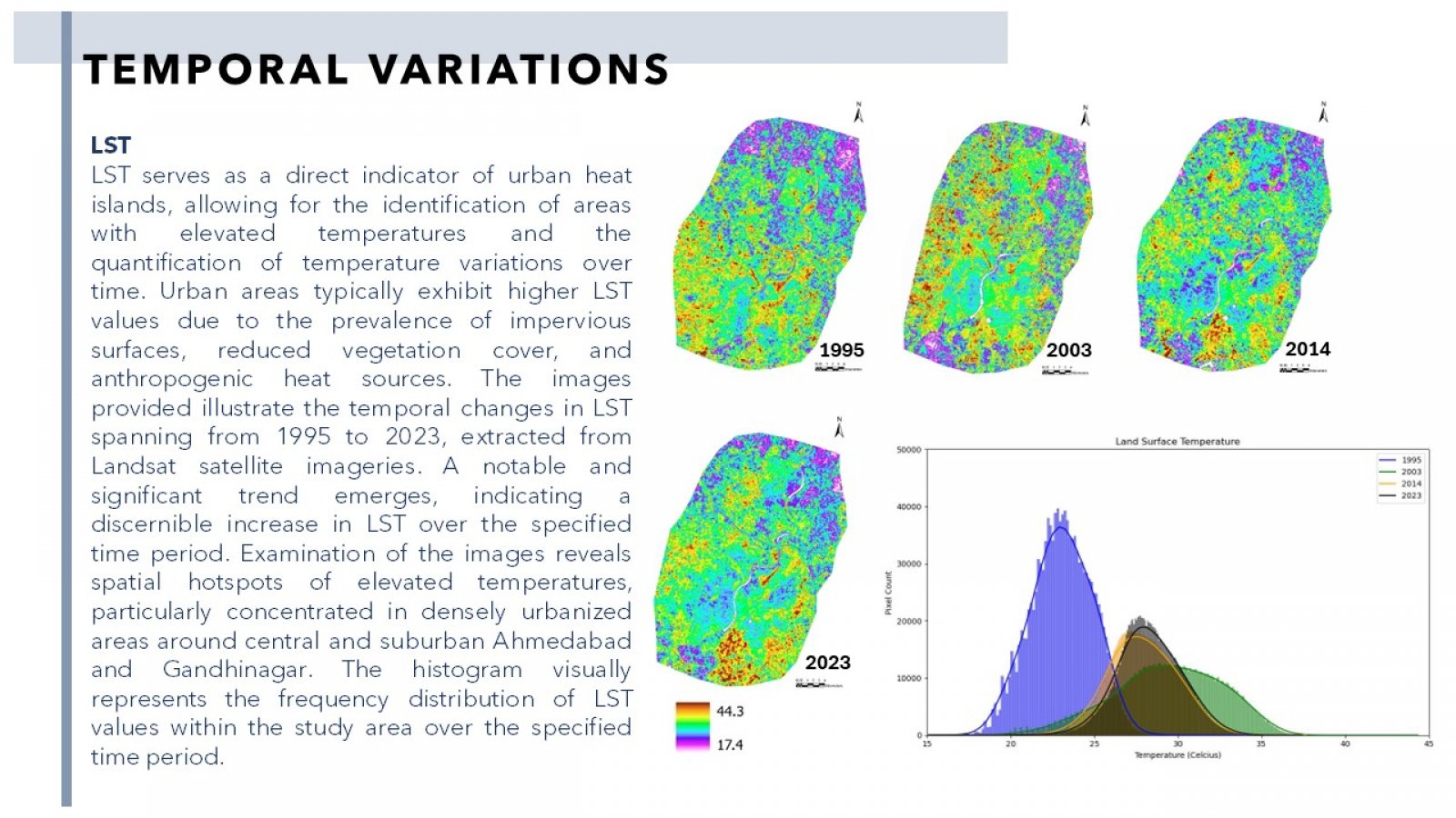
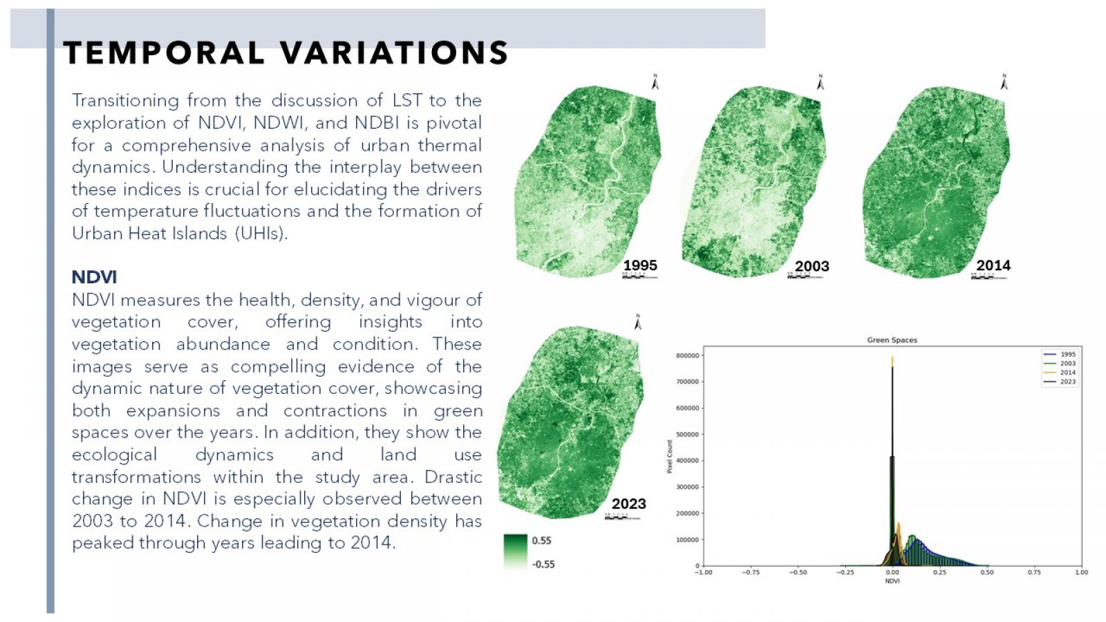
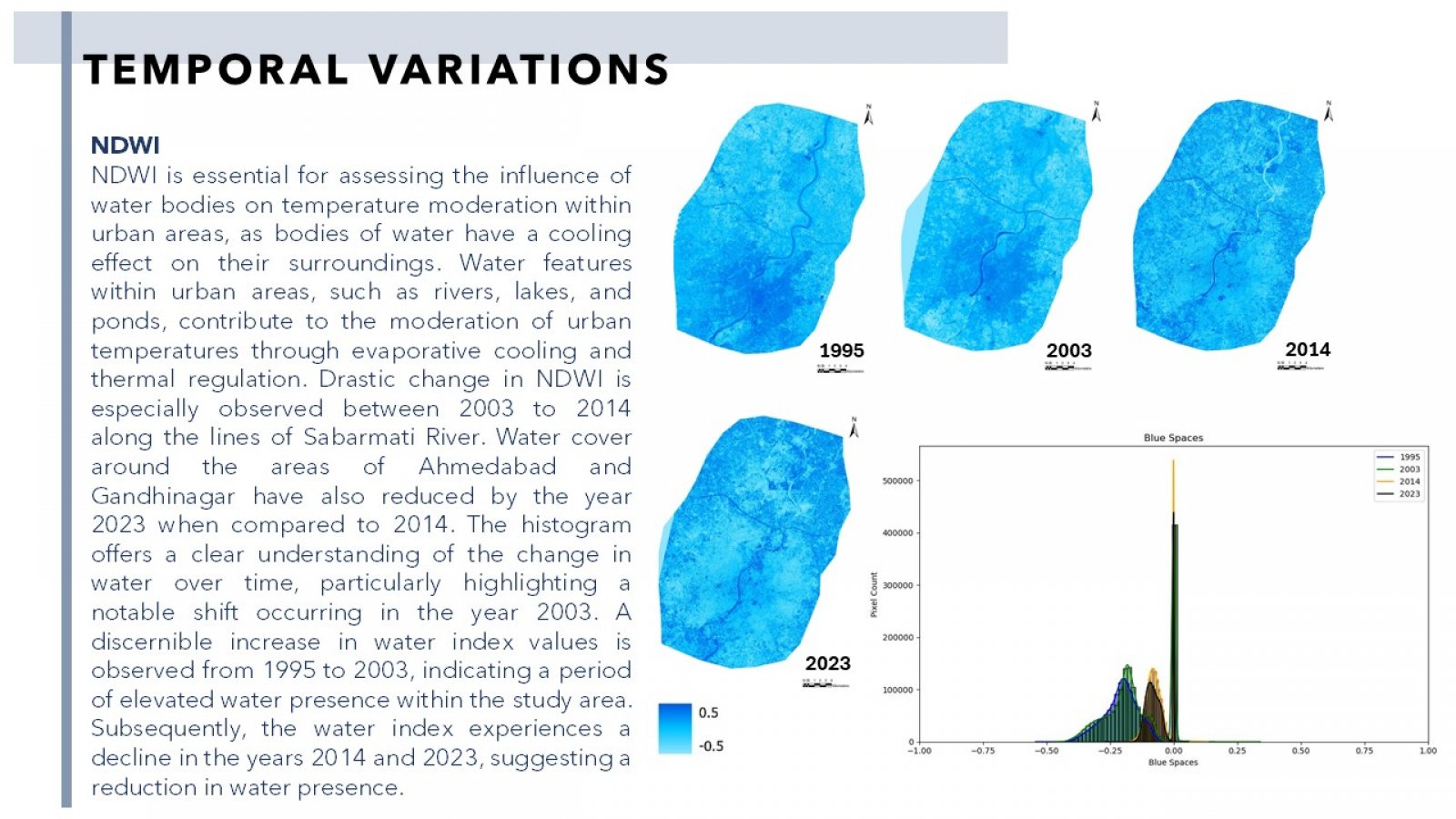
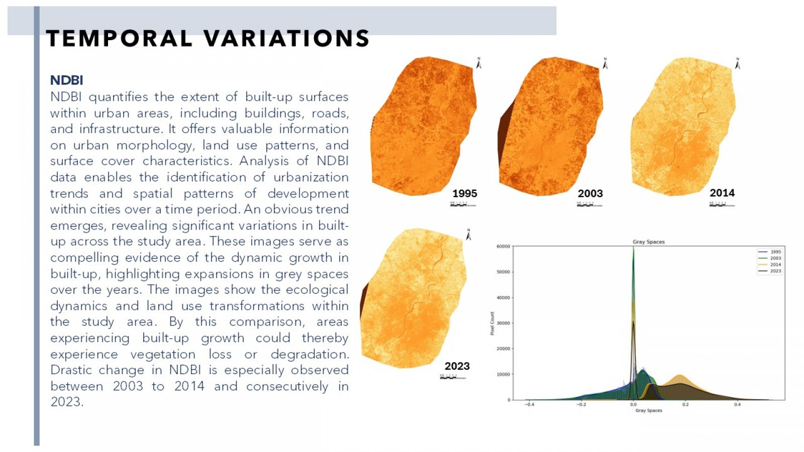
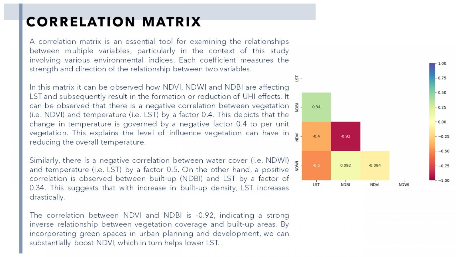
Urbanization is a defining characteristic of the 21st century, with over half of the global population residing in urban areas. While cities offer numerous advantages, including economic opportunities and access to services, they also face significant environmental challenges. Among these challenges, urban heat islands (UHIs) represent a growing concern. UHIs are localized areas within cities that experience substantially higher temperatures than their surrounding rural regions. Their effects extend beyond discomfort, impacting human health, energy consumption, and the overall livability of urban areas. This thesis seeks to delve into the complex relationship between urban form and UHIs, with a focus on dentification of tangible connections between vegetation, urban form and UHI as factors. Urban form encompasses a wide range of factors, such as building density, street layouts, land use patterns, and green spaces. These factors, when well-considered and modified, have the potential to mitigate the formation and intensity of UHIs. Utilizing geospatial data and analysis tools, this study aims to identify and map UHIs in Ahmedabad and Gandhinagar, investigate how urban form elements influence UHI formation, and the correlation within changes in vegetation.
