Your browser is out-of-date!
For a richer surfing experience on our website, please update your browser. Update my browser now!
For a richer surfing experience on our website, please update your browser. Update my browser now!
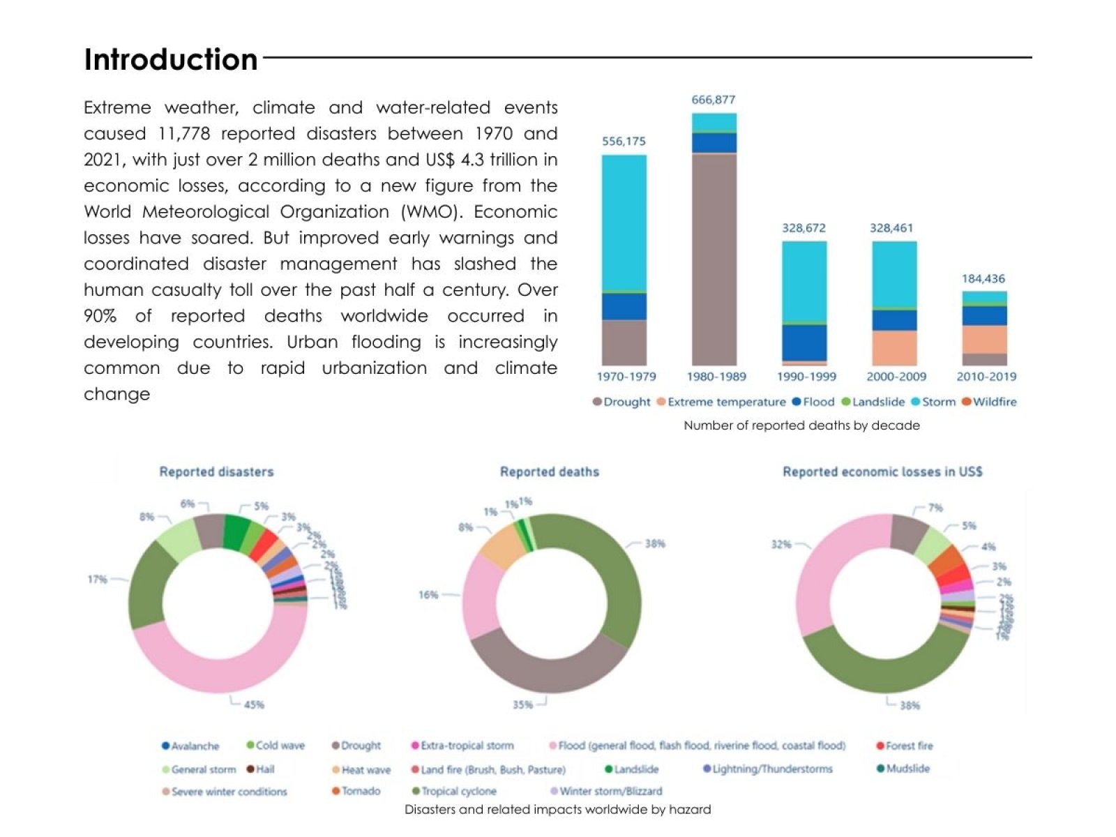
Urban flooding is increasingly common due to rapid urbanization and climate change, affecting densely populated areas in South Asia, including India, Bangladesh, and Pakistan. Climate change makes the problem worse by causing more rainfall that happens more often and more intensely (IPCC, 2021). The project aims to create a 2D flood model to predict how floods will spread. To simulate and understand the impact of such flood events, a catchment area was developed using ArcGIS Pro for Rajkot city. Rainfall-runoff was generated for the following catchment area using HEC-HMS which was later integrated with HEC-RAS to develop a 2D hydraulic model. The MCDM analysis was conducted on the 2D hydraulic model to determine the wards most susceptible to flooding. The results showed that ward six experienced the highest exposure, with over 21.3% of its area submerged and more than 4,000 residents affected. Ward fifteen followed with up to 14% of its area flooded. Despite its high population, Ward nine had a lower percentage of flooded area due to higher ground, but it still recorded over 10% of its residents at risk. In contrast, Ward one experienced minimal impact due to favorable elevation and less runoff accumulation. These findings clearly show that topography, land use, and population density greatly influence the extent and impact of flooding.
.jpg)
.jpg)
.jpg)
.jpg)
.jpg)
.jpg)
.jpg)
.jpg)
.jpg)