Your browser is out-of-date!
For a richer surfing experience on our website, please update your browser. Update my browser now!
For a richer surfing experience on our website, please update your browser. Update my browser now!
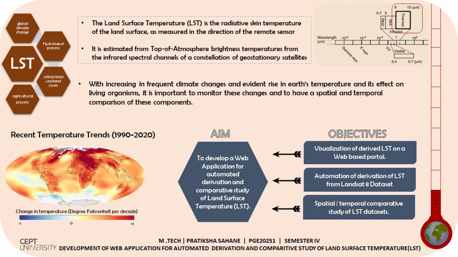
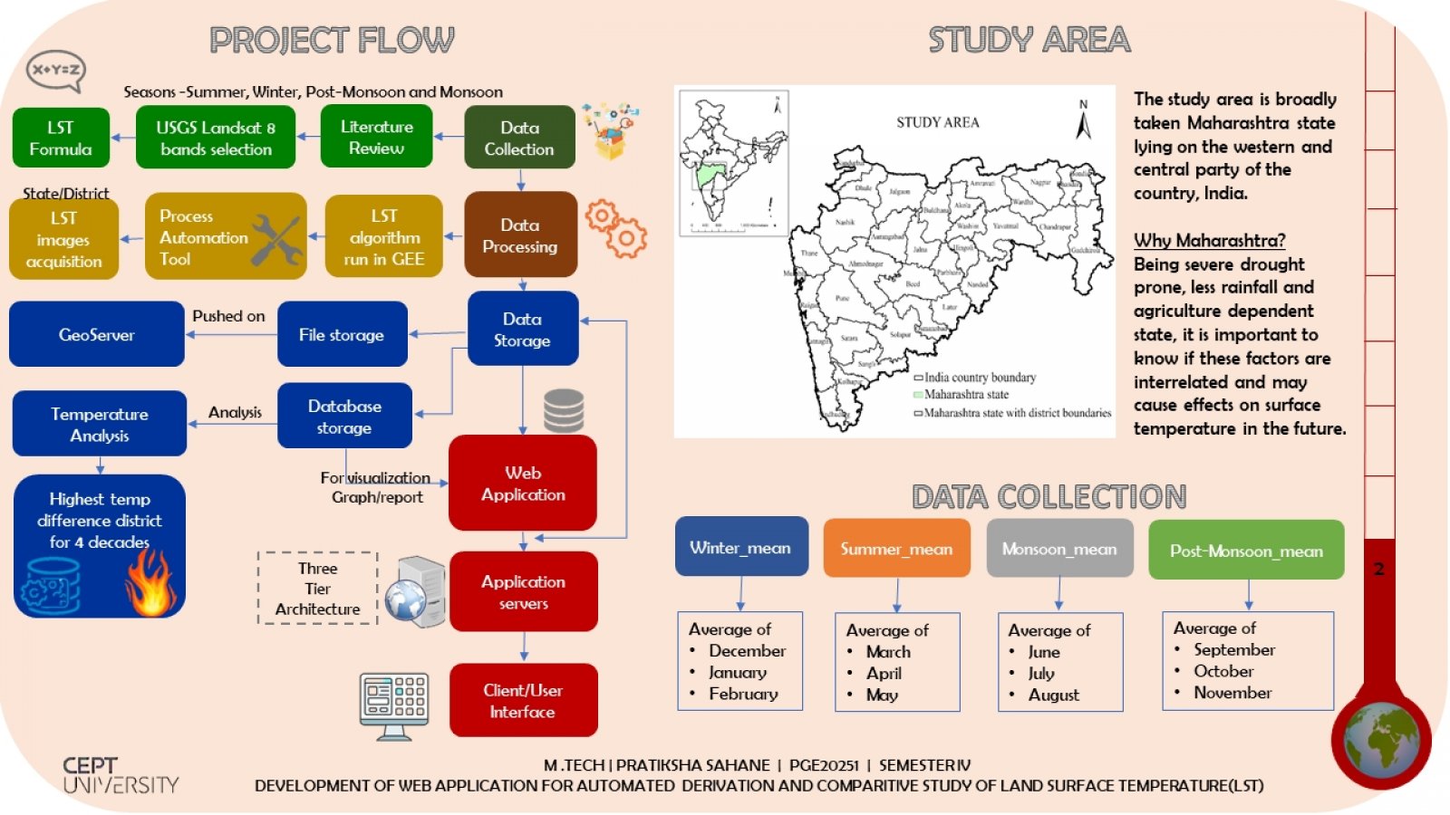
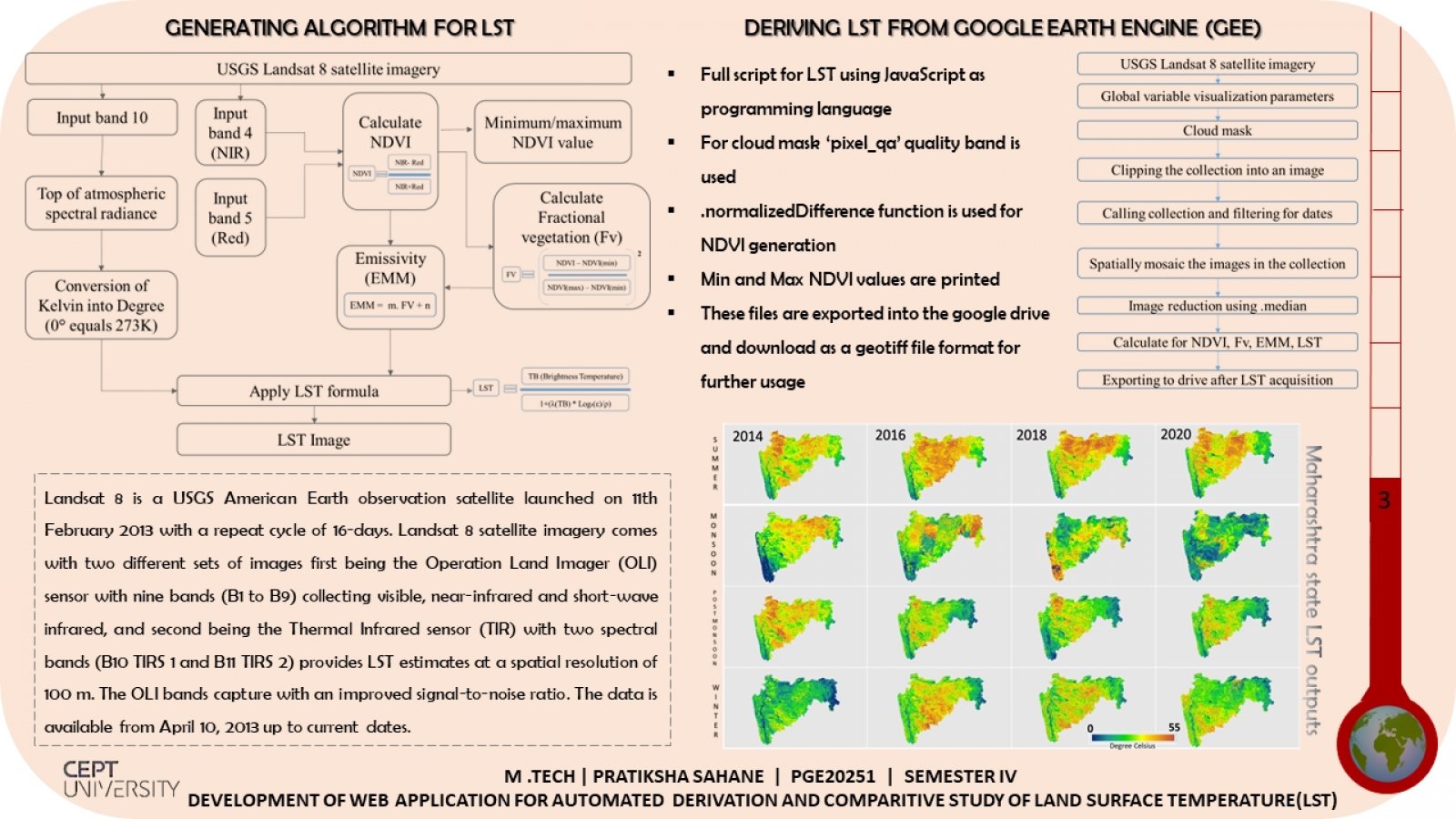
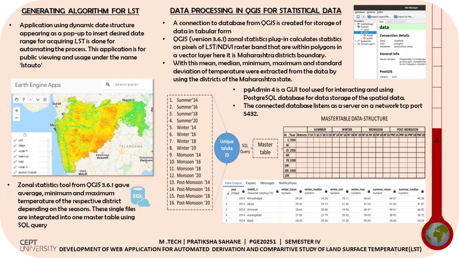
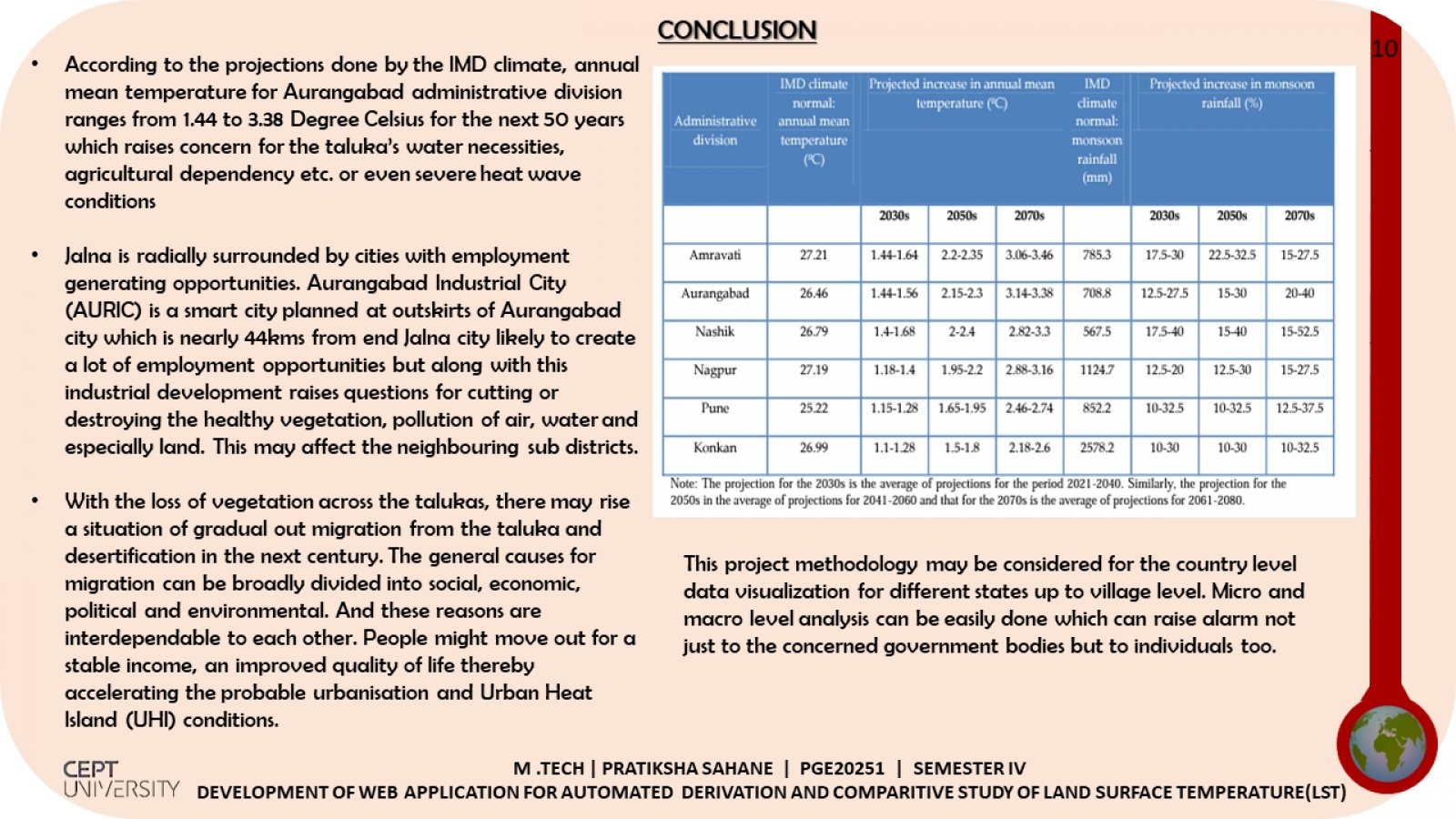
Land surface temperature is a sensitive issue when we foresee the future of our planet. Our planet thrives on solar energy and its benefits. But lately this solar energy along with human interference with natural activities has ended up rising in earth’s temperature. Hence this topic requires special attention. Having three objectives of this project each one equally challenging but interlinking in such a way that the aim is achieved effortlessly. Detailed understanding and usage of raster data and vector data. Multiple methodologies are involved in the flow of the project. The hottest region of my study area is achieved.