Your browser is out-of-date!
For a richer surfing experience on our website, please update your browser. Update my browser now!
For a richer surfing experience on our website, please update your browser. Update my browser now!
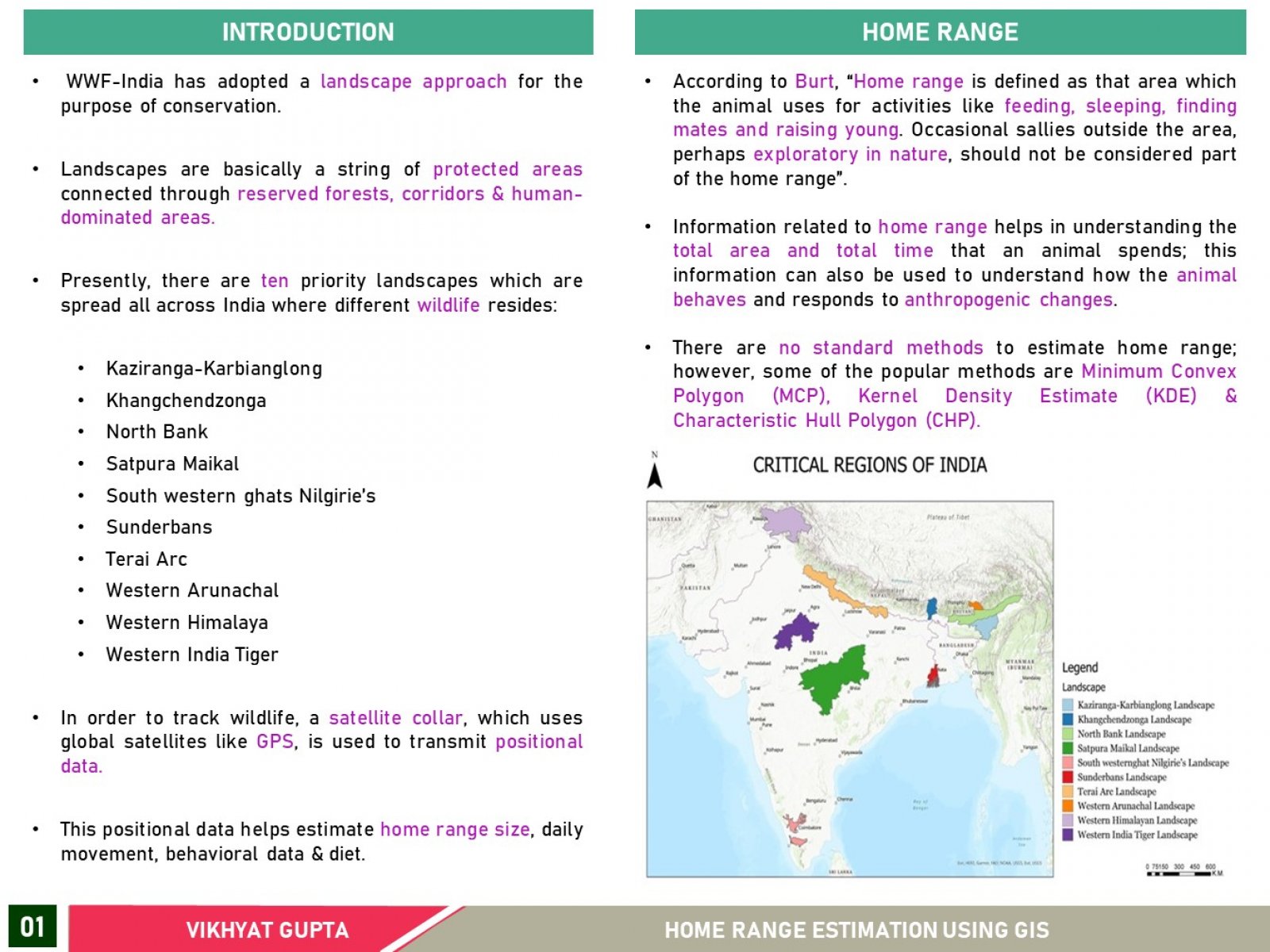
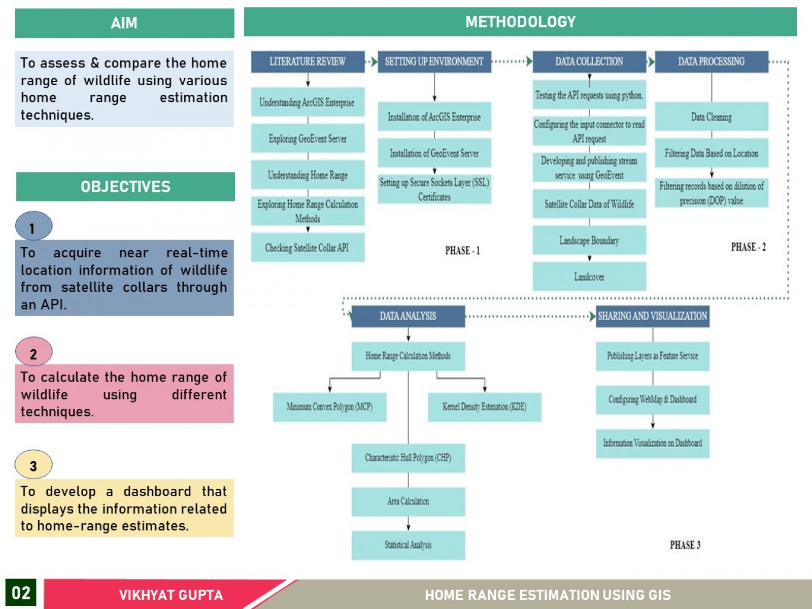
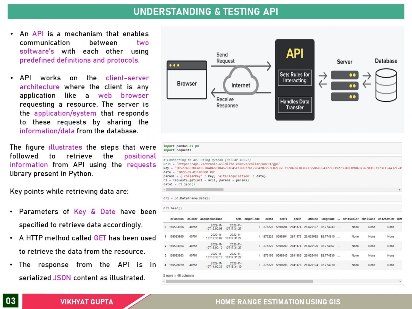
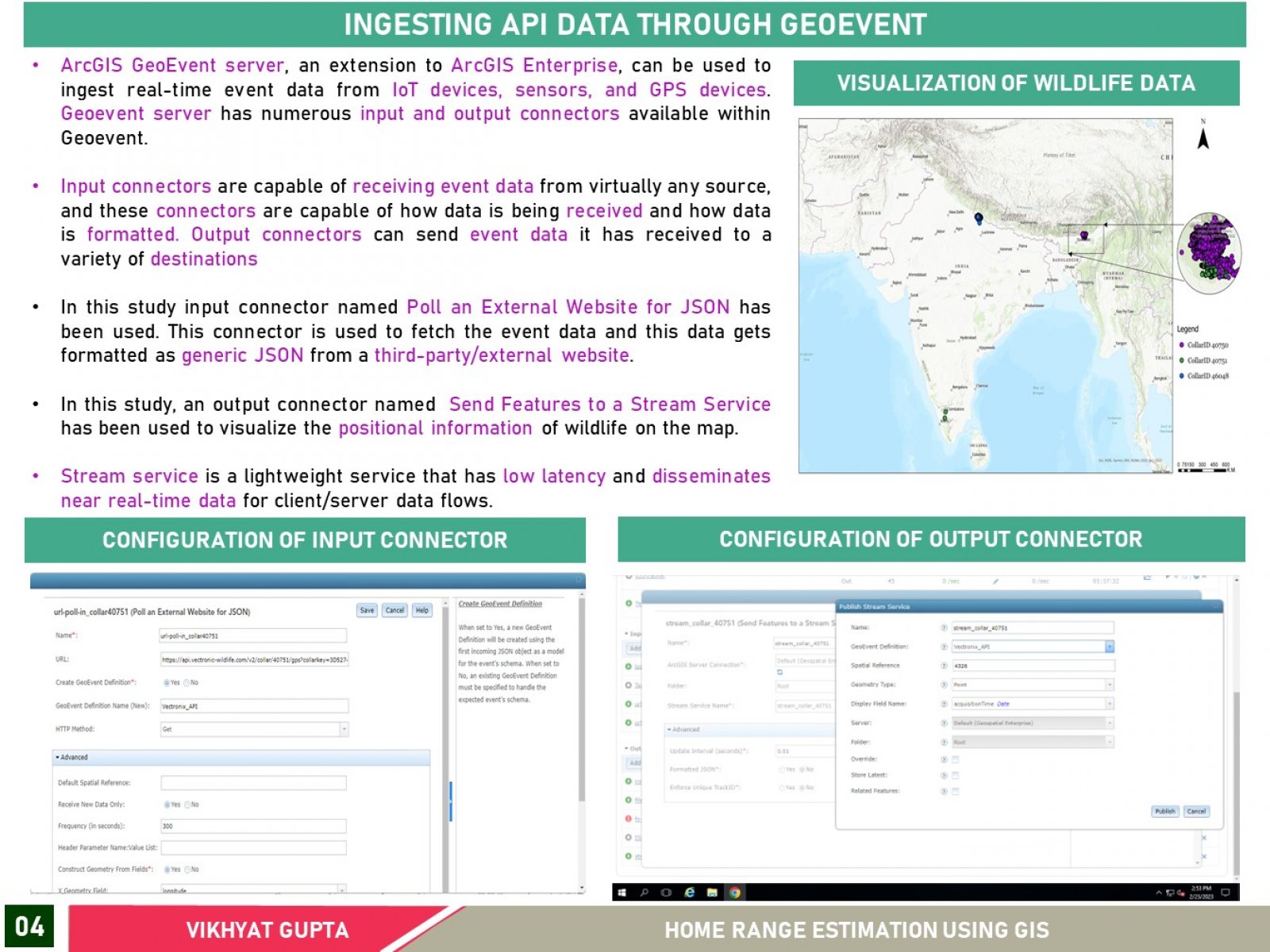
The World Wildlife Fund (WWF) in India prioritizes landscapes with protected areas connected through reserved forests, corridors, and human-dominated areas as habitats for many wildlife species. Researchers use satellite collars to monitor animal movements and obtain data on home range, behavior, and diet. This provides advantages over traditional methods, such as improved location accuracy and a larger dataset for mapping and understanding movement patterns. The present study used GeoEvent Server to perform real-time analytics on satellite collar data and estimate home range size using four methods. Results were published on ArcGIS Enterprise, and a dashboard was built to monitor wildlife positions regularly.