Your browser is out-of-date!
For a richer surfing experience on our website, please update your browser. Update my browser now!
For a richer surfing experience on our website, please update your browser. Update my browser now!
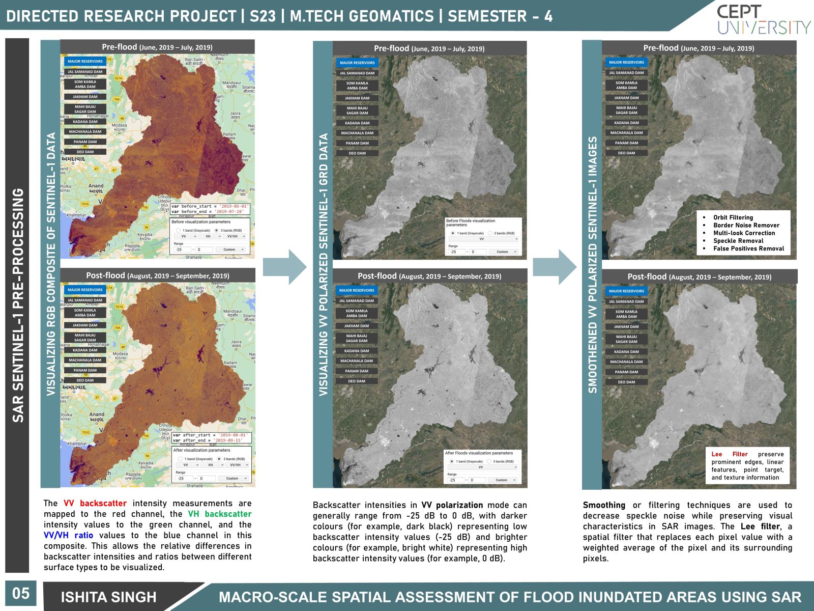
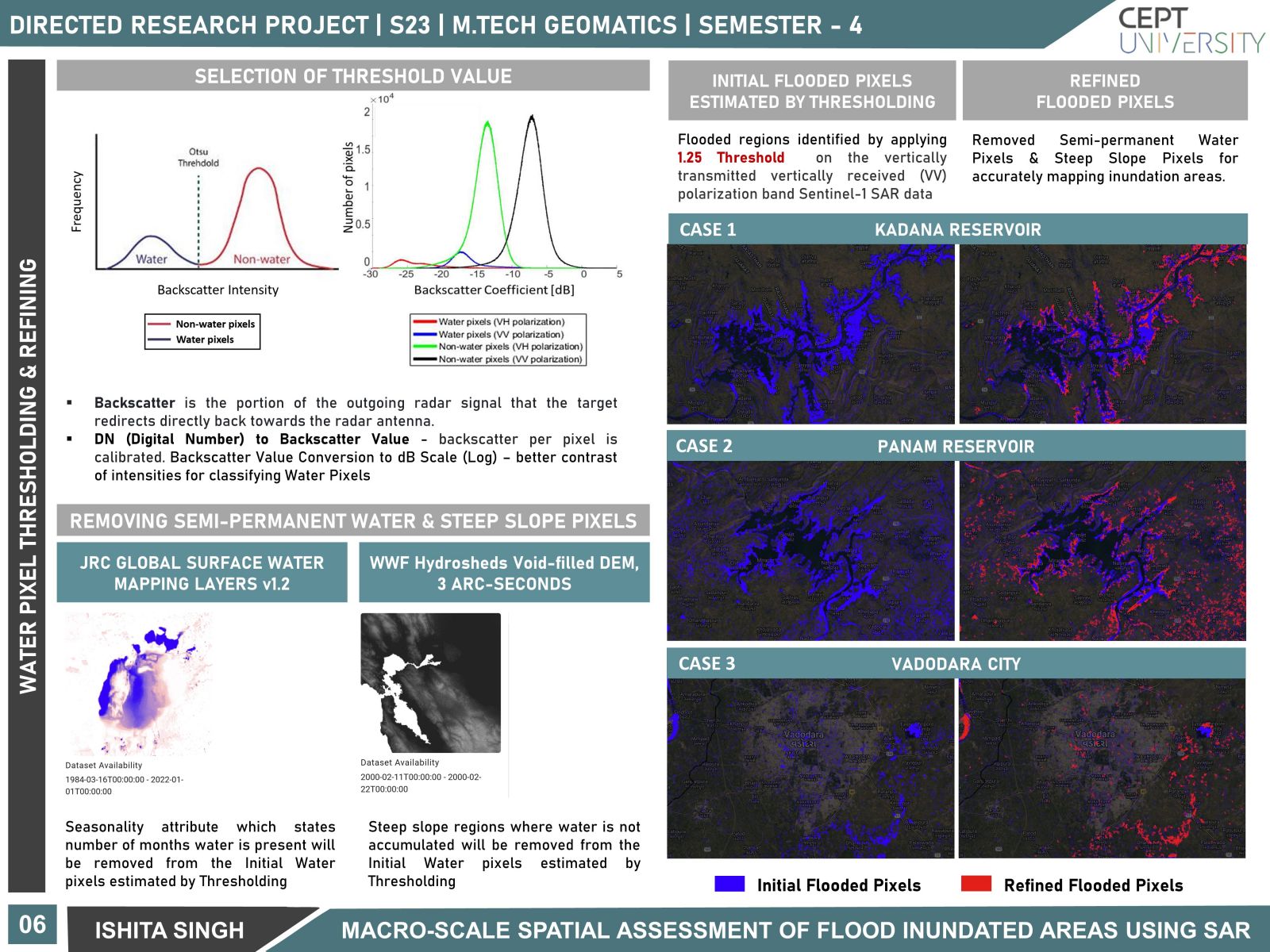
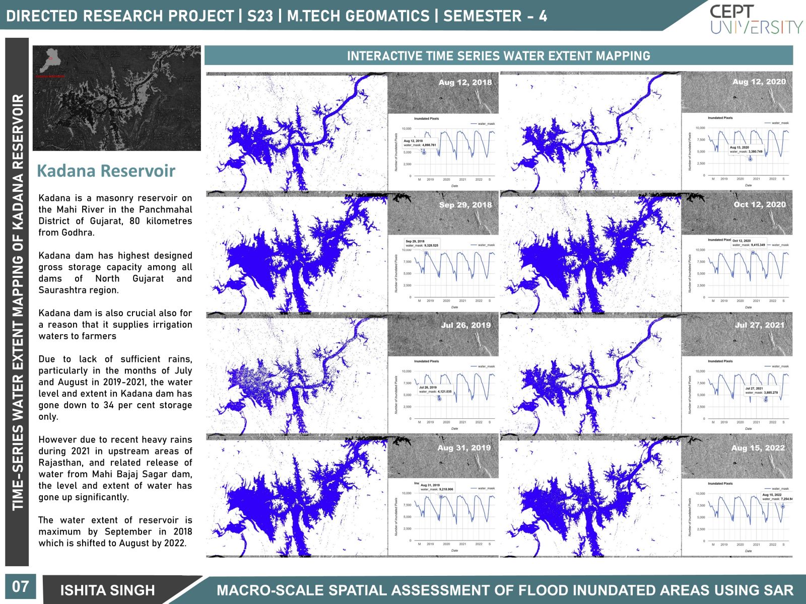
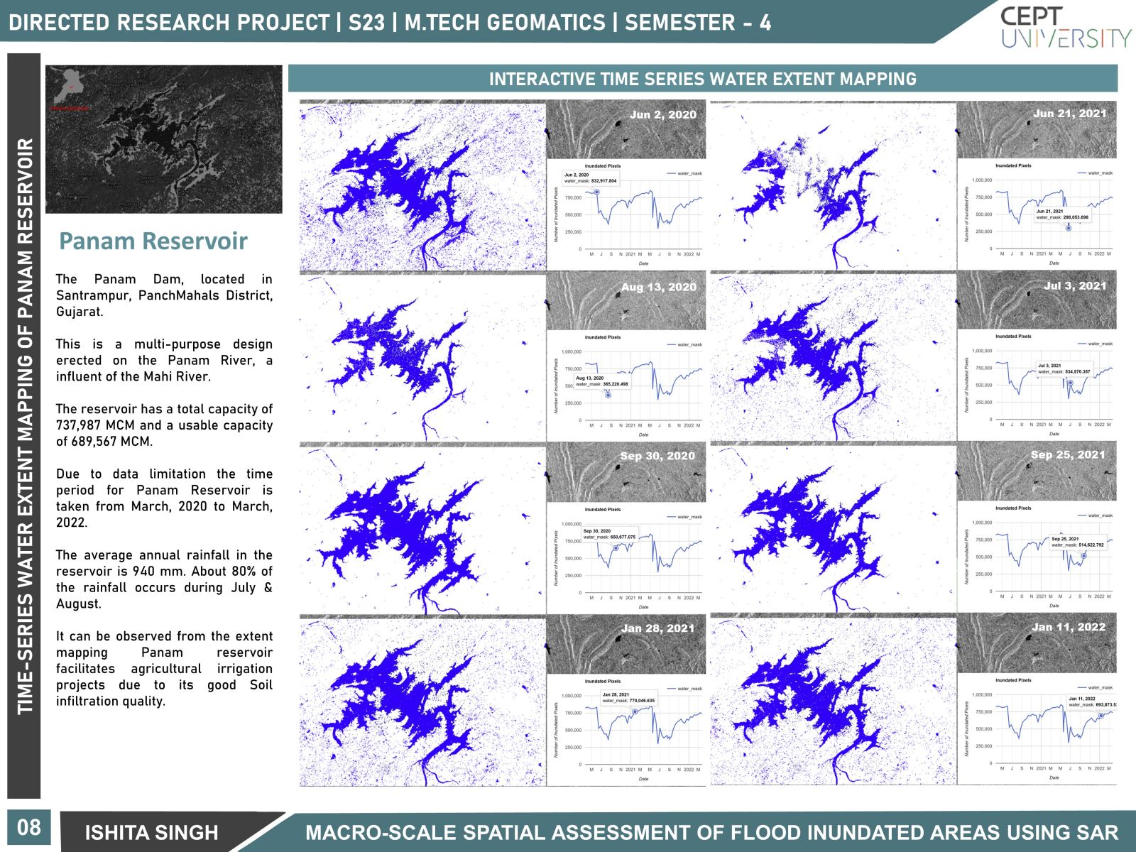
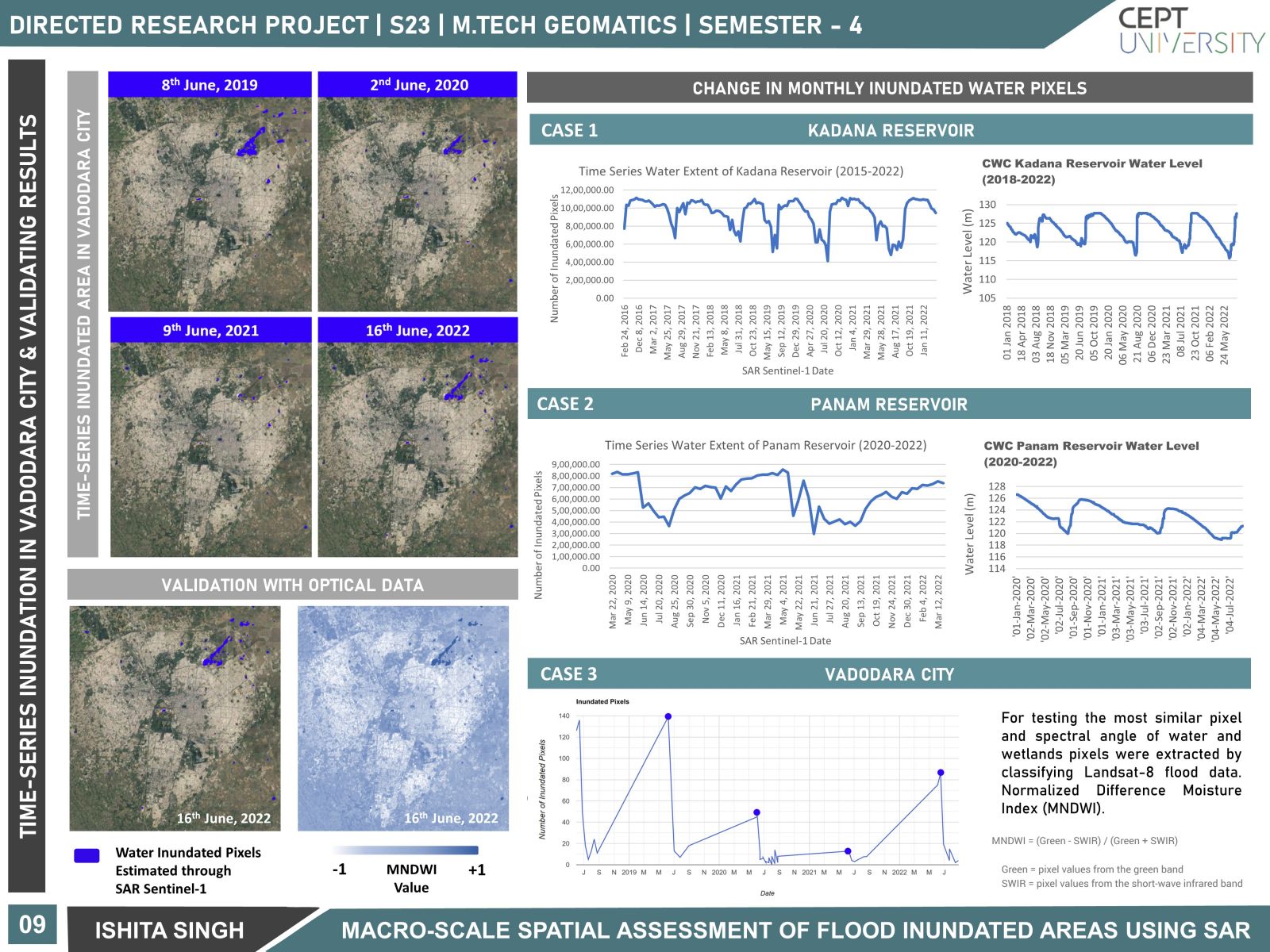
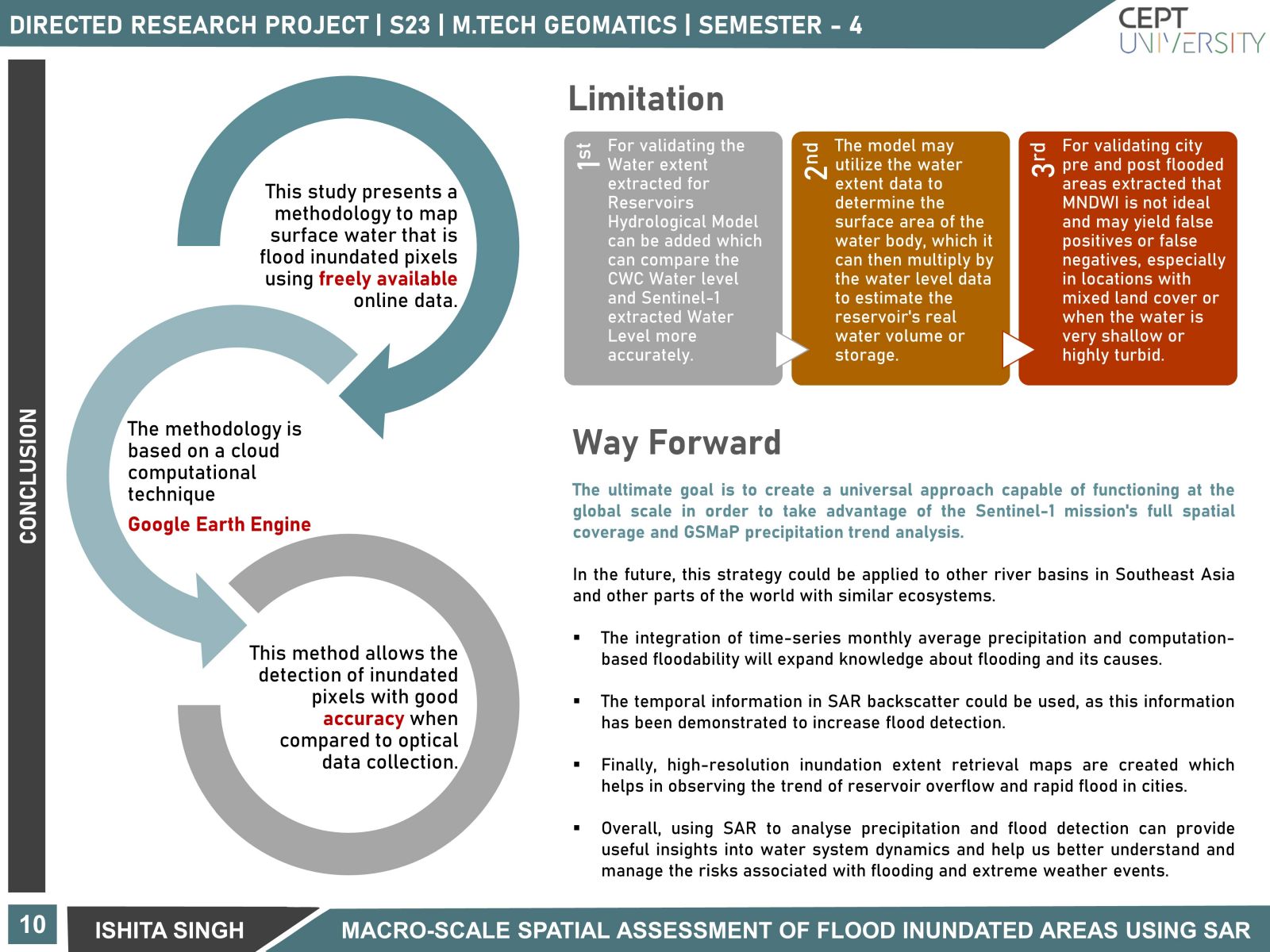
Floods are the most common naturally occurring catastrophic event that severely affects different types of land-cover structures in a river basin. This is due to climate change, which induces an increase in precipitation, which further leads to peak discharge during the monsoon season. This establishes the need for analyzing the rainfall trend and quantifying the temporal change in inundation area for flood resilient management. The study focuses on the use of microwave signals and their backpropagation technique through Space-based sensors like Synthetic Aperture Radar (SAR) for precisely detecting water pixels over the Western River basins of India. Urban areas and reservoirs are considered to be the major factors that need to be monitored as they affect the hydrological cycle of the basin. The Sentinel-1 SAR sensor equipped with C-band data is used for different temporal periods for mapping the change in flooding regions over major cities and the change in water extent of major reservoirs in the western river basins. The dual polarization characteristic of Sentinel-1 captured Ground Range Detection (GRD) imagery has high spatial and temporal resolution that is not affected by cloud-cover or night-time. This makes SAR the best approach for time-series flood detection. In this study, a cloud computation image processing platform, Google Earth Engine, is used for rainfall trend analysis, the pre-processing of Sentinel-1 data, and mapping inundation extent. The research focuses on analyzing major Reservoirs and Vadodara City in Mahi River Basin located in the north-western region of India. The results were refined by Otsu thresholding, speckle filtering, removing semi-permanent water pixels, and steep slope regions to effectively delineate actual flooded pixels. Validation of the estimated water pixels by Sentinel-1 is done using CWC water level data and manual thresholding of the Modified Normalized Difference Water Index (MNDWI). The difference between Pre-flood and Post-flood images of Vadodara City is done through the interferometric coherence technique, which measures the degree of correlation between both images to detect floodwater. The study's flood inundation outputs were used to create a Flood Extent Database, which can be integrated with hourly rainfall to assess the rainfall-inundation relationship within the basin, and high-resolution SAR data to effectively map and identify the flooded pixels.