Your browser is out-of-date!
For a richer surfing experience on our website, please update your browser. Update my browser now!
For a richer surfing experience on our website, please update your browser. Update my browser now!
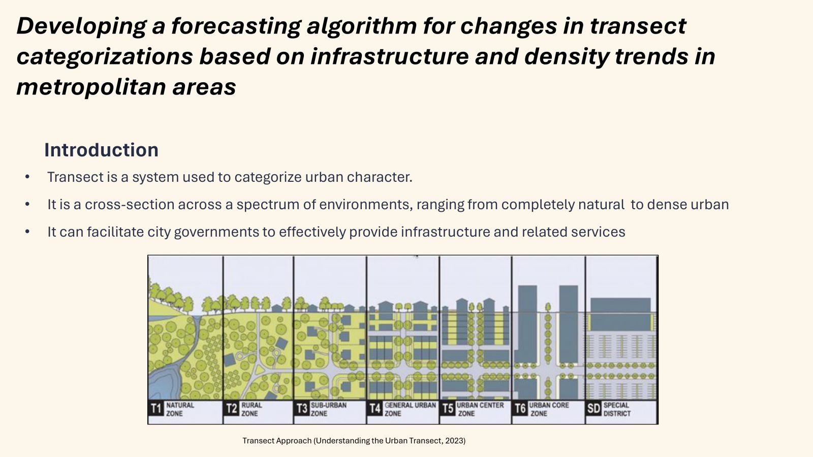
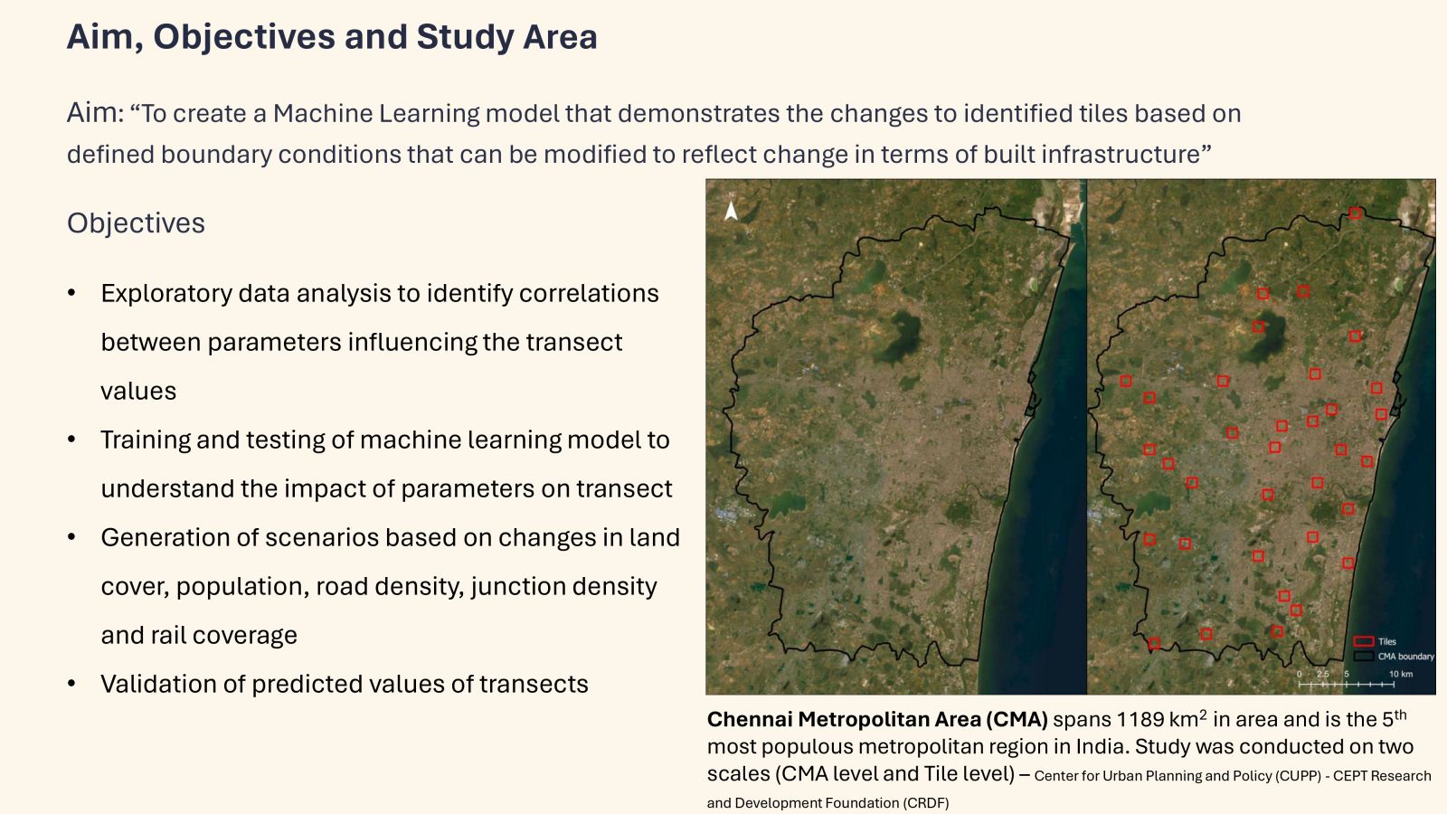
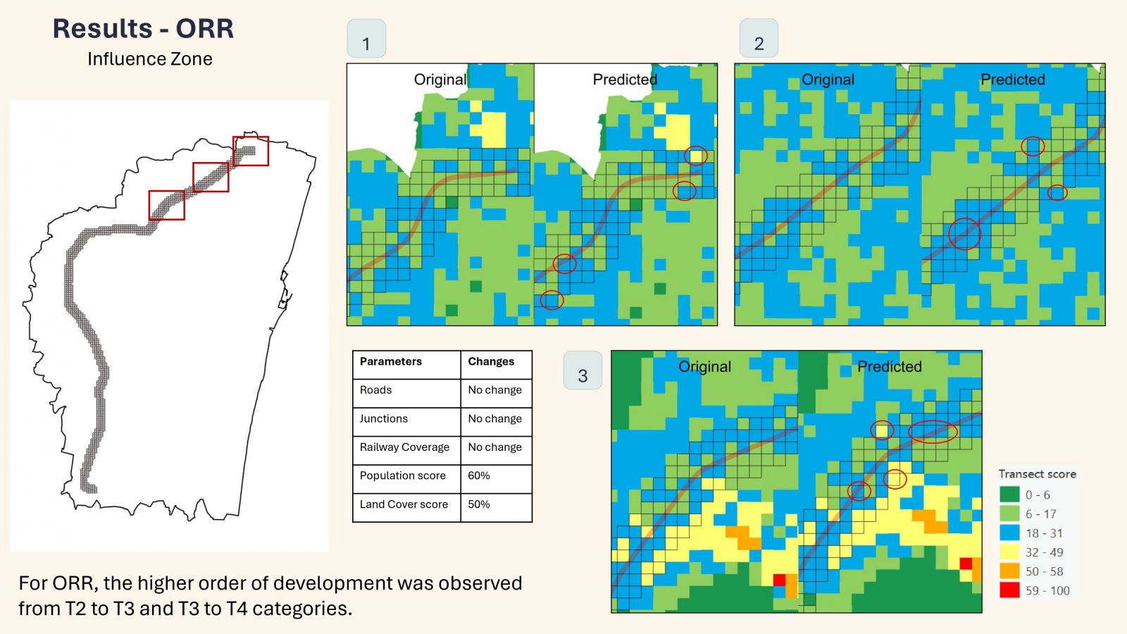
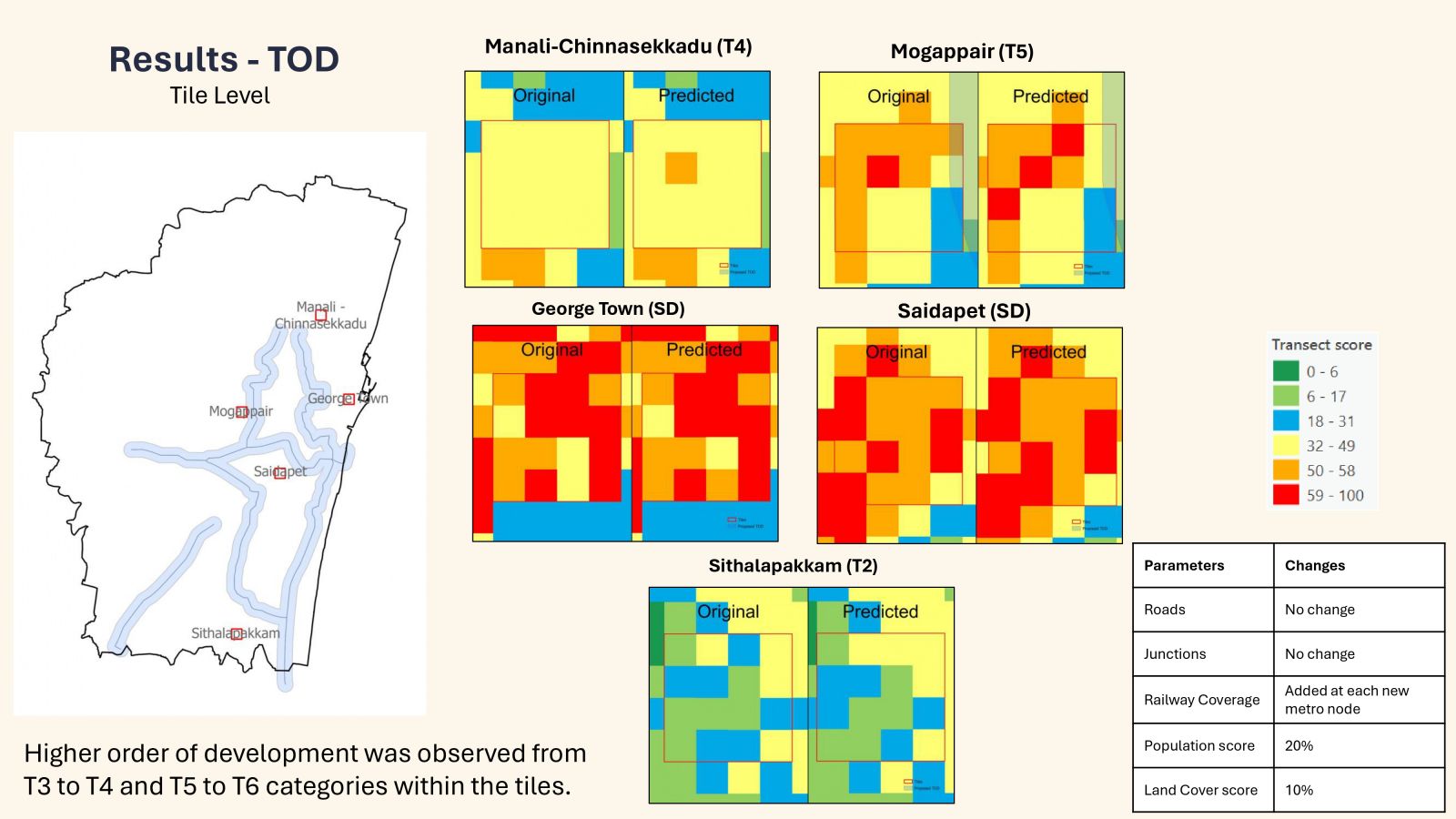
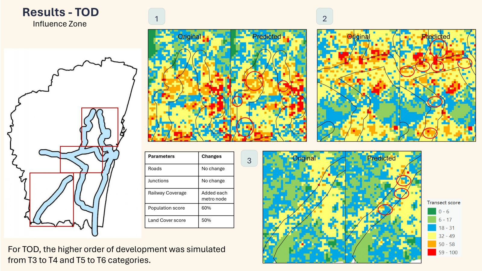
The transect approach provides a framework for understanding how a city operates and how the scale of built environments can vary from place to place. This method essentially divides the entire area into zones where elements are ordered from most rural to most urban. The transect includes a wide spectrum of human settlement types, addressing the connections between urban, suburban, and rural areas. It focuses on identifying the fundamental physical attributes that set them apart. This way, the degree of urbanization can be clearly understood.The main objective of the study would be to create a machine learning model that demonstrates the changes in transect values based on defined boundary conditions that can be modified to reflect changes in terms of built infrastructure. Identifying changes in transect will not only aid in efficient resource allocation based on the threshold of development but also serve as a regulatory apparatus, providing a comprehensive understanding that can guide urban planning and development. This study aligns with the ongoing Land value and Density distribution project of the Chennai Metropolitan Development Authority (CMDA), which aims to support the third master plan by providing sustainable growth strategies.