Your browser is out-of-date!
For a richer surfing experience on our website, please update your browser. Update my browser now!
For a richer surfing experience on our website, please update your browser. Update my browser now!
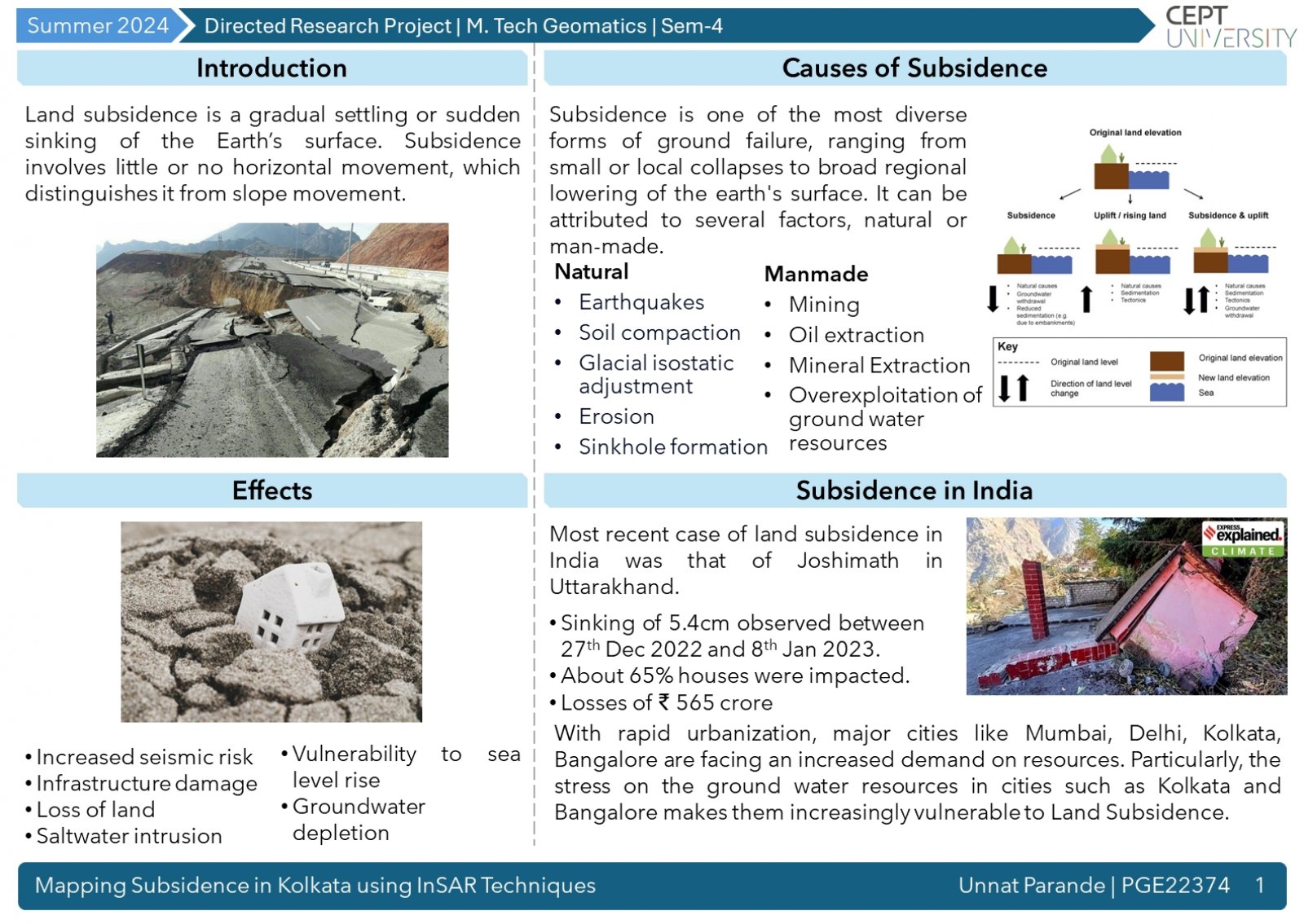
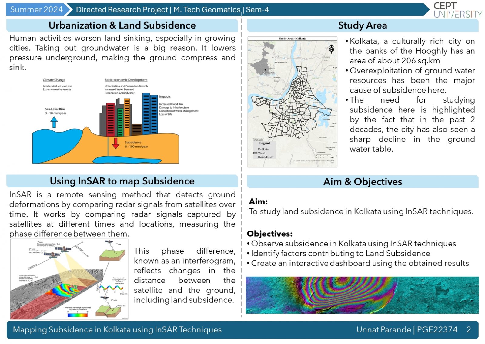
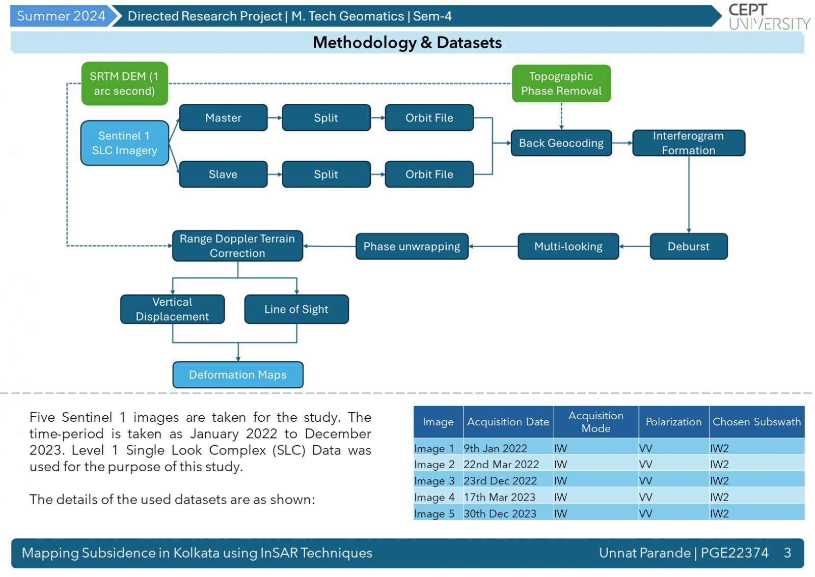
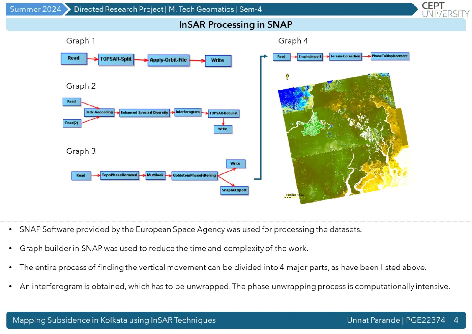
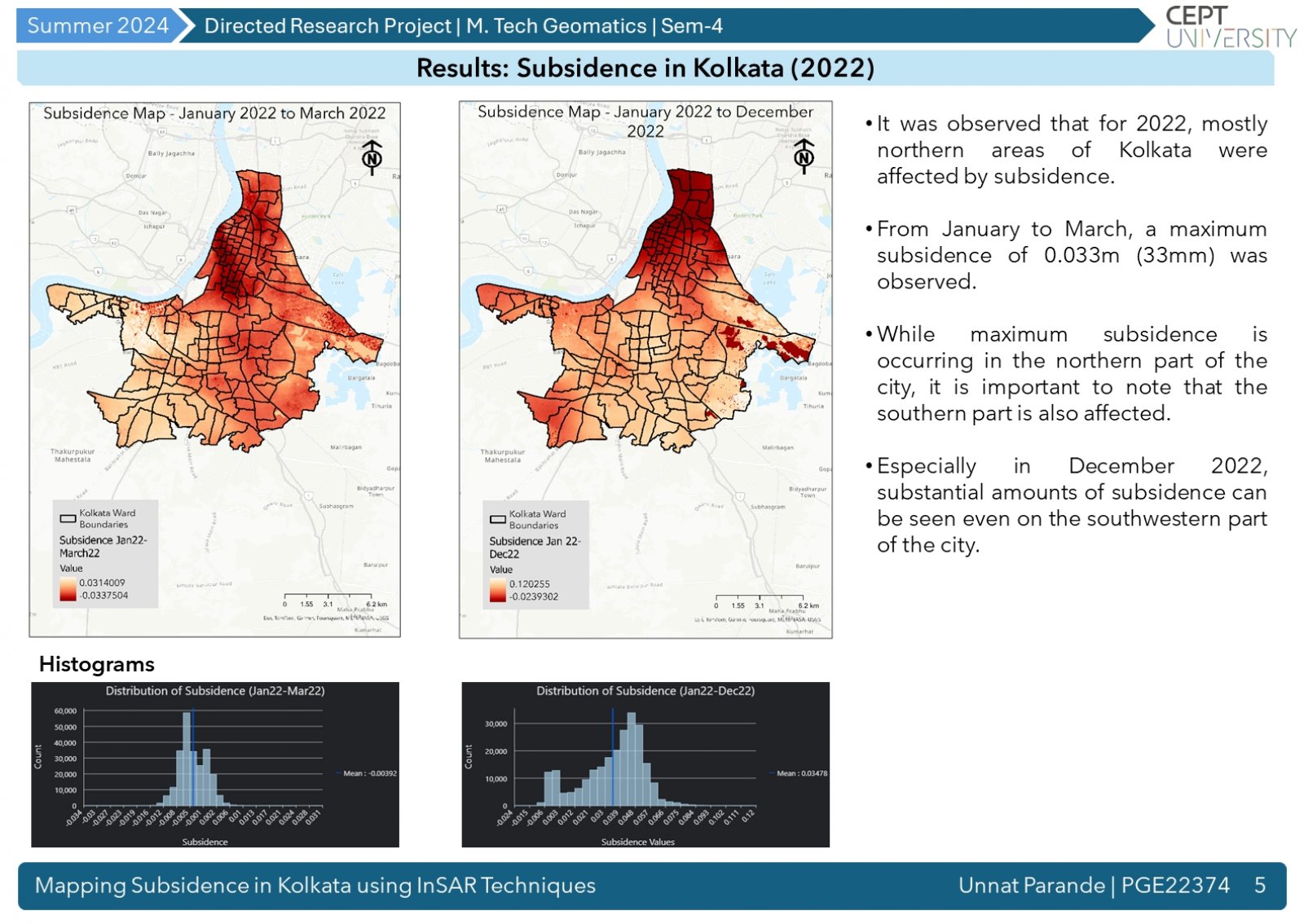
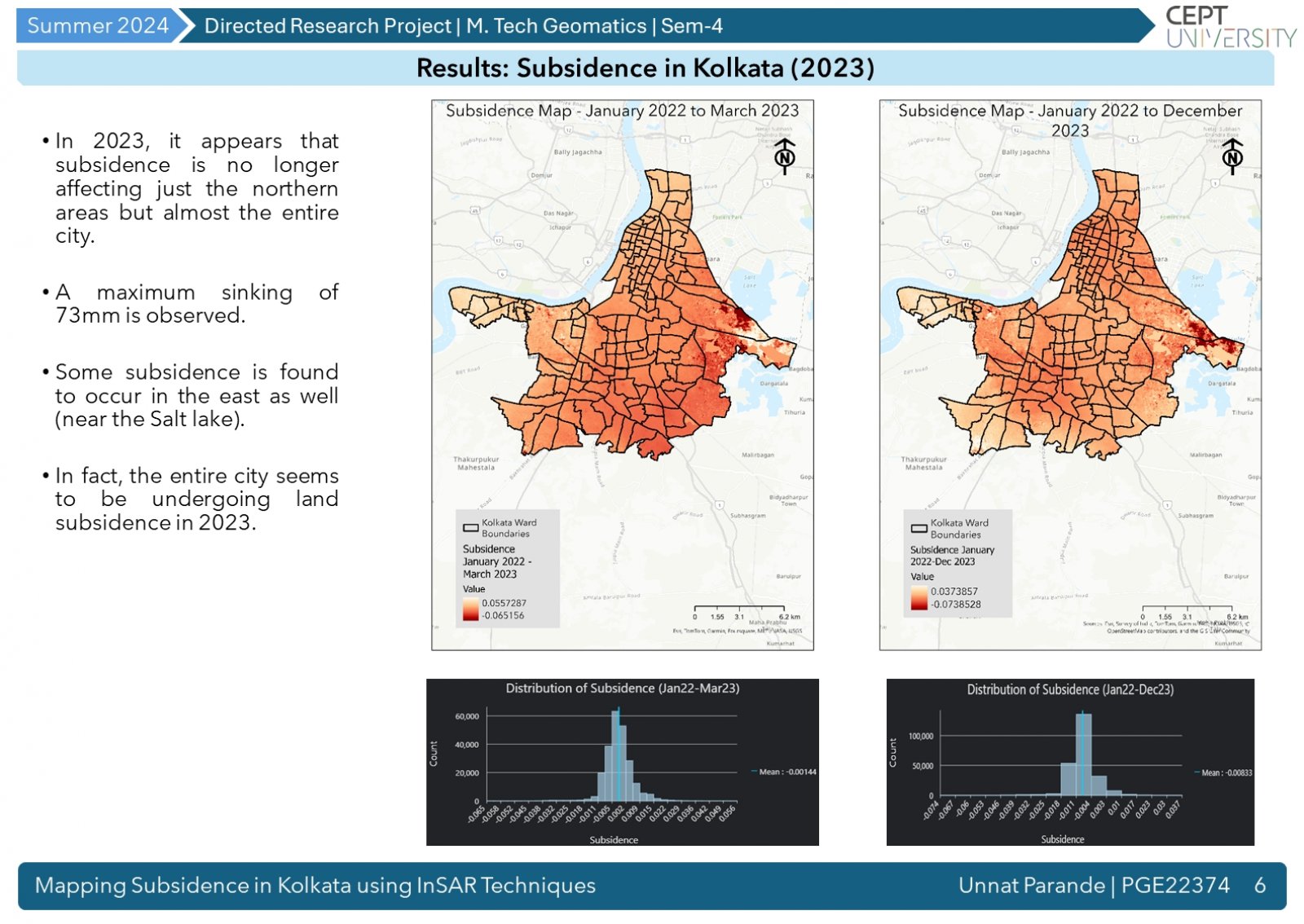
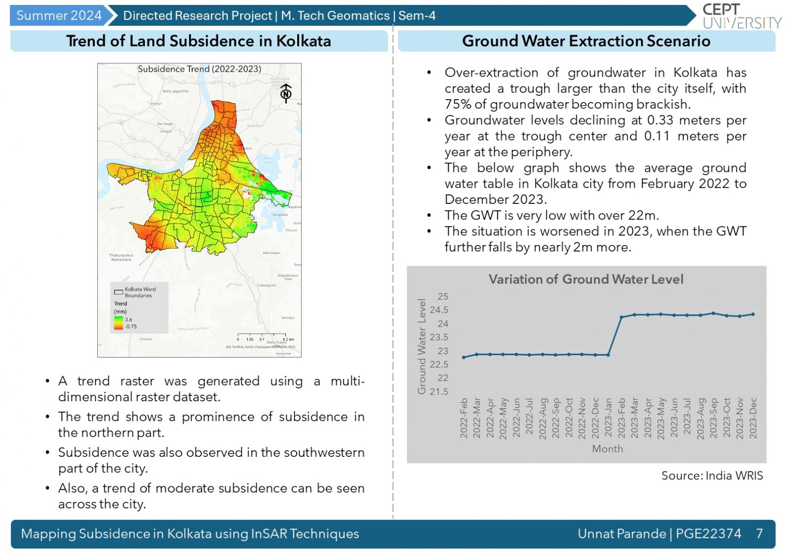
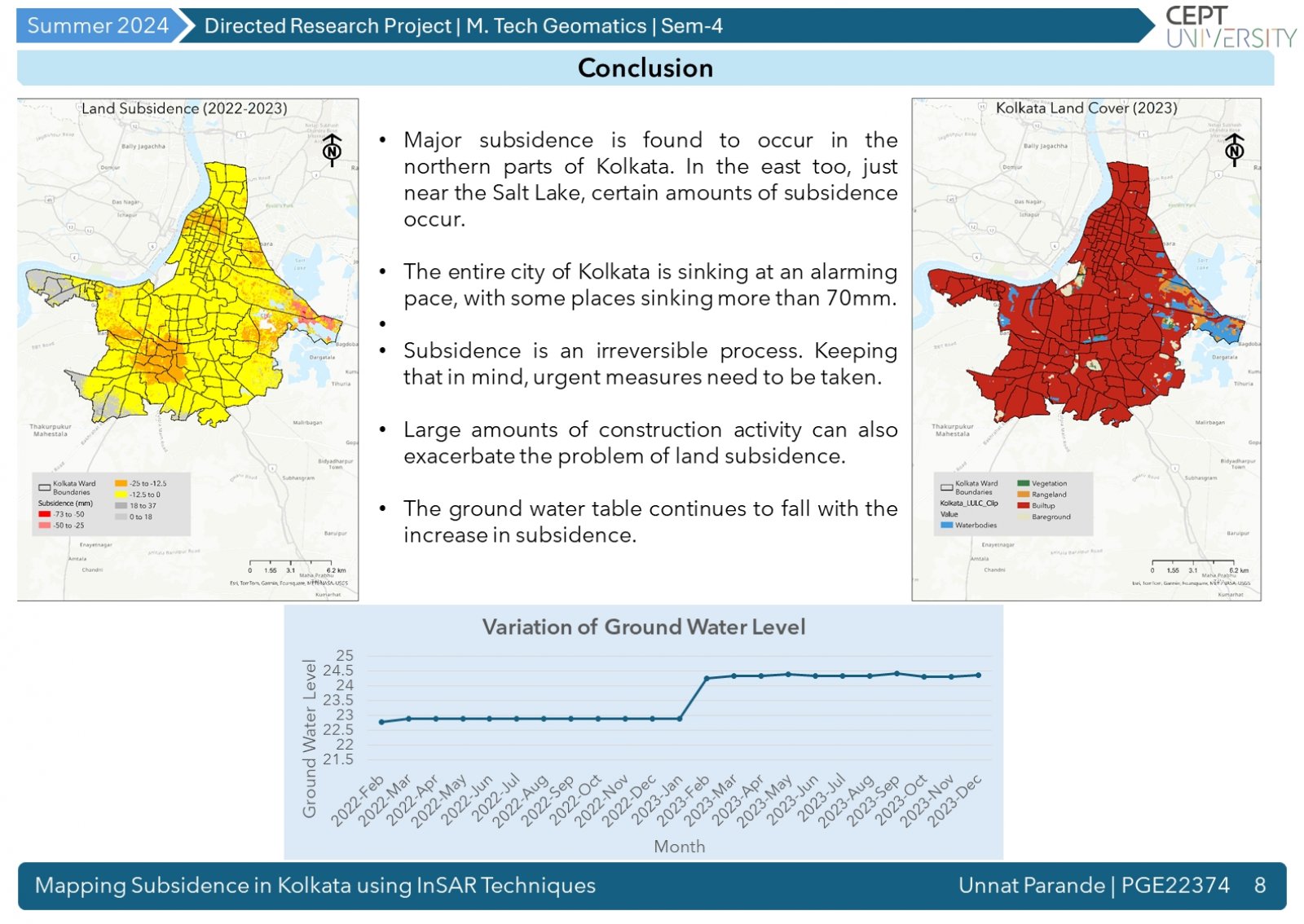
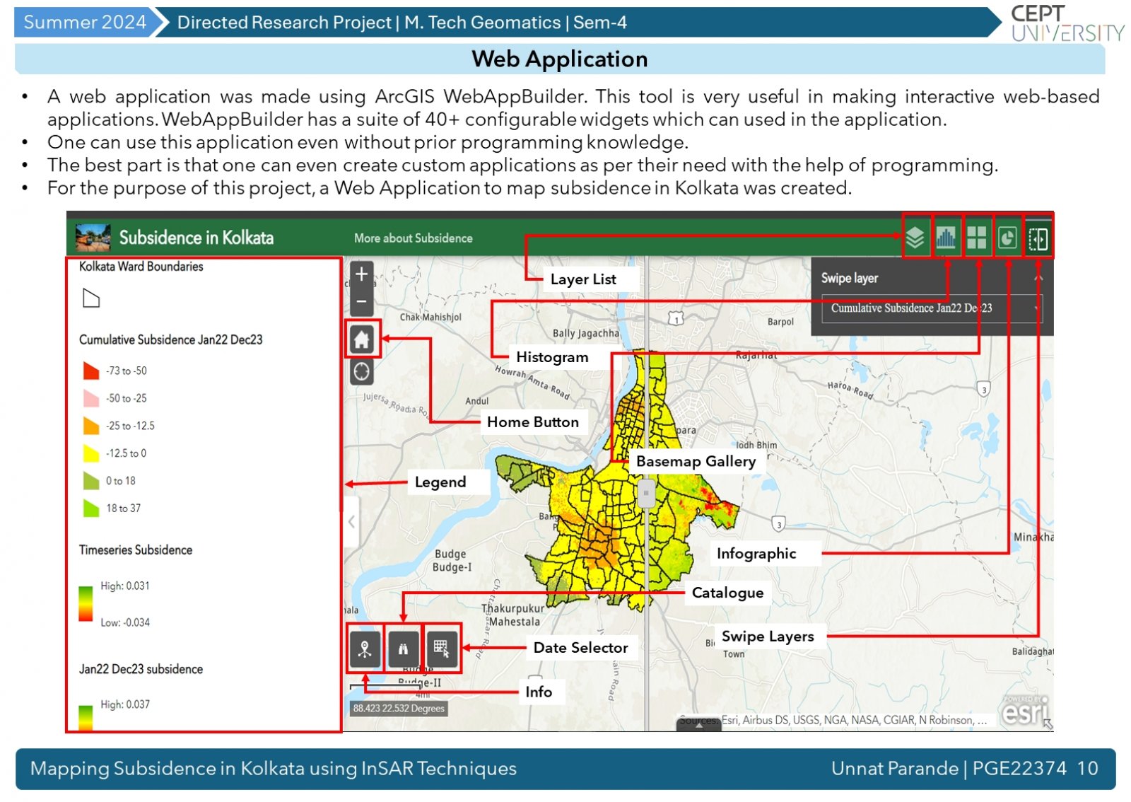
In the urban landscape, land subsidence can be a serious problem, which can cause damage to life and infrastructure. With sophisticated technologies like InSAR (Interferometric Synthetic Aperture Radar), the vertical movement of the ground can be mapped to millimeter level accuracies. This study aims to map subsidence in Kolkata and relates it to the problem of overexploitation of ground water resources in the city. The falling ground water tables in the city are testament to this very problem. In the end, an interactive dashboard has been created.
