Your browser is out-of-date!
For a richer surfing experience on our website, please update your browser. Update my browser now!
For a richer surfing experience on our website, please update your browser. Update my browser now!
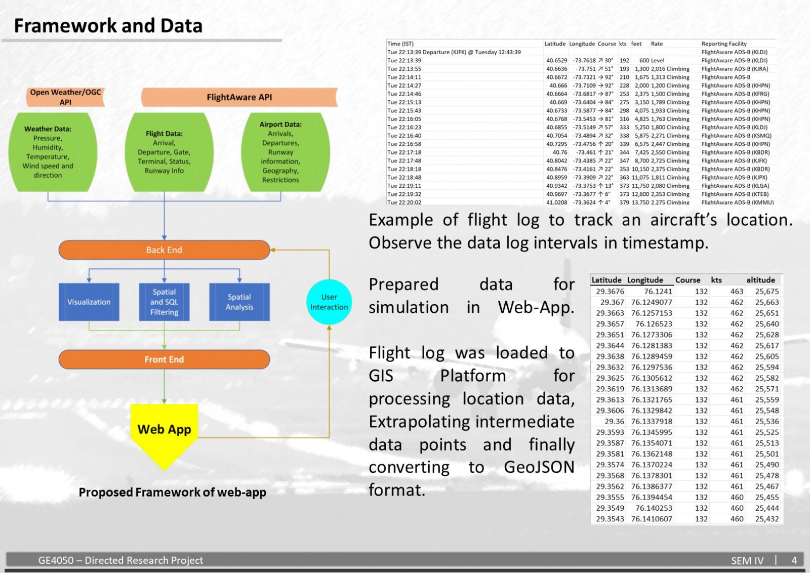
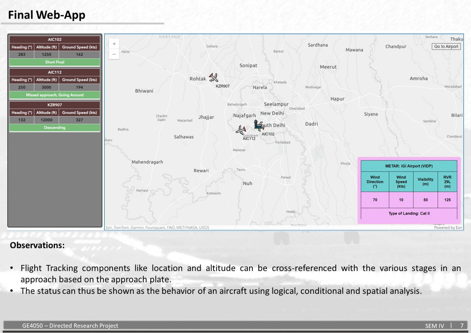
The dynamic nature of air travel demands access to real-time, comprehensive information for various stakeholders. This project proposes the development of an integrated flight insights and information system, leveraging geospatial technology to present a holistic view of air traffic. Geospatial technology and aviation, when integrated, share a symbiotic relationship which revolutionizes the way airspace and flights are managed. Geographic Information Systems (GIS), Global Positioning Systems (GPS) and Remote sensing play a vital role in enhancing the functionality of aviation systems by providing highly accurate, reliable and real-time data for efficient operations. In this transformative approach, further enhancement and integration of various systems will aid in focusing on providing passengers with insights and information regarding flights. This includes the introduction of live flight tracking, along with respective flight information and details, Airport information, near real time weather updates, airspace congestion levels, traffic patterns, disruptions and delays. The IFIIS uses a combination of APIs, HTML, CSS, JavaScript and various spatial analyses integrated seamlessly to provide insights into the flight information, tracking, weather update and predict possible disruptions in Airspace management and operations. This project aims to benefit a wide range of audiences. Passengers will gain valuable insights into their journeys, including flight updates, potential delays, and alternative travel options. Aviation Aficionados and aspiring aviators can enjoy immersive visualizations of air traffic patterns and in-depth flight data. Aviation authorities will benefit from enhanced situational awareness, potentially improving operational efficiency and decision-making.
