Your browser is out-of-date!
For a richer surfing experience on our website, please update your browser. Update my browser now!
For a richer surfing experience on our website, please update your browser. Update my browser now!
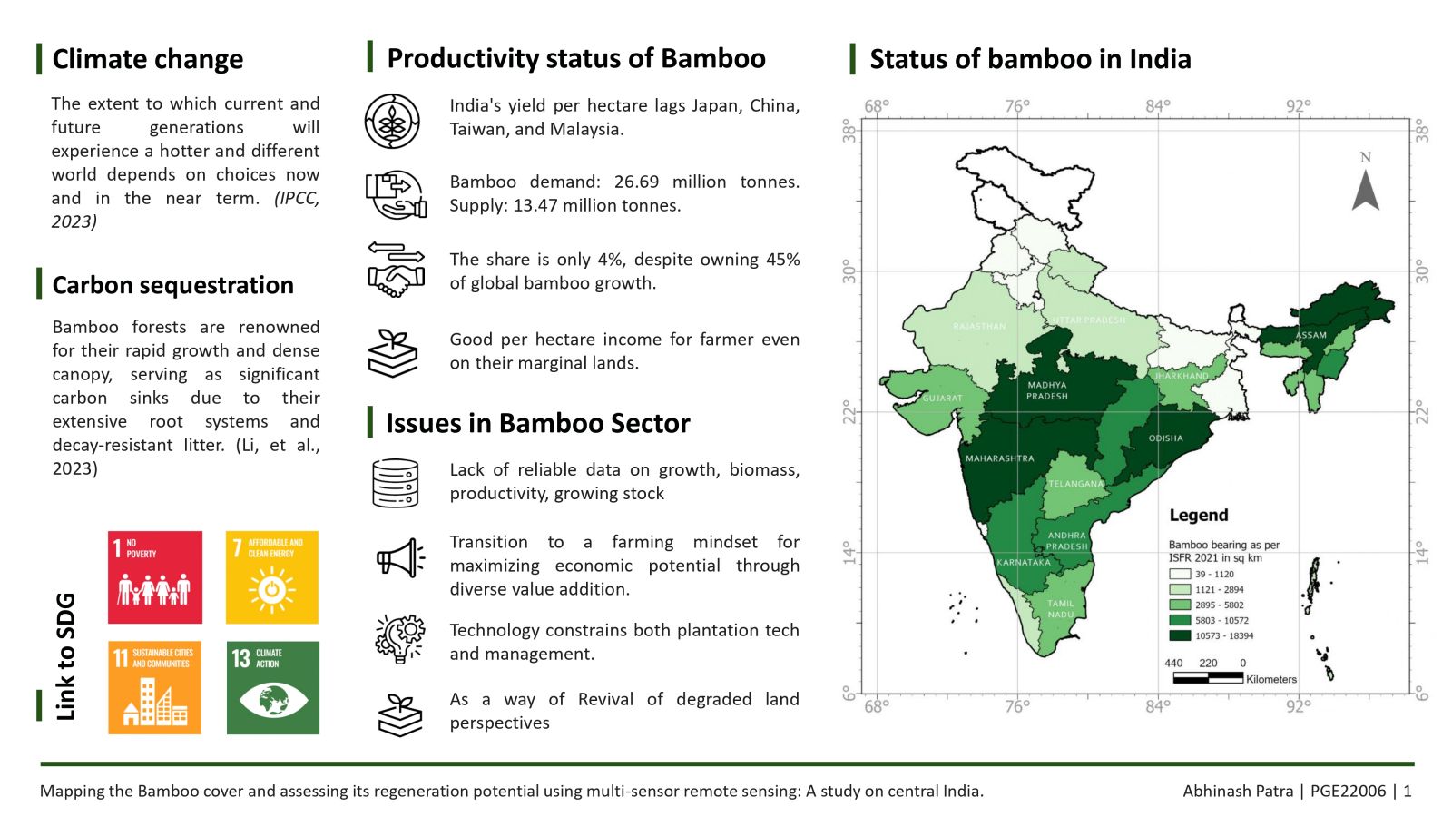
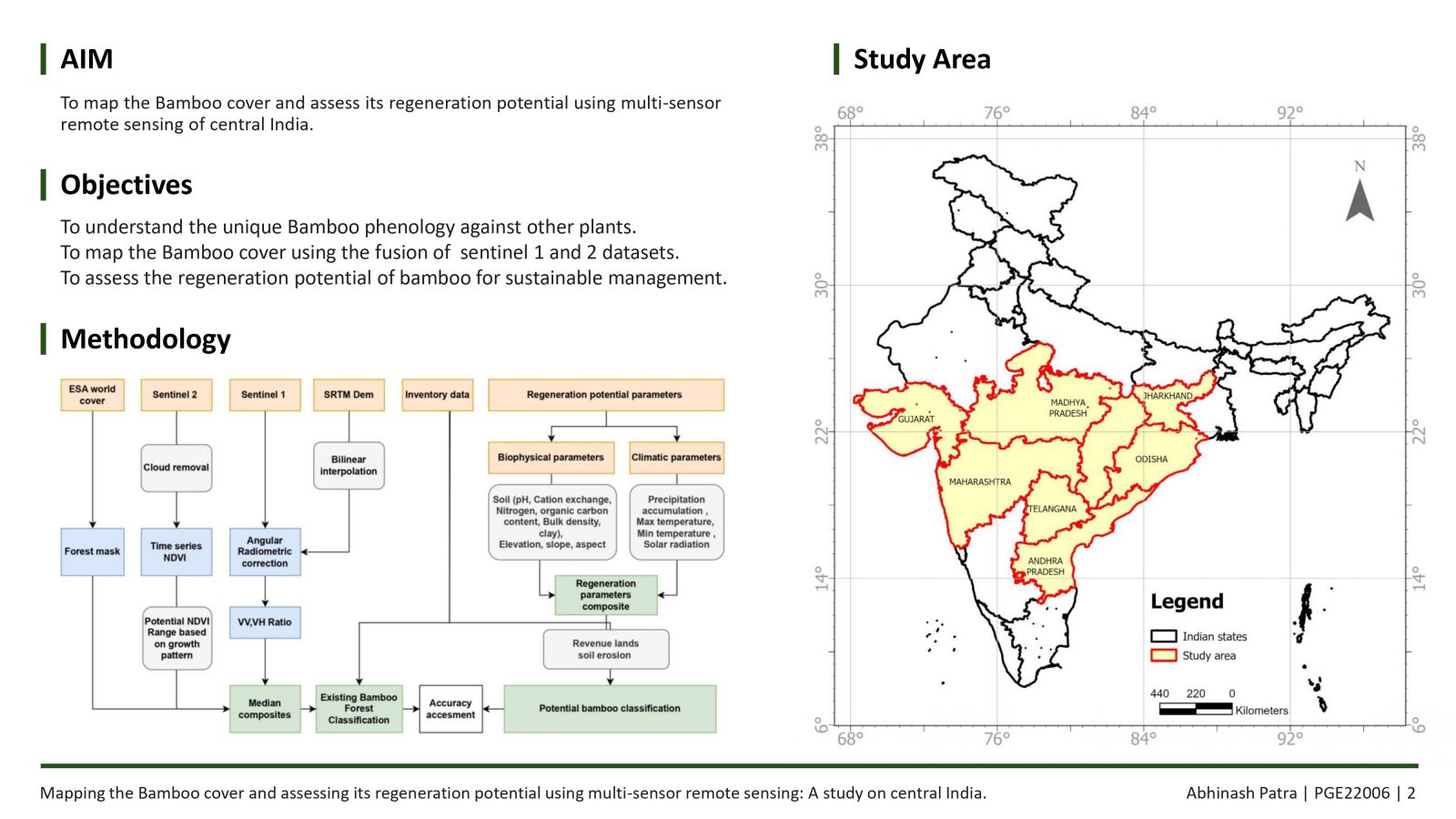
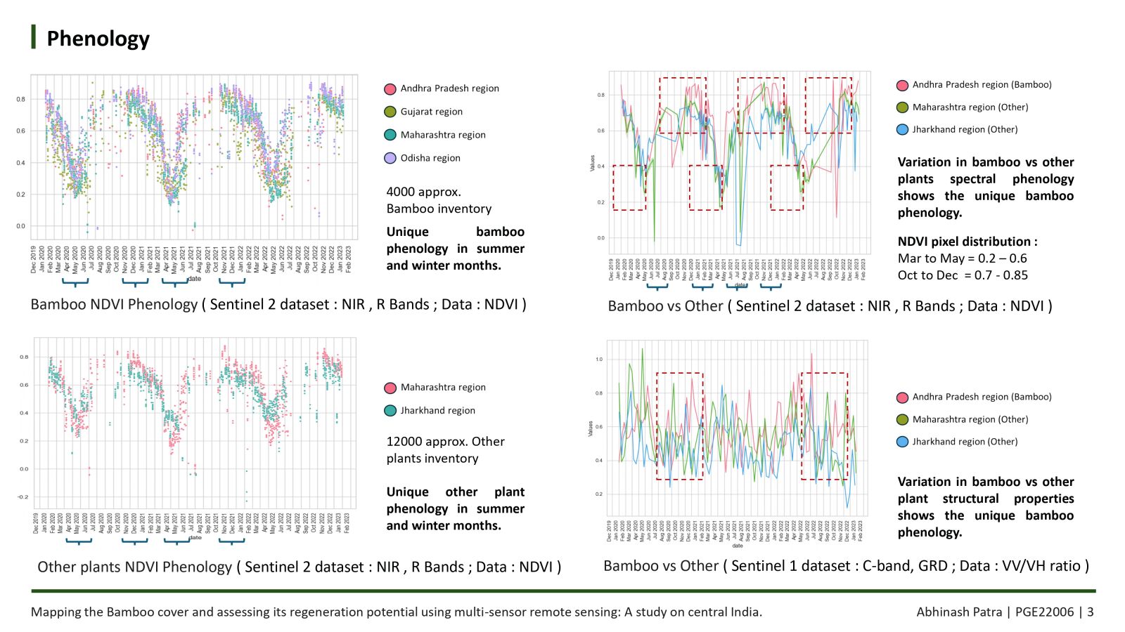
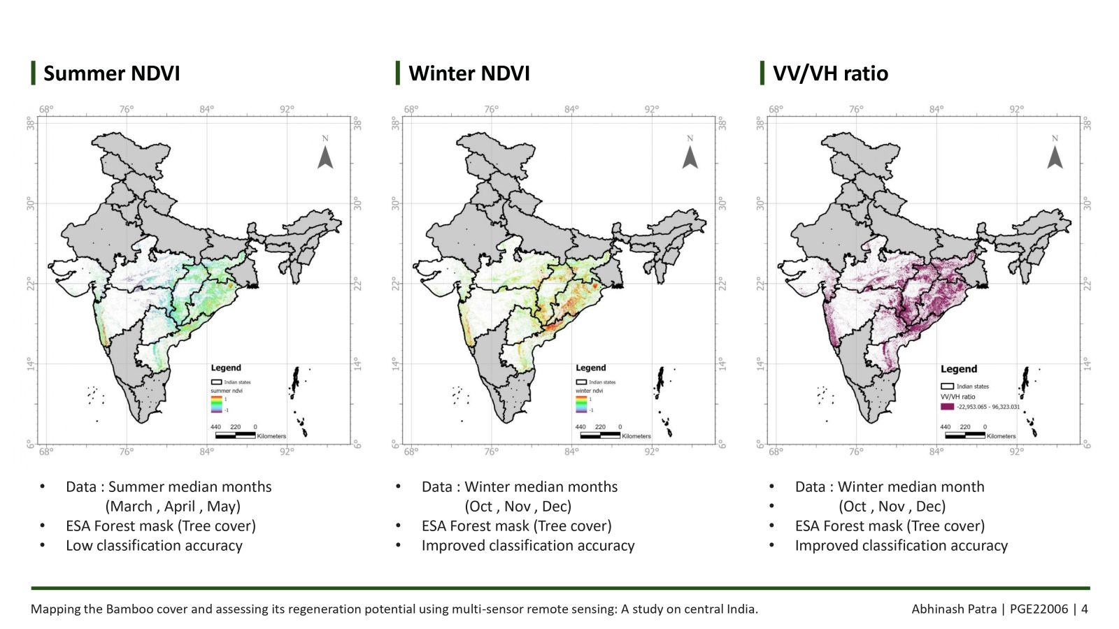
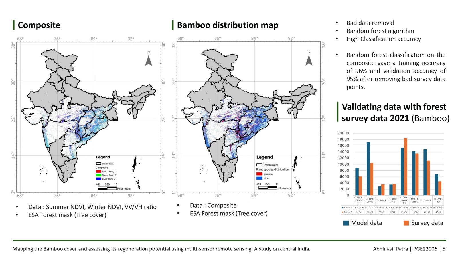
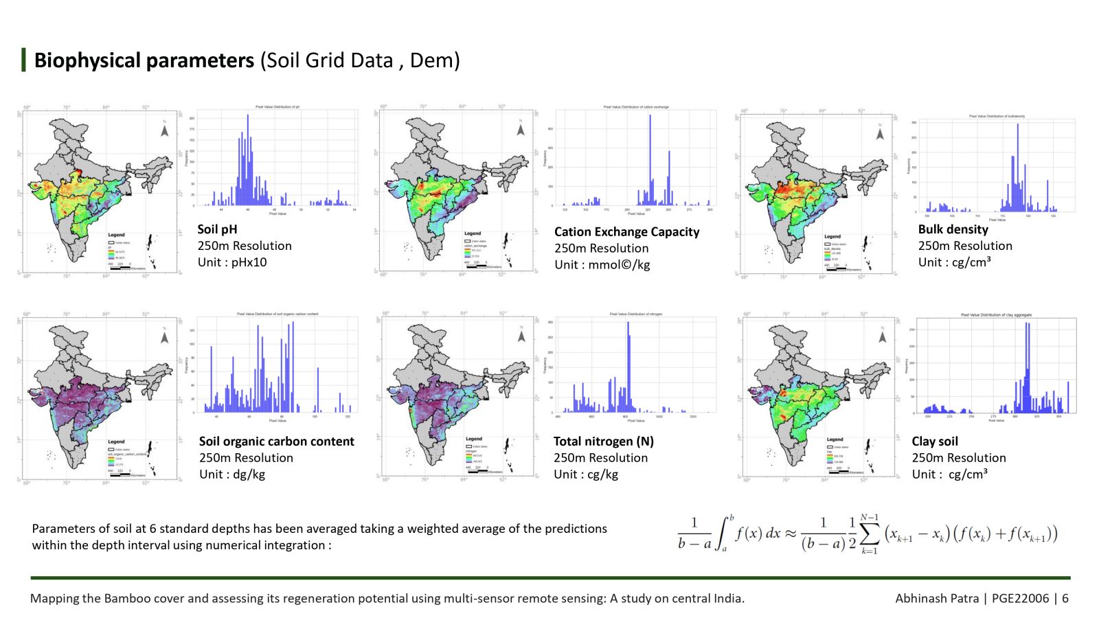
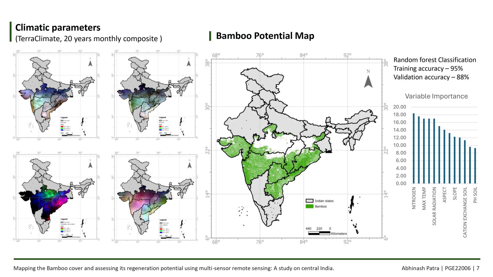
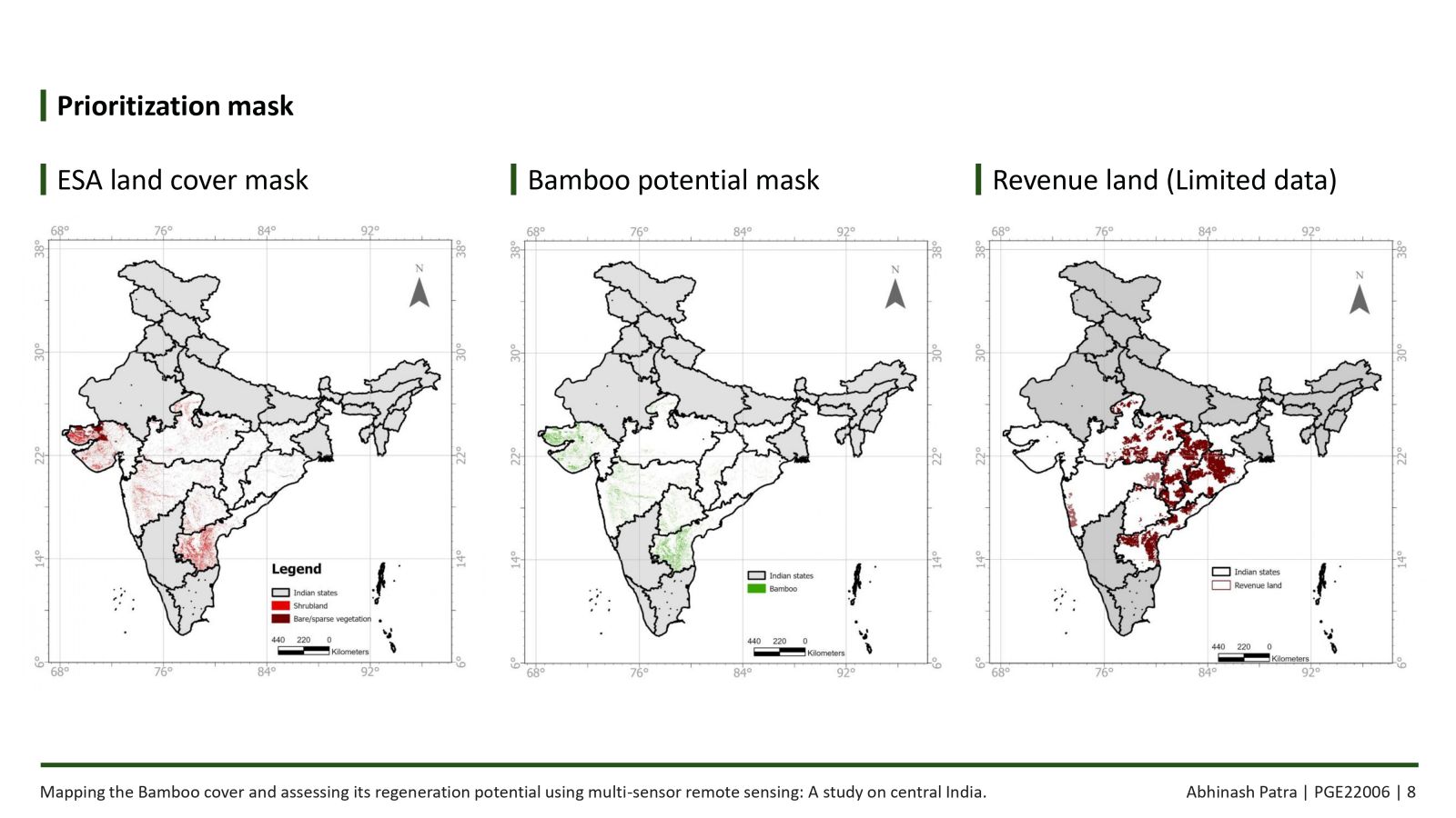
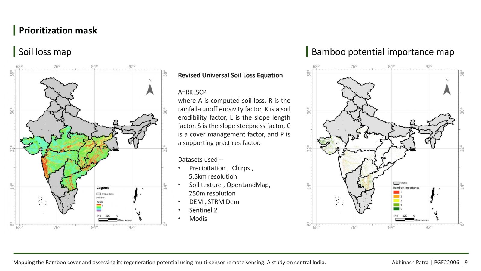
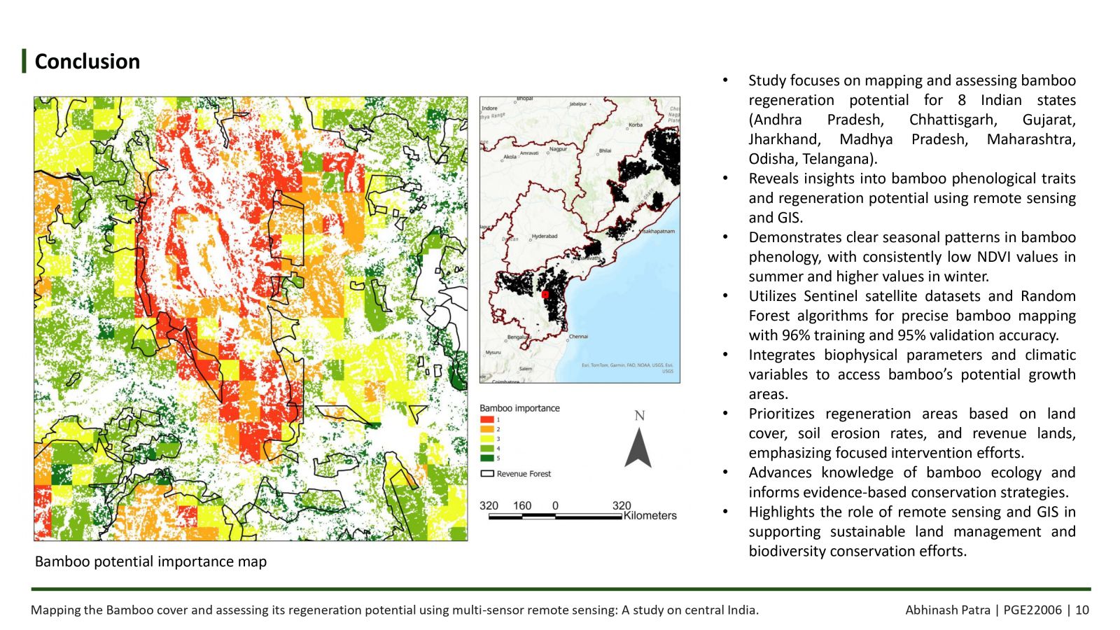
The need of addressing global warming underscores the necessity for sustainable practices, as exemplified by the Kyoto Protocol. This study utilizes remote sensing and GIS to map bamboo and assess its potential for regeneration. By analyzing backscatter characteristics and NDVI, the research employs Random Forest to achieve accurate mapping and evaluate regeneration prospects. Bamboo's distinct features are highlighted through comparison with other plant species. The study identifies priority areas for regeneration activities by integrating biophysical parameters and long-term climatic variables, emphasizing the pivotal role of GIS and remote sensing in conservation and sustainable resource management.
