Your browser is out-of-date!
For a richer surfing experience on our website, please update your browser. Update my browser now!
For a richer surfing experience on our website, please update your browser. Update my browser now!
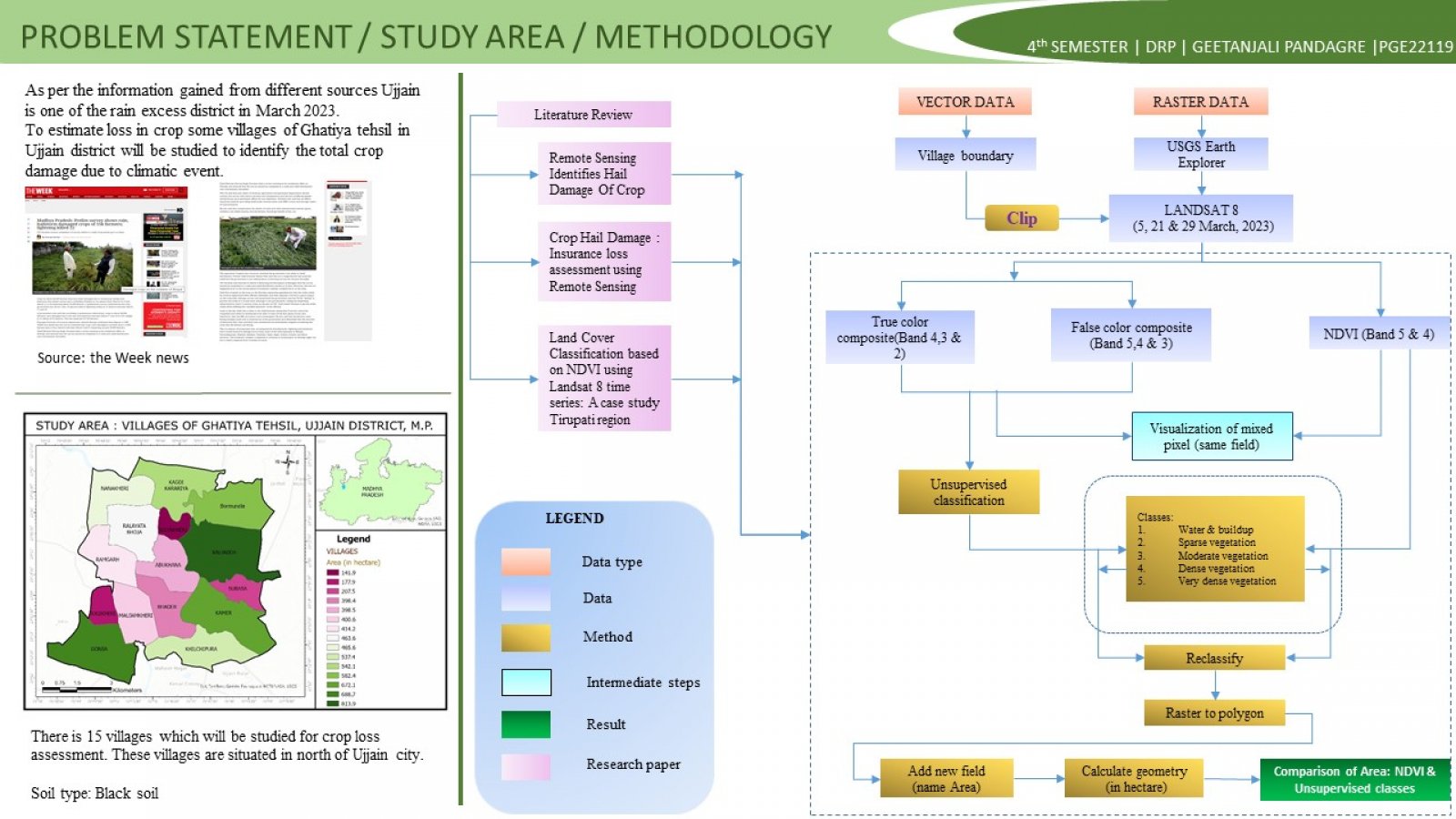
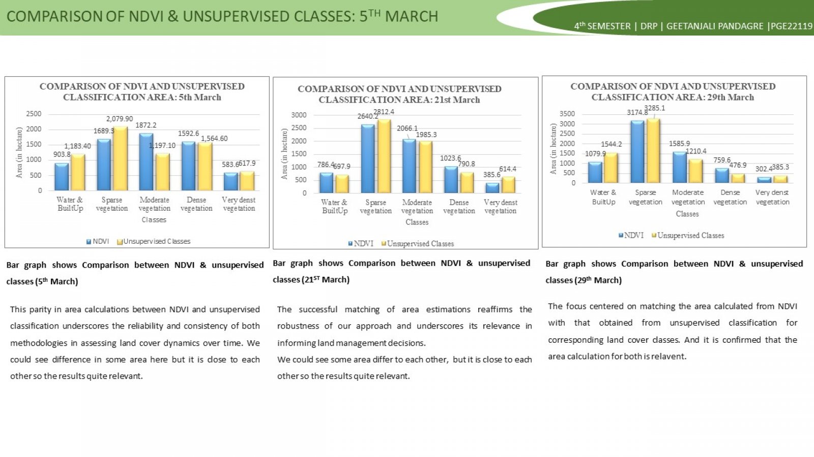
The project focused on designing a remote sensing data acquisitions strategy that will suitably respond to the requirements of crop damage mapping and assessment before event and after event. The Normalized Difference Vegetation Index (NDVI) is one of the most widely used numerical indicator that uses the visible (VIS) and near-infrared bands (NIR) of the electromagnetic spectrum and is utilized to analyze remote sensing images and assess whether the target contains live green vegetation or not. This paper analyze the change in vegetation during rabi crop due to heavy rainfall. Images of level-1 data of Landsat8 were collected for before event and after event of the same region and derived the NDVI values. For land cover classification, various band combinations of the remote sensed data are treated and the spatial distribution such as water bodies, built-up area, vegetation and dense vegetation are easily examined by computing their normalized difference vegetation index from multi-spectral data. On-going portion of present study focuses on making out the difference between the vegetation indexes of different land cover types by performing Unsupervised classification.