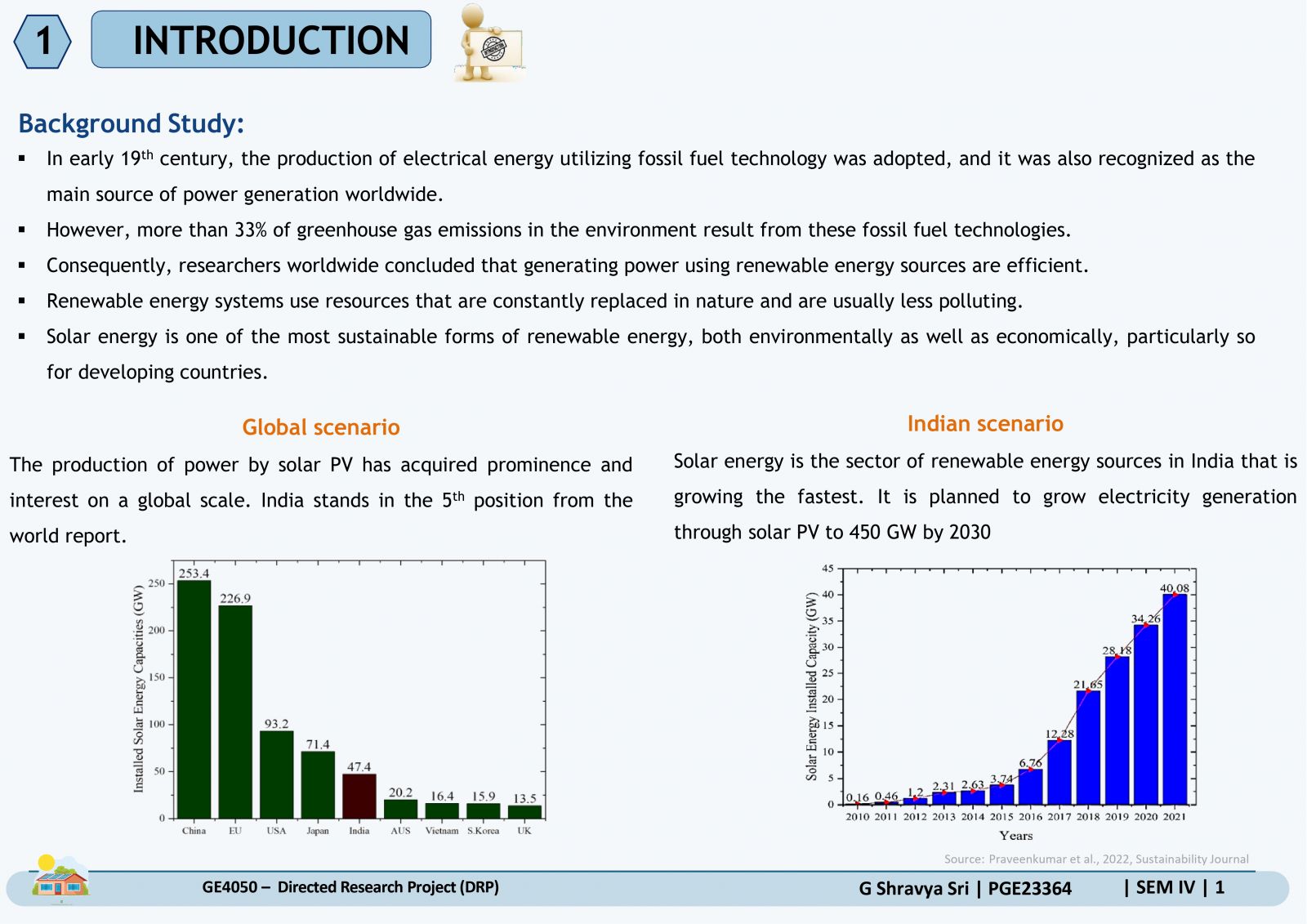
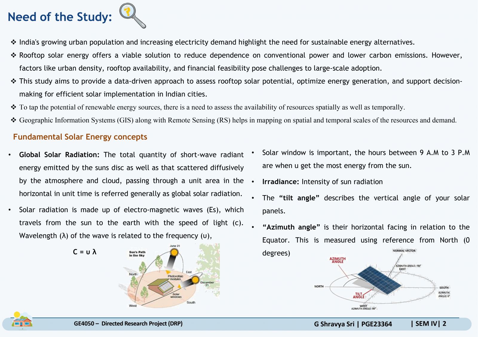
Your browser is out-of-date!
For a richer surfing experience on our website, please update your browser. Update my browser now!
For a richer surfing experience on our website, please update your browser. Update my browser now!
Solar Energy Potential Assessment using GIS & Remote Sensing
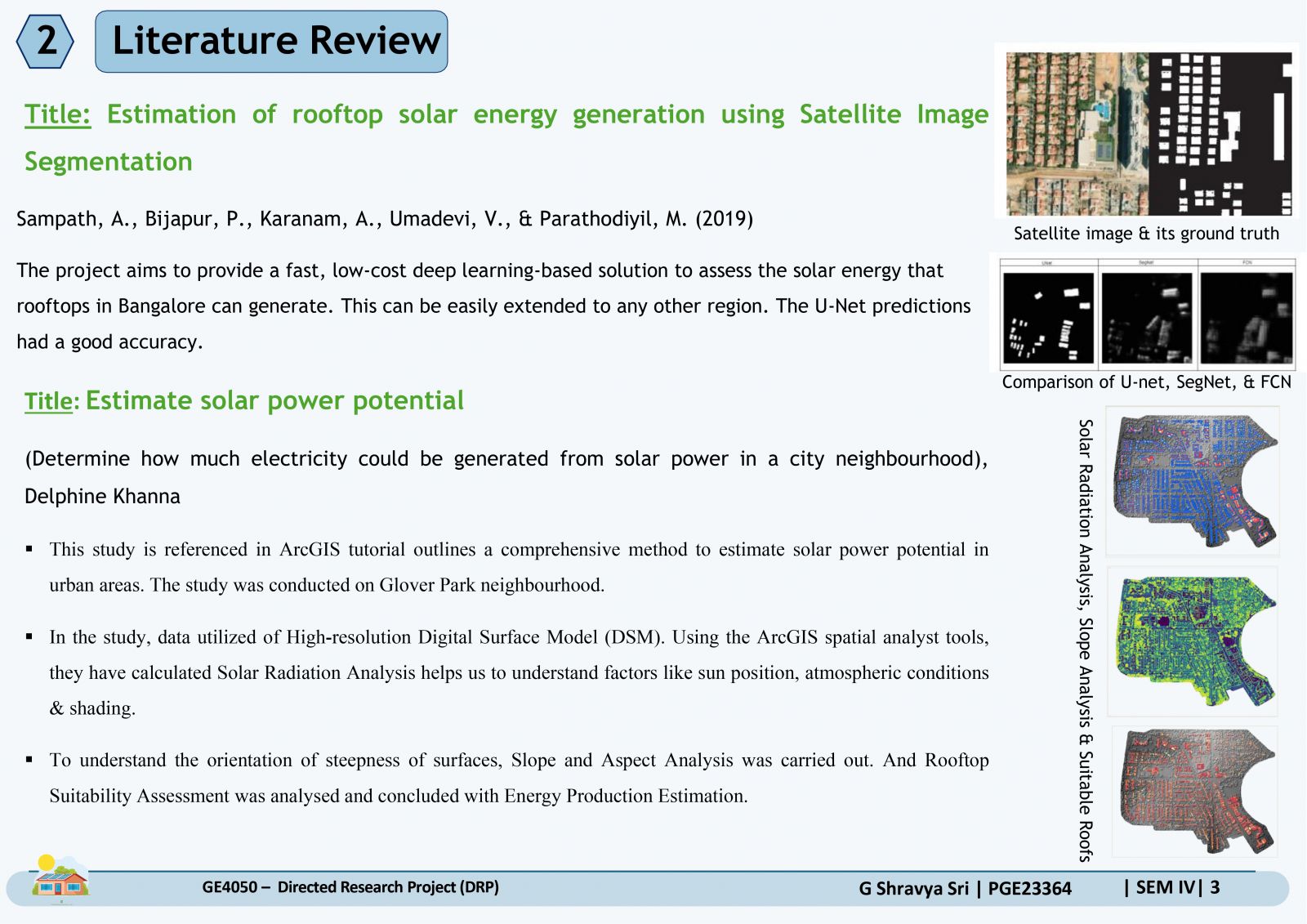
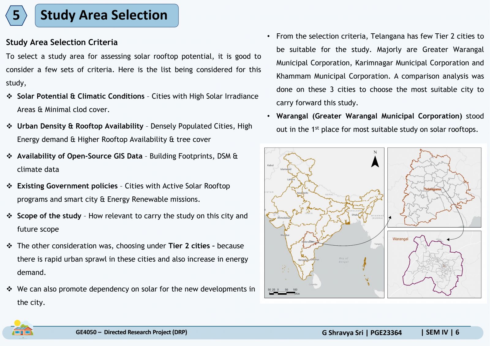
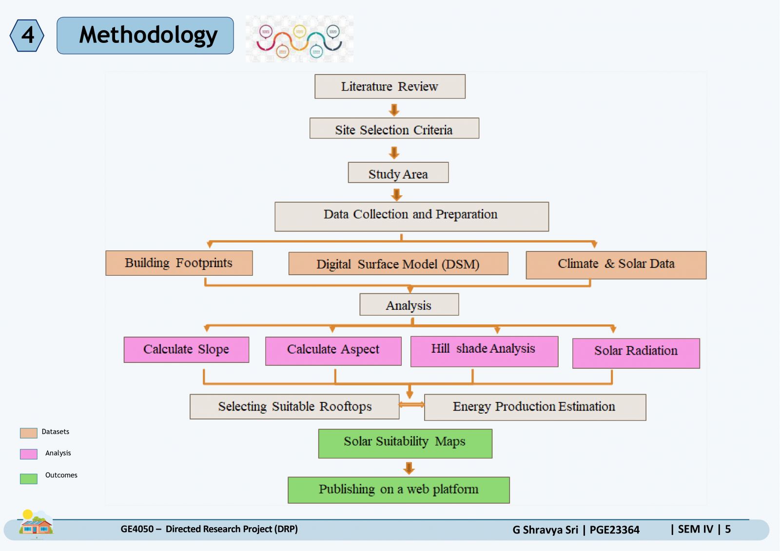
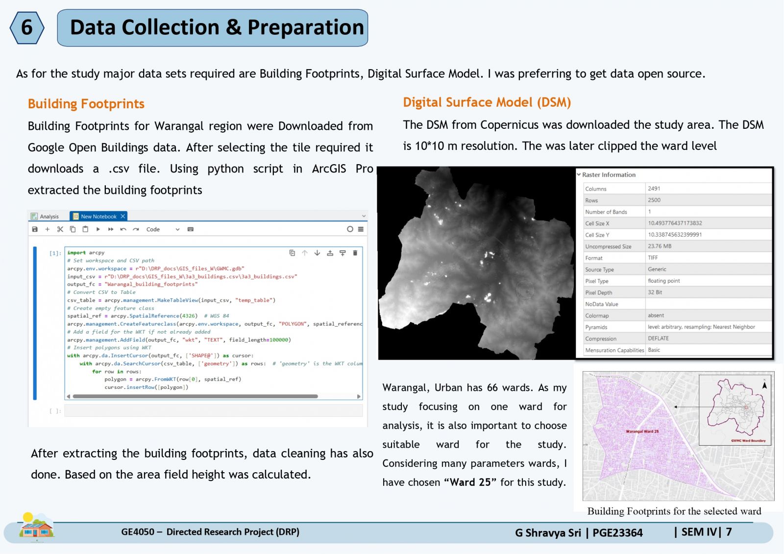
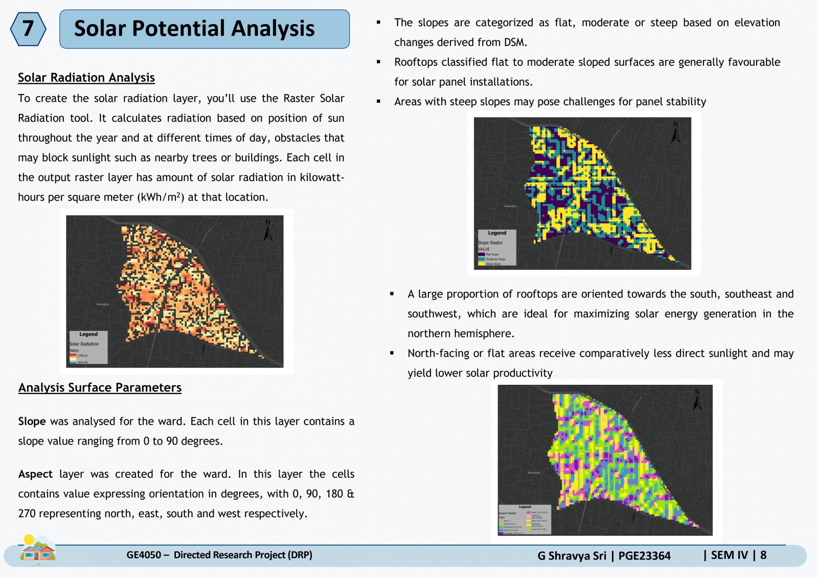
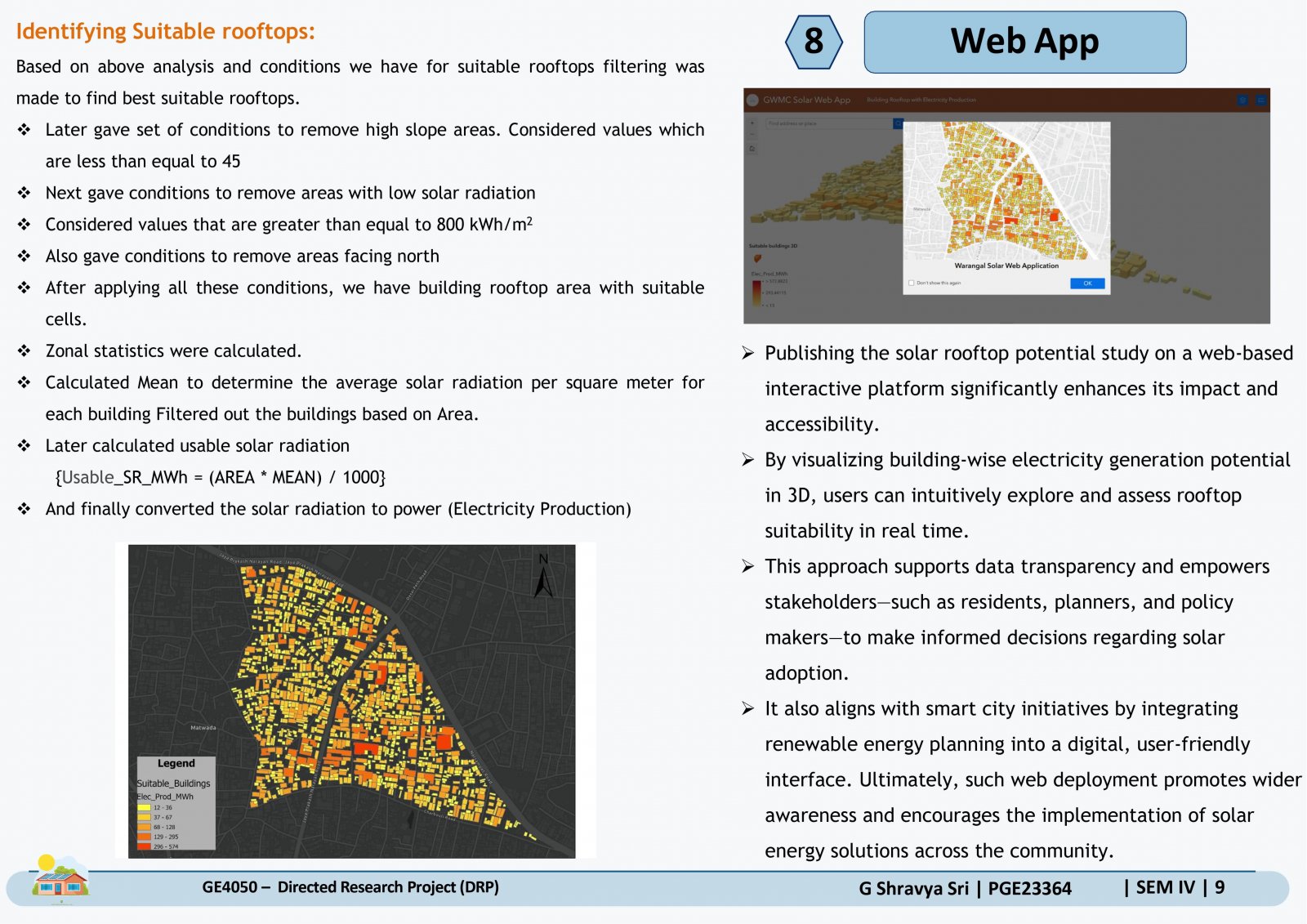
With increasing energy demands and urbanization, cities are seeking sustainable solutions to reduce dependency on conventional energy sources. The study focuses on leveraging Geographic Information System (GIS) and Remote Sensing (RS) for the spatial assessment of renewable energy resources. The proposed project involves mapping solar energy potential using satellite imagery and geospatial analysis, considering factors such as solar irradiance and rooftop suitability to support informed decision-making. The study was carried out on Greater Warangal Municipal Corporation, Telangana, India. A suitable ward was selected to carry out the study on solar rooftop potential analysis using geospatial techniques. Key parameters such as solar radiation, slope, and aspect were analysed to identify buildings most suitable for solar panel installation