Your browser is out-of-date!
For a richer surfing experience on our website, please update your browser. Update my browser now!
For a richer surfing experience on our website, please update your browser. Update my browser now!
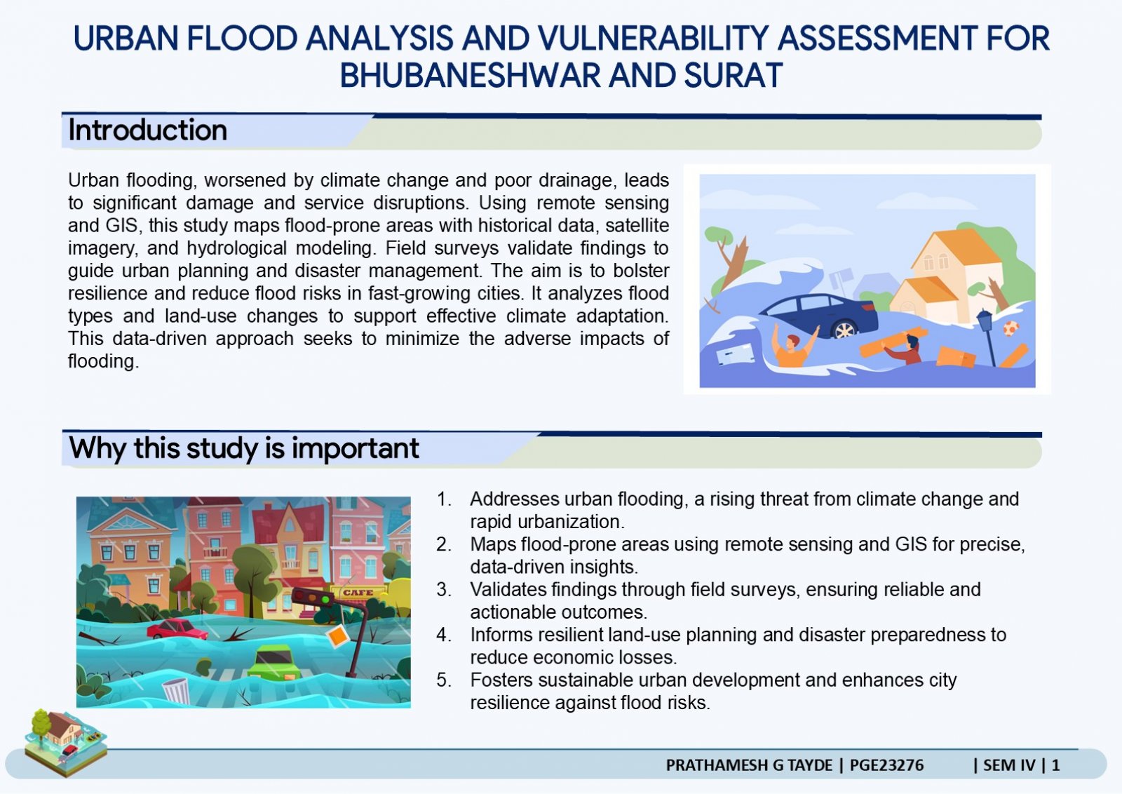
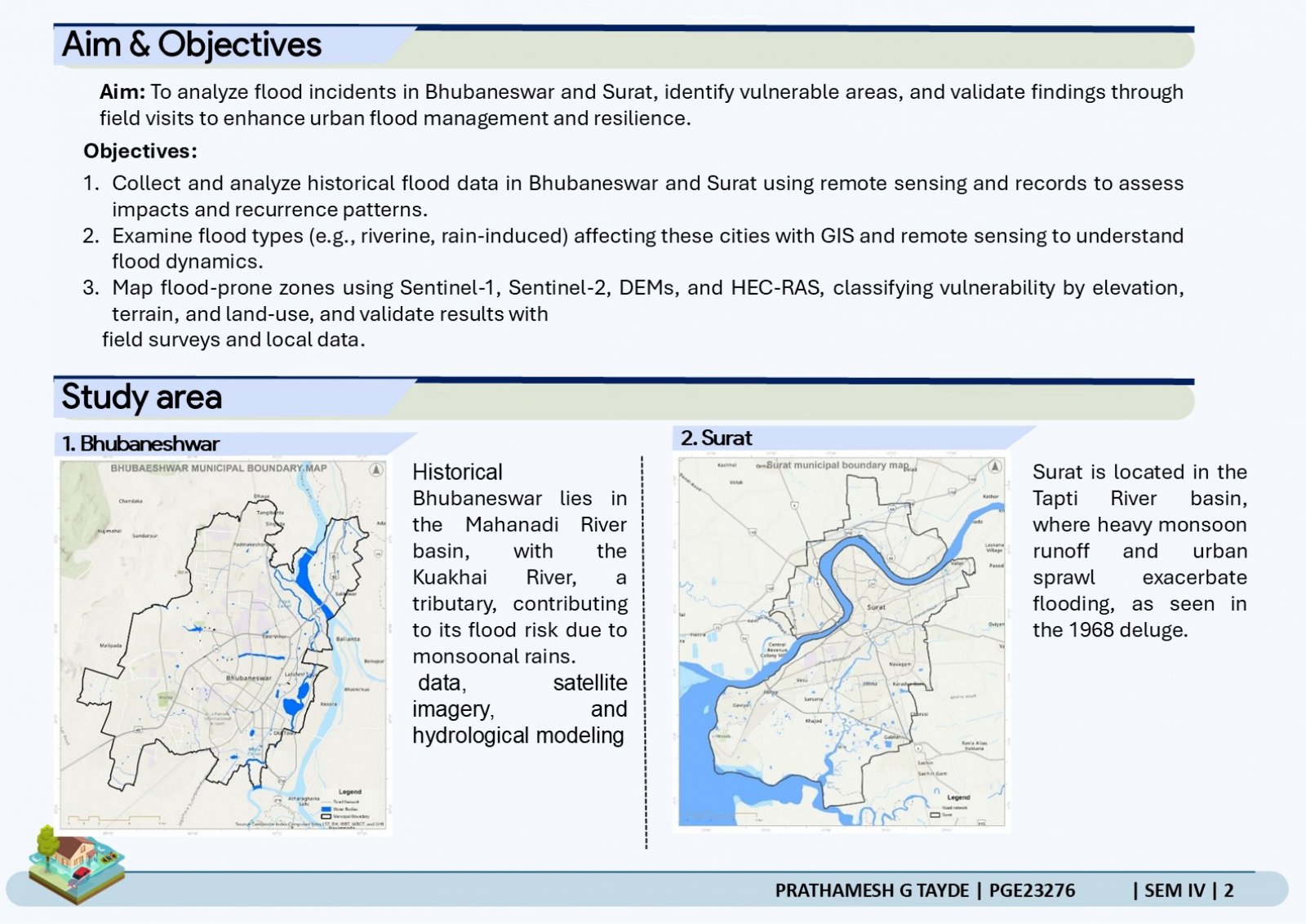
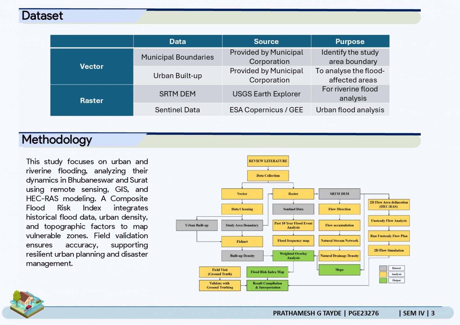
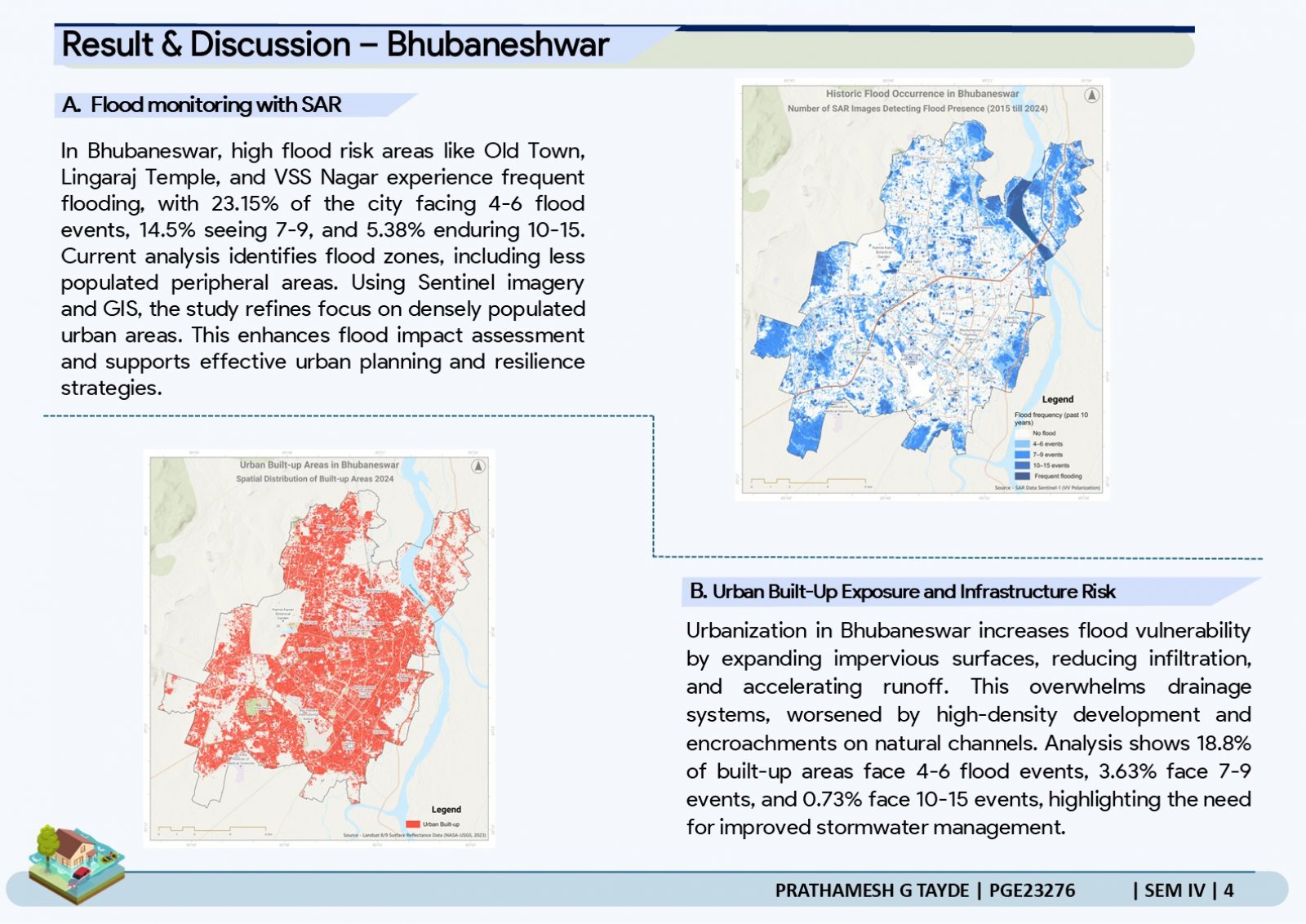
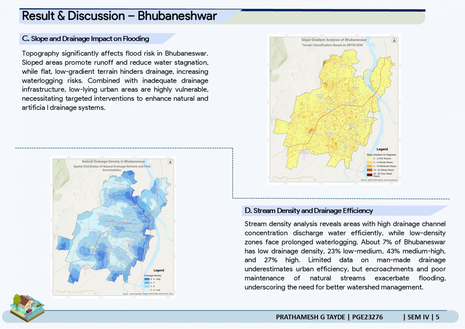
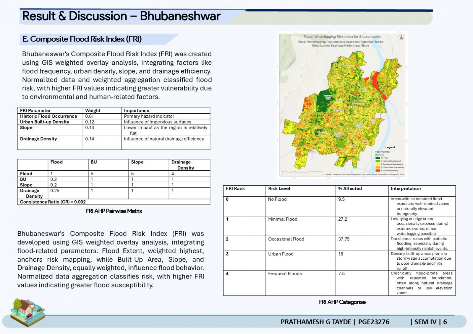
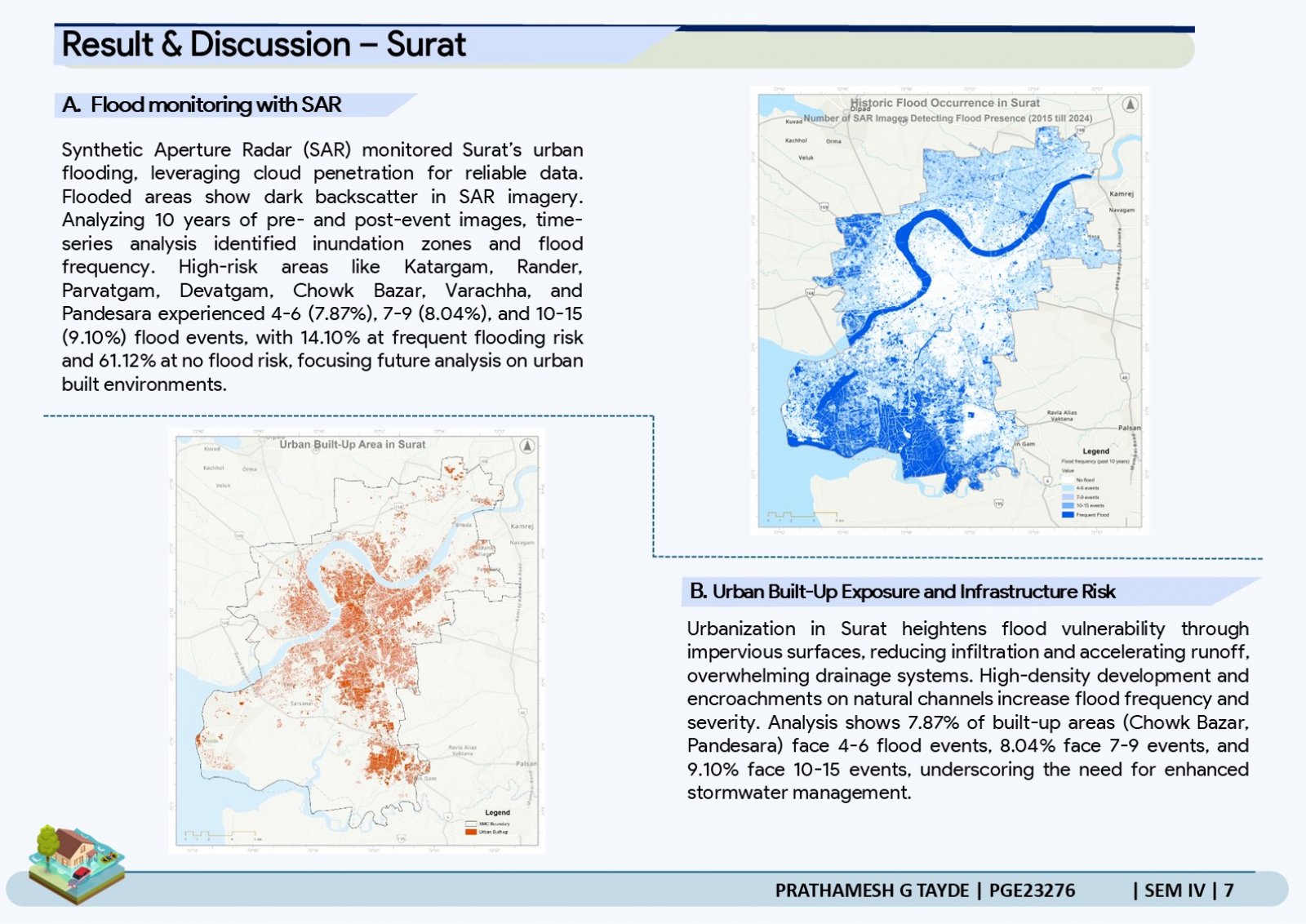
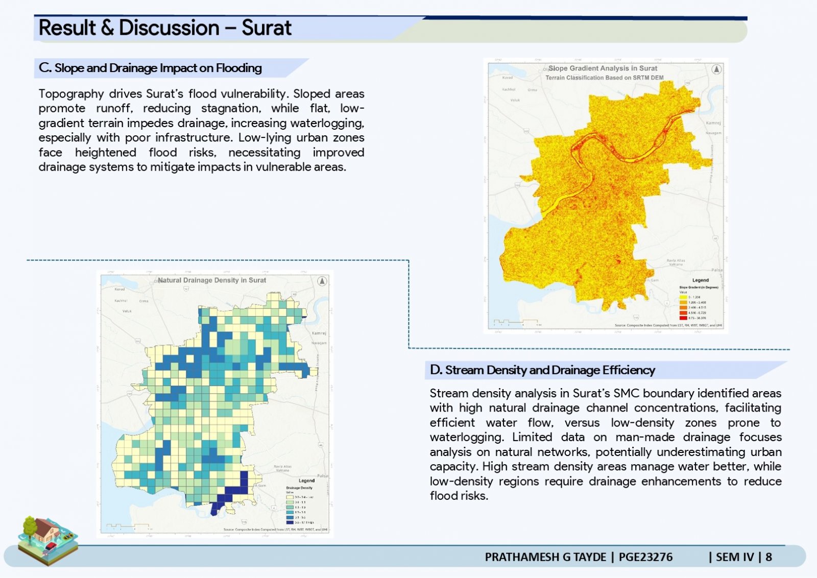
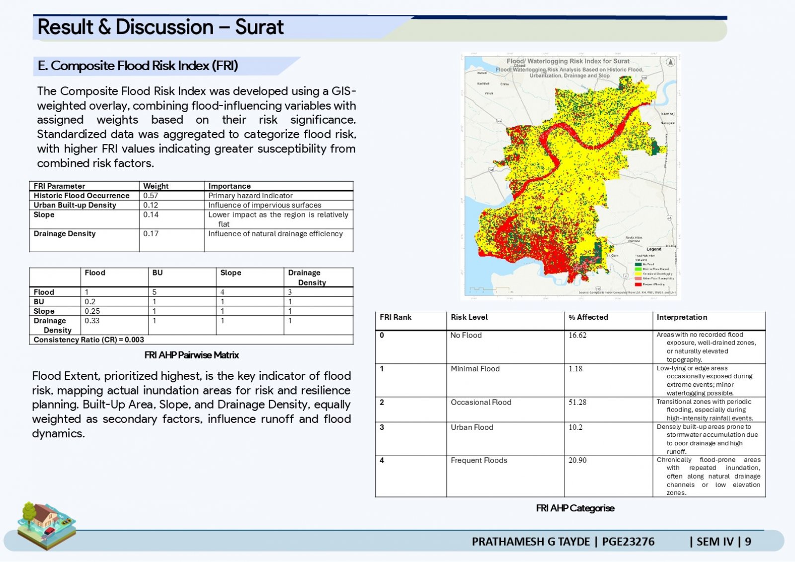
This project examines urban flooding in Bhubaneswar and Surat, cities vulnerable to climate change, rapid urbanization, and poor drainage. Using remote sensing and GIS, it maps flood-prone areas with historical data and Sentinel imagery. High-risk zones like Old Town and Baramunda in Bhubaneswar, and Chowk Bazar and Katargam in Surat, are analyzed. A Composite Flood Risk Index (FRI) classifies vulnerability based on flood extent, urban density, slope, and drainage efficiency. Field verification ensures the accuracy of satellite-derived flood maps. The study aims to guide urban planning and disaster preparedness to mitigate flood impacts. It highlights the need for sustainable infrastructure to enhance resilience in these growing cities.