Your browser is out-of-date!
For a richer surfing experience on our website, please update your browser. Update my browser now!
For a richer surfing experience on our website, please update your browser. Update my browser now!
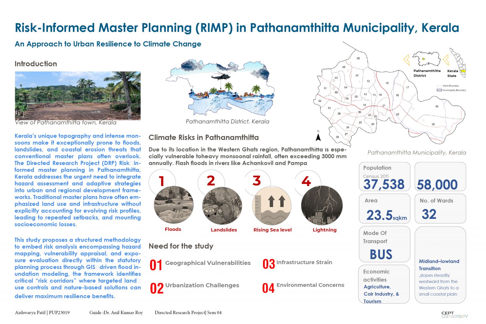
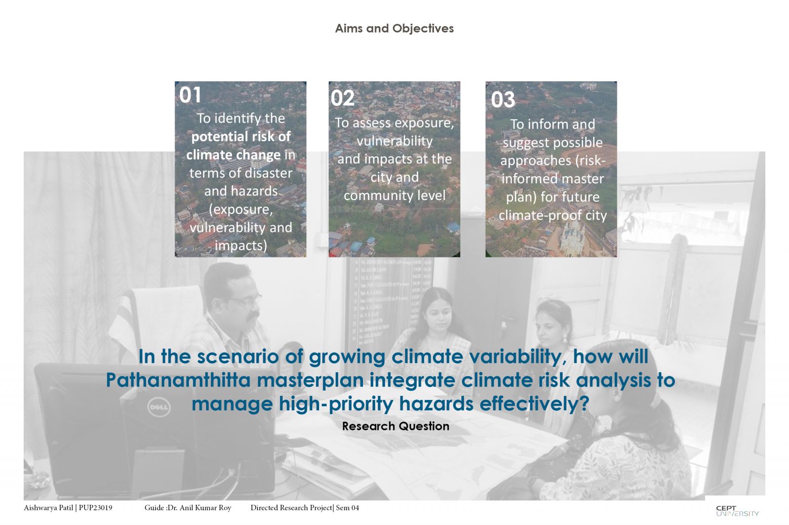
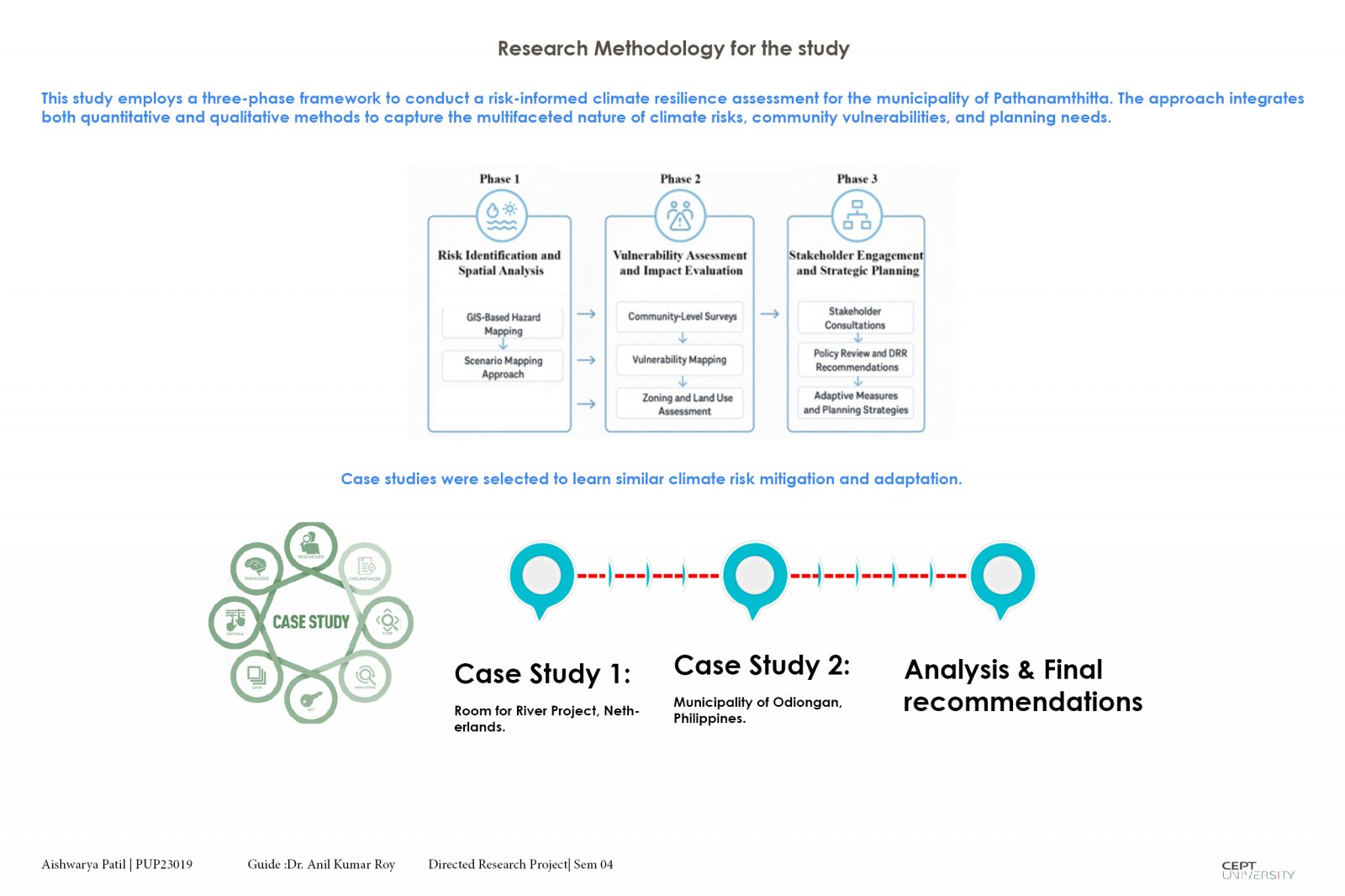
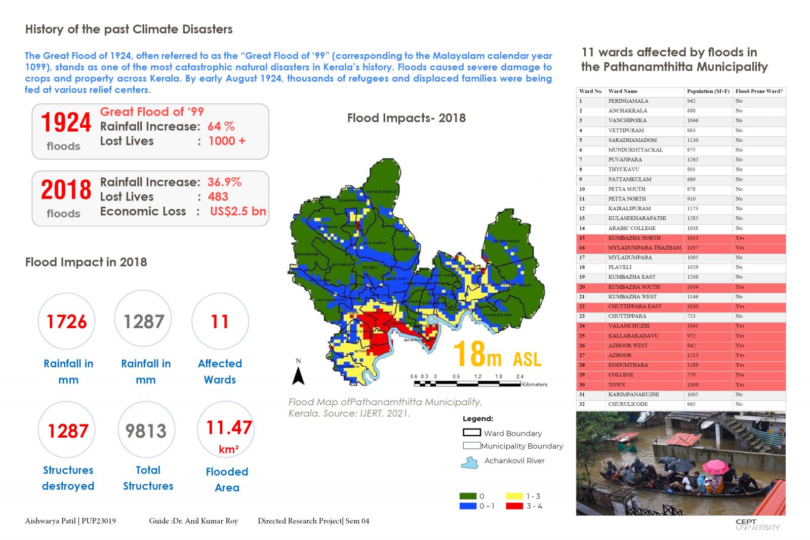
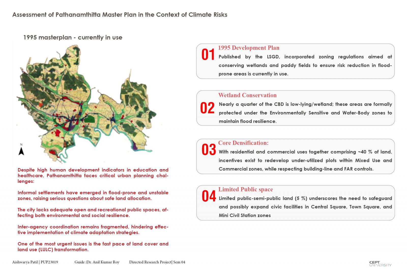
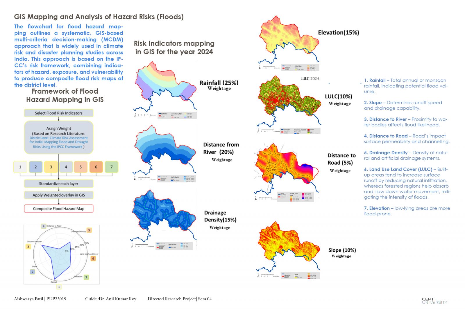
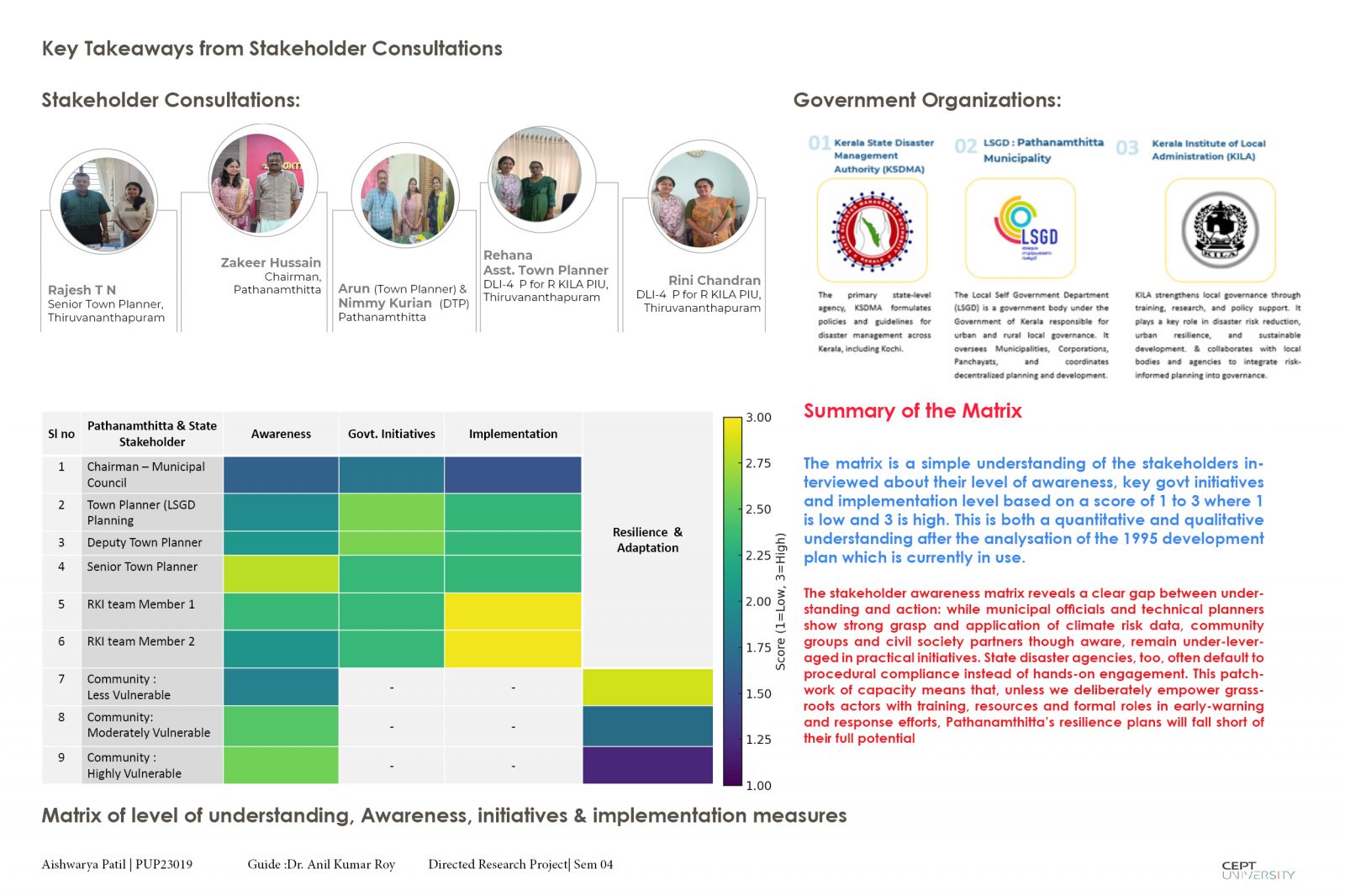
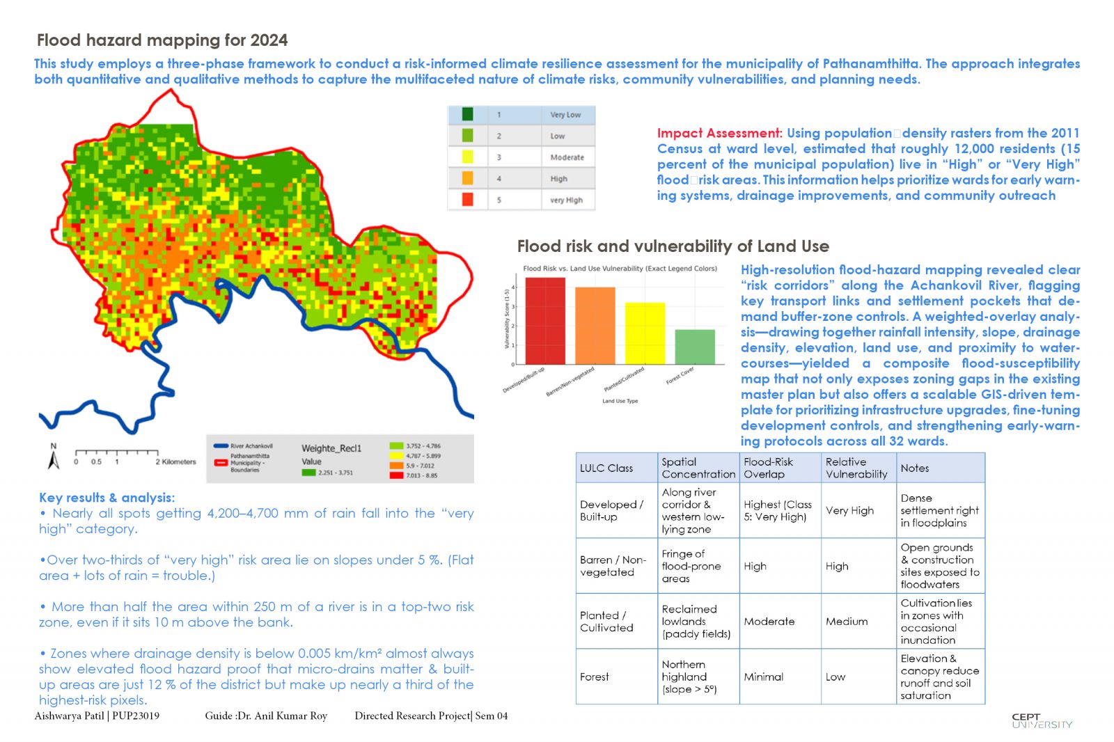
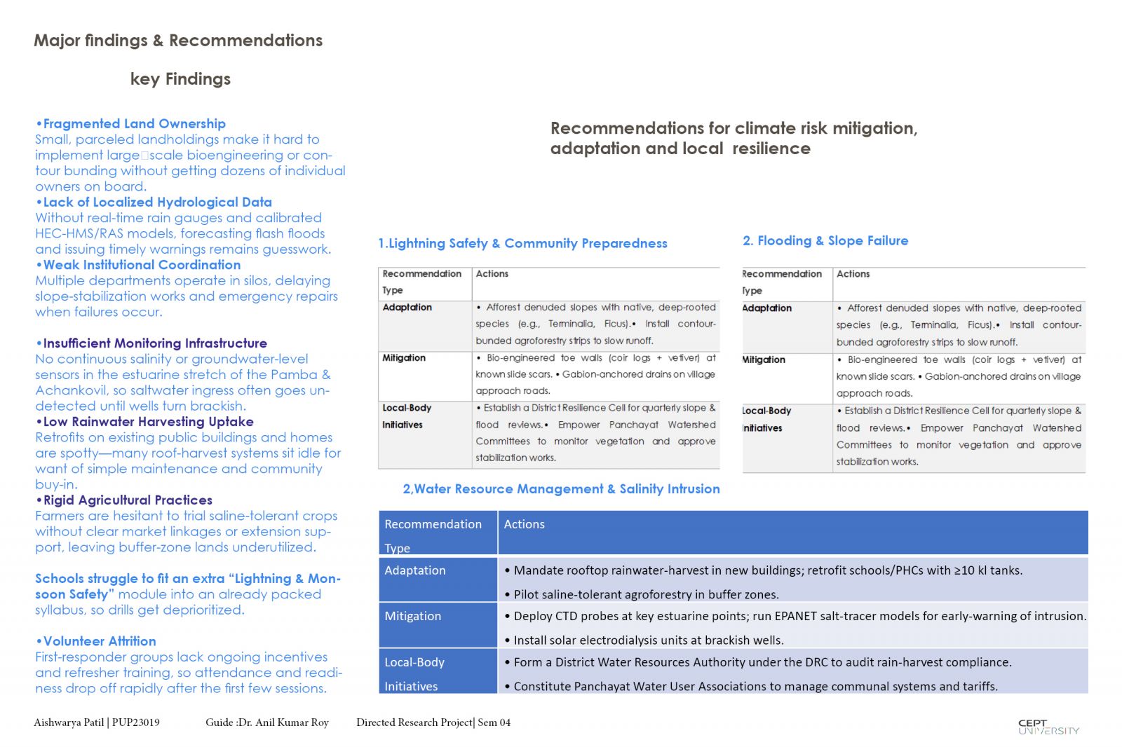
Risk-Informed Master Planning in Pathanamthitta, Kerala: This project integrates climate risk into urban planning to bolster resilience in Pathanamthitta, Kerala. It employs GIS to map flooding hazard through weighted overlays. Community surveys and stakeholder workshops reveal local vulnerabilities and institutional gaps. Findings identify critical risk corridors and flood-prone wards, guiding adaptive zoning, slope stabilization and green-blue infrastructure. Recommendations propose updated development controls, nature-based solutions and formal early-warning committees led by municipal and watershed bodies. By combining technical analysis with grassroots insights, the study provides a concise template for embedding risk management into future master plans.