Your browser is out-of-date!
For a richer surfing experience on our website, please update your browser. Update my browser now!
For a richer surfing experience on our website, please update your browser. Update my browser now!
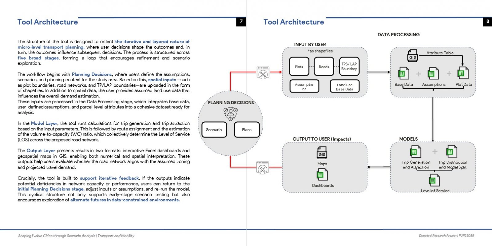
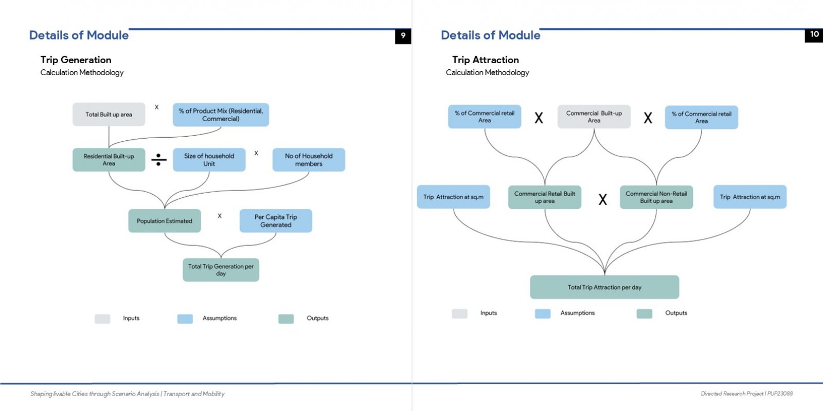
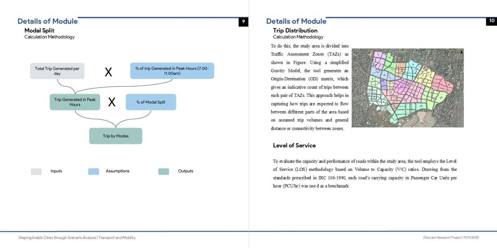
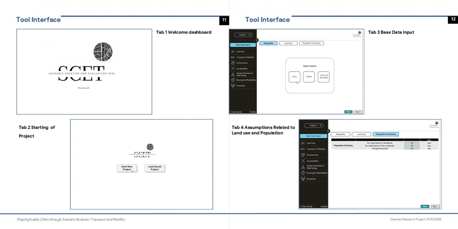
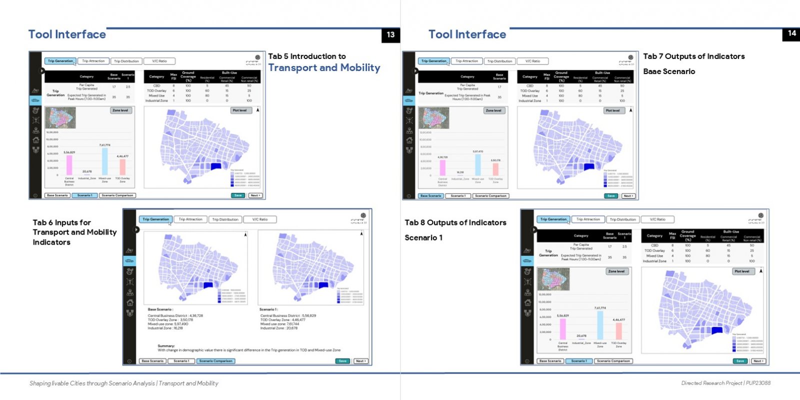
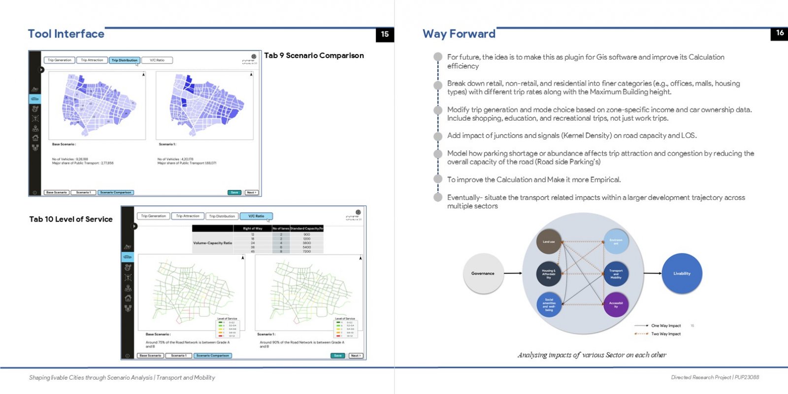
This project focuses on designing a GIS-based scenario analysis interface to support micro-level urban planning. It explores how changes in land use impacts transport and liveability indicators, helping planners visualize and compare alternative development scenarios. The interface is intended to aid decision-making in LAP's and TP Schemes by making data more accessible, adaptable, and context-sensitive.