Your browser is out-of-date!
For a richer surfing experience on our website, please update your browser. Update my browser now!
For a richer surfing experience on our website, please update your browser. Update my browser now!
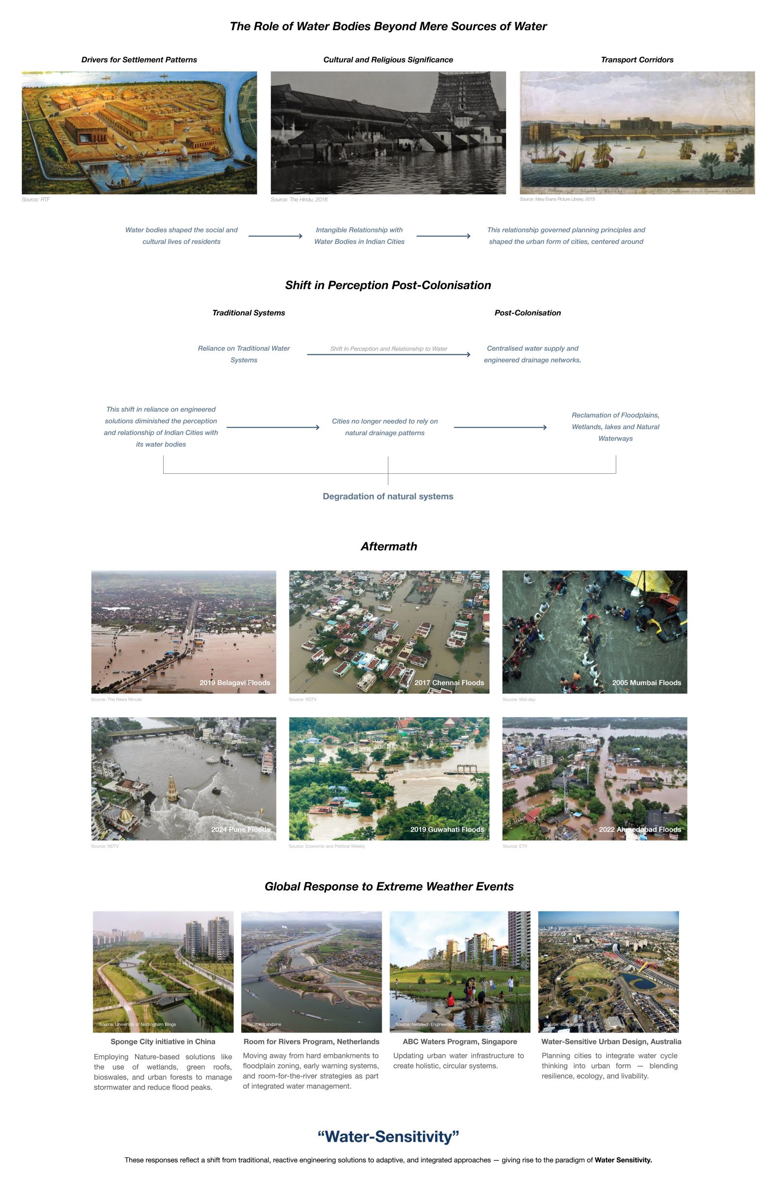
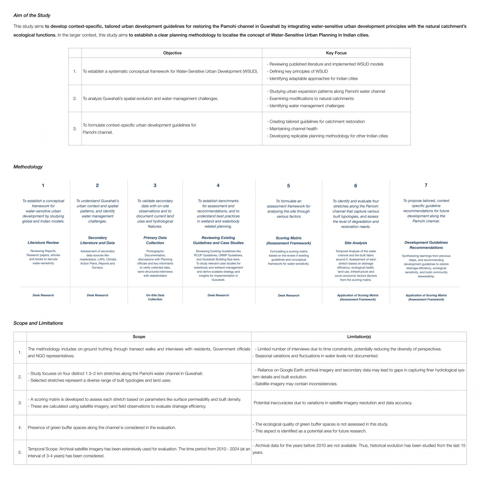
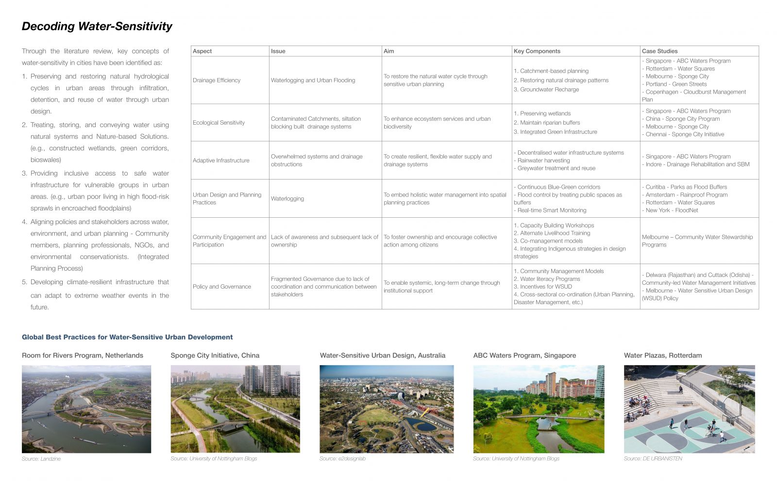
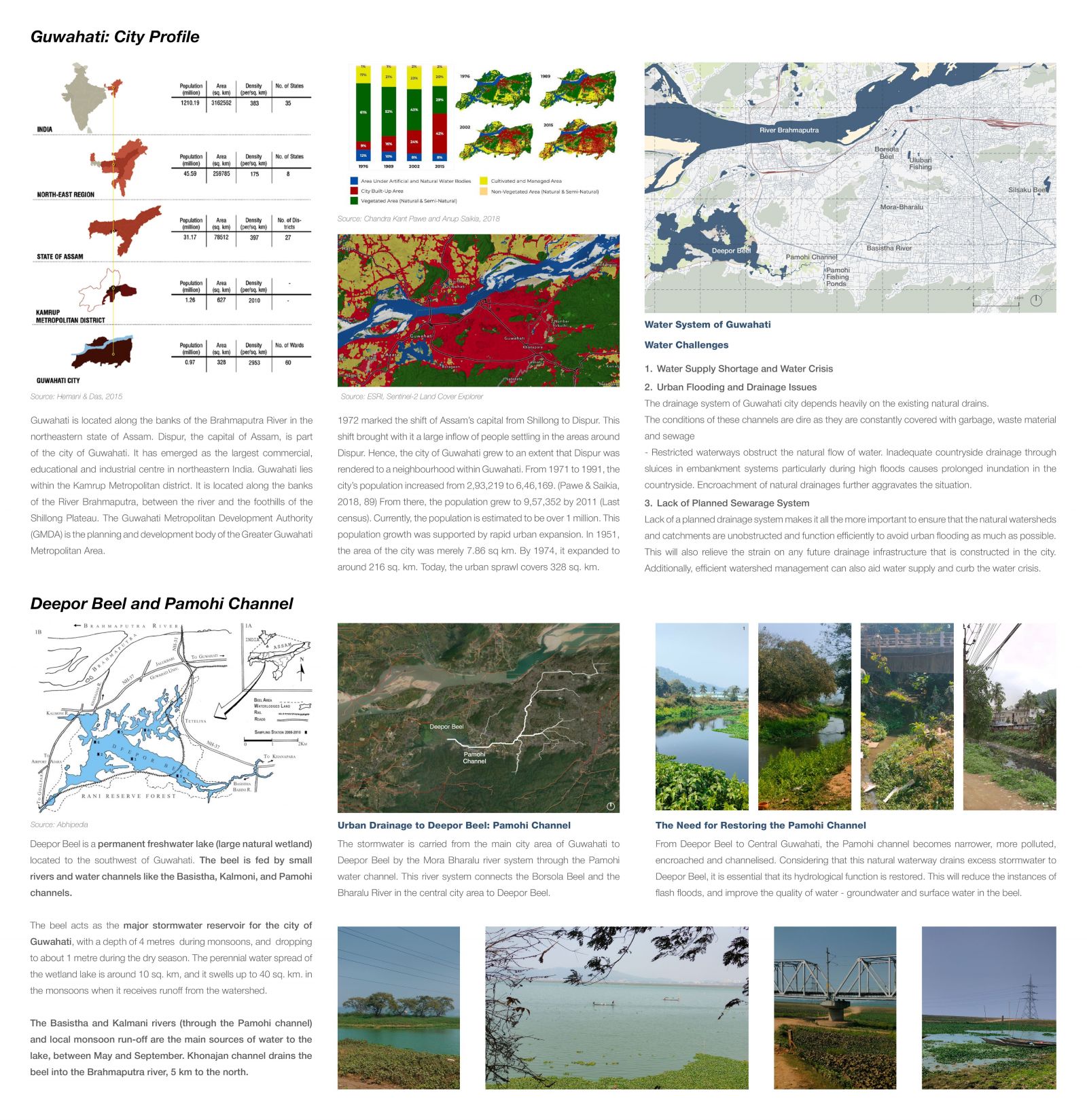
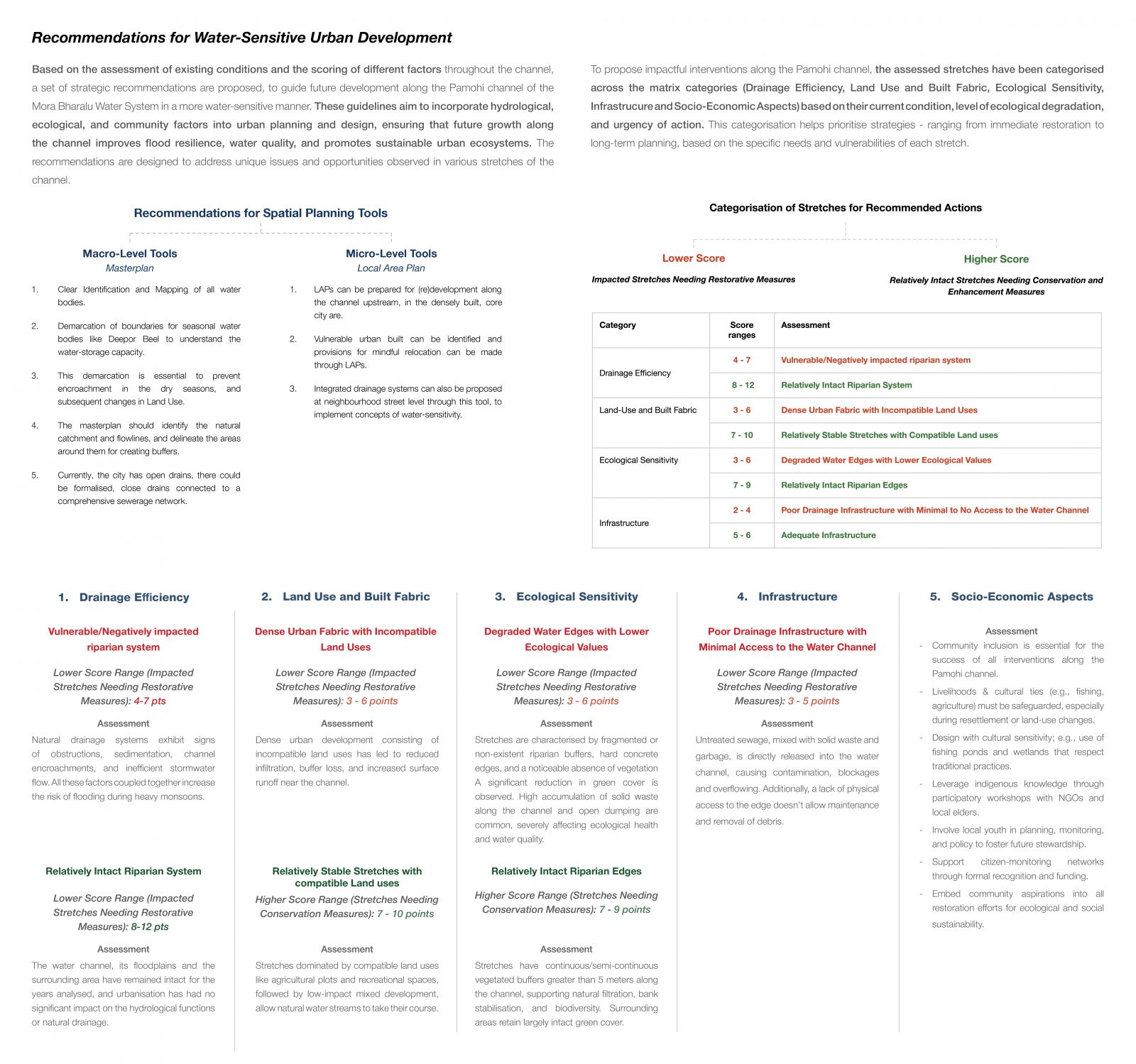
Globally, due to climate change, there is an increase in extreme weather events like heatwaves, droughts, and flash floods. According to the 6th IPCC Report, Indian cities are four times more vulnerable to climate change-induced natural disasters than other Asian cities. The stress from these global climate change events, rapidly increasing population, and subsequent uncontrolled urbanisation adds extra pressure on our cities’ water infrastructure. Thus, it becomes crucial to ensure that our urban water systems are resilient enough to withstand the sudden shocks brought on by these extreme climate events. Many cities worldwide have adopted the “Water-Sensitive Cities” concept to manage urban water resources efficiently and mitigate the effects of climate change. A Water-Sensitive City acts as an efficient water catchment region, providing various water sources at different scales for multiple uses. Cities like Singapore, Portland, and Chennai have responded to water calamities by incorporating strategies for water sensitivity into their urban planning policies and design guidelines. India has launched initiatives like the AMRUT 2.0 scheme to develop circular water systems in about 500 statutory cities and towns. Guwahati, located along the banks of River Brahmaputra, is an AMRUT city in the Northeastern state of Assam. The city lacks a planned drainage system and relies heavily on the terrain’s existing natural drains. Since these natural waterways have been obstructed by encroachment, unplanned urbanisation, garbage dumping, and siltation, Guwahati faces frequent flash floods during the monsoon season and water scarcity in some parts during the dry months. Pamohi channel is a natural waterway that drains Guwahati's excess stormwater to Deepor Beel, a naturally occurring wetland located at the western tip of Guwahati’s suburban area, from where it eventually empties into the Brahmaputra River. However, the catchment of the Pamohi channel has been obstructed due to unplanned urbanisation, sewage inflow, and garbage dumping. This study aims to analyse the built fabric along this waterway and propose guidelines for future urban development to ensure that the channel’s natural hydrological functions are restored, thus reducing the occurrence of flash floods in the surrounding areas.In a larger context, this study will establish a clear planning methodology to ensure appropriate spatial planning tools can be used to localise the concept of water-sensitivity in Indian cities.
View Additional Work