Your browser is out-of-date!
For a richer surfing experience on our website, please update your browser. Update my browser now!
For a richer surfing experience on our website, please update your browser. Update my browser now!
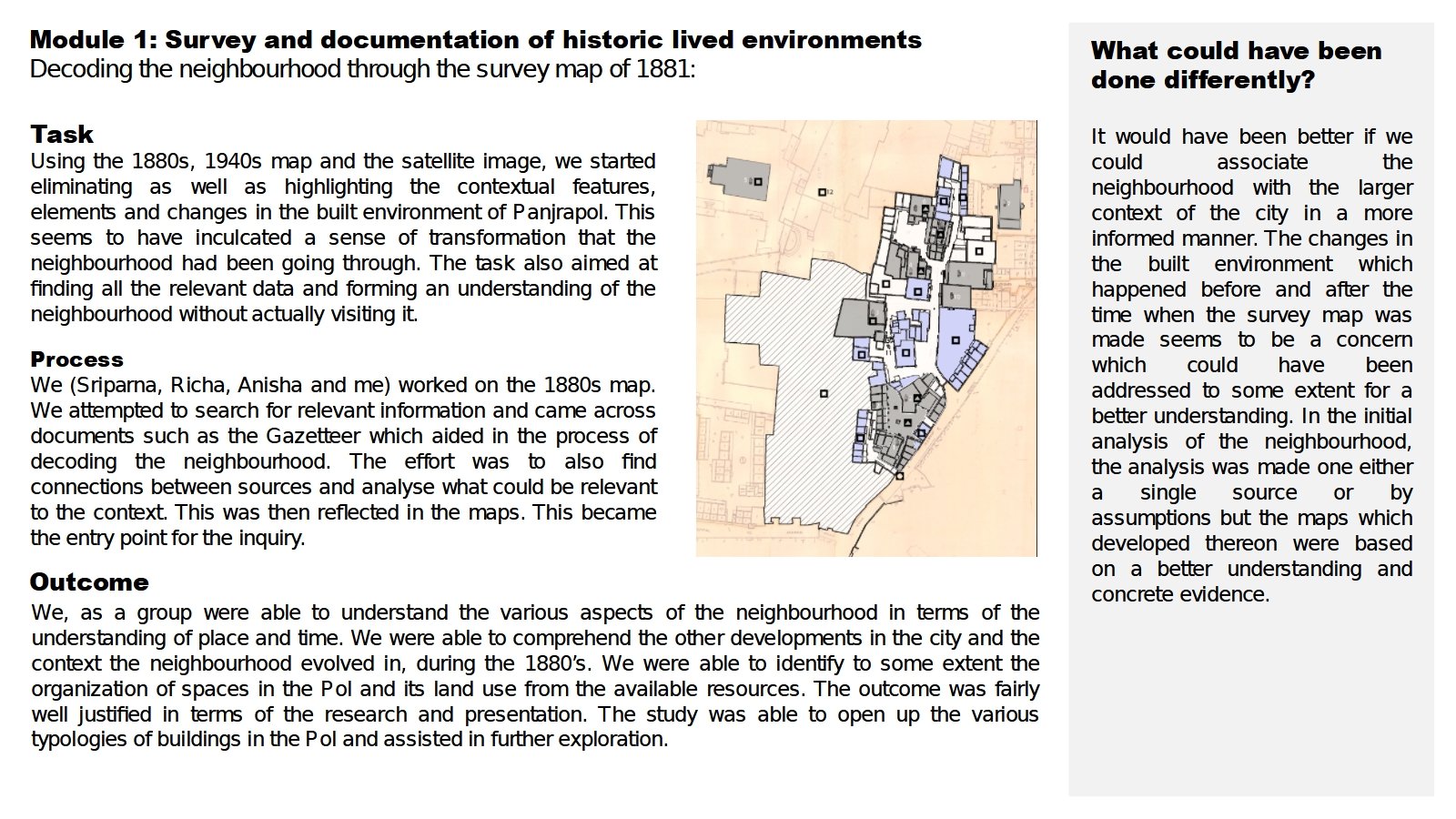
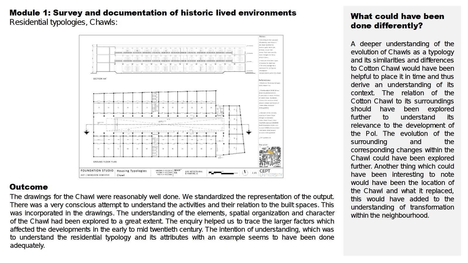
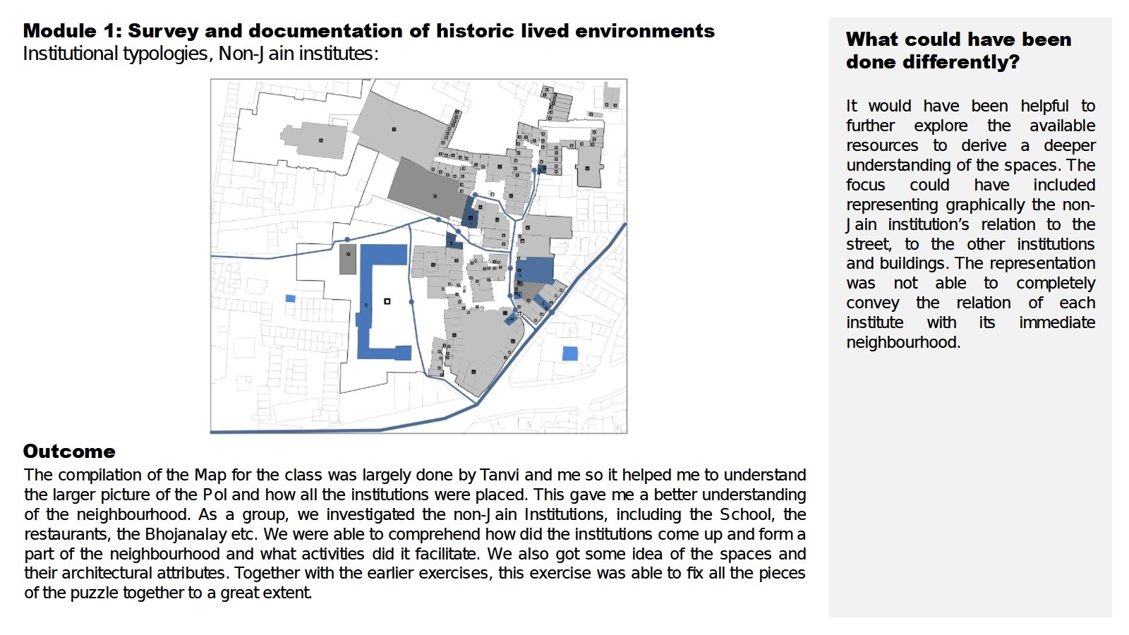
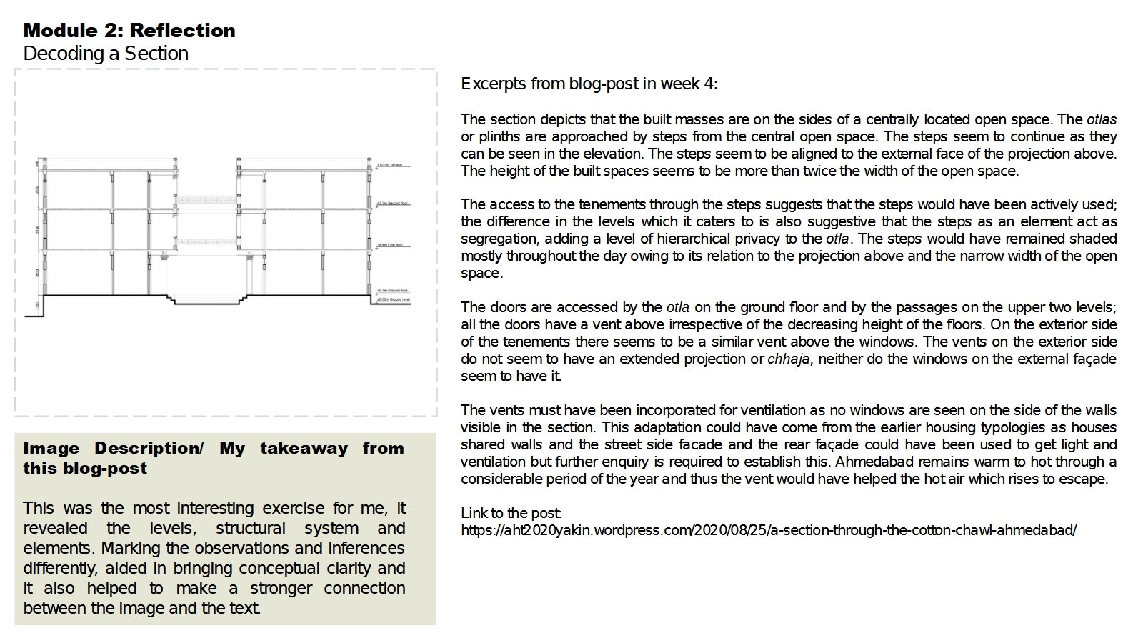
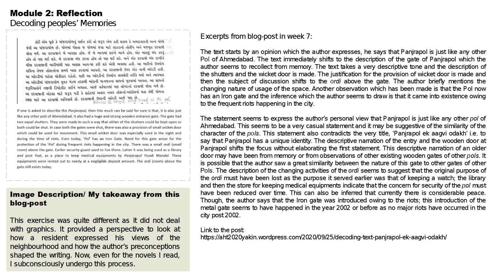
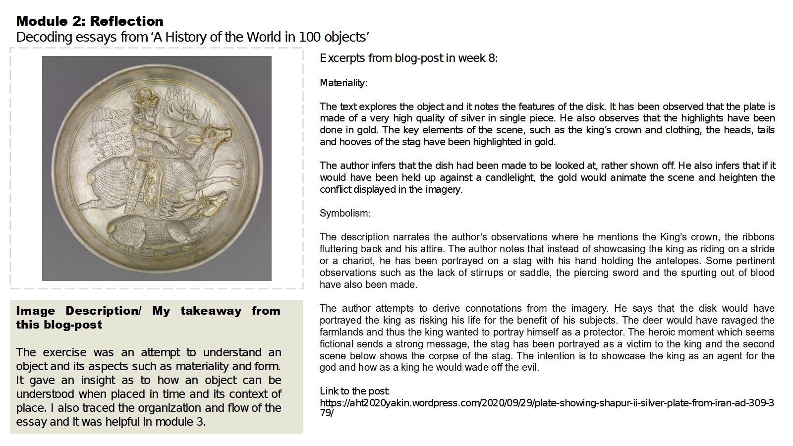
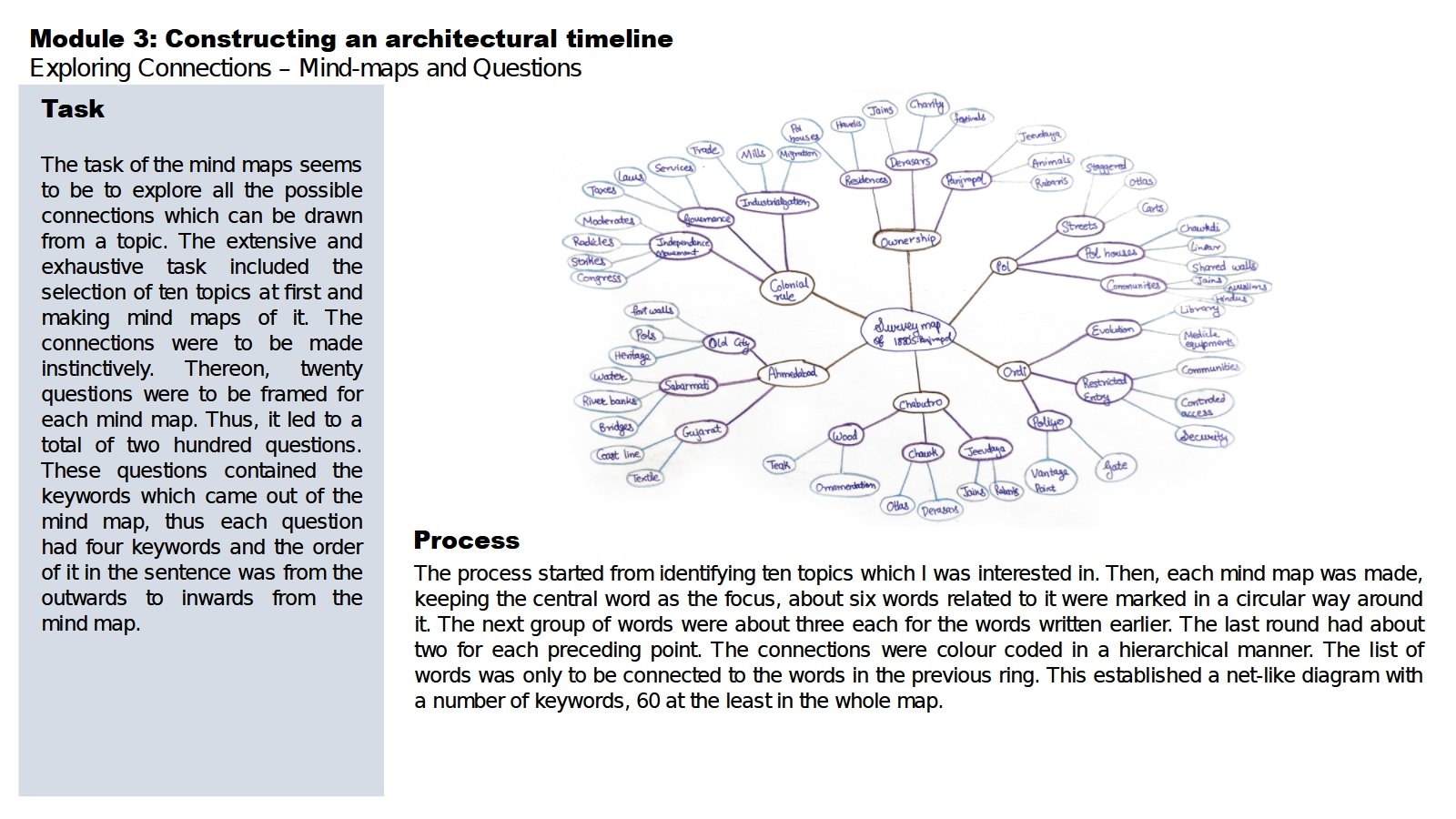
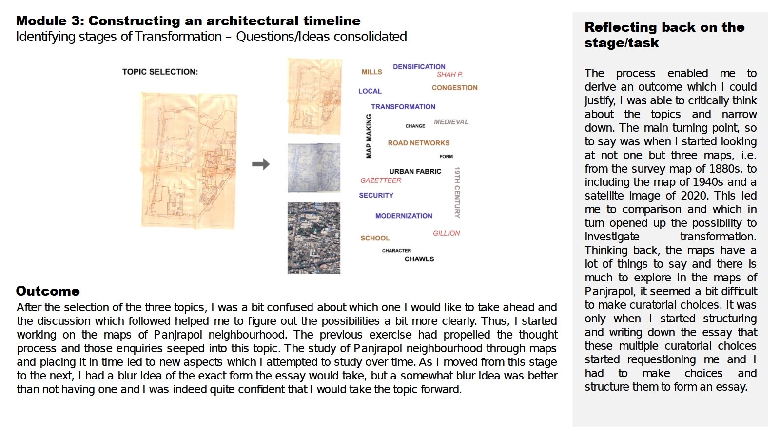
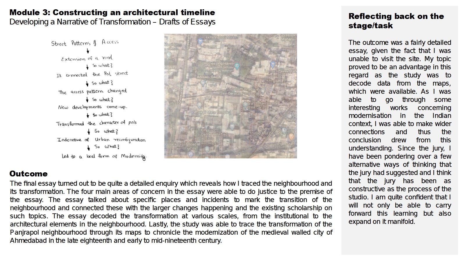
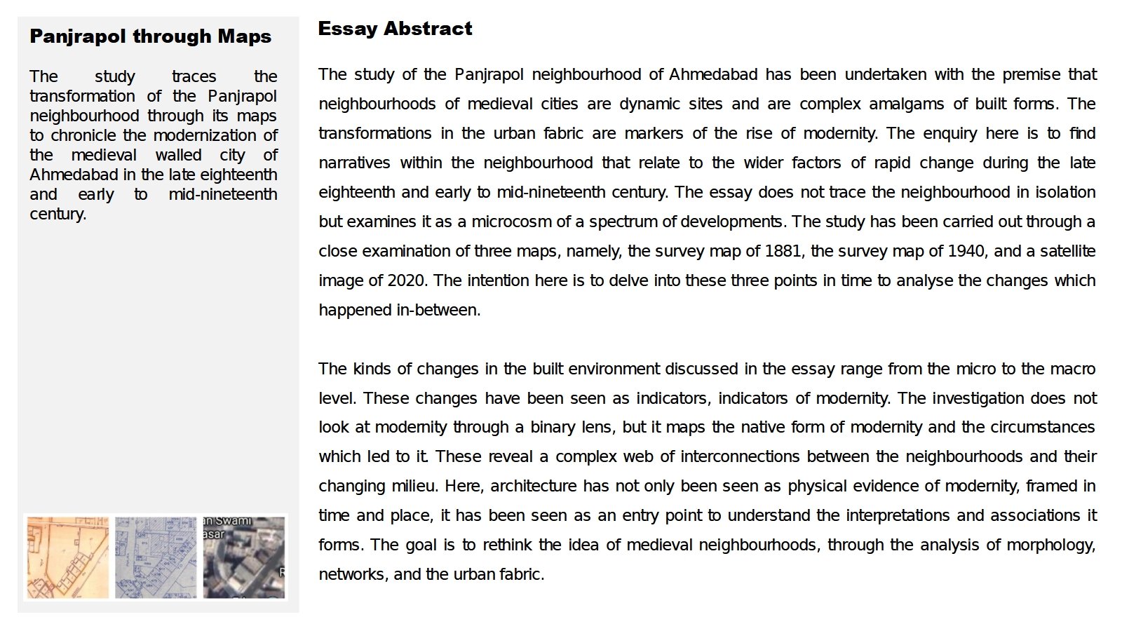
The semester was divided into three modules. The first one was constructive in decoding the Panjrapol neighbourhood, the second investigated and analyzed the tools of data representation and the third module culminated in an essay. The essay, ‘Panjrapol through maps’ traces the transformation of the Panjrapol neighbourhood through its maps to chronicle the modernization of the medieval walled city of Ahmedabad in the late eighteenth and early to mid-nineteenth century. The study of the historic site revealed that it is a dynamic site and forms an integral component to understand subdued local voices, interpretations, and expressions of modernity.
View Additional Work