Waraich Avneet Kaur Amarjit Harvinder

LA4012

Hebbal Kere and the Resilience of Commons

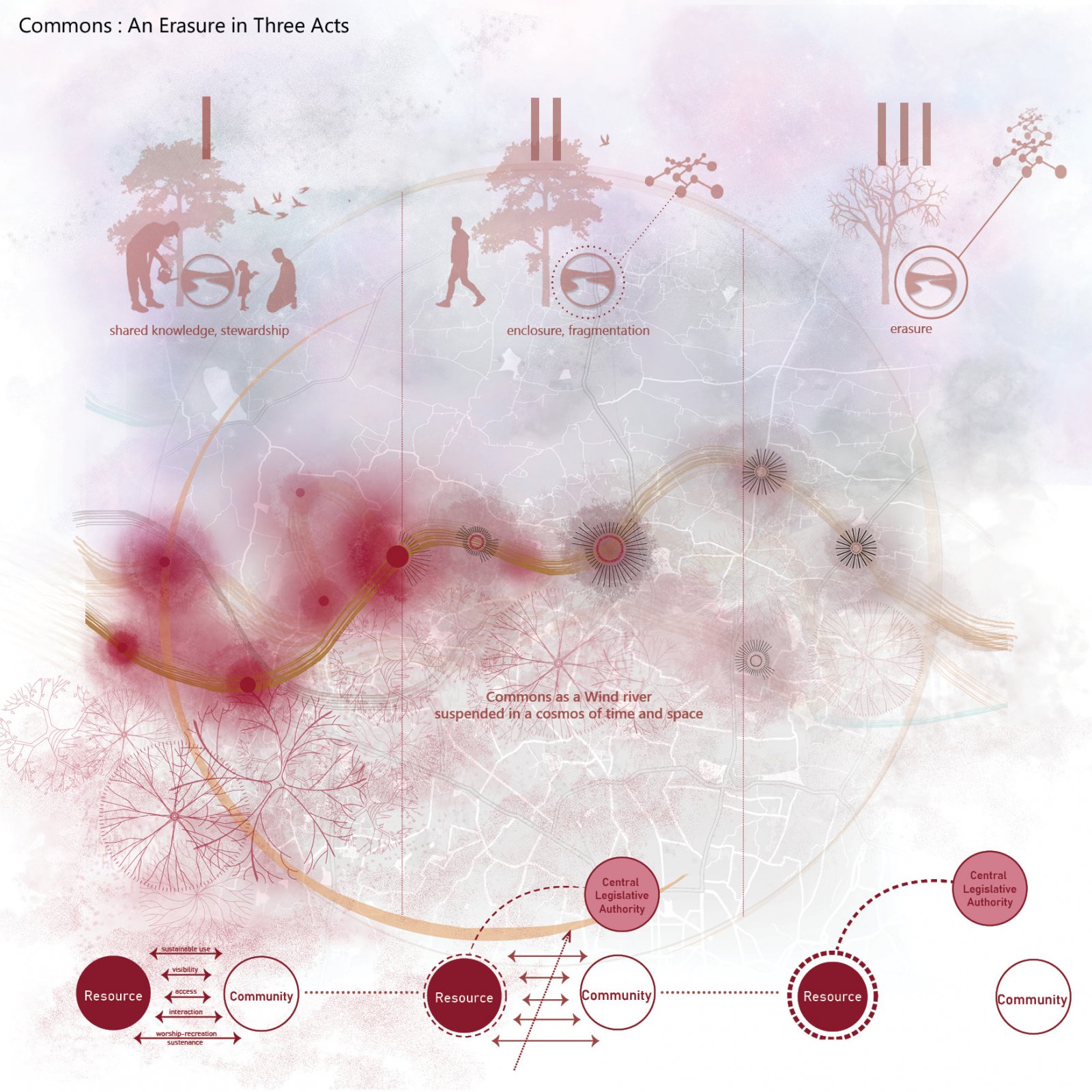
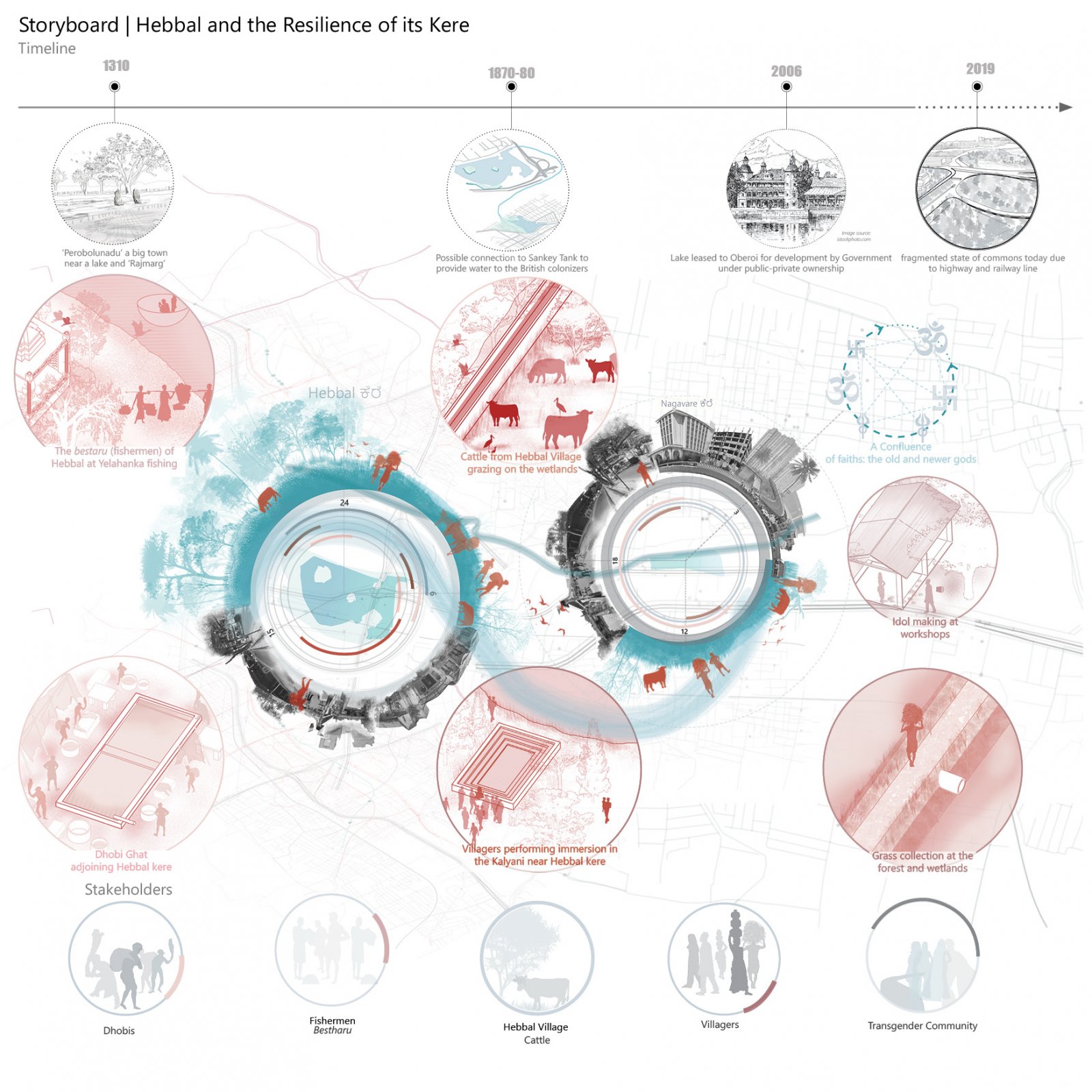
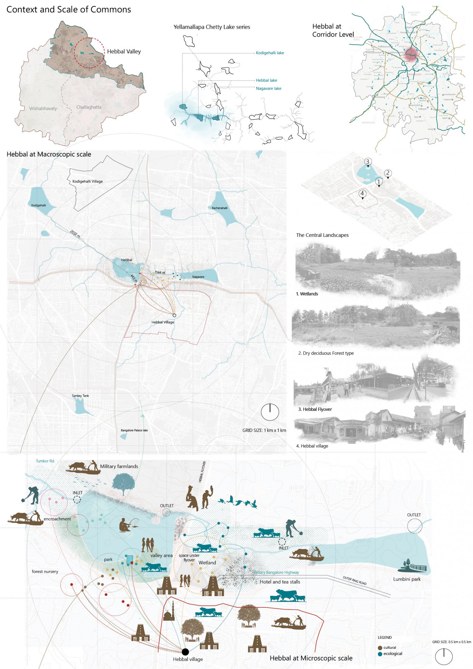
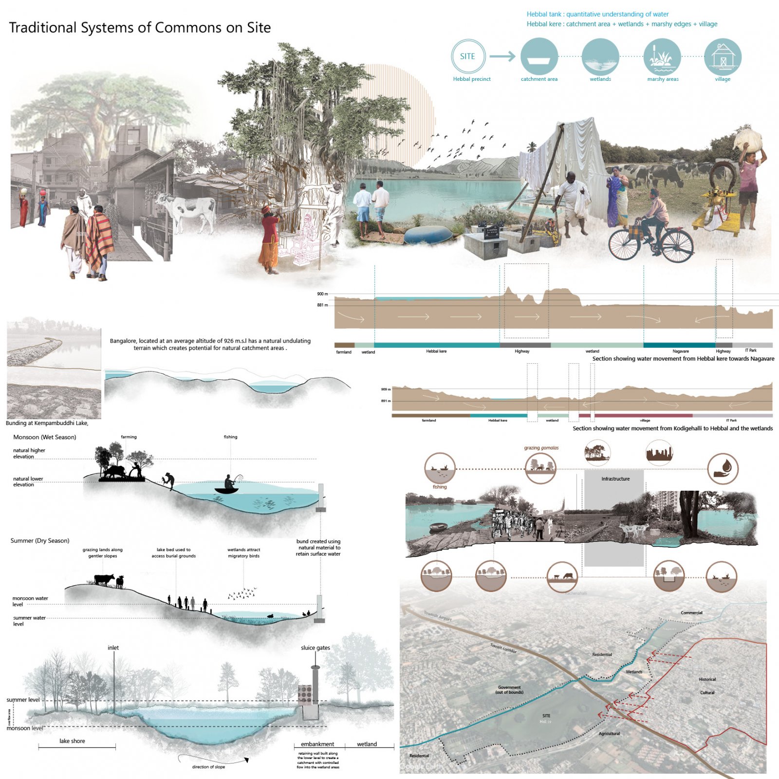
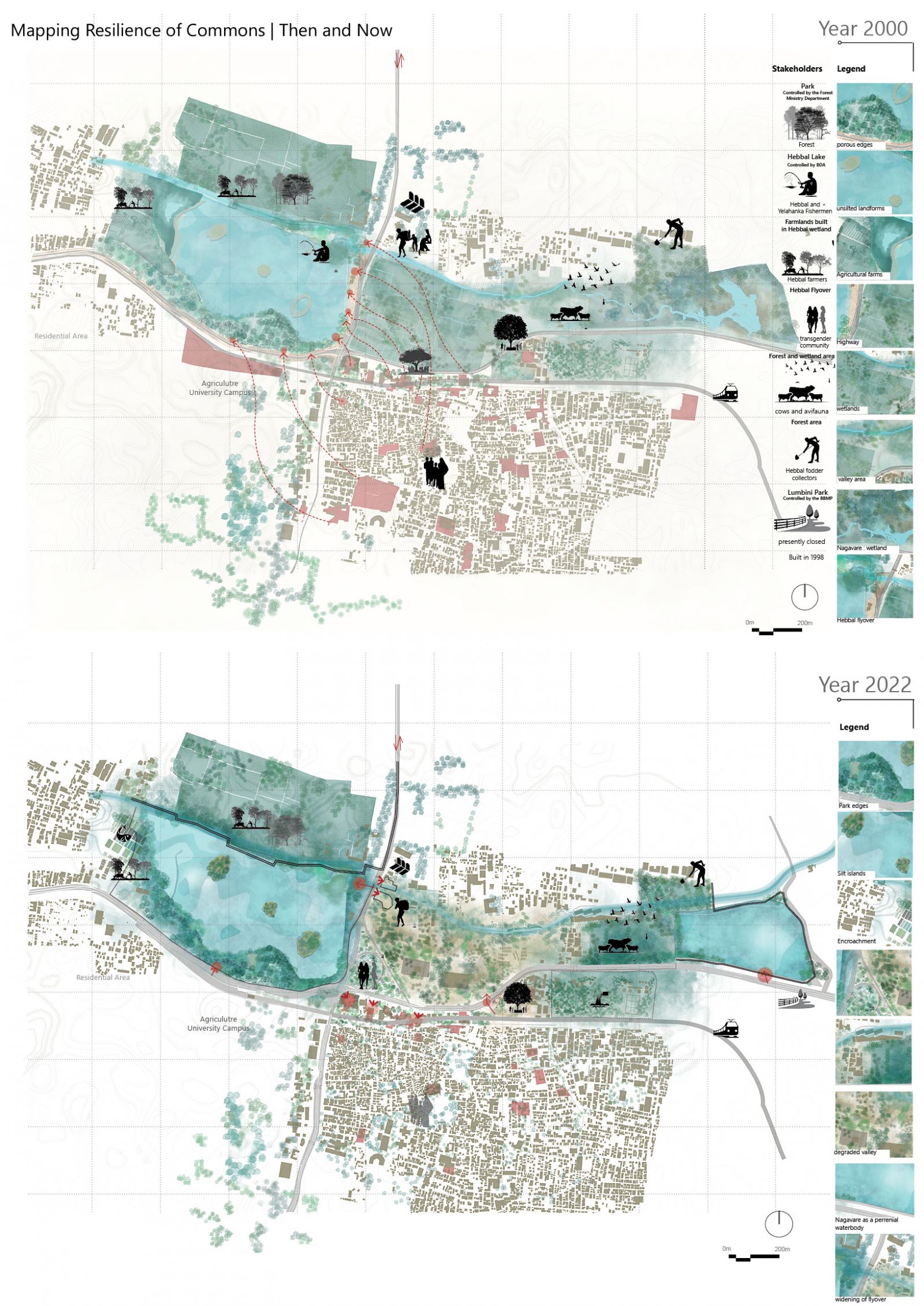
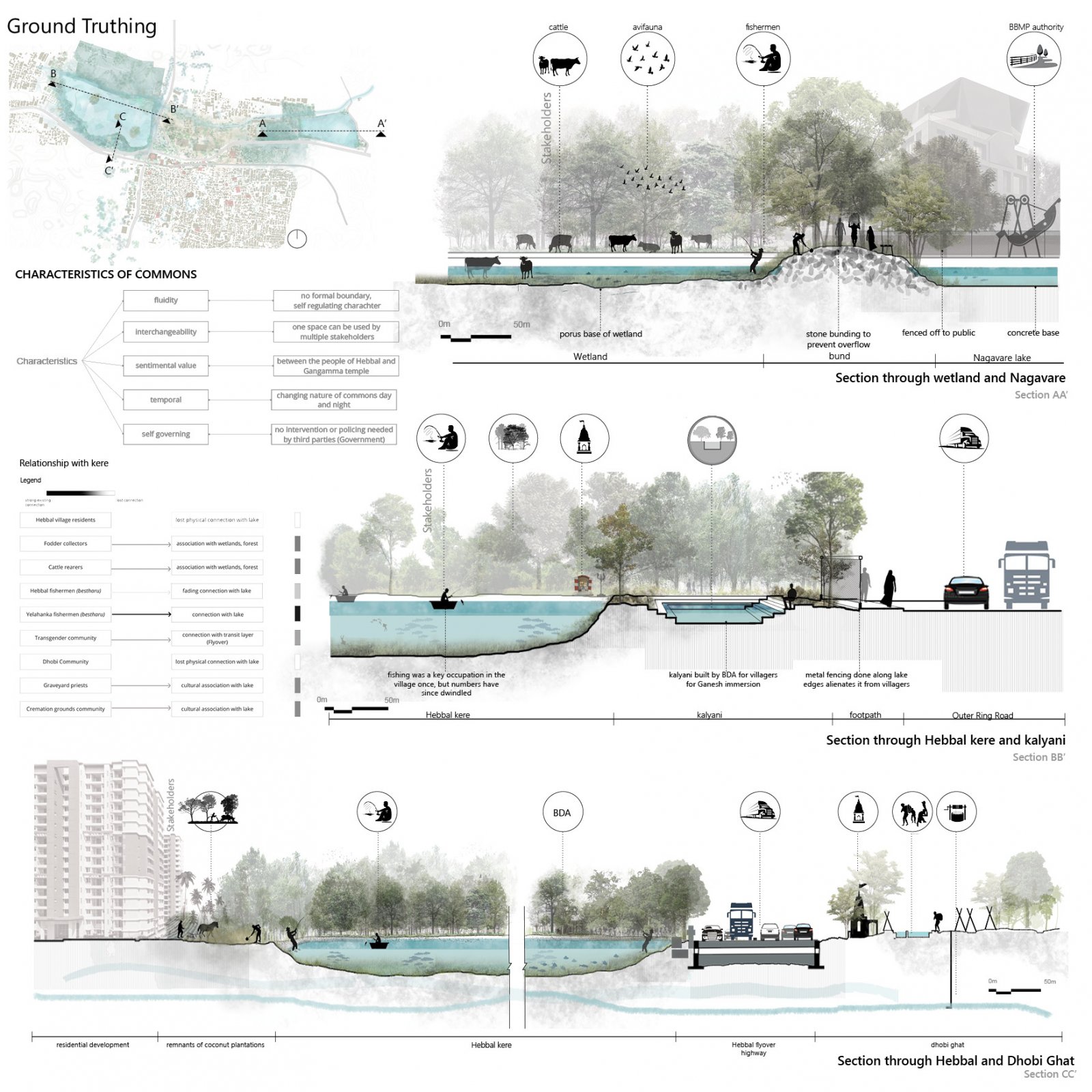
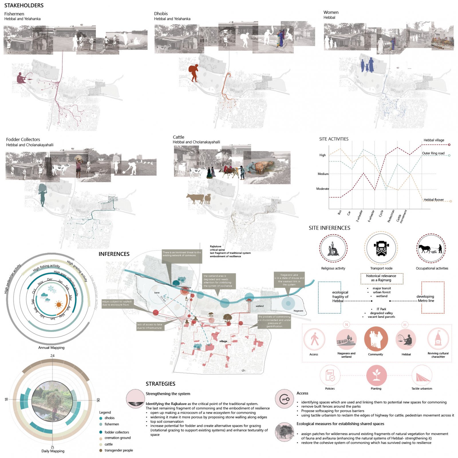
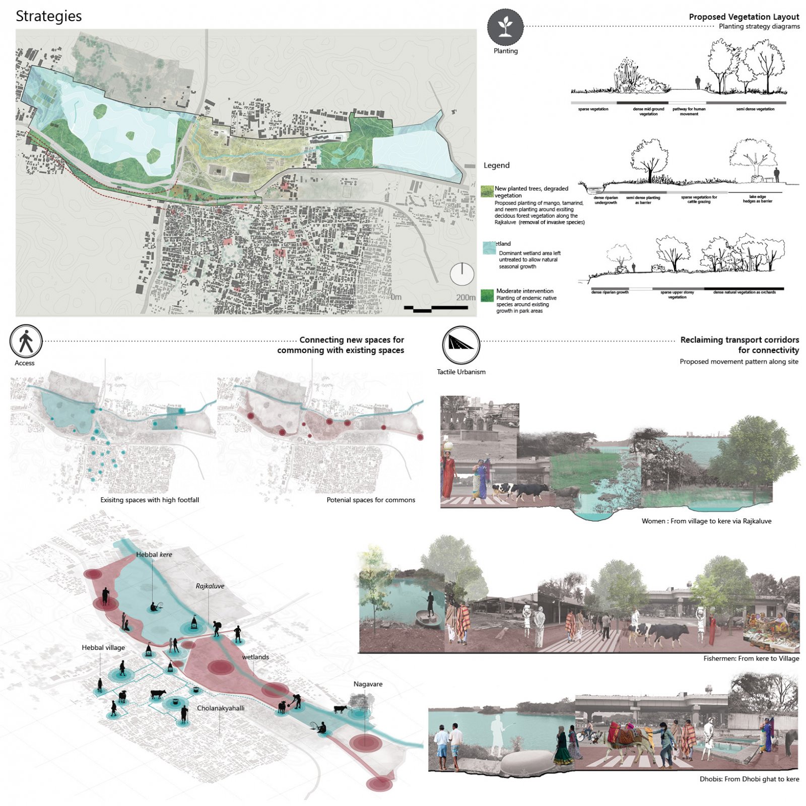
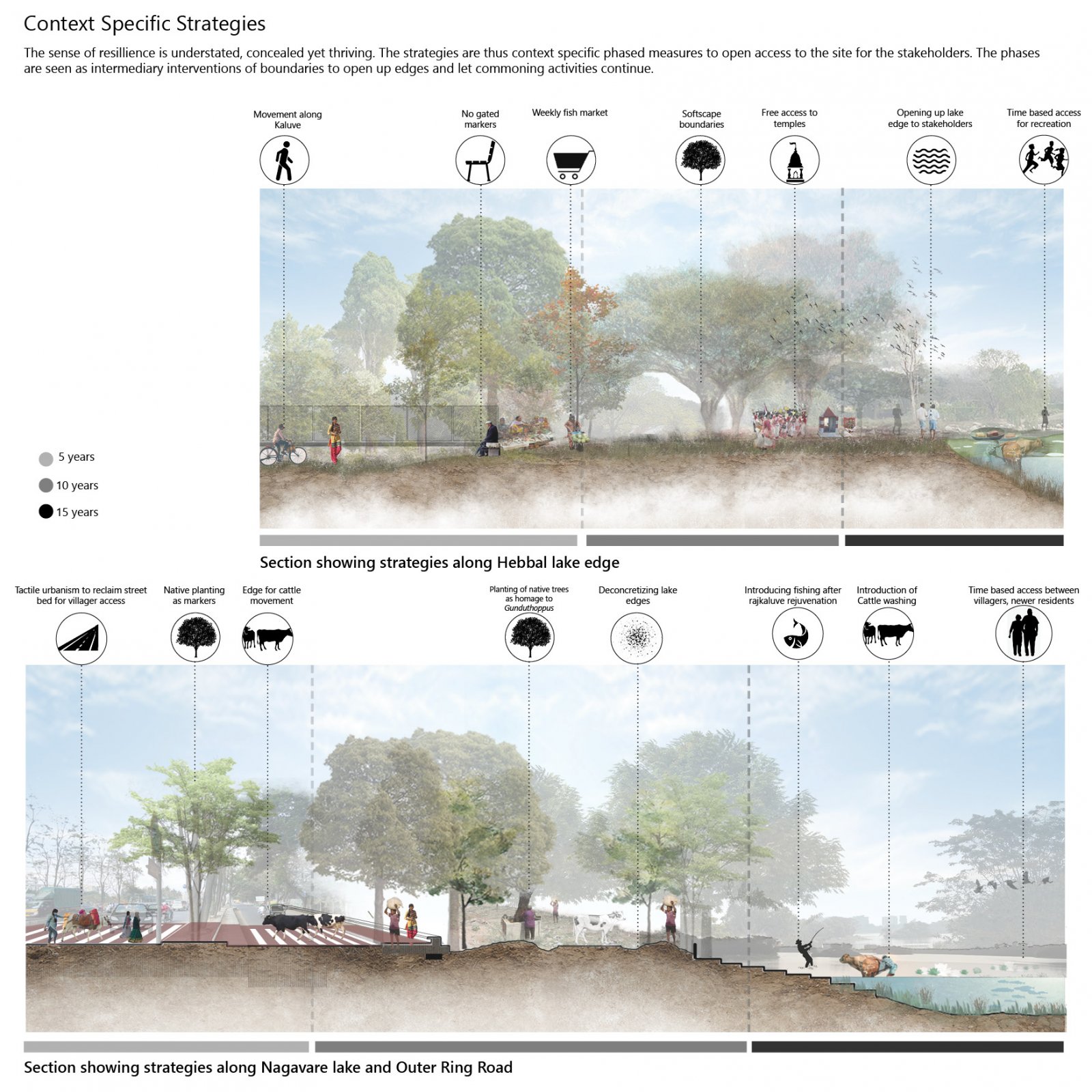
Hebbal kere is a lake north of Bangalore city, connecting it to the Airport via Hebbal flyover. The lake and adjoining village juxtaposed with the highway and flyover fragmenting the landscape further projecting it to understand its tenacity.

View Additional Work

Report Content

As a first impression, I envision the erasure of commons as a tragedy in three acts. A sequential unravelling of years of a lived culture that is heartlessly commodified for the profit of the few. If this culture is envisioned as threads of a wind river-suspended in space, spanning generations of memories, activities and tradition- then the commons are temporal bursts of vitality that interconnect them. These commons are stains depicting cultural heritage, brimming with exuberance and radiating life! Over the course of this tragedy, however, the threads of the river run dry-unravelling and paling as the acts progress.

Hebbal kere is part of a much larger landscape of wetlands and forests, that connects to Nagavare located 1800 meters away. The storyboard illustrates the criticality of relationships between the land and its people. They reveal themselves on the ground if one is conscious of them- uncovering revelations of old and the new relationships with the land. These systems, though fragmented today,must be identified to understand the Commons of Hebbal: its dynamics, its relationships and the resilience of its kere.

Hebbal is analyzed on 3 different scales: city level, corridor level, and neighborhood level. The commoning is seen under these lenses as well as from the purview of the larger system the landscape encompasses to understand and map the resilience of its practices with respect to the city around it.

A traditional knowledge system of socio-cultural and occupational-based practices presided over the commons of Hebbal. The land surrounding the lake was essential to the village it was a part of, which now lies fragmented and only a few components of this landscape lie accessible. The response to the landscape demonstrates an embedded system at many levels.

Over a span of 22 years, we see a considerable change in the condition of the kere (lake) and its surroundings. Some differences have been mapped and depicted with the stakeholders listed alongside to understand the resource dynamic and other nuances.

The extensive process of ground truthing unearthed various on site realities and existing conditions. This, when correlated to the characteristics of commons, depicts the complex and layered aspects of these temporal practices.

The point of inquiry centers on the case of mapping the resilience of commons built over the years across the practices followed on site. The project aims at analyzing this and proposing strategies for the same.

Elaborating on 3 strategies: planting, access and tactile urbanism, we see how these measure spatially relate to the site conditions. The intent is to strengthen the existing commons and connect them to potential spaces of commoning to withstand future pressures of urbanization. The aim is to rejuvenate the larger system of commoning by addressing these smaller aspects.

The strategies have been conceptualized as phases for non invasive measures to preserve the commoning practices and allow it to strengthen over time . Commoning is not a one size fits all solution. It is emphatically context specific and community oriented in its bottom up approach.The following methodologies have been selected to address the point of inquiry.

My first impressions on commons concluded with the statement written by me : “There is a sense of imminent doom to this tragedy of enclosure. But knowledge can serve as a thoughtful tool in preparing us for the future.” After a study of commoning at Hebbal, I still stand by this statement.