• Home
  • FA
  • LA4004
  • The interdependent convergence of ecology and urbanity

Tulsi Bhardwaj

LA4004

The interdependent convergence of ecology and urbanity

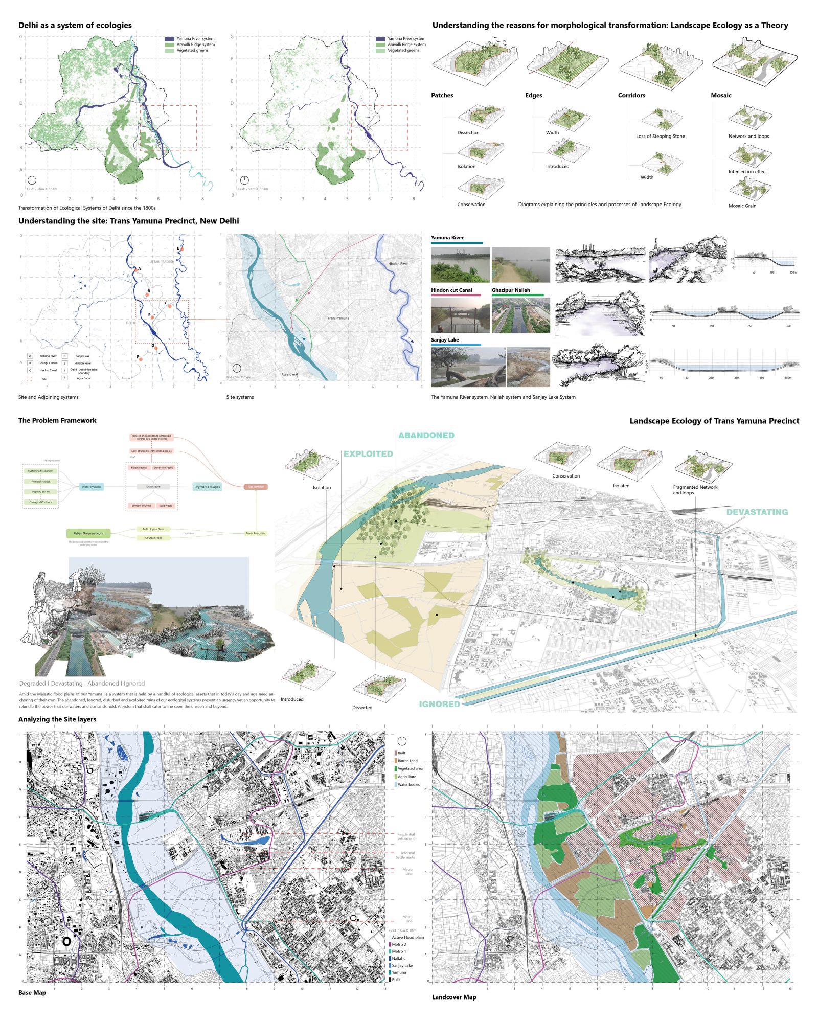
The fate of the capital city of New Delhi has been similar to many urbanizing cities across the globe. For many years now, our cities have seen the boon and the bane of urbanization. Since its inception from the seven cities, today Delhi has evolved into a bustling metropolis with monumental built infrastructure that is a marvel in itself but on the other hand, have we pondered upon enough so as to how our ecological systems have evolved? Delhi houses several complex yet significant ecological assets within its bounds. It is situated at the banks of the River Yamuna linked to the profuse network of Nallahs and is home to several point wetland systems. Dissected by the ancient Aravallis in the North-South, Delhi projects a juxtaposition of such varied ecosystems that stands at the face of urbanization only to be exploited, ignored and abandoned. The aim of the thesis is to propose a network of ecologically cohesive landscape system encompassing the river Yamuna, Sanjay Lake, Ghazipur Nallah and Hindon cut canal that also acts as a city level public space, hence establishing and interdependent reciprocity among urbanity and ecology. When talking about the degradation of our ecological systems, a critical layer to consider is the perception with which people view these systems. Looking at the current state of these systems from an anthropocentric lens, the human or the people of the city do not identify with the systems. It is often observed that people tend to protect what they care for, If as designers we were to reinforce the idea of an image associated to spaces of ecological significance, it will further reinforce the idea of sustainability of these systems. 

View Additional Work
Report Content

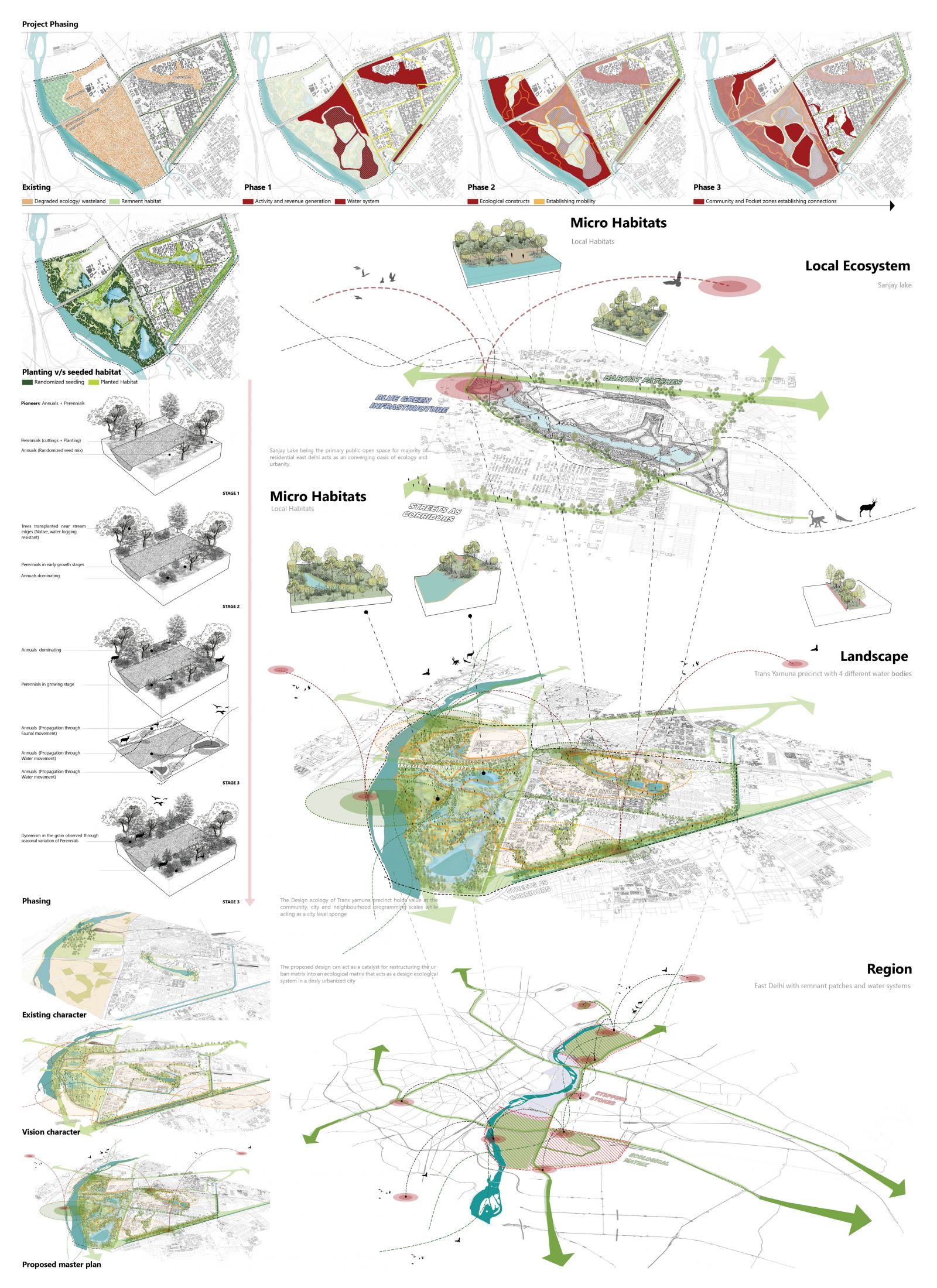
Understanding and reading the region | Introduction and Analysis | Trans Yamuna Precinct lies on the eastern bank of Yamuna river. The region under consideration is approximately 5100 acres and houses 4 types of water systems.

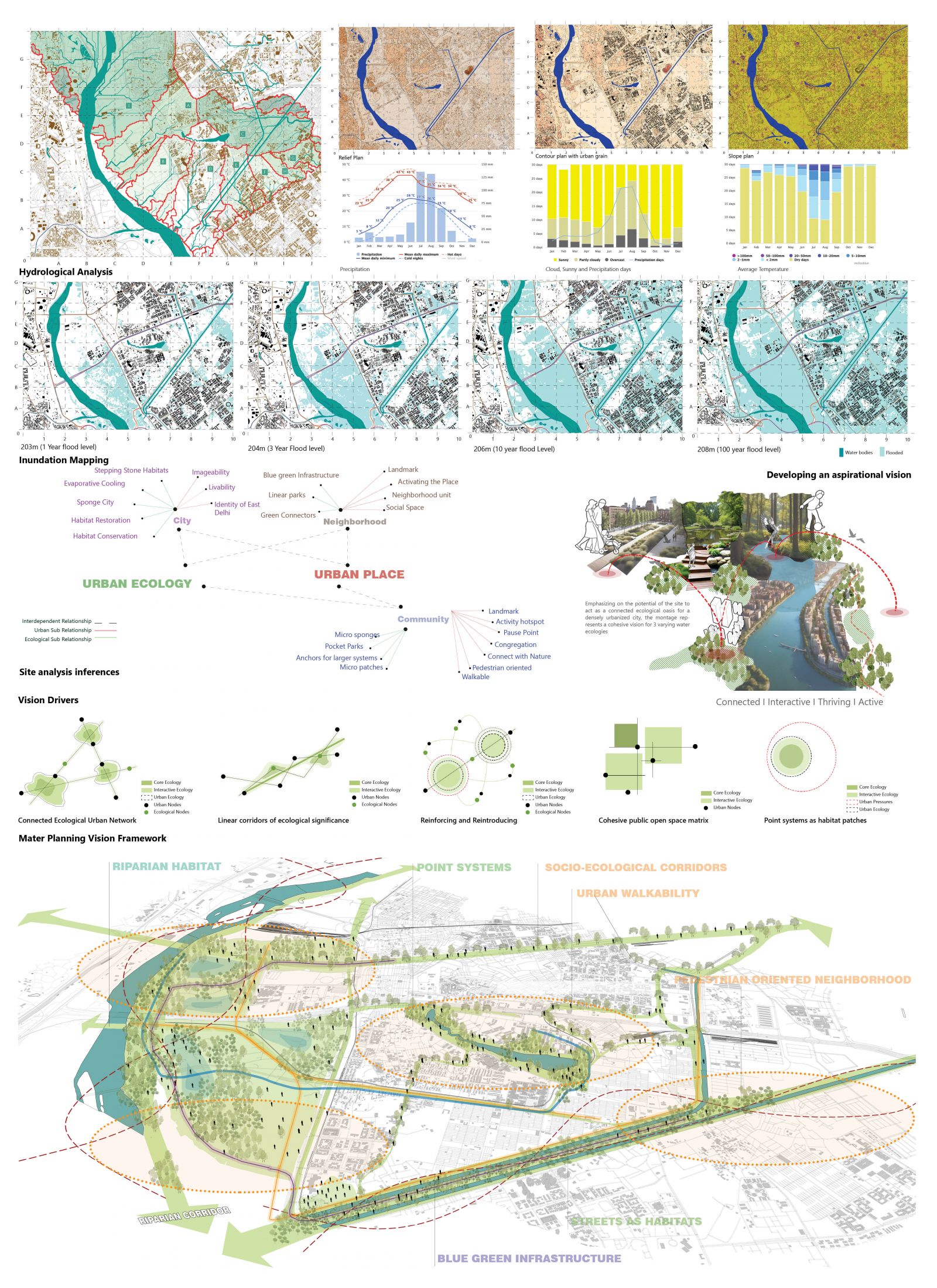
Developing an aspirational vision | Inferences and vision development I The idea is to propose a network of ecologically cohesive landscape system encompassing the river Yamuna, Sanjay Lake, Ghazipur Nallah and Hindon cut canal that also acts as a city level public space, hence establishing and interdependent reciprocity among urbanity and ecology.

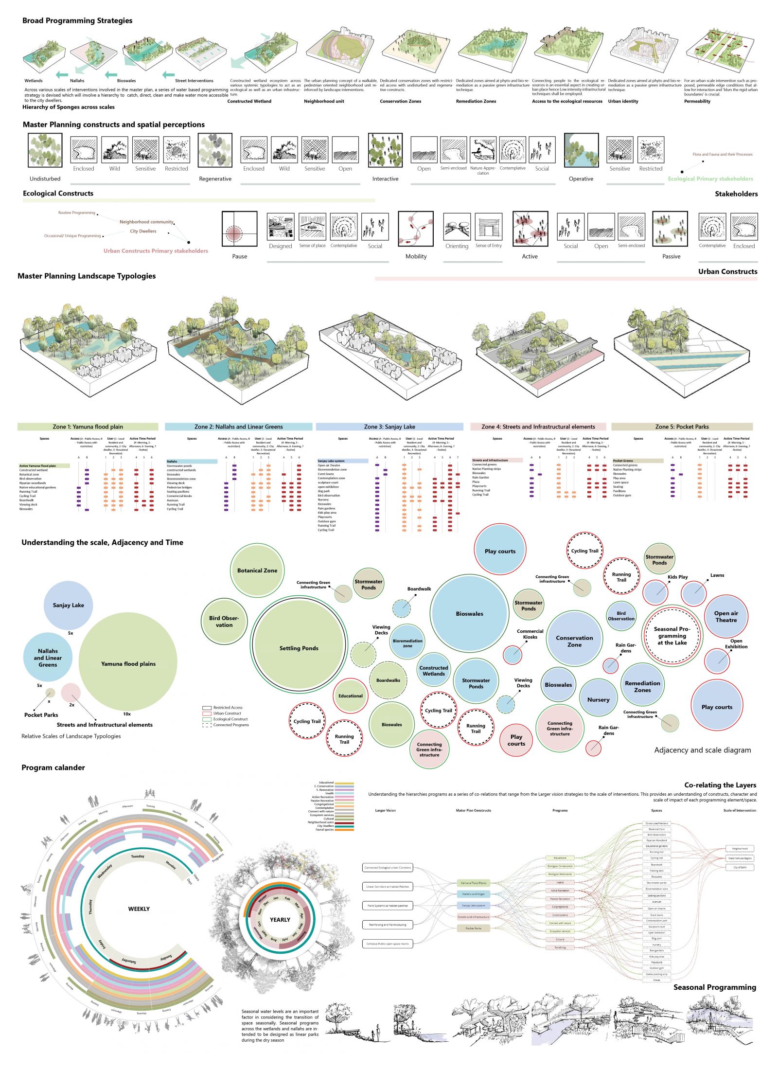
Devising a cohesive program | Programming for the site| A compressive program encompassing 5 scales of landscape is devised. Constructs, spatial perceptions, program matrix across time scale and adjacency is established.

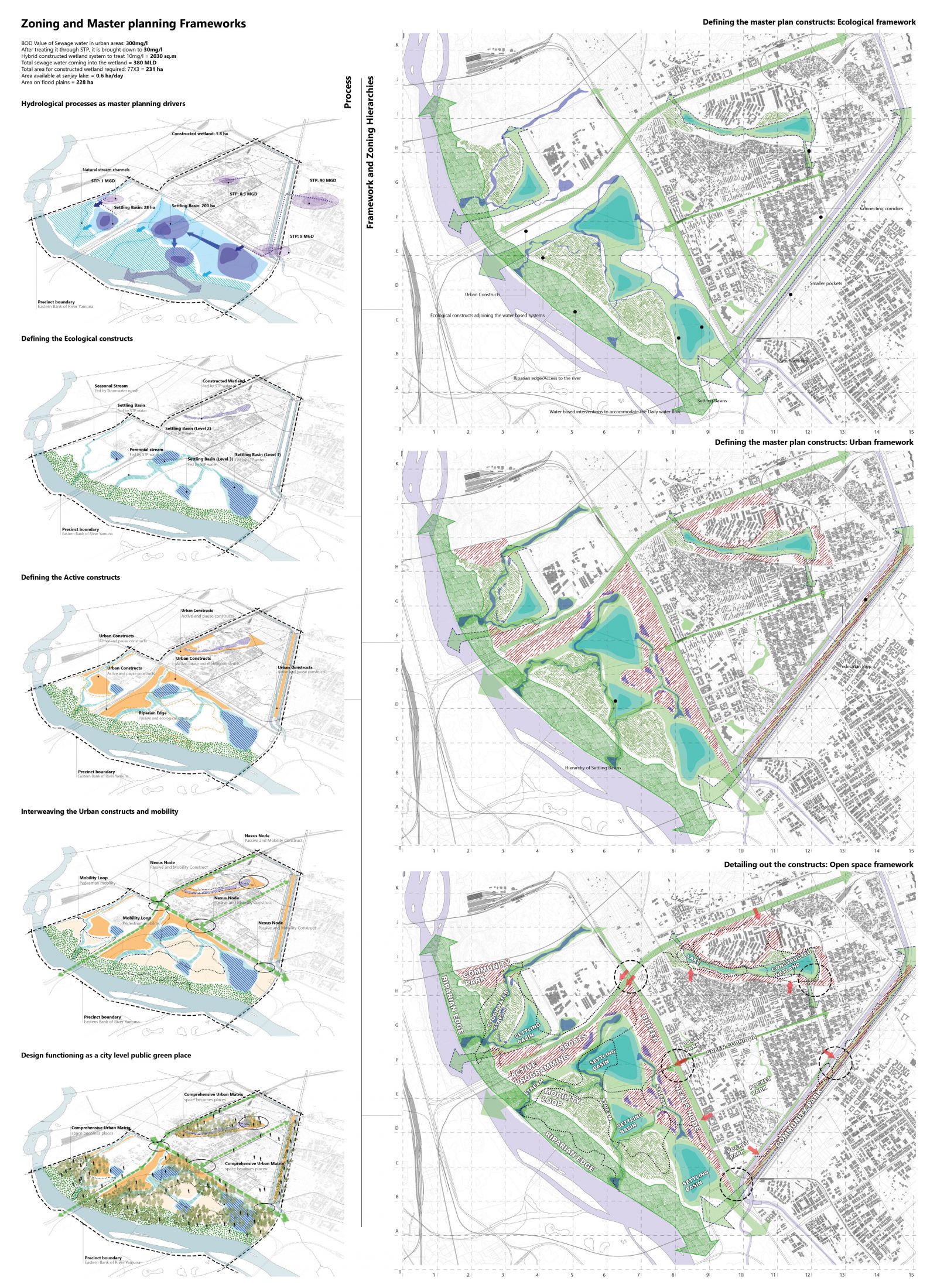
Crafting the Landscape | Zoning and master planning frameworks | A series of conceptual diagrams to establish the process behind master planning then converted into zoning frameworks to establish ecological and social constructs along with mobility and open space structure.

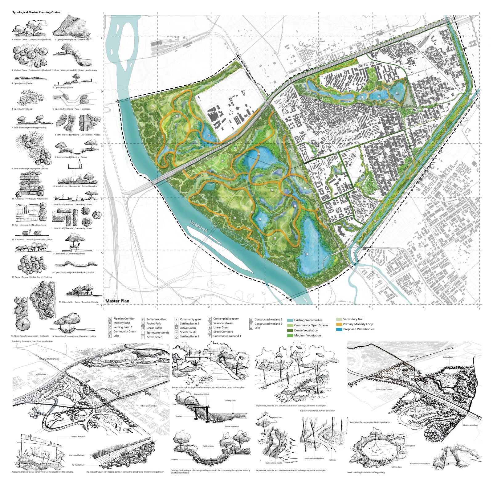
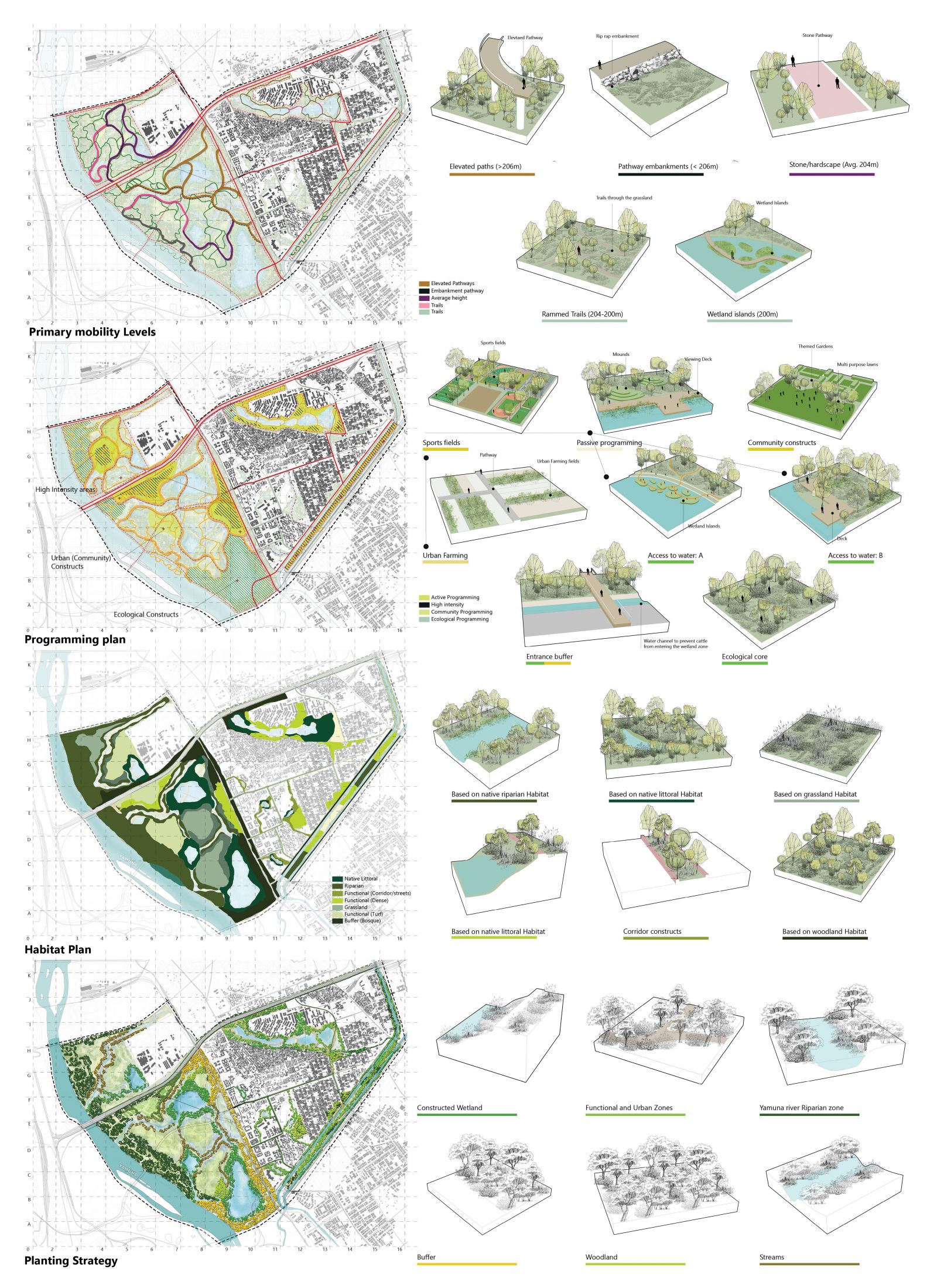
Crafting the Landscape | Master plan | The Proposal acts as a city level sponge that creates perennial water bodies, establishing an additional layer of passive water filtration mechanism before releasing it into the river, There are 4 Types of seasonal and perennial water bodies proposed across the master plan, The hierarchy of settling basins and a lake on the yamuna flood plains that recieves the water from the largest STP in east Delhi, Kondli STP with a capacity of 90 MGD. The largest hierarchy of lake is designed with a buffer mechanism to limit the physical access of the people this zone. The Second and third hierarchies receives water by water channels proposed at the course of original stream channels identified via hydrological analysis. Several seasonal streams are also proposed which will channel the runoff during storm season while acting as a linear green space during dry season. The main 3 hierarchies of greens i.e. the flood plains, the lake and the nallah green are con

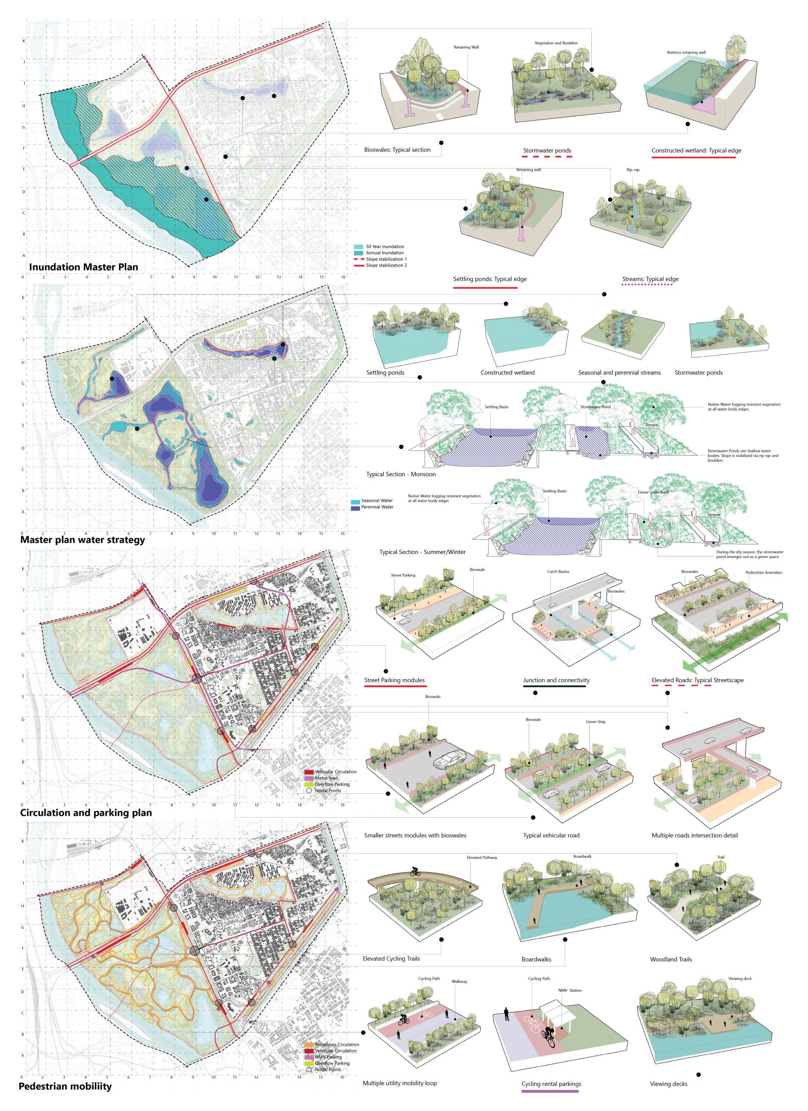
Crafting the Landscape | Master plan detailing | 8 layers were identified where a set of typical details and conditions were established. The water strategy and inundation master plan highlights the perennial and seasonal character of water while establishing a strategy for managing inundation volumes upto 50 year mark along with retaining and embankment strategies. Mobility and movement patterns are one of the most significant urban connectors hence a circulation plan with vehicular, pedestrian and adjacent parameters of parking and varying levels were detailed out.

Crafting the Landscape | Master plan detailing | 8 layers were identified where a set of typical details and conditions were established. The water strategy and inundation master plan highlights the perennial and seasonal character of water while establishing a strategy for managing inundation volumes upto 50 year mark along with retaining and embankment strategies. Mobility and movement patterns are one of the most significant urban connectors hence a circulation plan with vehicular, pedestrian and adjacent parameters of parking and varying levels were detailed out.

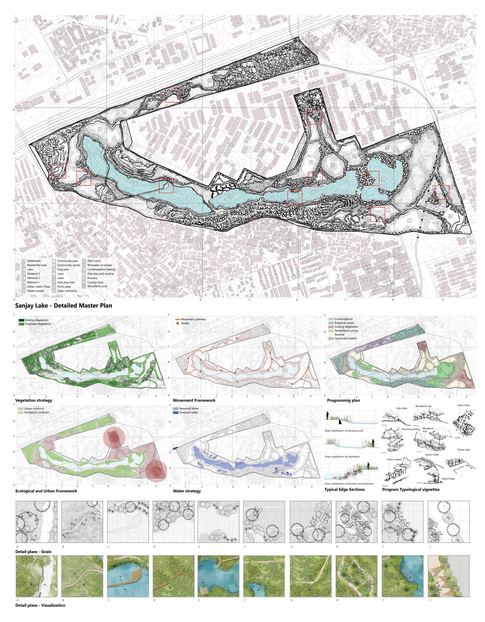
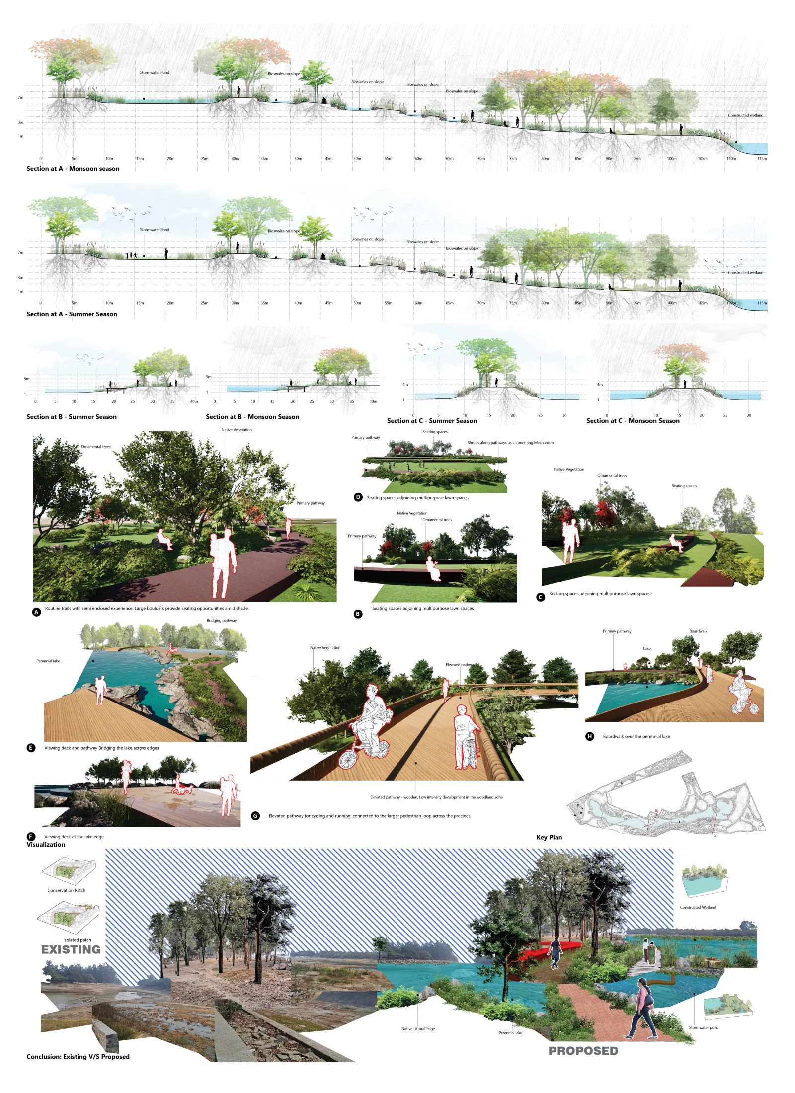
Detailing the Master plan | Sanjay Lake master plan | the point system of sanjay lake is designed as a constructed wetland system. A system of 3 degrees of water treatment is designed before it enters the deepest western part of the site and becomes a perennial lake

Detailing the Master plan | Sanjay Lake master plan | the point system of sanjay lake is designed as a constructed wetland system. A system of 3 degrees of water treatment is designed before it enters the deepest western part of the site and becomes a perennial lake

Trans Yamuna Precinct as an interdependent system| Conclusion | To conclude, imagining a precinct as a system comprising several ecological assets and connecting them via corridors can establish an interdependent reciprocity among ecology and urban processes that is reflected at every scale, from city scale, to the precient, to point system and eventually on site micro ecologies.