Your browser is out-of-date!
For a richer surfing experience on our website, please update your browser. Update my browser now!
For a richer surfing experience on our website, please update your browser. Update my browser now!
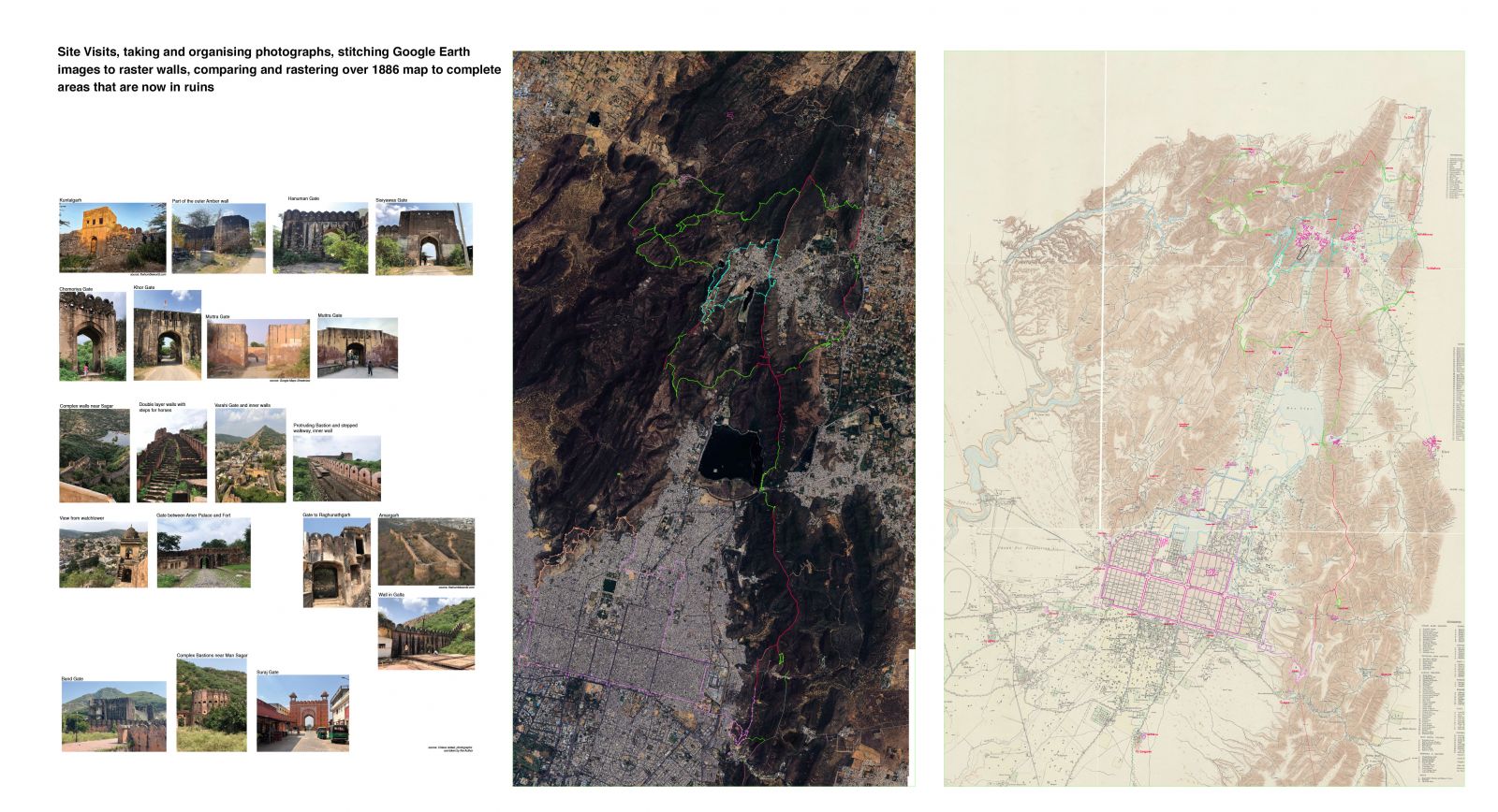
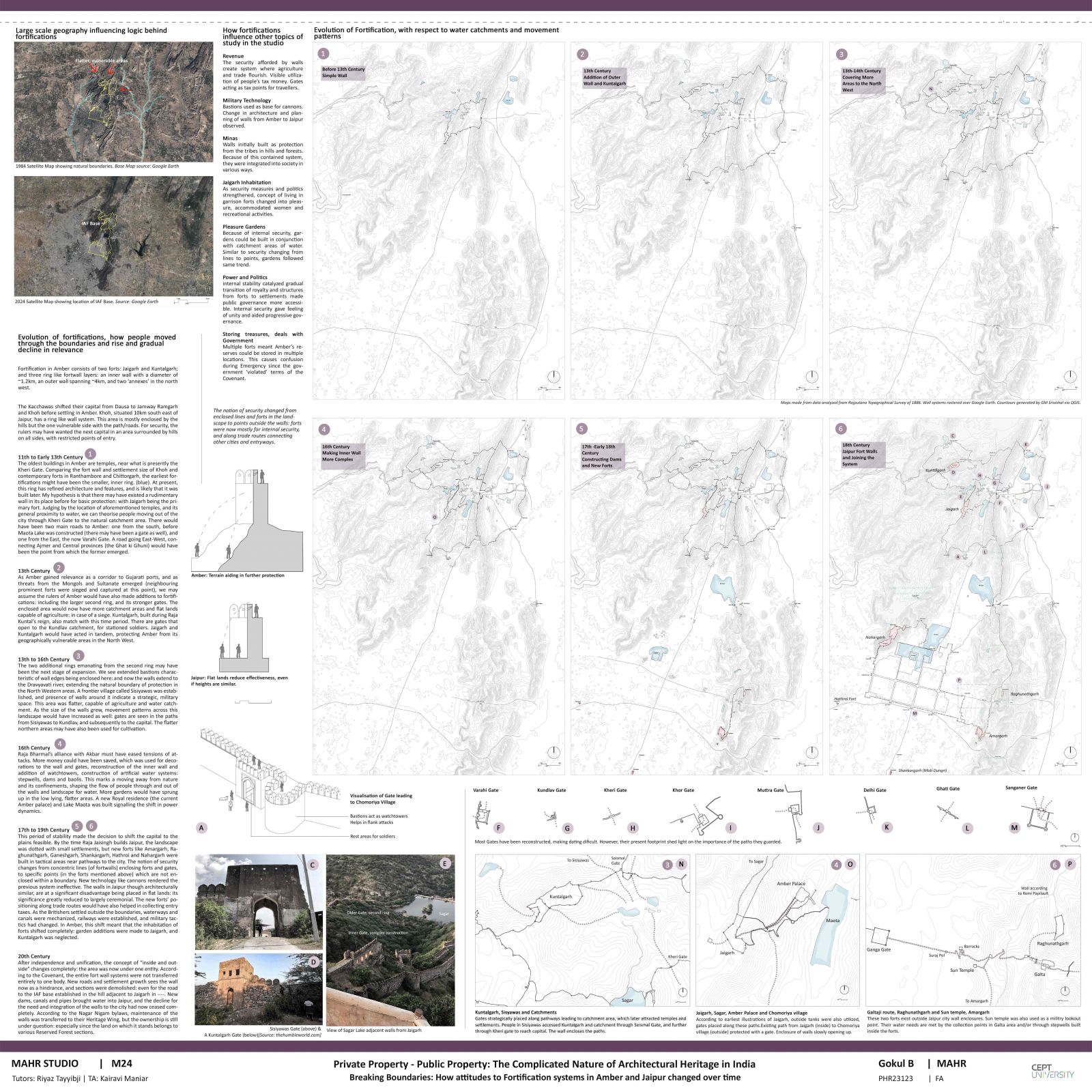
From being dependent on natural water catchment areas and geographical boundaries in Amber to building structures like dams and canals in the plains; the notion of security, porosity and concept of fortifications change with the shift in capitals. As a result, the flow of people through the landscape and built boundaries also changes, ultimately resulting in the attrition of the fort wall system. After the independence, new water, military, and forest agencies also came into the picture. The study aims to capture the nature of the walls about stimuli, their rise and fall in relevance, and present context.

.jpg)
.jpg)
.jpg)
.jpg)
.jpg)
