Your browser is out-of-date!
For a richer surfing experience on our website, please update your browser. Update my browser now!
For a richer surfing experience on our website, please update your browser. Update my browser now!
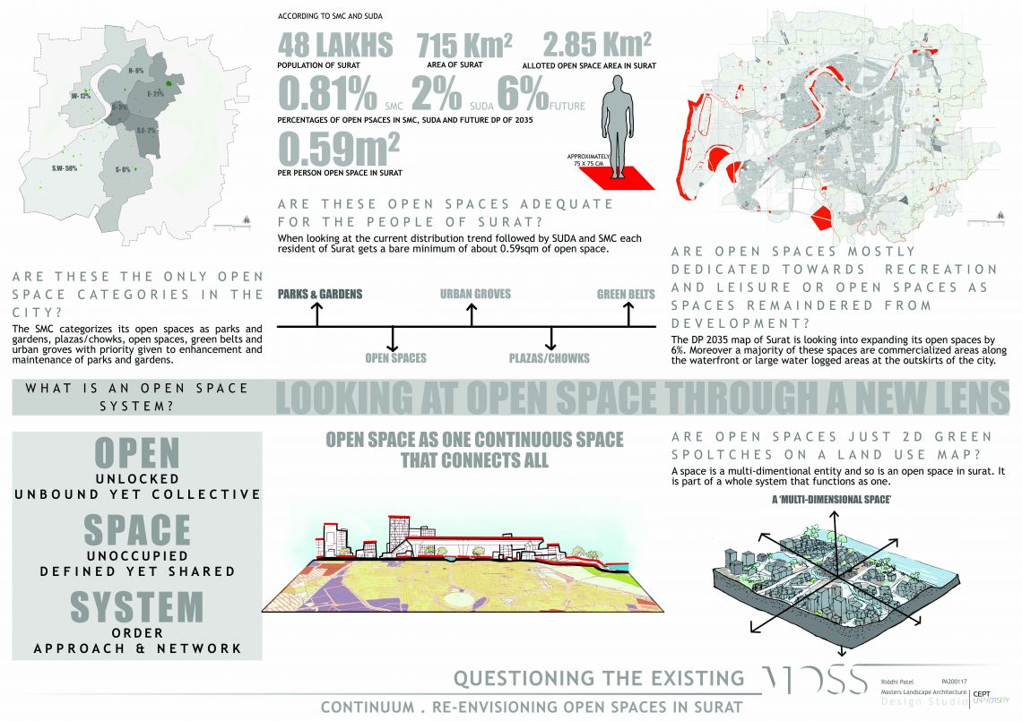
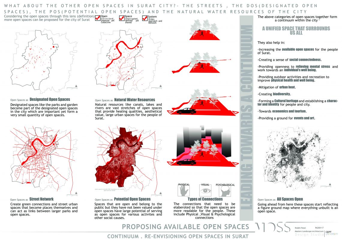
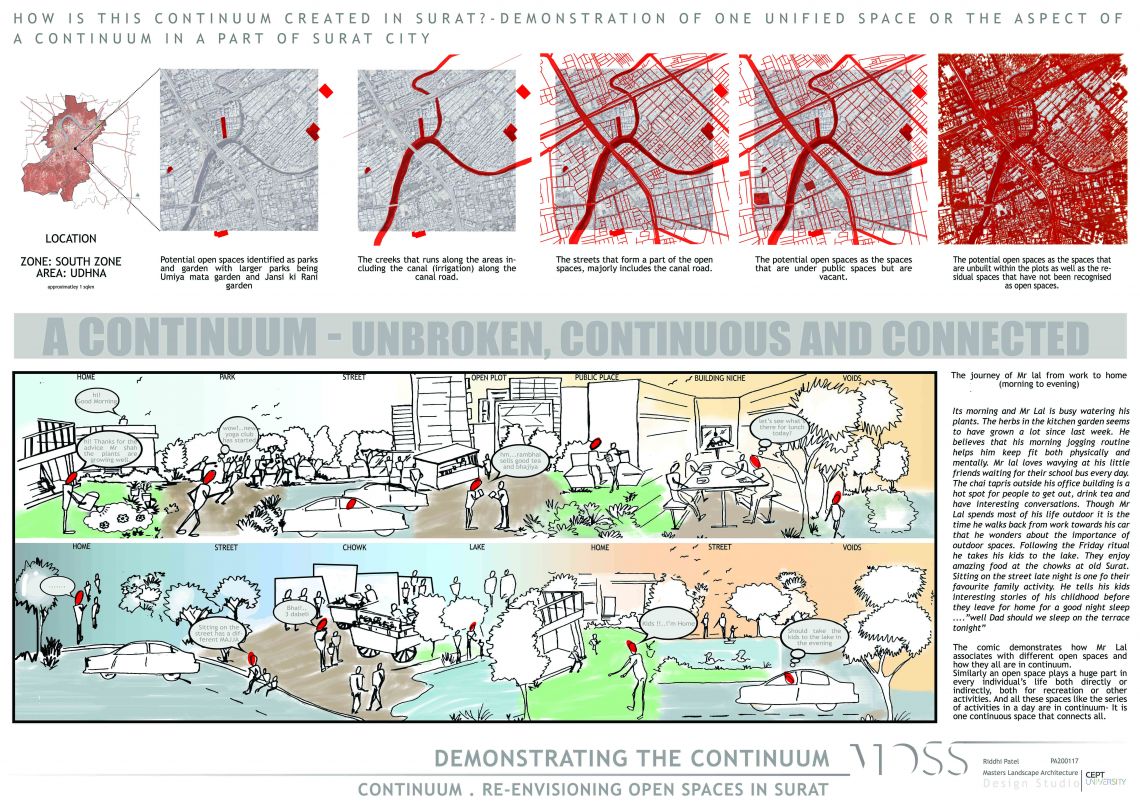
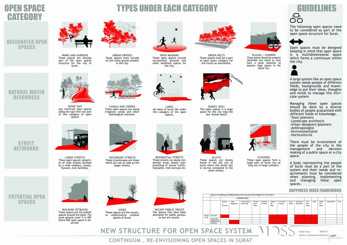
What is an open space system? How is it recognized, identified or perceived? This project will be looking at ‘Open Space - Systems / Standards / Structure’ for the City of Surat. Identifying that the Inadequate Open Space Systems need a ‘Perspective Change’ at the very conception of its Structure. Looking into present day Definitions / Categorization / Distribution / Networking / Management inadequacy of the Open Spaces. Establishing New Lens of identifying the Open Space System - Open (Unlocked, Unbound yet Collective), Space (Unoccupied, Defined yet Shared), System (Order, Structure & Network) Identifying the Spaces within the city that uphold your definition- the Designated Parks / the Potential Vacant Spaces/ the unbuilt spaces within the Plots / the Streetscapes / the Water Sheets / the Hydrological Channels, Undiscovered Residual Space. Professing the City Open Space as a One Large Continuous Space - Unbroken / Continuous / Connected – a CONTINUUM. Stating that Open Spaces are not just 2D Patches on the Land Use Map. They rather represent a Multi-dimensional, Continuous, Unbroken City Space and should be planned accordingly.


