Shreshtha Waghray

LA4008

Harmonizing Heterogeneity

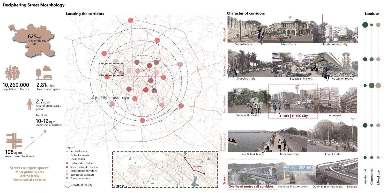
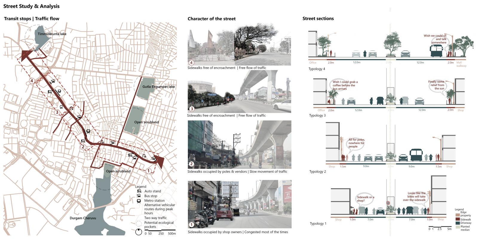
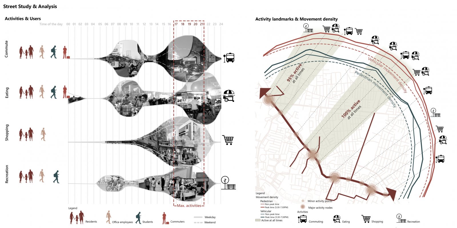
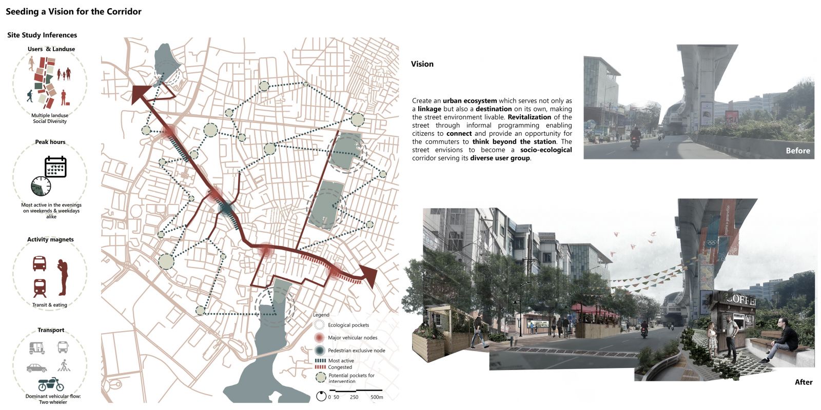
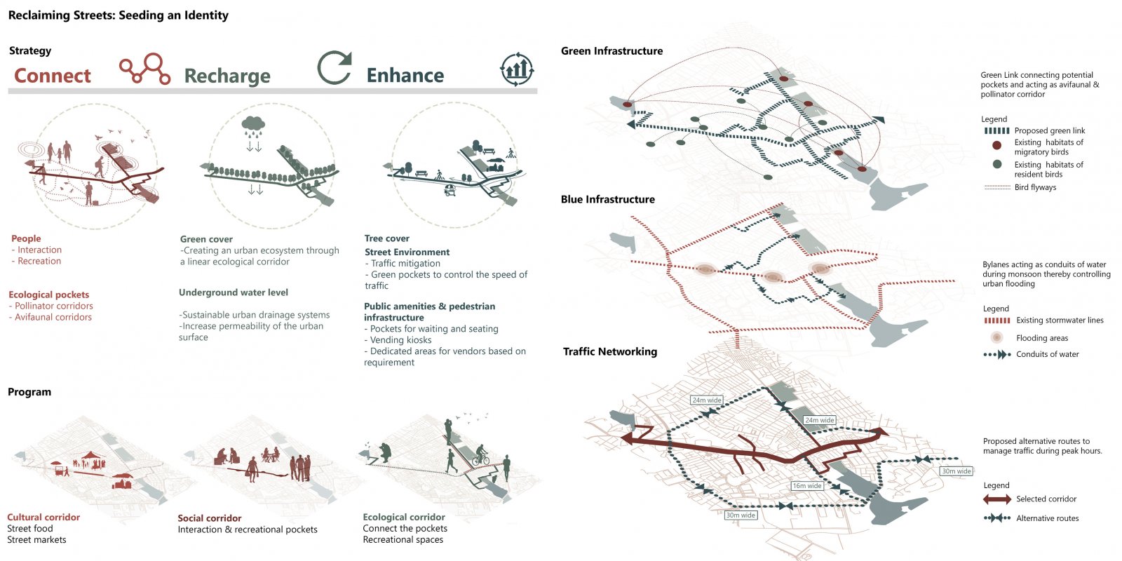
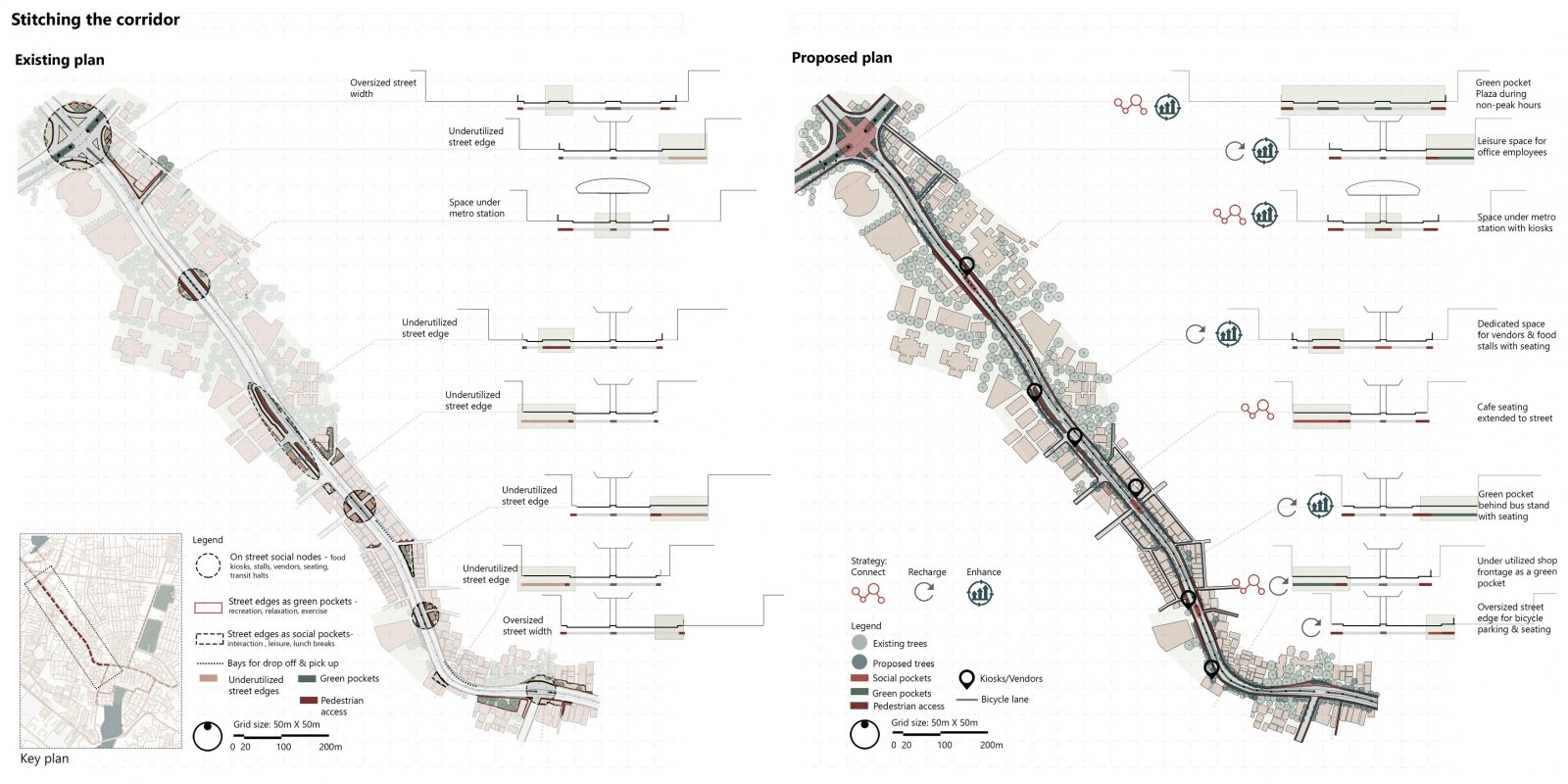
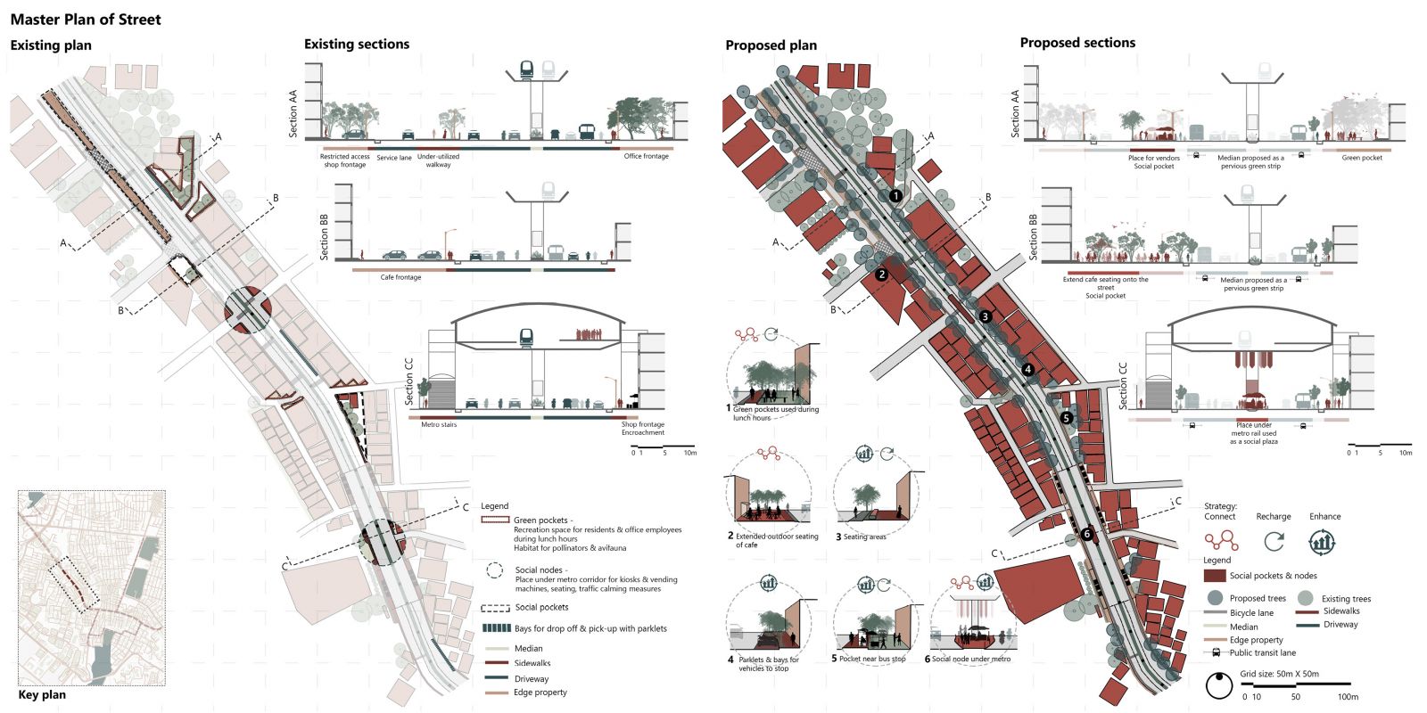
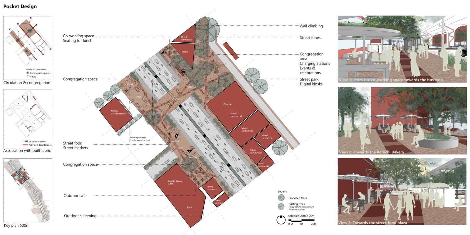
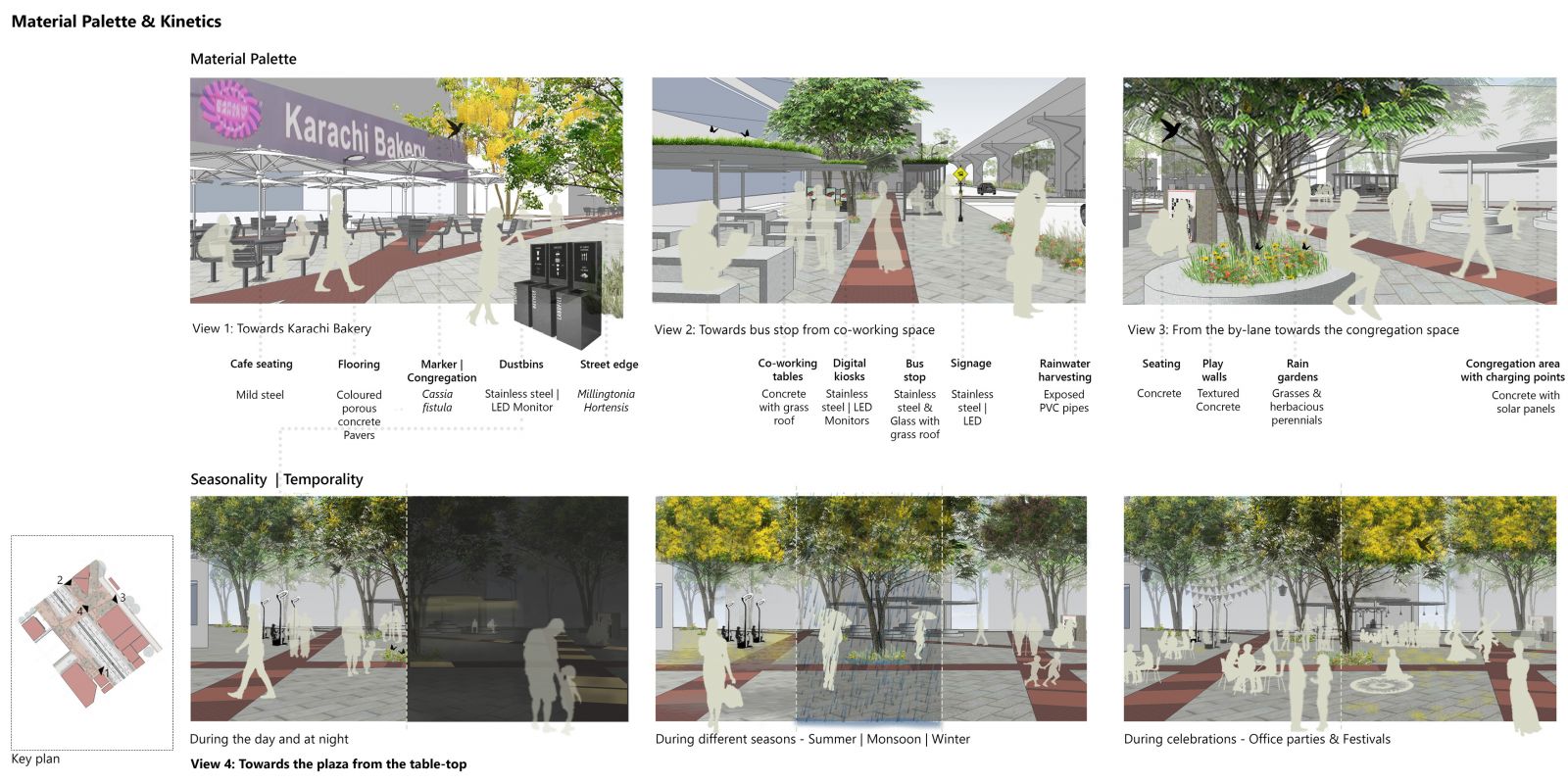
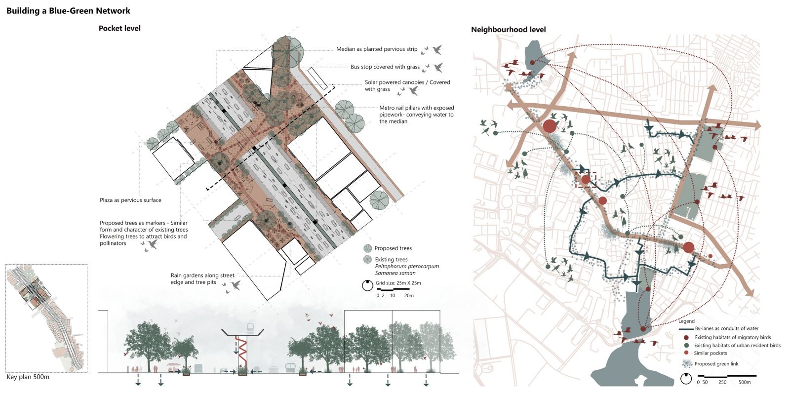
With an area of 625sq.km., Hyderabad provides only 2.7sq.m. open space per person. The streets account for 108sq.km. with a mix of historical, socio-cultural, ecological, institutional, and transit corridors. An attempt has been made to relook at allocating road space and design to accommodate other non-mobile uses as well instead of cutting into the available open spaces to cater to the requirements of the citizens. The site chosen for the proposal is located in Madhapur, the Information Technology (IT) centre known as the HITEC City. The street connects the city to the IT hub making it an important transit corridor. Recently the street has seen rapid development to improve the user experience and manage the traffic at peak hours, the latest being the addition of the overhead metro rail system. How do such developments benefit the citizens without catering to their basic comfort and necessities? The street is addressed through a three-way strategy – Connect, Recharge and Enhance, to make it liveable for the Hyderabadis. The street builds a relationship with its setting and users, revitalizes this connection, and further enhances it to make the spatial experience its identity. The corridor establishes a green link between potential areas and imagines the street as a destination catering to its diverse social group. Enlivening the street with informal programming will enable the citizens to connect and also provide an opportunity for the commuters to think beyond the station by providing social pockets. The corridor establishes a green link between potential areas and imagines the street as a destination catering to its diverse social group, “Harmonizing Heterogeneity”. From a mere transit corridor, the street envisions to become a socio-ecological corridor, thereby “Revitalizing the HITEC City”. 

View Additional Work

Report Content

From a humble origin as a small town in 1591, Hyderabad has seen rapid urbanization over the years. Today it aims at becoming an International Megapolis. The setting up of the IT Park in the 2000s was a major boom with large in-migration of people, saturating its central region. The HITEC City area which is the IT Hub showcases a distinct street character inhabited by migrants and locals as the city has been growing in this direction.

The site is located in Madhapur and connects the city to the HITEC City making it an important transit corridor. The recent addition of the metro rail has made the corridor even more significant. The street shows four distinct characters as one progresses from North to South, spanning over 3.8km. Potential ecological pockets are also present in the neighborhood.

The street provides a diverse user group to be catered to, due to a mixed landuse along the edges and the by-lanes being residential. The street tends to remain active all through the day with the dominant activities of shopping, eating, and transit. There is constant activity round the clock as majority of the offices offer night shifts as well. The map shows the different activity landmarks along the street identifying important nodes. The graphs demonstrate movement densities for pedestrian and vehicular movement.

Summing up the site study, major vehicular and pedestrian nodes have been identified which act as activity holding points. Different potential pockets across the neighbourhood can form a network creating a link to the larger pockets around the site. The project attempts to create an urban ecosystem which serves not only as a linkage but also a destination making the street environment livable.

The street is addressed through a three way strategy – Connect, Recharge and Enhance. The green infrastructure is looked in terms of creating small pockets using underutilized edges, which will present opportunities for increasing the amount of permeable surfaces throughout the street which could serve as patches for pollinators for birds. Blue infrastructure proposes the by-lanes as conduits of water following the stream network.

About 1.5km of the corridor has been selected and the interventions in terms of social nodes and green spaces have been demonstrated schematically, where the sections show how the underutilized spaces have been converted to create pockets with different characters along the street.

The strategy has been applied to a 500m of the corridor to develop the master plan. Based on the existing activity patterns and edges uses the underutilized areas have been repurposed such as office frontages as green pockets to be used during leisure or extended outdoor seating of café and so on.

The pocket has been designed as a combination of 3 plazas, connected across the street through a table top which is at the same level as the plazas. The larger eastern plaza is a multipurpose plaza which also offers space for events and celebrations. The western plaza looks at street food and markets whereas the southern plaza caters to the outdoor seating of the café.

Different digital elements have been proposed such as charging stations, solar powered co-working tables, digital gaming kiosks, waste disposal kiosks, etc. catering to the IT office employees as well as the users. The multipurpose plaza hosts a variety of programs where it can transform into a celebration area for office parties or events and even during the festivals.

The diagrams here tie back the different ends of the blue-green infrastructure proposals on the pocket as well as the neighborhood. The section shows how the different elements of the pocket work together. At the neighbourhood level, by-lanes act as conduits of water with swales as medians, carrying water to the nearby catchments areas. The street establishes a green link connecting the different ecological pockets. It could become a corridor for the avifauna and the pollinators as there are existing habitats of migratory birds as well as urban resident birds.