Vandana Pandey

LA4010

Aikyam: Oneness , Harmony

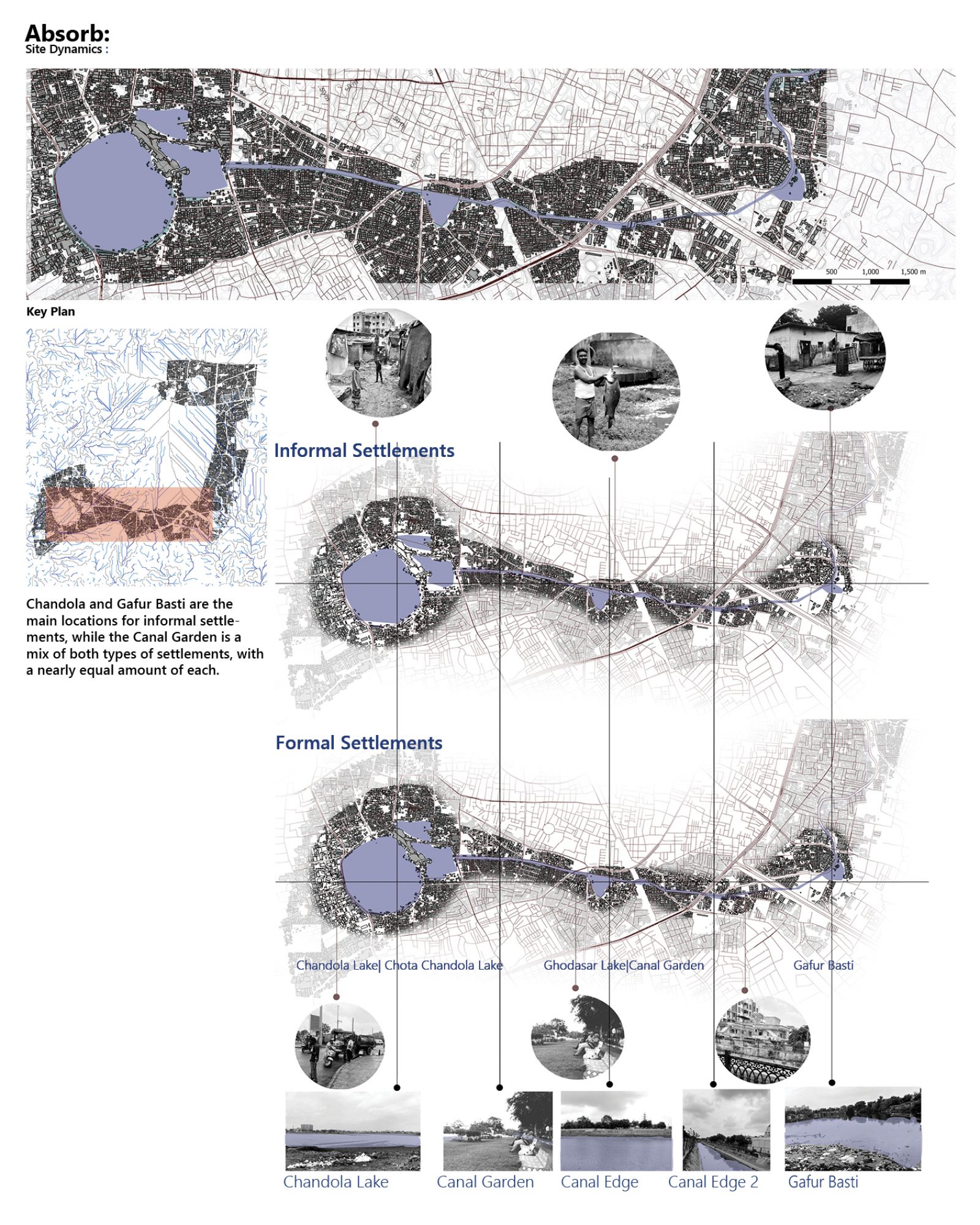
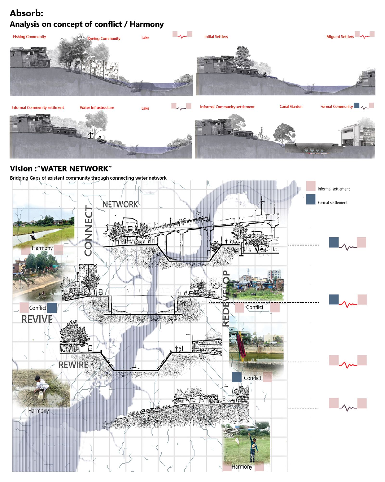
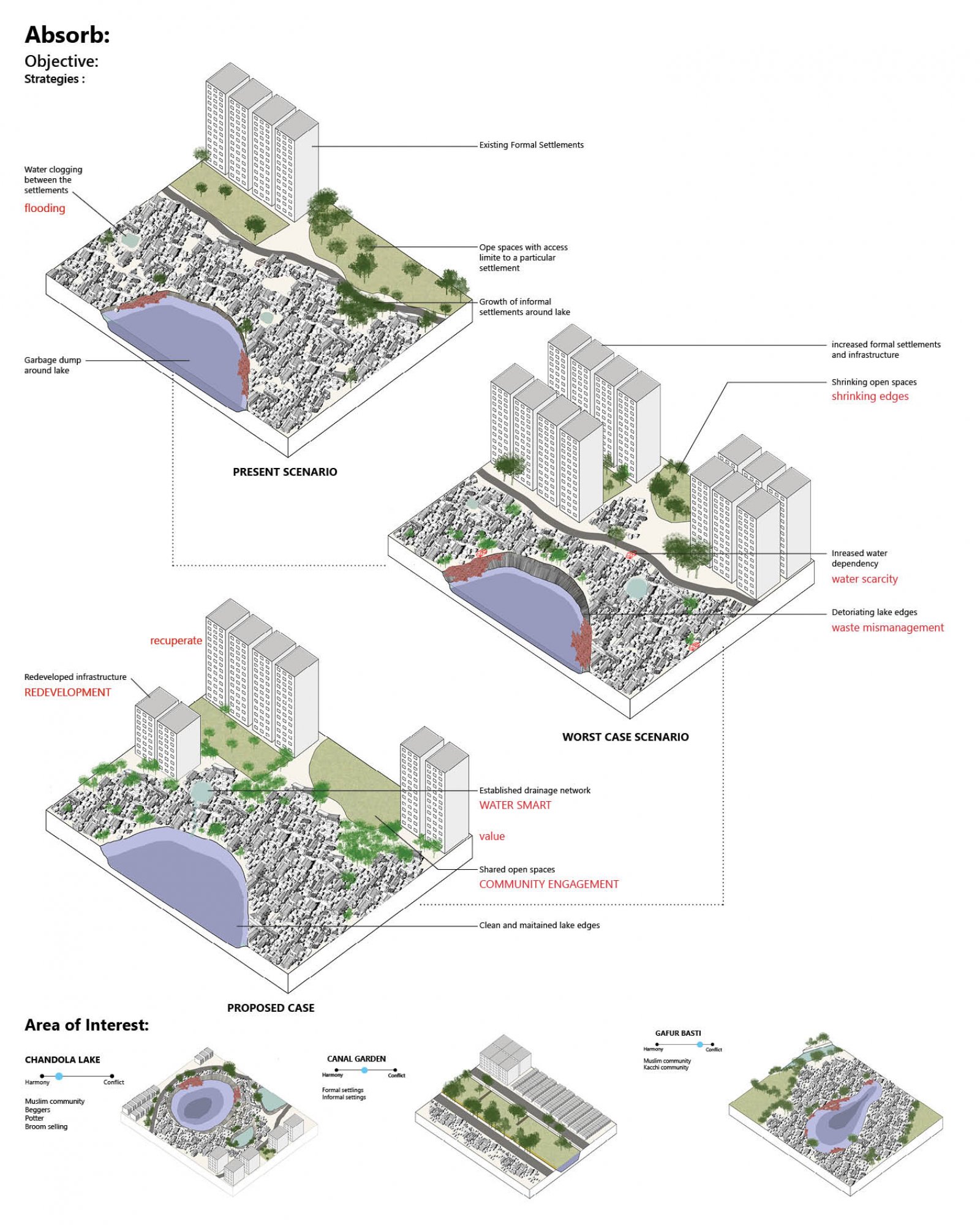
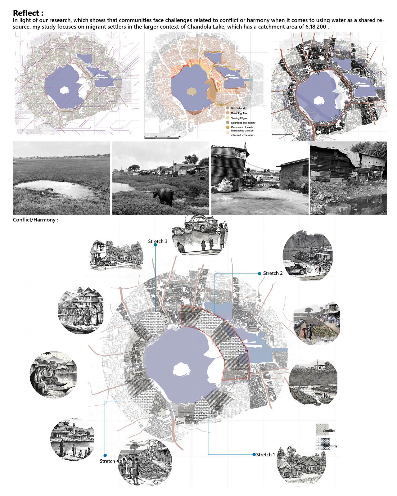
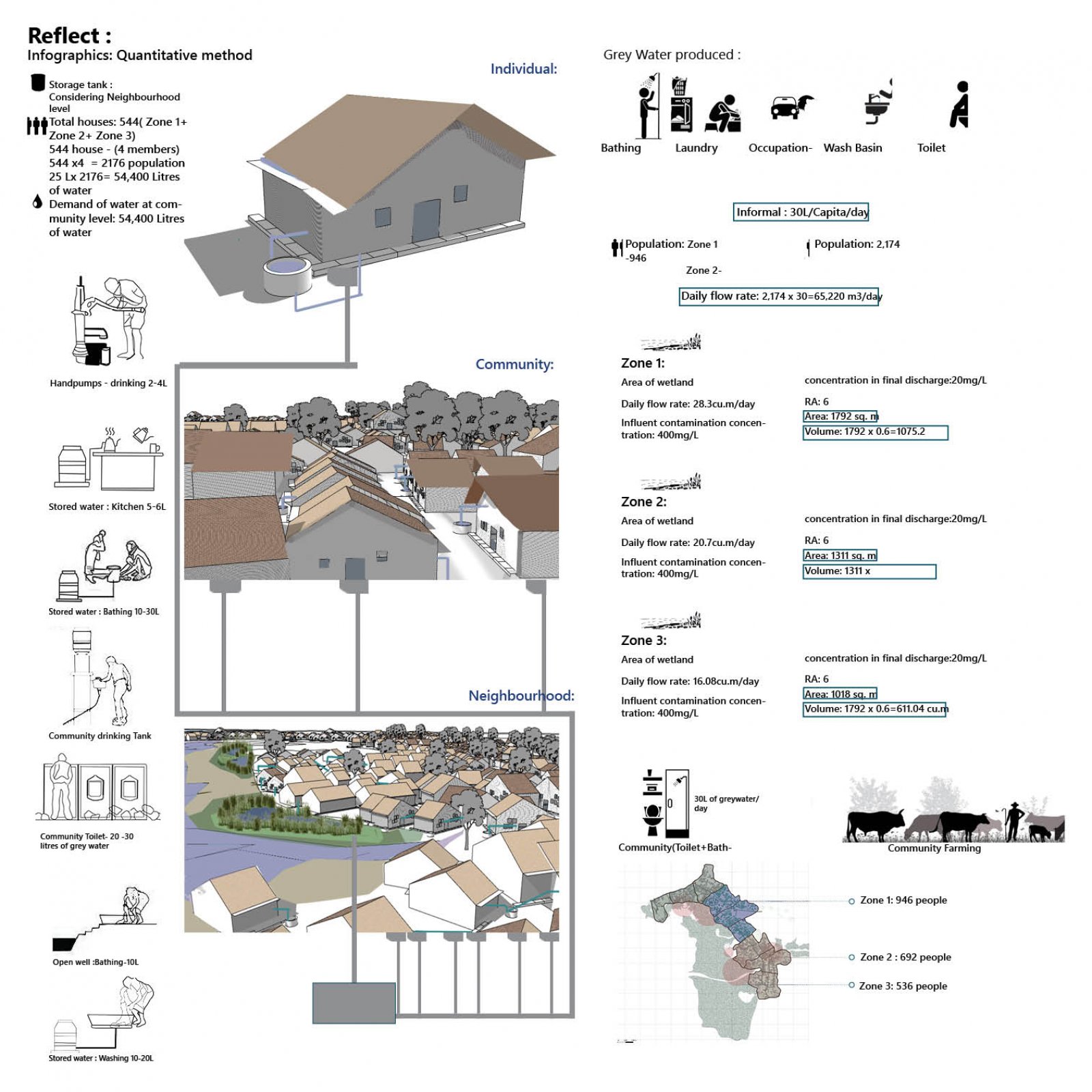
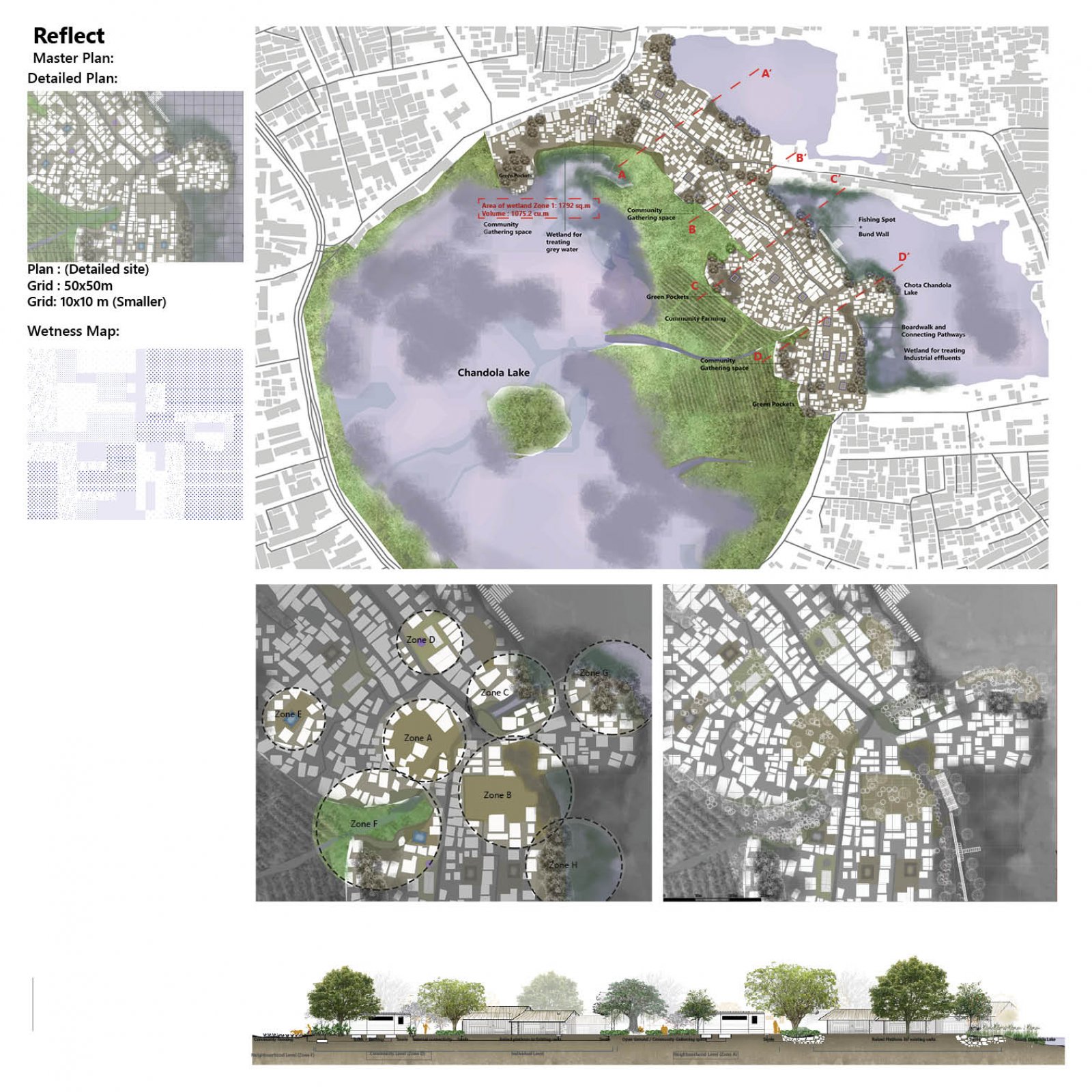
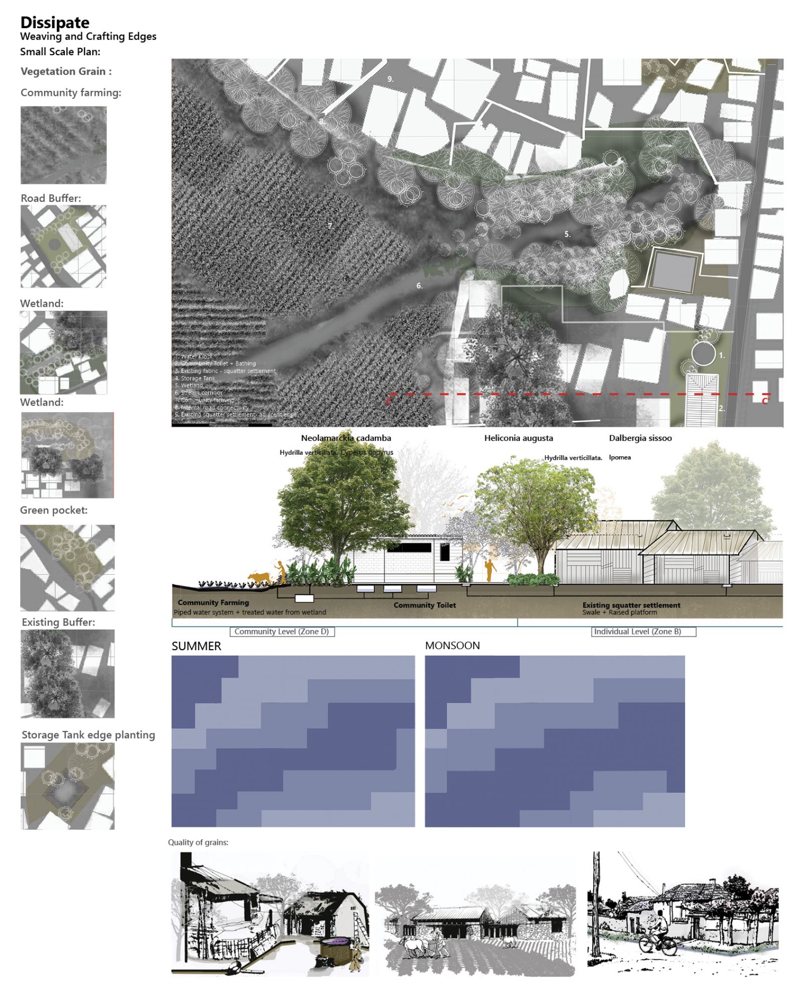
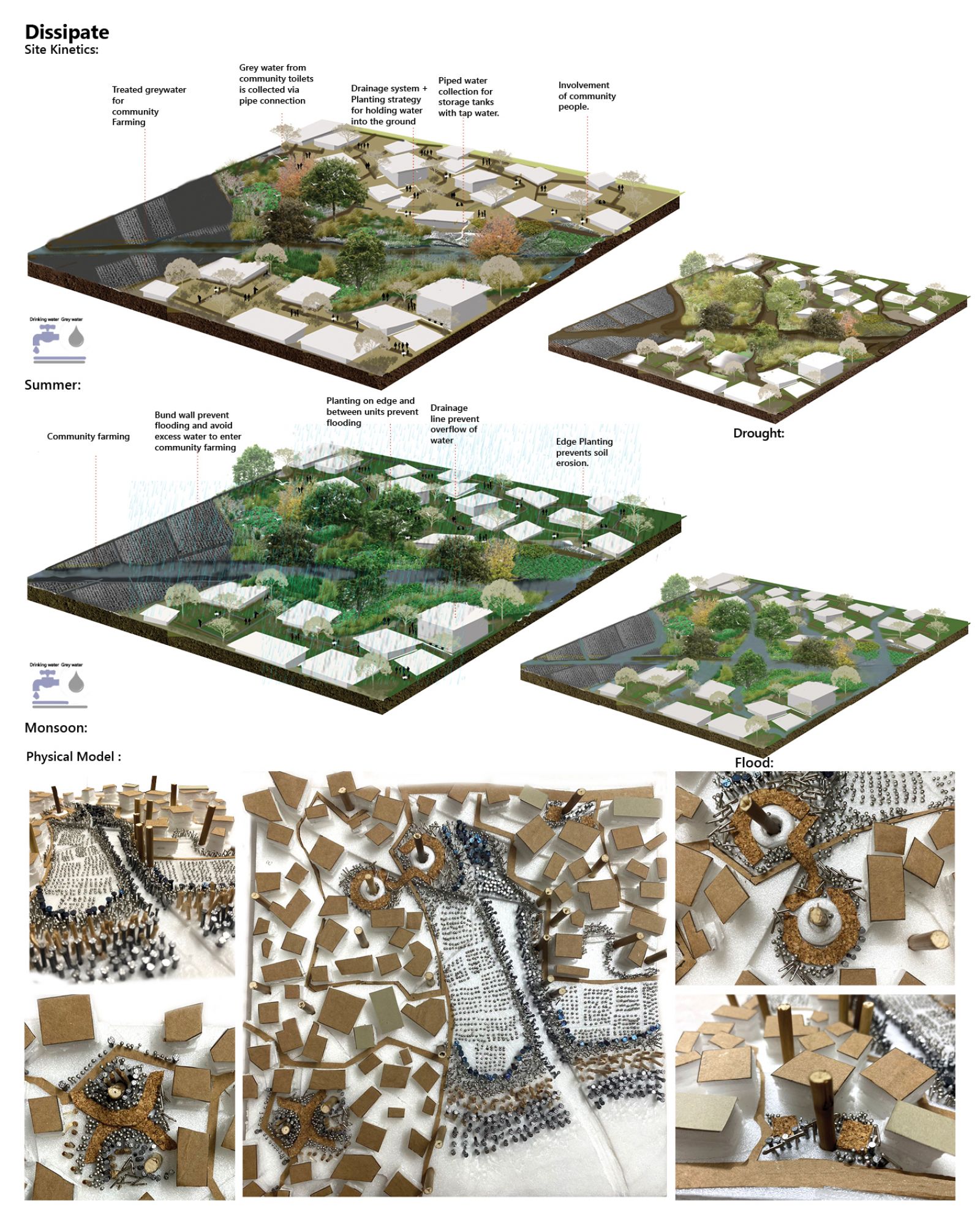
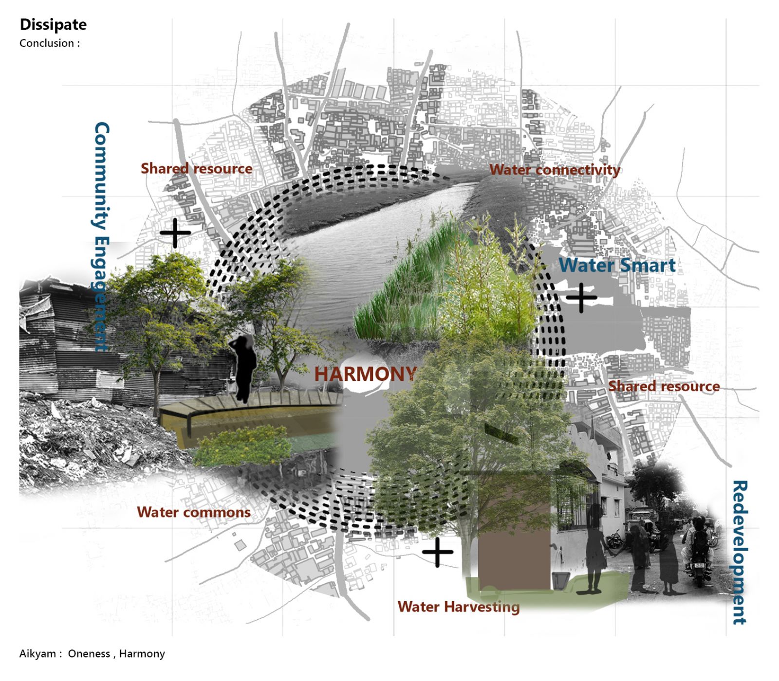
Chandola Lake has been majorly encroached upon by a large no. of Informal settlers who may rely on the lake for fishing, water, and other resources. As the population grows or environmental conditions change, competition for these resources has intensified, leading to conflicts over access. The coexistence of informal settlements is putting stress on the lake’s ecosystem by Unregulated waste disposal, infiltration of soil, and overfishing lead to environmental degradation, which is triggering conflicts as communities blame each other for the deterioration of the lake whereas there are some adjusting by resembling harmony by simply residing on the edge. The project aimed to address problems and foster greater harmony and unity among people at the individual, community, and neighborhood levels considering water as a shared resource. This can be accomplished by implementing zonal plugins that consider redevelopment, water-smart practices, and active involvement of the community.

View Additional Work

Report Content

Recognizing the coexistence of significant informal settlements at the location between Chandola Lake and Gafur Basti that manage conflict between the adjacent formal and informal communities

Understanding the objectives through a concept of residents either living in conflict and harmony considering water as shared resource and deriving at a vision is to rewire the water networks by building self-sustaining water smart communities centred around the idea of water commons.

Deriving the strategies : Redevelopment , community involvement and water smart by selecting the area of interest.

Understanding the Larger context :Site analysis through reading conflict between physical conditions and stakeholders at a larger context

Detailed Site :Site selection at a comprehensive patch to examine the population density, current condition, and graphical representation is done for developing the proposed program, that includes plugins at both the primary and secondary levels.

Quantitative description of a proposed program at individual , community and neighbourhood level.

Master Plan with large and small scale iterations at individual , community and neighbourhood level

Small scale plan with approached design plugins: This part of the site was chosen as it has resilience with the different seasons, an area with maximum flux due to natural stream corridor flowing through stretch.

Physical Model : Testing the module through seasons where the planting scheme are changing seasonally , giving new experiences also the farming will adapt crops seasonally.

Conclusion: It fosters a sense of unity and harmony by encouraging inclusive participation of decentralized system of close knit fabric in the management and sharing of water resources by implementing zonal plugins that consider redevelopment, water-smart practices, and community engagement.