Elangkumaran S

UR2008

Portable Waterscapes

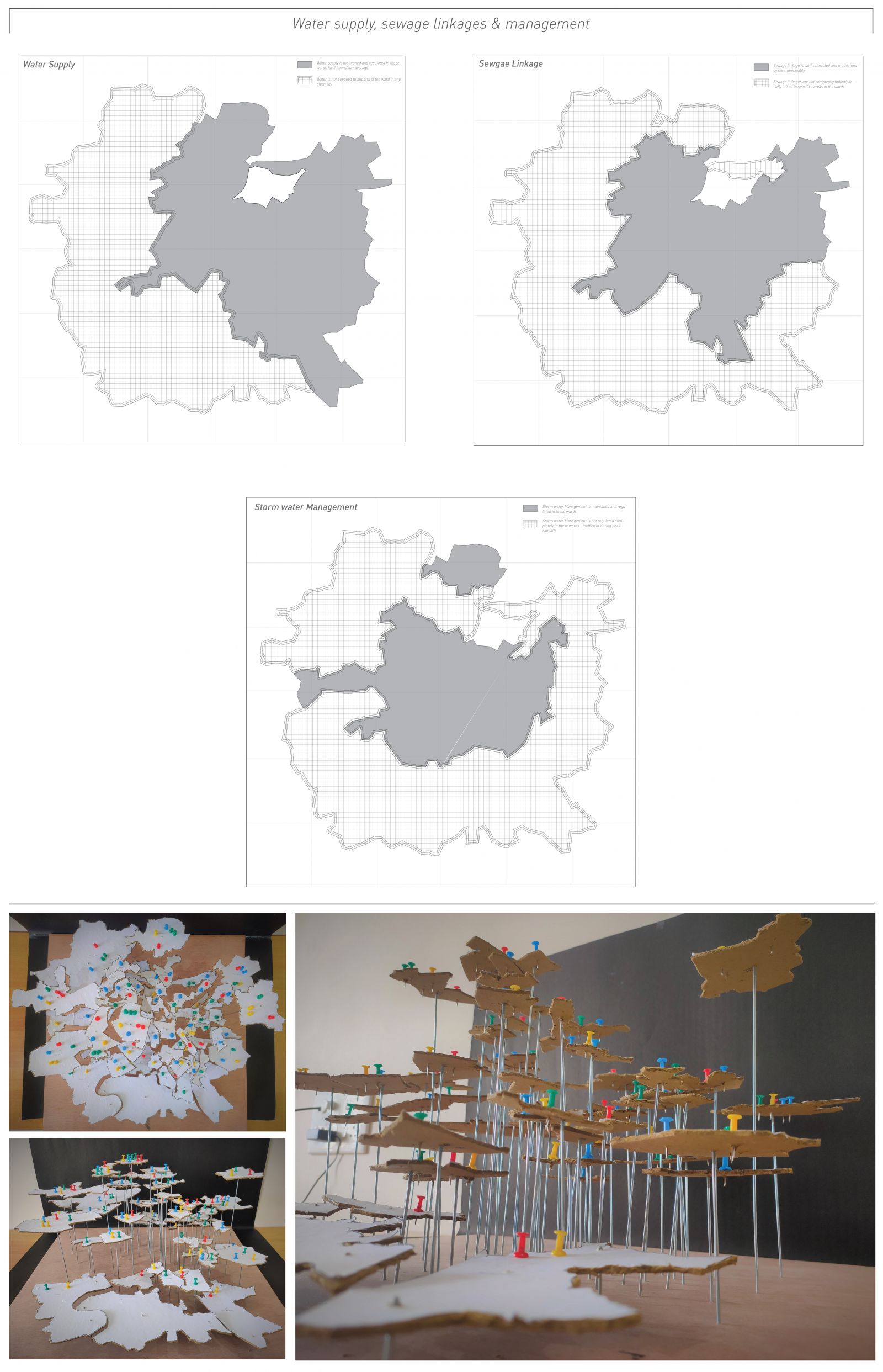
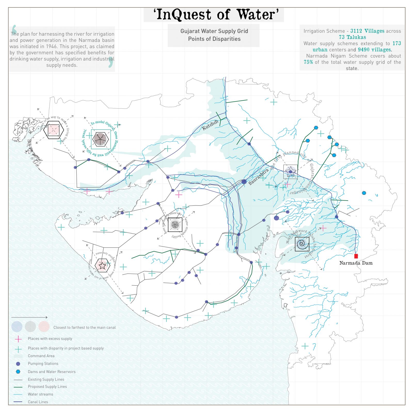
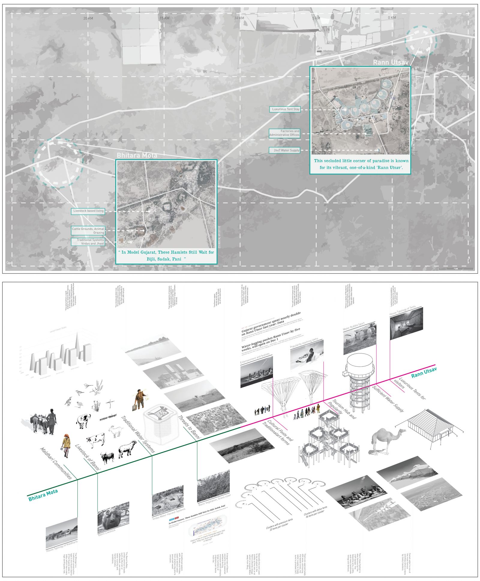
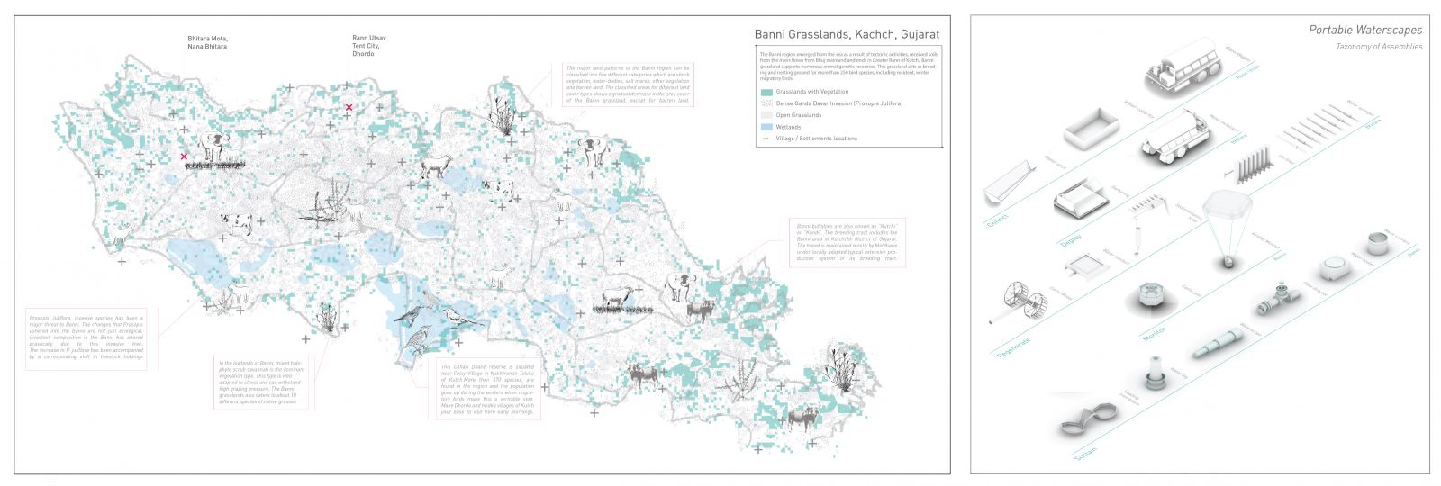
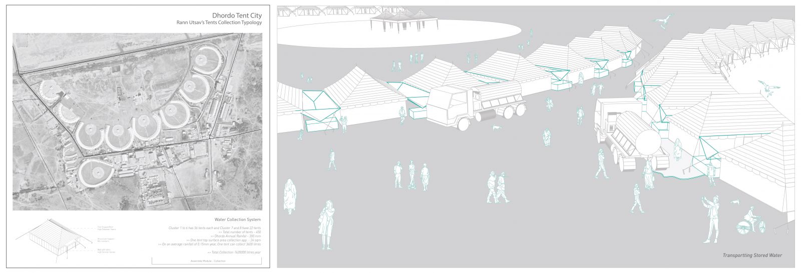
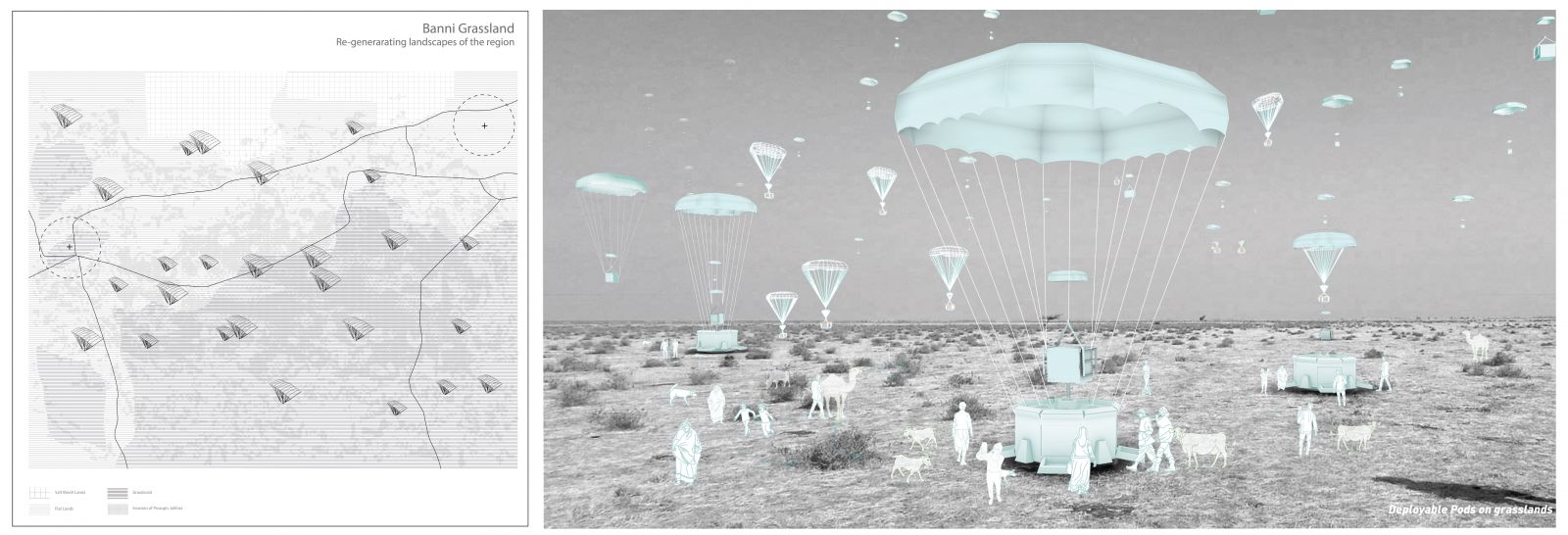
“Portable Water scapes” is a project of discourse where a village Bhitara mota with noted disparity in the Kutch region of Gujarat is seen as opportunity to extend the possibilities of getting water infrastructure from the neighboring landmark, Rann Utsav that has been well developed and organized because of its political, geographical and economic influences. The villages are not just identified as places for intervention, but are also looked at as catalyst points to develop the neighborhood, its infrastructure and the landscape, provokes a different way of thinking and imagining conditions.
It also looks at imagining assemblies and scenarios for water portability as a way to revive landscape, provokes conditions on the notes of disparity in villages. It specifies imagination at ways to develop such conditions through water infrastructure, in all it focuses to re-think the disparities or at least bring in a point to converse about such cases.  

View Additional Work

Report Content

The neighbourhood mapping representation shows an overall observation of 5 factors – timeline vs depth of the borewell , soil texture and water conditions underneath, borewell lorry and process, every household and their snippet about groundwater and borewell, public and private borewell uses.Its important to note the significant level drops of underground water, w.r.t to the timeline of comparing two decades.The water that was drawn at 50 ft in average in the last decade in now in search of an alternative aquifer at about twice i.e. 100 to 140 ft.

The speculation focuses on imagining and thinking a scenario derived from the mapping in the neighborhood. It questions the case on how the future image would look like if all the underground borewells are dried out and the machinery lorry could not perform such functions of extraction. Several add-on assemblies function together to indicate, conserve and reserve water in the future.

Underscored is a city scale mapping that highlights the overlapped areas where public infrastructures are not well accessible or available. The highlighted areas are places where many layers of facilities are unavailable or partially accessible to the entire ward population. There are four classes with weighted averages that constitute to respective information on the public, its built, the accessibility and thus the disparity.

The representation is one of the scoring layers, it is essential to map out the service sectors, the educational facilities and healthcare. In many cases it was repetitive to note the fact that south eastern and western wards have only adequate facilities and infrastructure management.

The scoring for water based management and resources was weighed more. The overlapped areas in the south east and west wards could perhaps be seen as an opportunity to develop strategies that would affect the welfare of its place and also contribute or exchange relations with the neighbourhood wards that have a med. or high scores with better facilities.

The regional scale analysis begins with this map of finding cases of water scarcity, disputes that manifest into disparities at a larger scale. These findings were tied up with certain relations that were classified based on the evidence found for each.

The map aims at decoding all the activities and day to day life in both the places to decode the lifestyle which further helped in developing speculative thoughts for the village. In Rann Utsav is mainly due to its popularity and the festival that also helps in getting 24/7 water supply and in fact water bubble sport for the tourists, and the maldharis in Bhitara are still waiting for tankers to supply water once in 5 days.

The approach to speculate the scenario is to see Rann of Kutch and the possibilities that could help in extending some “Kits of Portable structures” as tools to develop assemblies that deploy at Bhitara to benefit the Maldharis.

The thought was to collect water in with the tent typology to store water with water sacs. There are structures that are inflatable which pop up during rain, collect it and store in after filtration in pits. Later, the water vagons help in carrying this collected water to Bhitara.

Once water related issues, overgrazing of cattle threats are identified from the aerial forms, these structures would deploy in the grasslands. Later, it expanded itself as a structure that caters to provide stored water to cattles, storing seeds etc. This also becomes a place for the moving community in transit to rest, and also help in developing the regional landscape from the threats to Banni.

Project Video