Your browser is out-of-date!
For a richer surfing experience on our website, please update your browser. Update my browser now!
For a richer surfing experience on our website, please update your browser. Update my browser now!
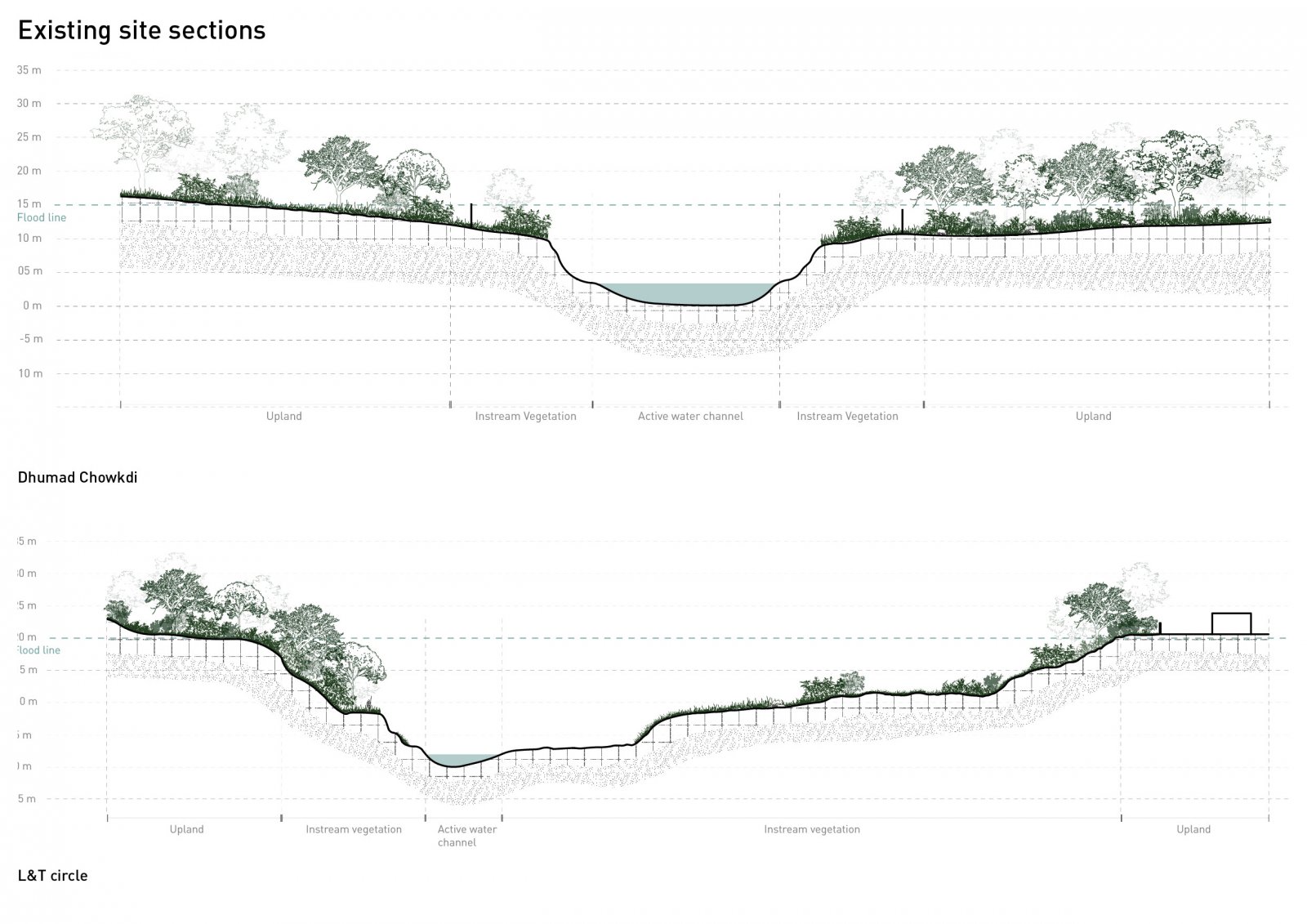
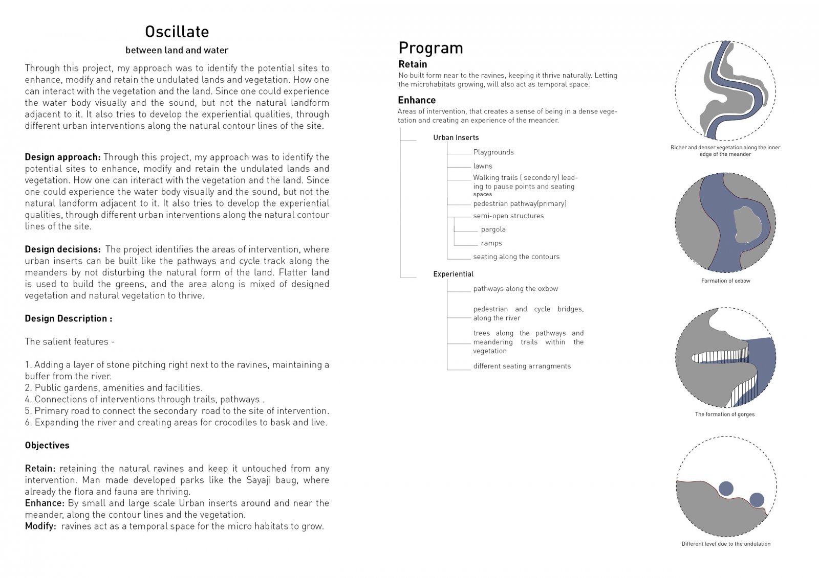
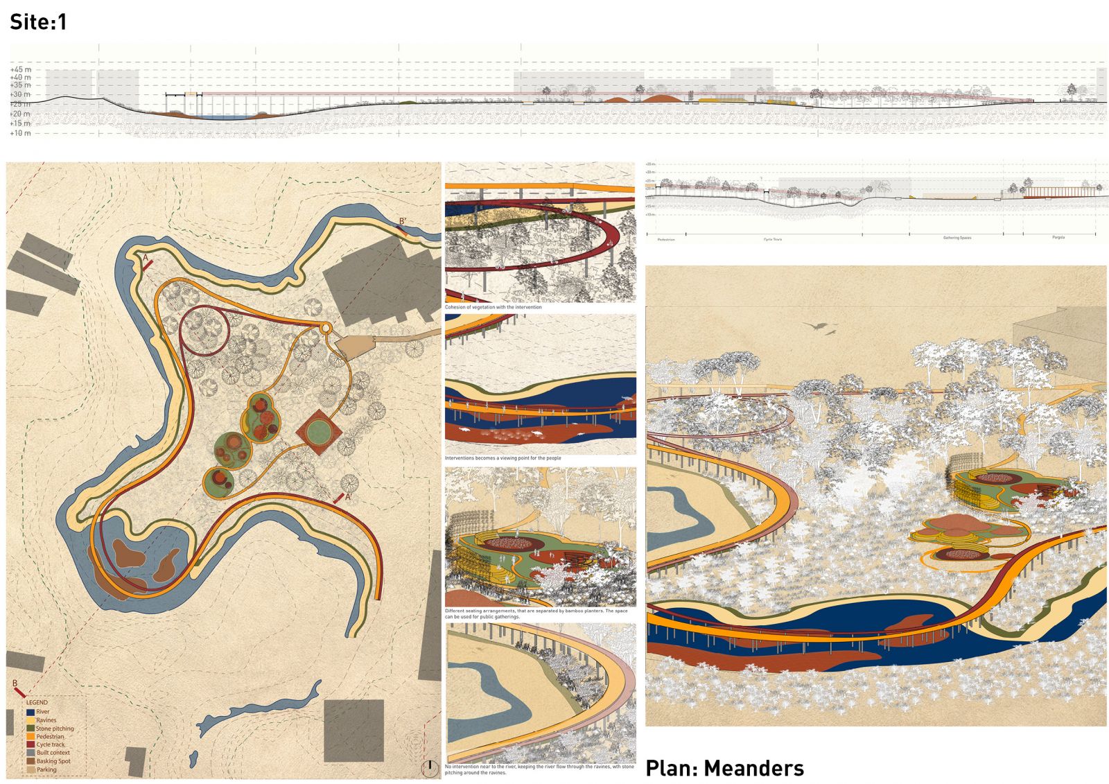
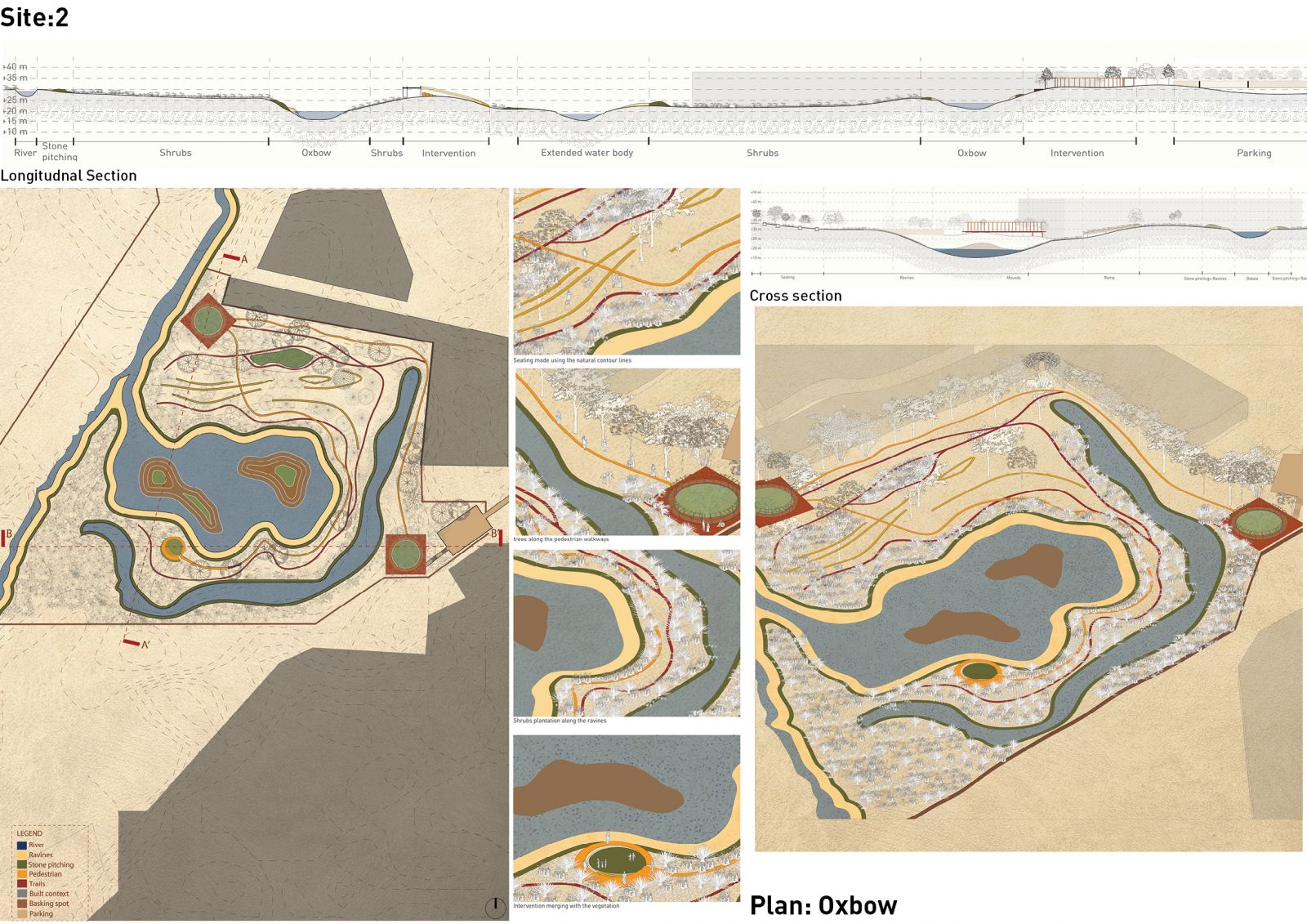
Through this project, my approach was to identify the potential sites to enhance, modify and retain the undulated lands and vegetation. How one can interact with the vegetation and the land. Since one could experience the water body visually and the sound, but not the natural landform adjacent to it. It also tries to develop experiential qualities, through different urban interventions along the natural contour lines of the site. Design decisions: The project identifies the areas of intervention, where urban inserts can be built like the pathways and cycle track along the meanders by not disturbing the natural form of the land. Flatter land is used to build the greens, and the area along is mixed with designed vegetation and natural vegetation to thrive. Full portfolio
View Additional Work