Your browser is out-of-date!
For a richer surfing experience on our website, please update your browser. Update my browser now!
For a richer surfing experience on our website, please update your browser. Update my browser now!
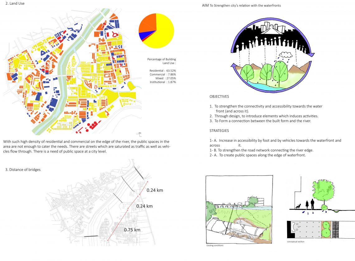
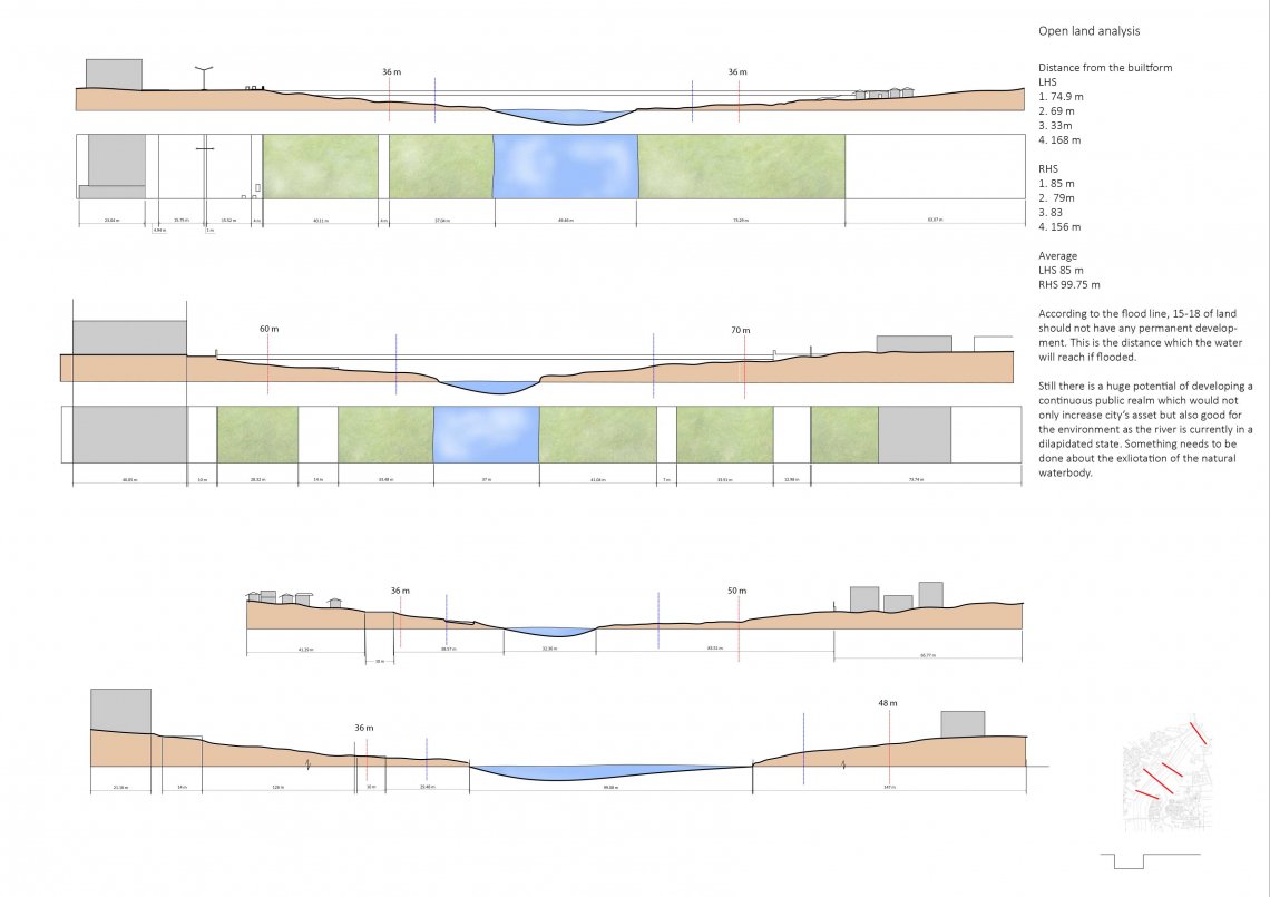
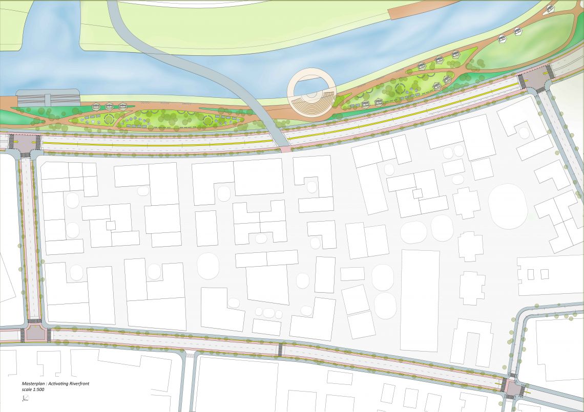
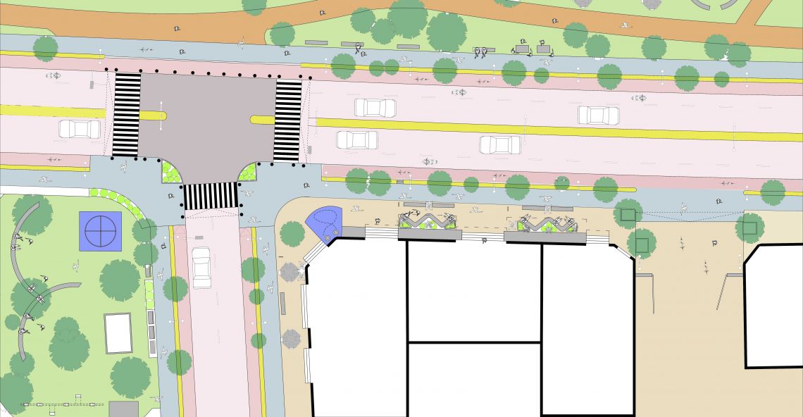
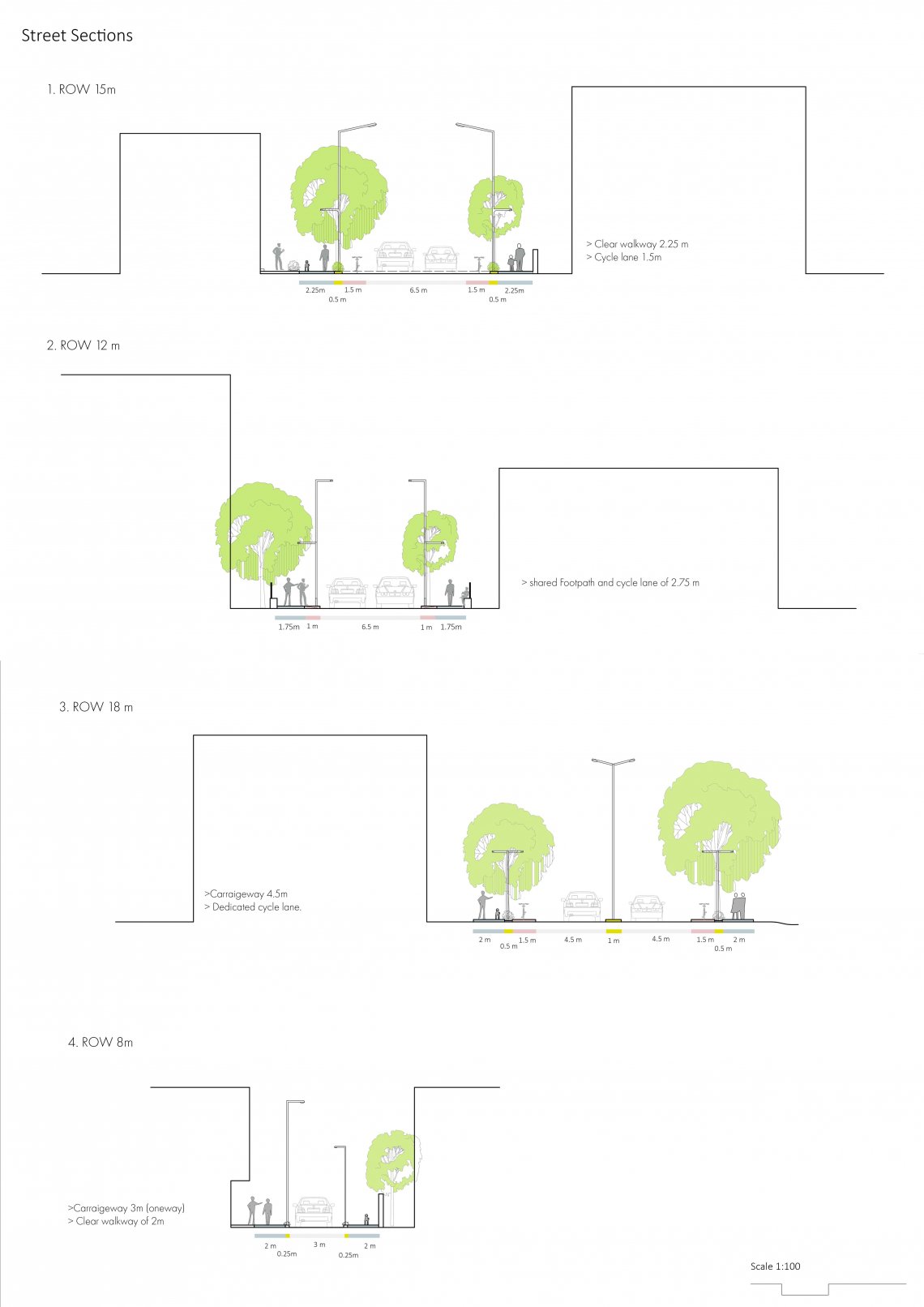
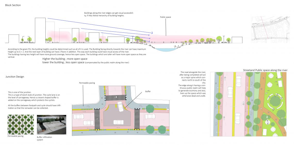
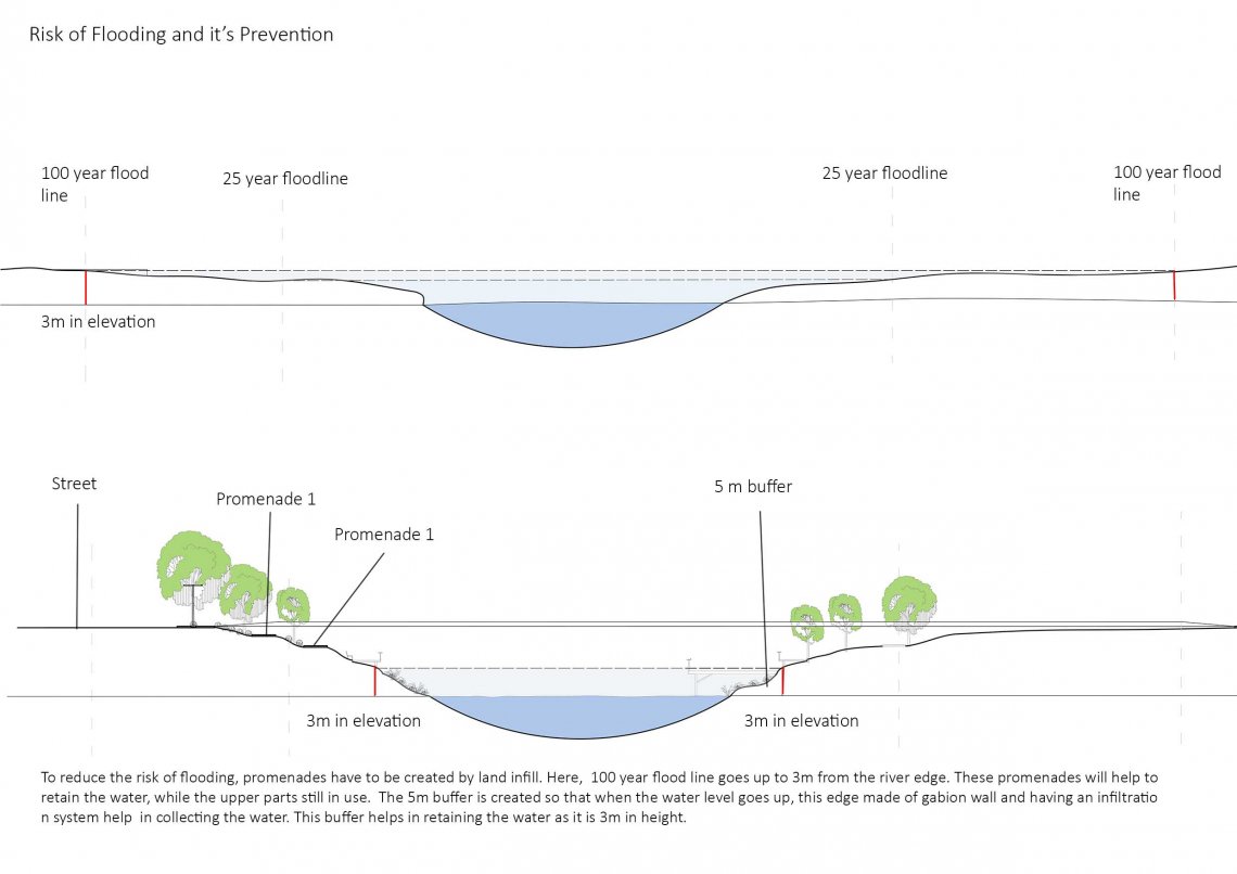
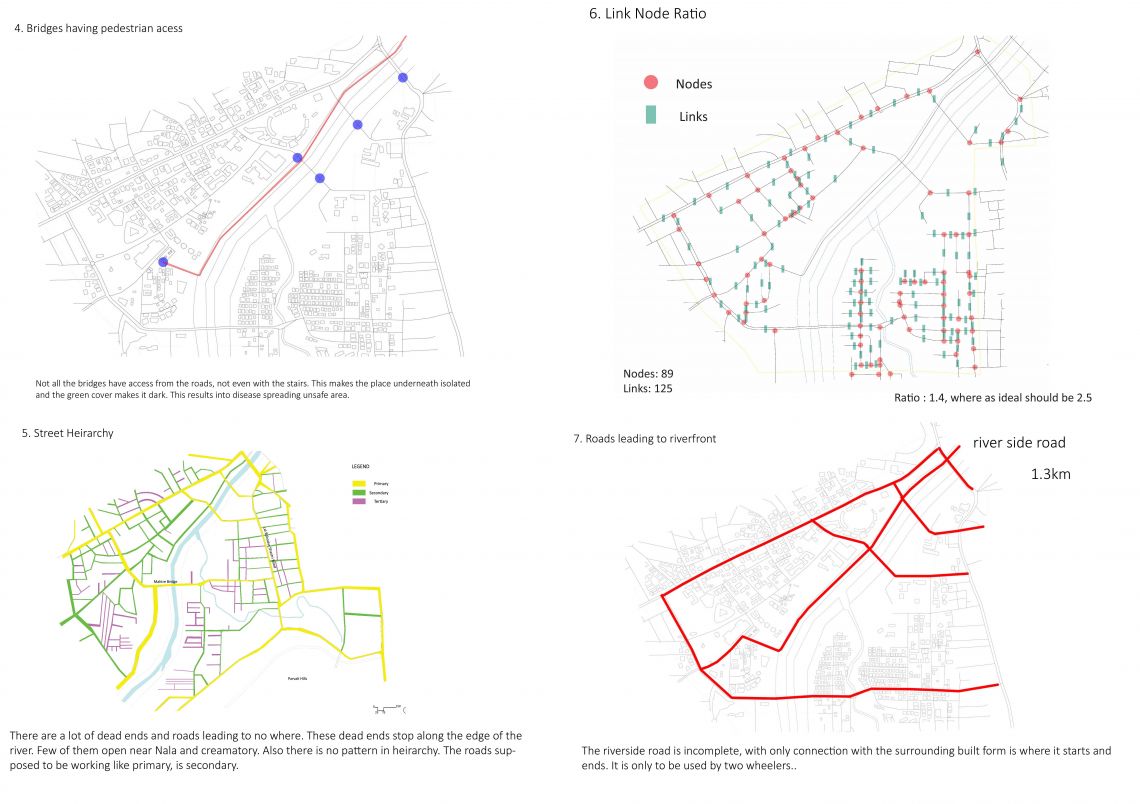
The two sides of the river acted as two different entities. Instead of being a connecting point it divided it. The integration of it had to be done. The main objective was to strengthen city’s relation with the waterfront. This could be done by increasing accessibility and creating a continuous public realm along it. The river edge of Pune has unutilised land along it’s stretch. The lack of public space, which was about 3.1% on the site had to be increased, as it is very less in comparison to the area of 3.6 sq.km. The lack of accessibility towards and across the river also resulted into this utilised land. If accessibility could be increased, it could serve purpose of mobility and an active public realm. This will increase in social interaction and safety which was otherwise unsafe as nobody would go. The visual accessibility is also taken into consideration, by giving details of the block and heights. The streets have cycle tracks with continuous pedestrian walkway. The buffers facilitate stormwater drainage.