Your browser is out-of-date!
For a richer surfing experience on our website, please update your browser. Update my browser now!
For a richer surfing experience on our website, please update your browser. Update my browser now!
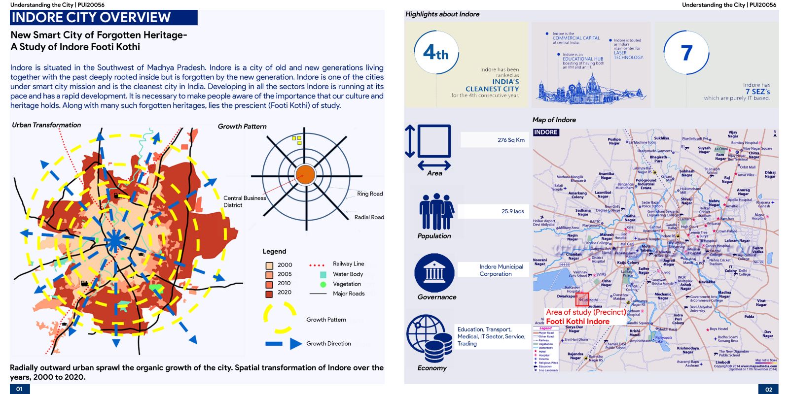
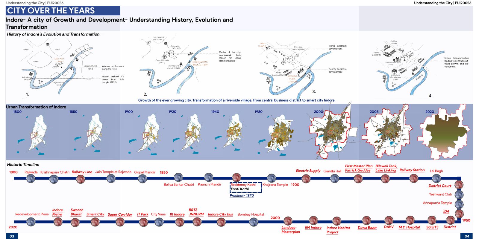
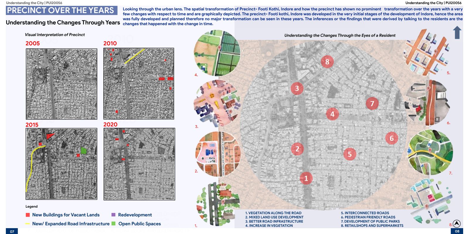
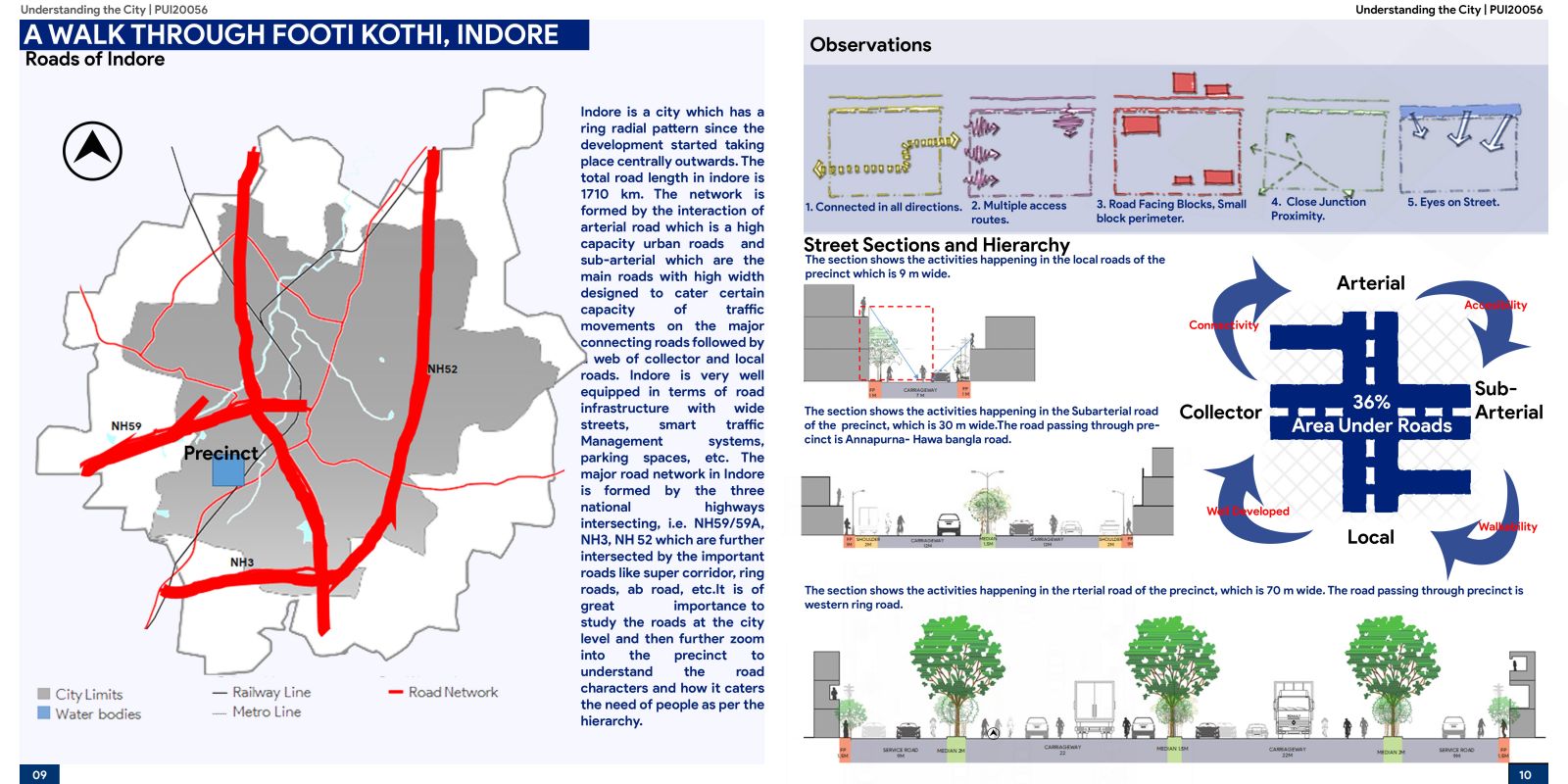
The analysis which is done on the selected study area Footi Kothi in the city of Indore, M.P. talks about the transformation that took place over a decade and the factors that contributed to this transformation. A detailed study on satellite imagery is being done by generating various maps supported and verified by field visits which gives an understanding of evolution, transformation, street patterns, built infrastructure, etc, which are also supported by secondary data like Household surveys and Census Data.The portfolio shows the Understanding of the City, based on various urban parameters and how it functions to meet the needs of the people. It aims to document the study of an urban area - Footi Kothi located in Indore and how it has grown and evolved over time. It gives an overall spatial analysis to understand the city and what are the factors contributing in making a city work.
