Your browser is out-of-date!
For a richer surfing experience on our website, please update your browser. Update my browser now!
For a richer surfing experience on our website, please update your browser. Update my browser now!
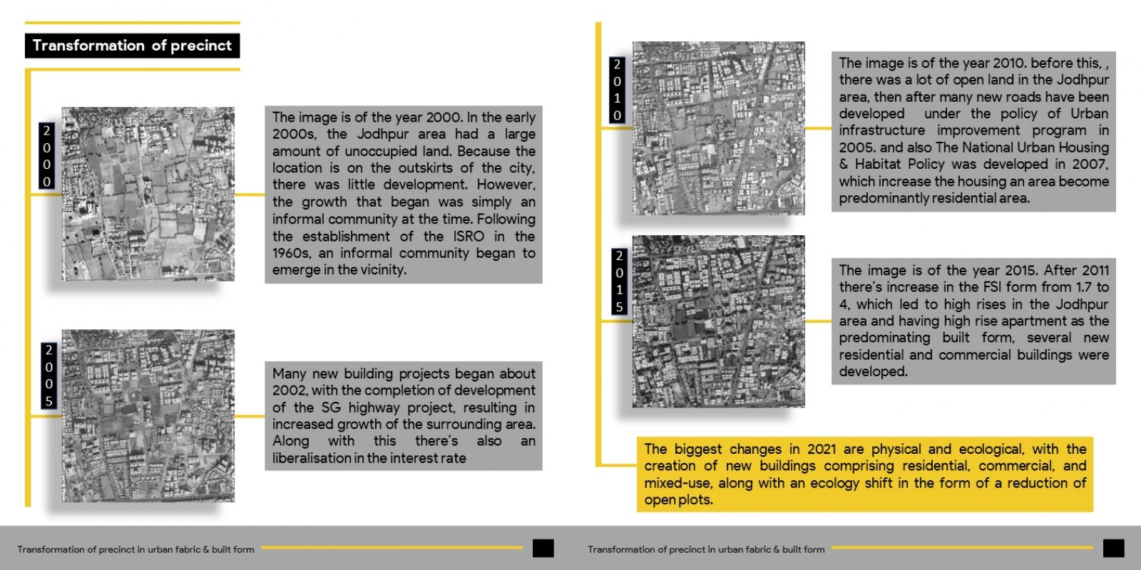
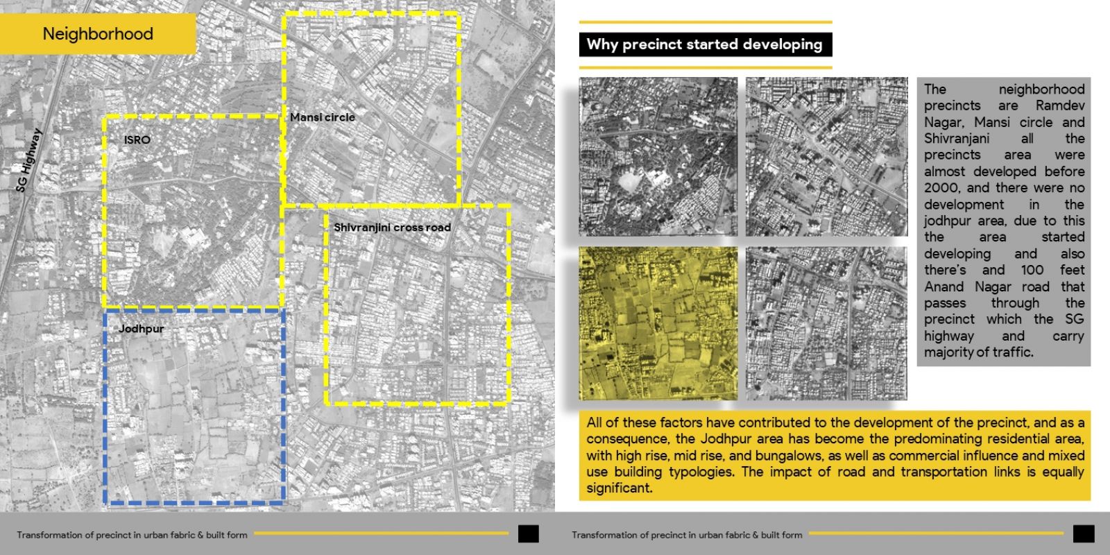
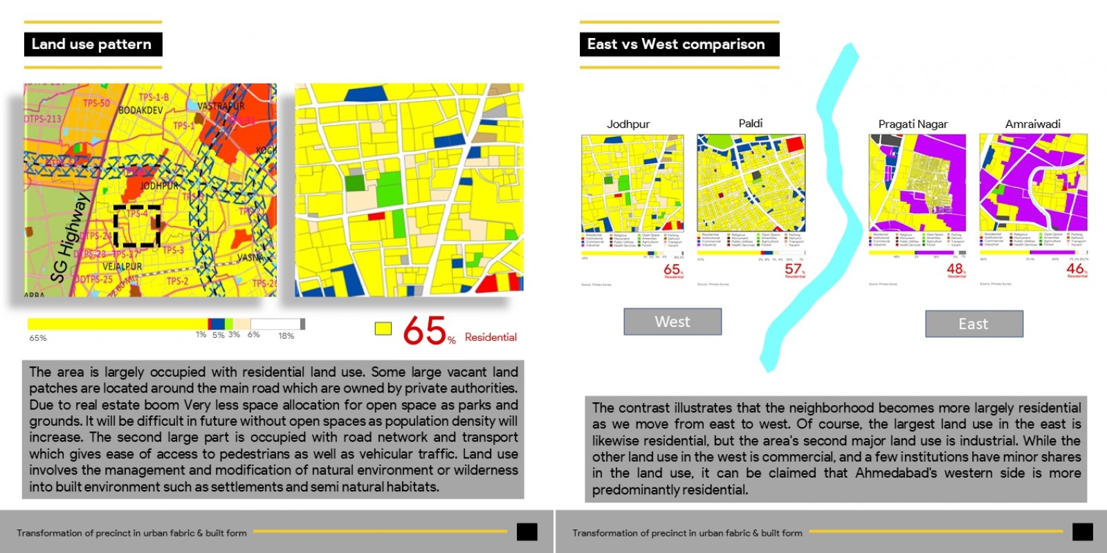
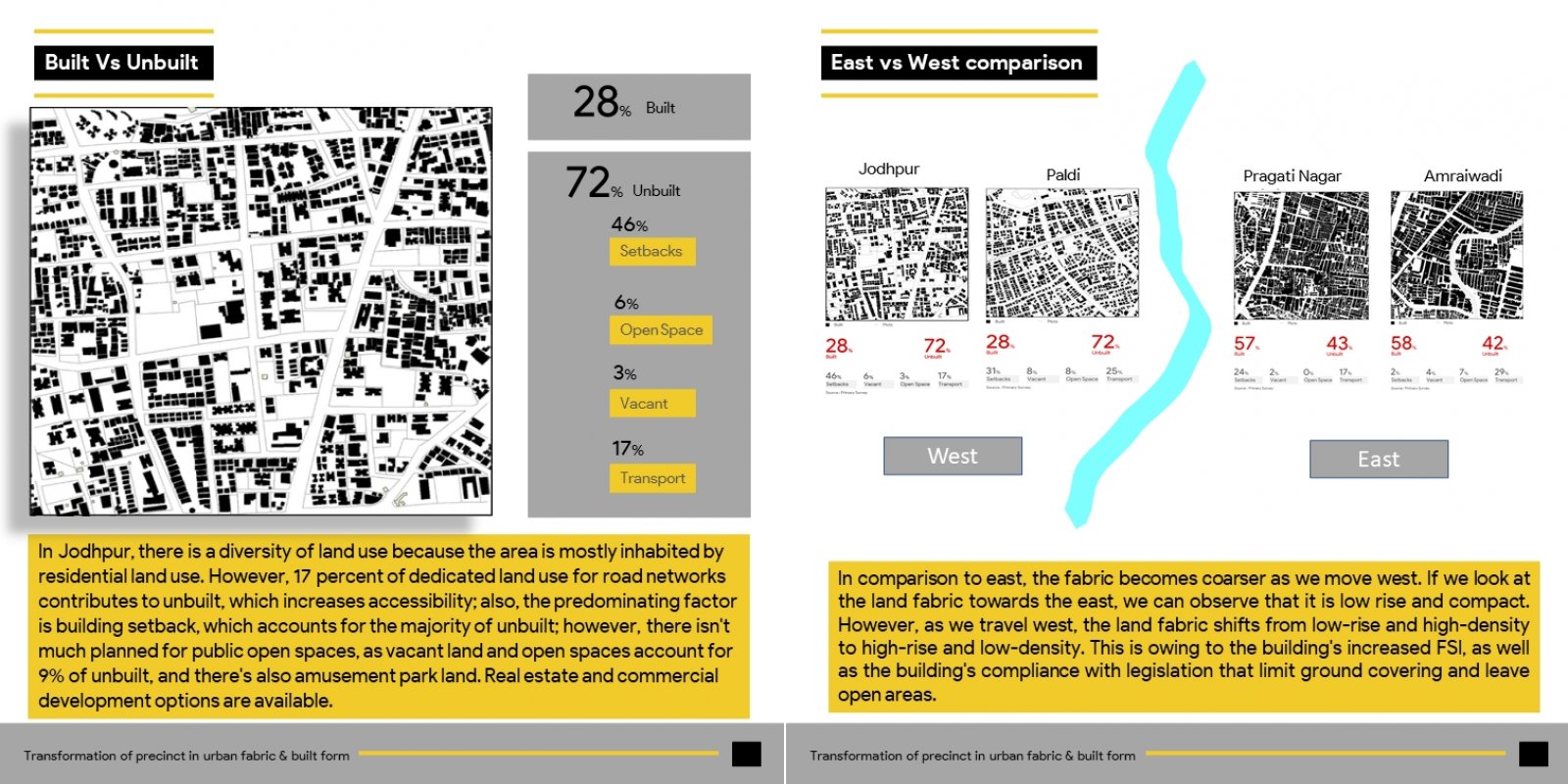
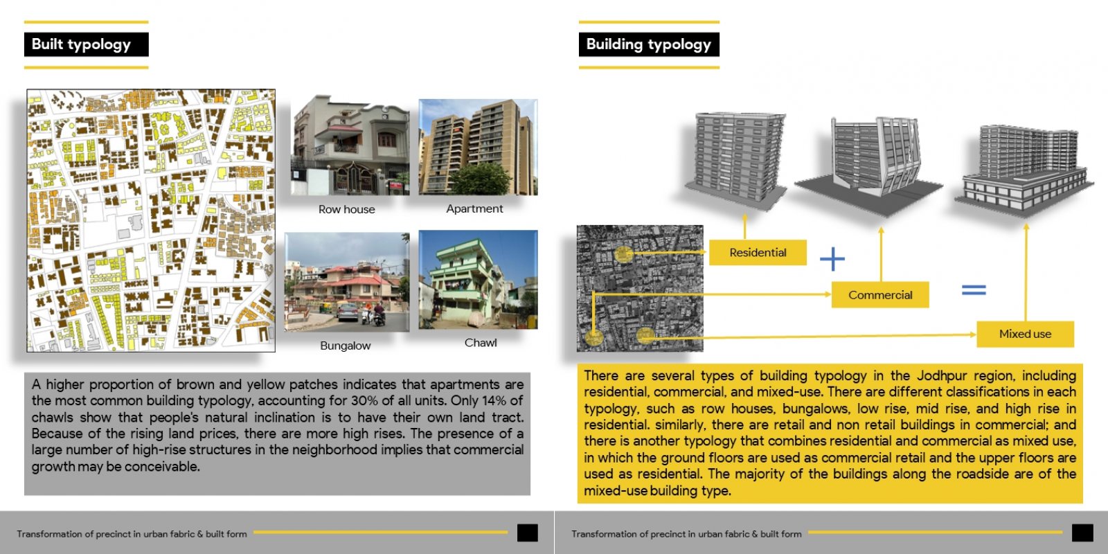
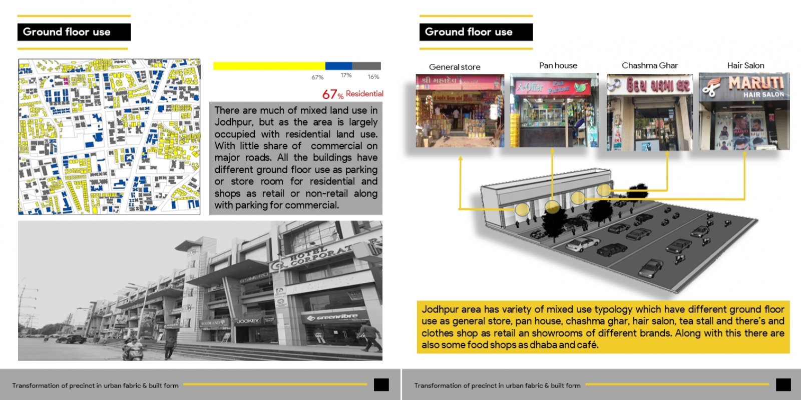
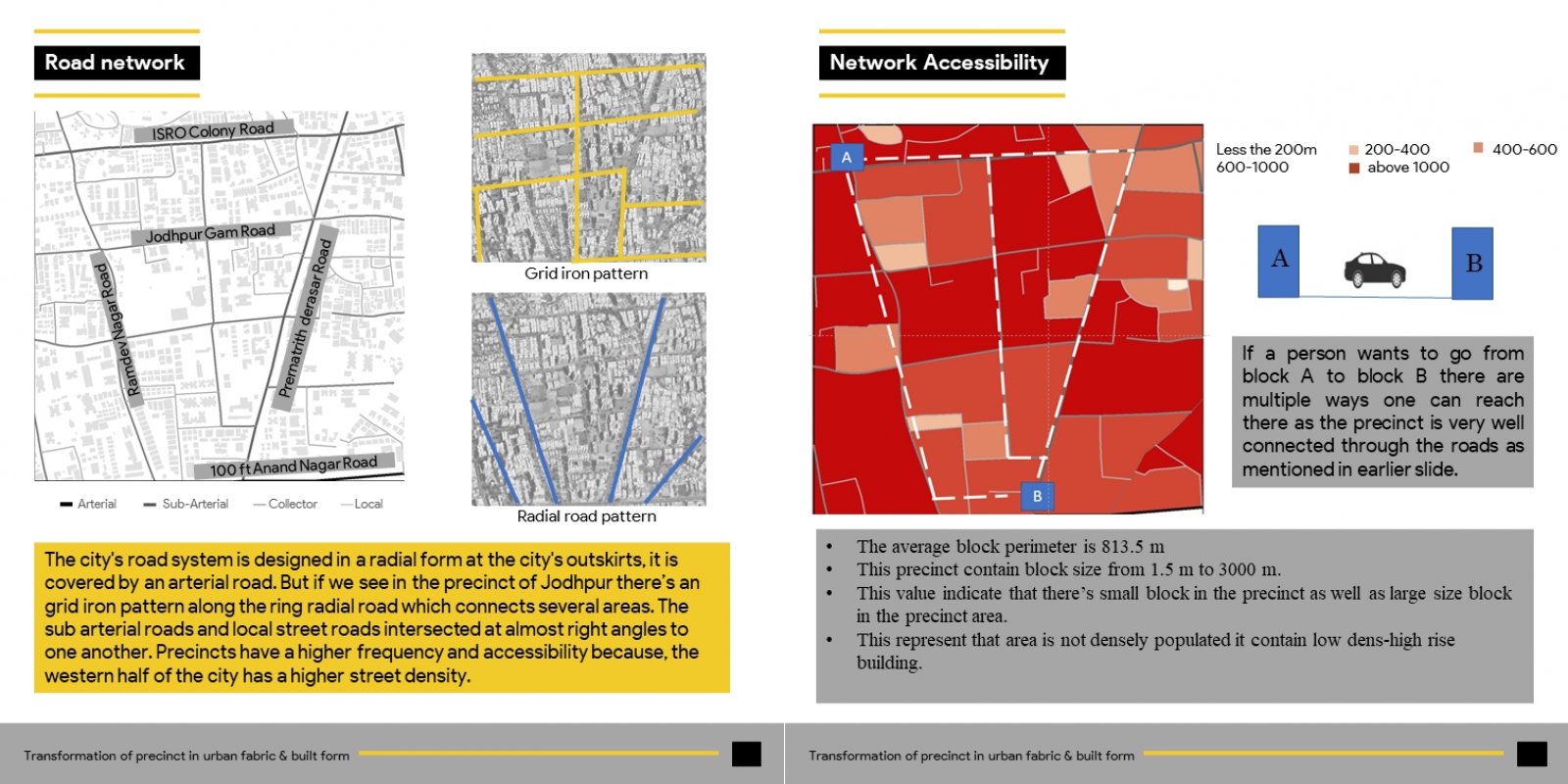
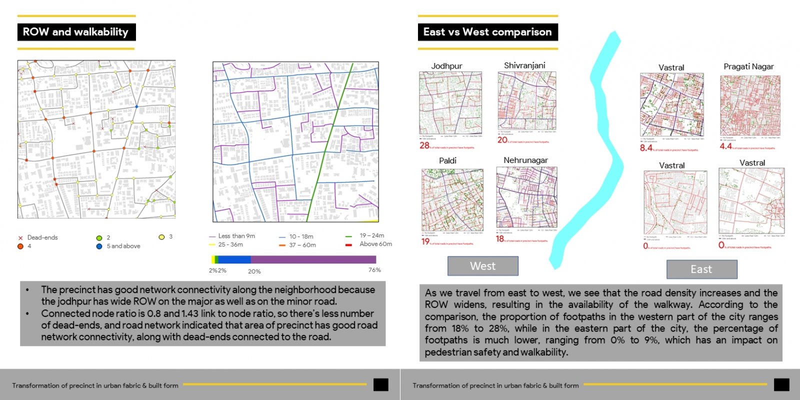
The text focuses on primary observation of the Jodhpur area with the help of aerial & satellite imagery of 1 sq. km which is selected for the analysis, The precinct area is developed in gridiron pattern and ring radial system. it is a predominantly residential area with high rises and row houses. It also focuses on how roadside development led to the real estate and commercial development within the area which comprises the connectivity to SG highway. The text analyses the "Transformation of the precinct in the urban context as urban fabric & built form" of the Jodhpur area. It consists of observations regarding history, road network pattern, built form & land use development.

