Your browser is out-of-date!
For a richer surfing experience on our website, please update your browser. Update my browser now!
For a richer surfing experience on our website, please update your browser. Update my browser now!
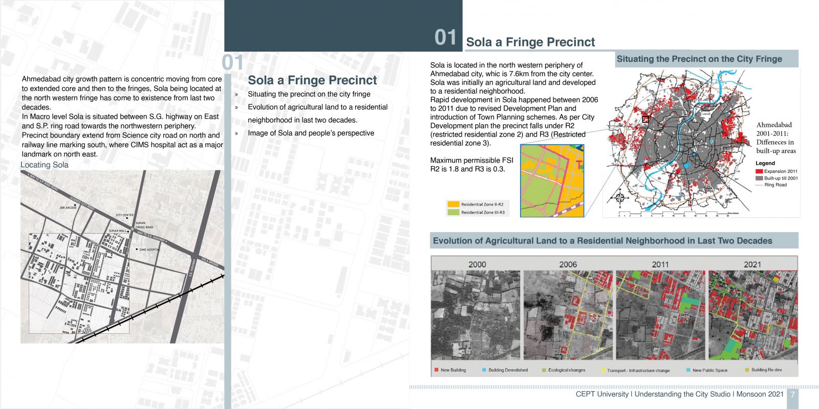
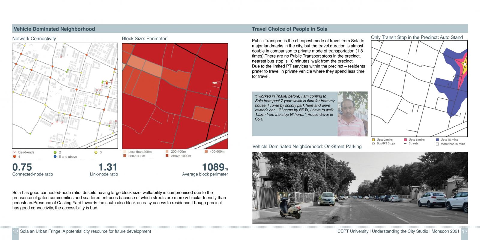
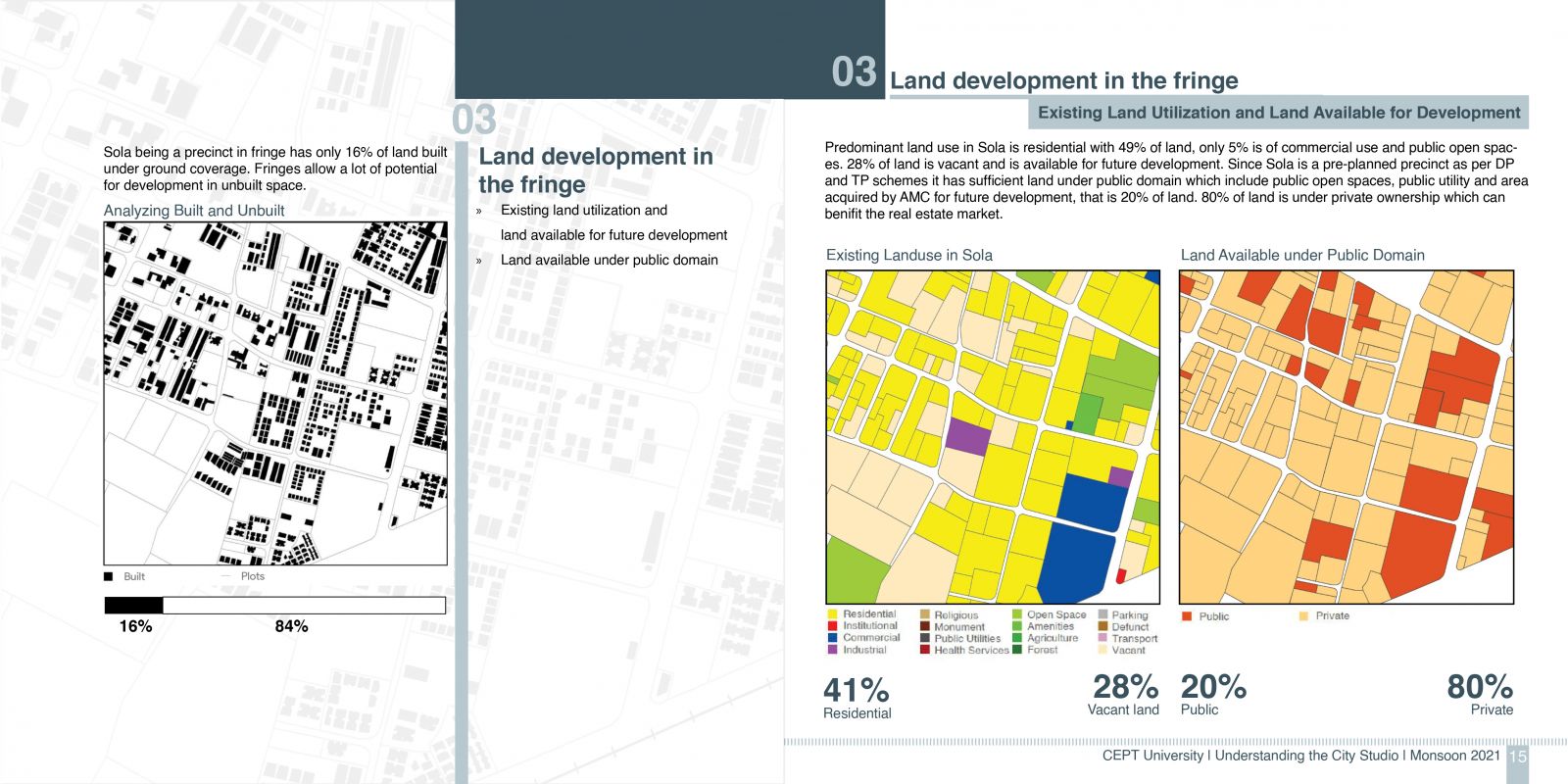
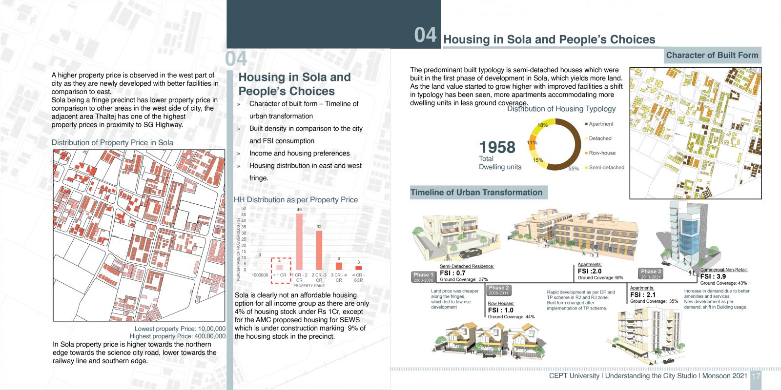
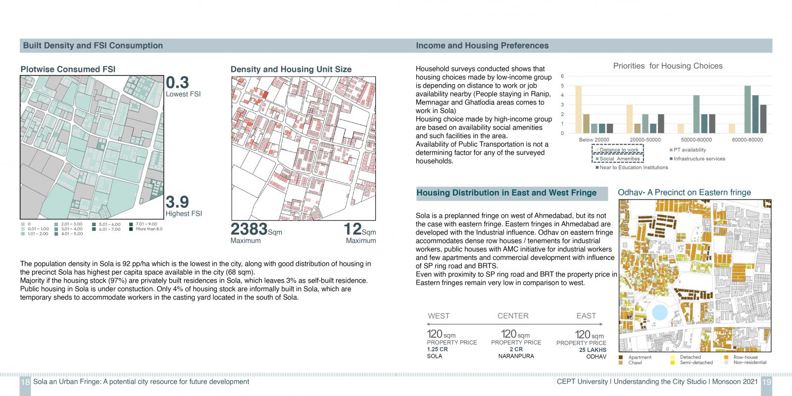
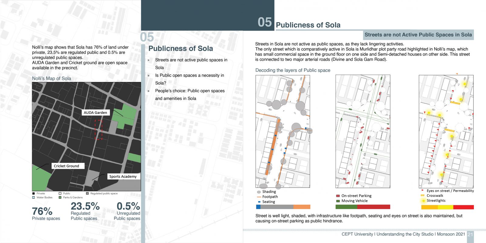
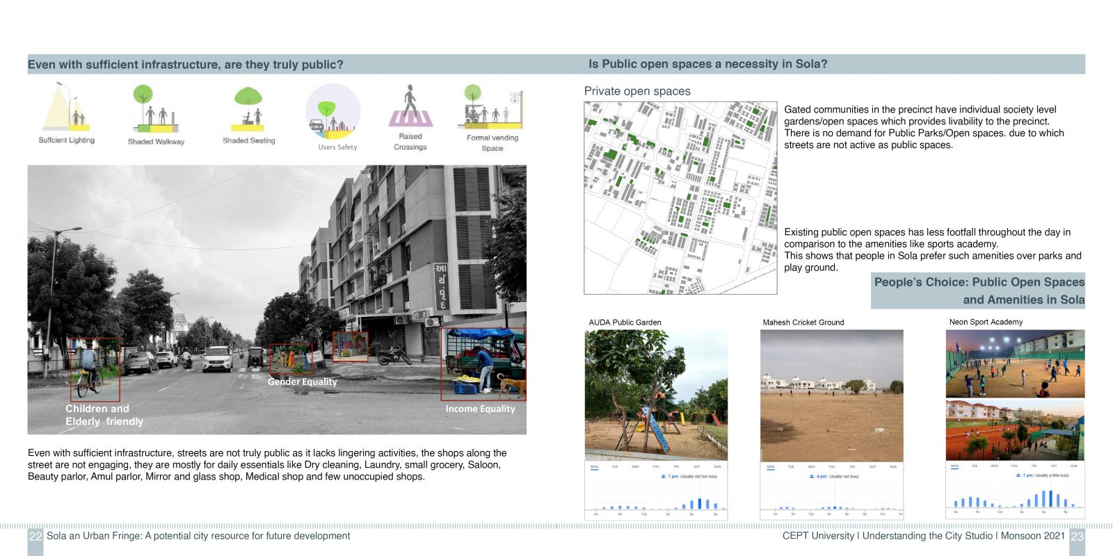
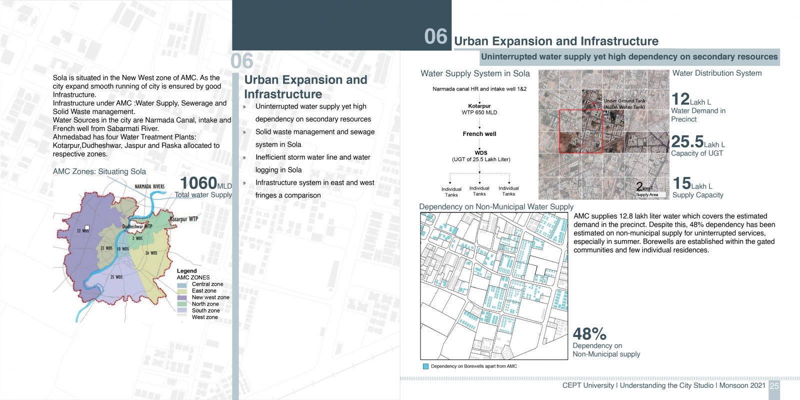
Sola is a precinct located 7.6km away from city center, along the north western fringe of Ahmedabad city. Sola will be analyzed based on various parameters like land development and built form in the fringe, which is evolved completely in the past two decades as per development plan and town planning schemes. Following parameters would be analyzed through the lens of a fringe precinct: existing land use pattern, built from and distribution of housing stock, road network and accessibility, infrastructure and services, publicness and people choices of housing, job and travel. Data collection was done through surveys and secondary sources. Maps and data are generated in Geographic Information System (GIS). The studio scope was deep understanding of various layers of development and thus no proposal are made in this portfolio.
