Your browser is out-of-date!
For a richer surfing experience on our website, please update your browser. Update my browser now!
For a richer surfing experience on our website, please update your browser. Update my browser now!
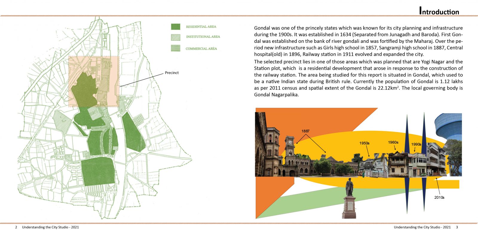
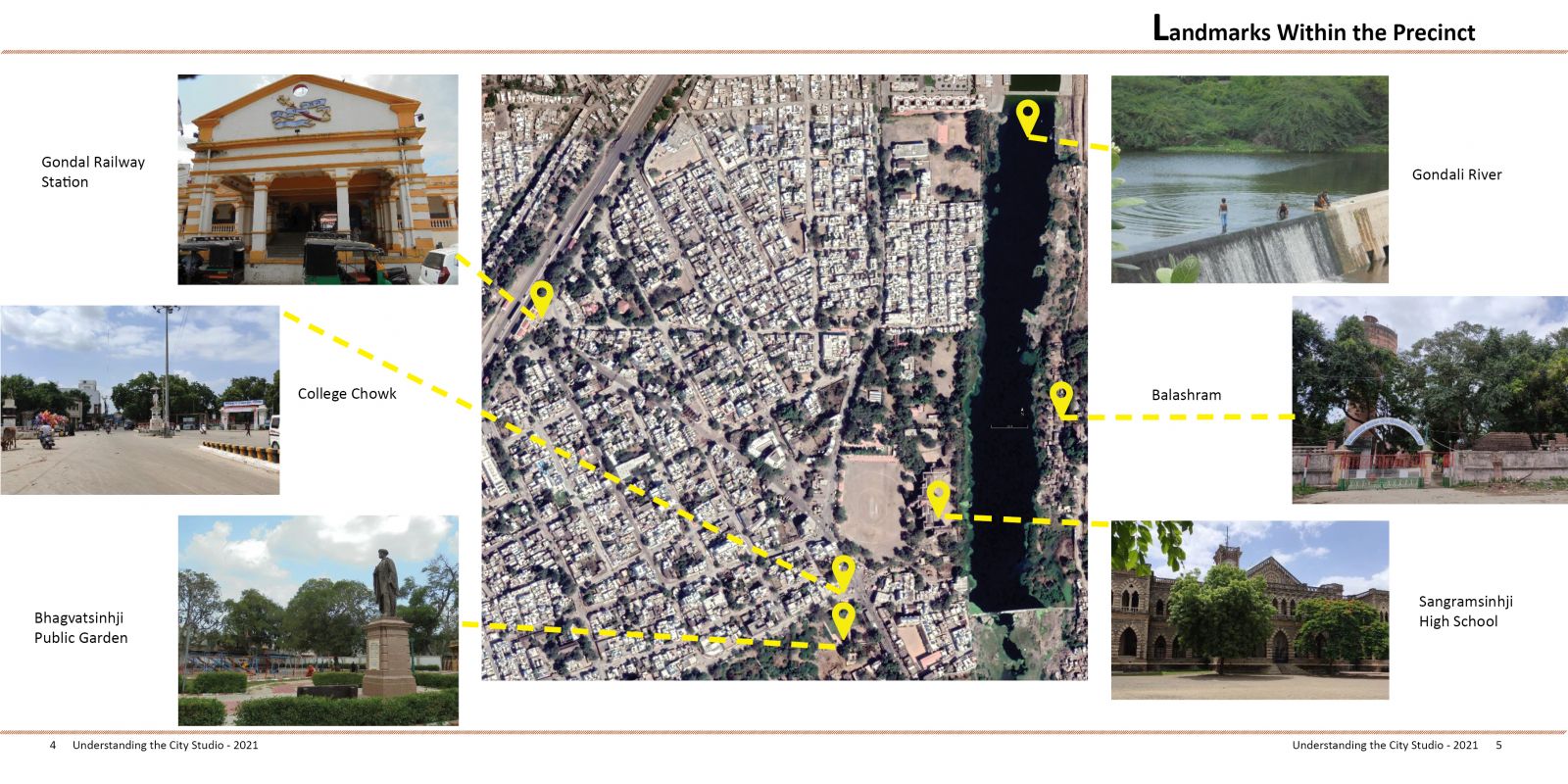
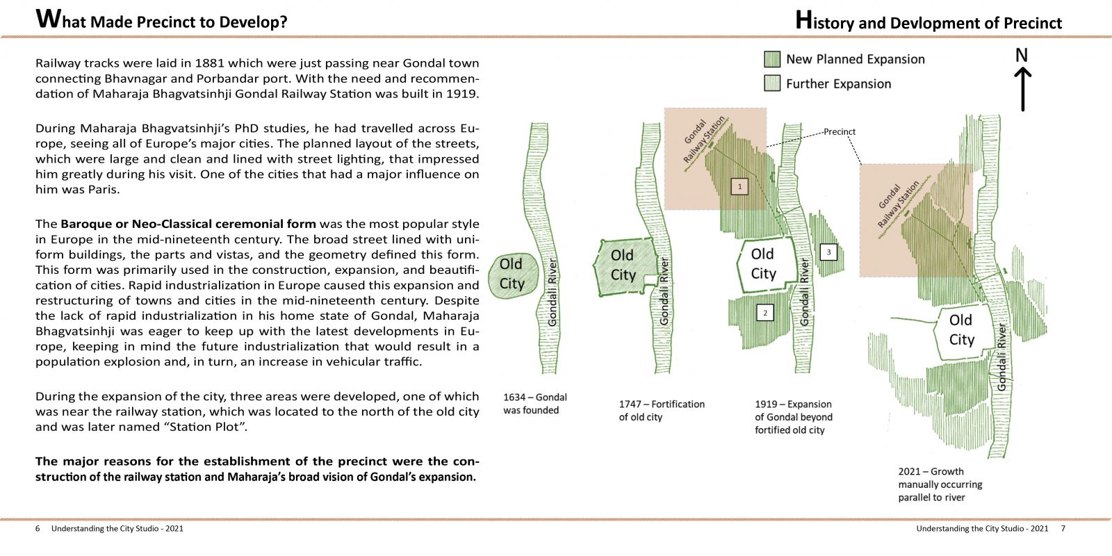
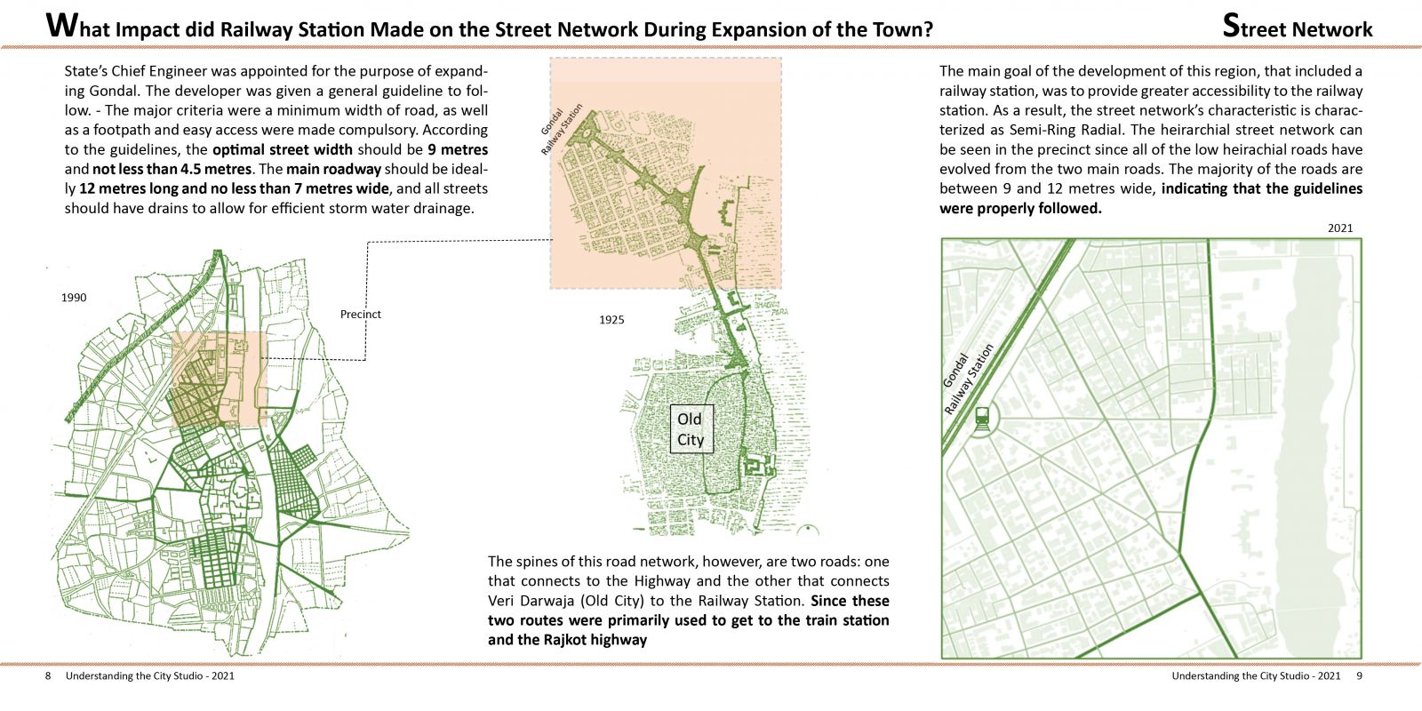
Gondal was one of India’s princely states. Previously located on the ancient Kathiawar peninsula of Gujarat, Gondal is presently located in the Rajkot district of the Saurashtra region. During colonial times, Gondal was highly recognized for its city planning and infrastructure, such as the railway station and Sangramsinh high school. On the west bank of the river Gondali, Gondal was developed linearly (vertically) in the 1560s. It got separated from the states of Rajkot, Junagadh, and Baroda in 1634. It was merely a typical town on the west bank of the river at the time. As a city, it grew and expanded. From 2000 we can see the steady change that is only in policies i.e. new TP schemes (Town Planning schemes), Widening of roads, increase in the use of solar power generation, etc.