Hirani Ashvin Bhaveshbhai

UP4002-4

Understanding Amdupura

This work will address the high-density urban habitation problems of Amdupura through chawls, underutilized industrial zones, and inadequate public infrastructure. The main objectives are walkability, strengthening connections of public transport, and solving waterlogging issues and waste management. The study will explore the sustainable land use approach to optimize available space with mixed-use development initiatives and equitable public spaces. Thus, the precinct will be well-designed to be livable, economically dynamic, and environmentally sustainable.
Report Content

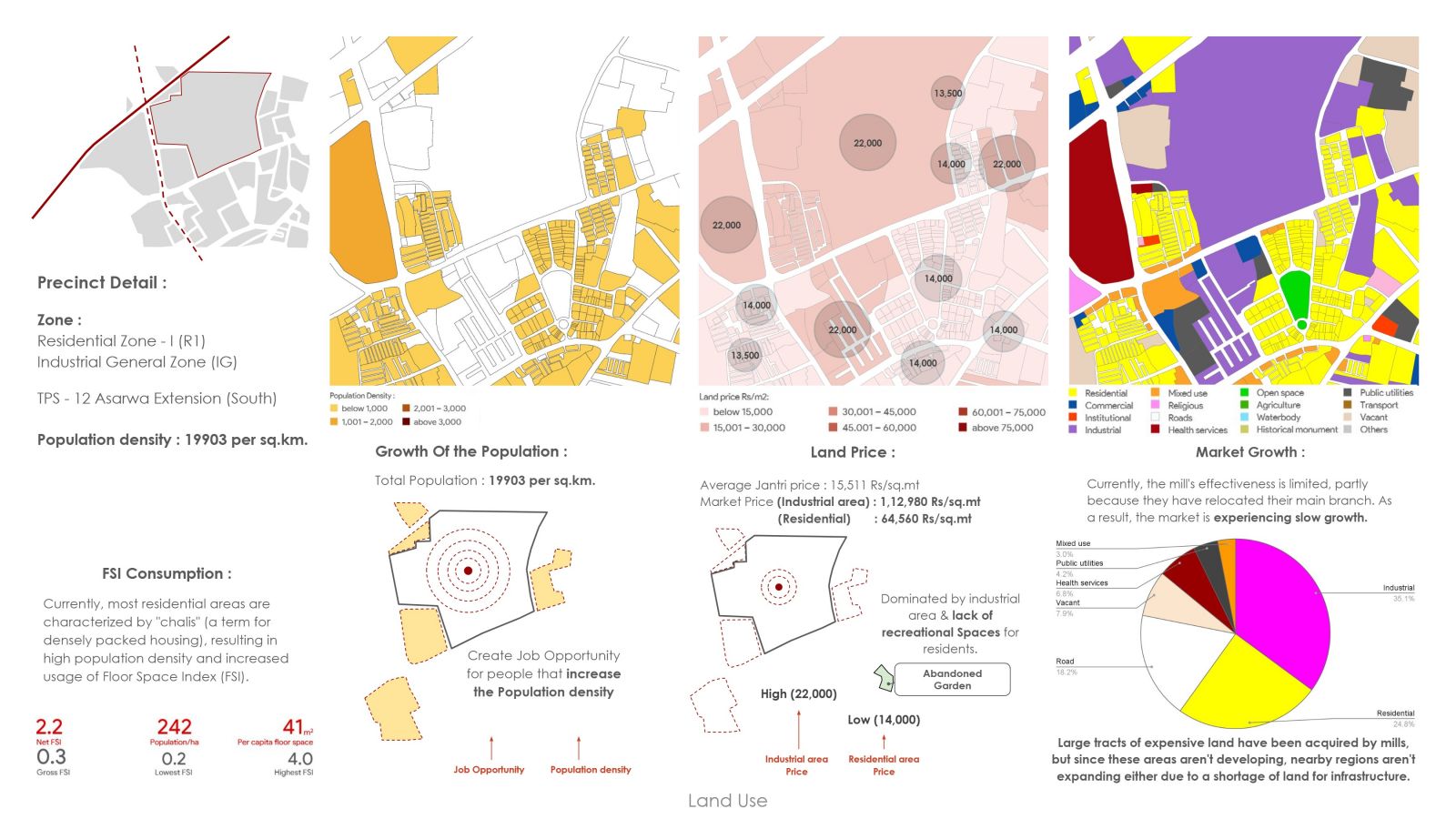
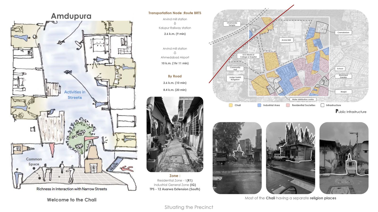
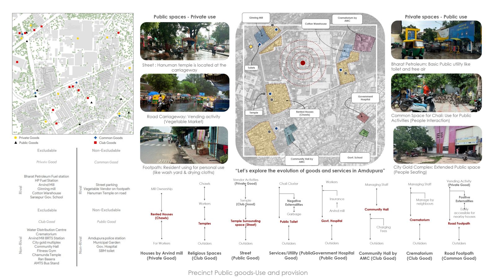
The region is organized around "chalis" or clusters of closely packed residences, with slender thoroughfares acting as living social spaces. Public infrastructure in the form of hospitals, schools, and community halls exists; however, it suffers from inequitable access because of land configuration and usage.

Public and private spaces often become blurred with streets and open areas turned into places to vend or to conduct religious activities. Although public goods such as public places are accessible to residents and outsiders, informal activities produce litter accumulation and traffic congestion.

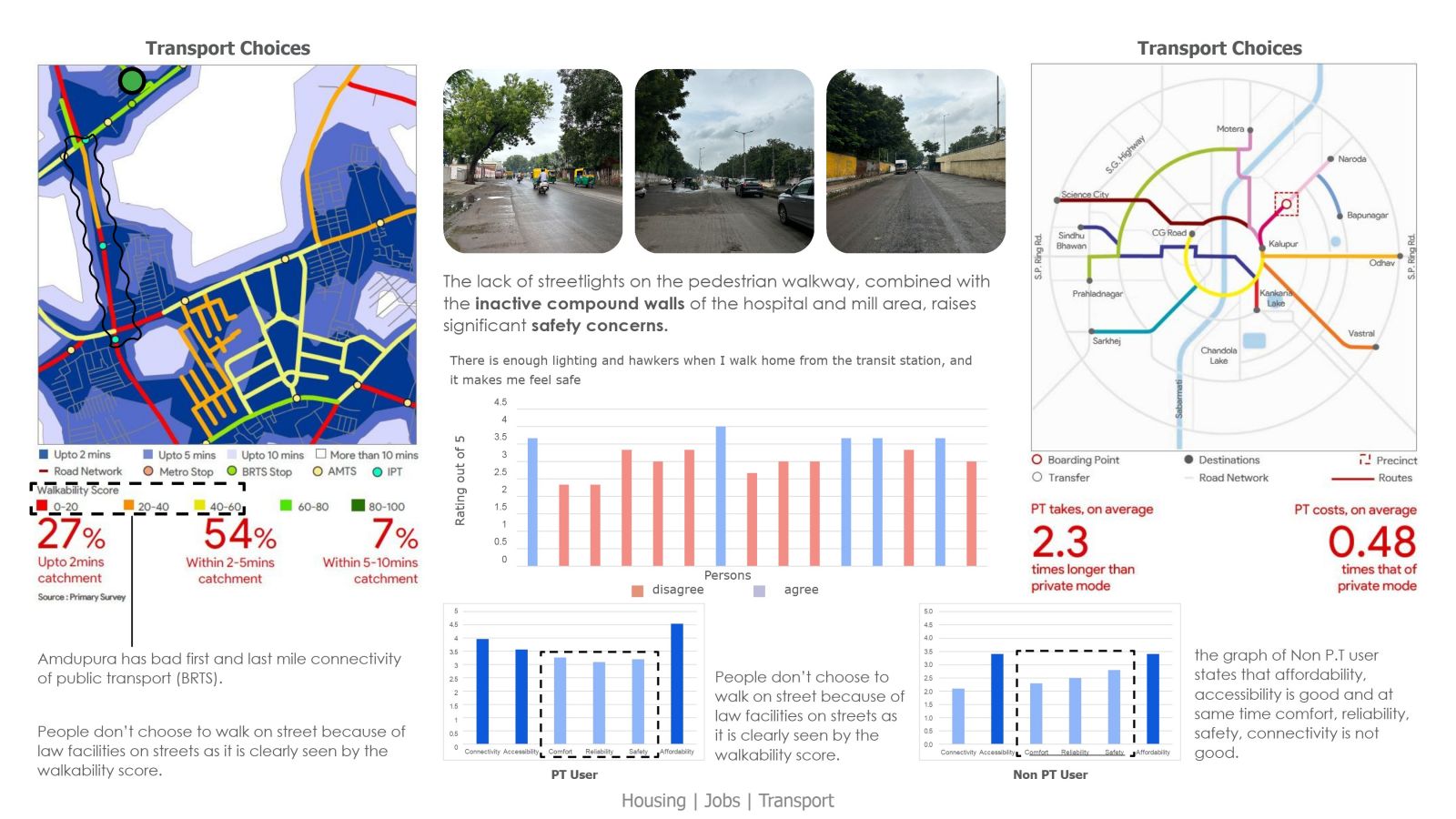
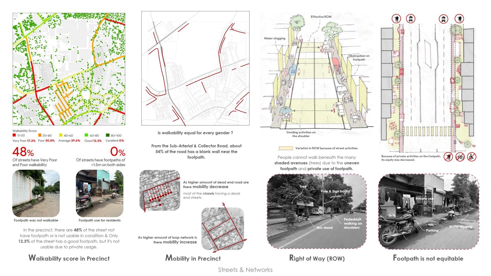
The area records poor walkability, whereby 48 percent of the streets scored poorly due to lack of pedestrian pathways and encroachment. Dead-end roads and uneven sidewalks all contribute to limiting mobility and safety for pedestrians.

It is essentially industrial and residential. Open spaces, though scarce, are very few, and recreational areas also limited. A greater chalis population density increases demand for infrastructure, while unused mill grounds idle.

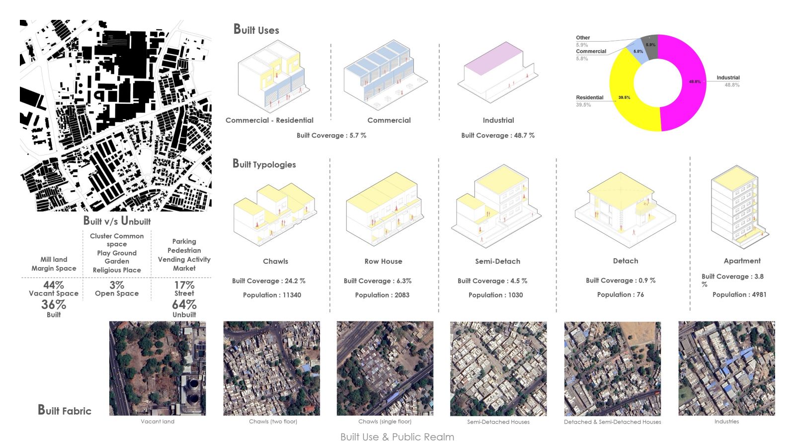
Built fabric is concentrated in industrial as well as chawl clusters, and unbuilt spaces typically take over the street space or vacant mill land. The commercial boundaries usually show improper setbacks, which allows for intrusion and unregulated use.

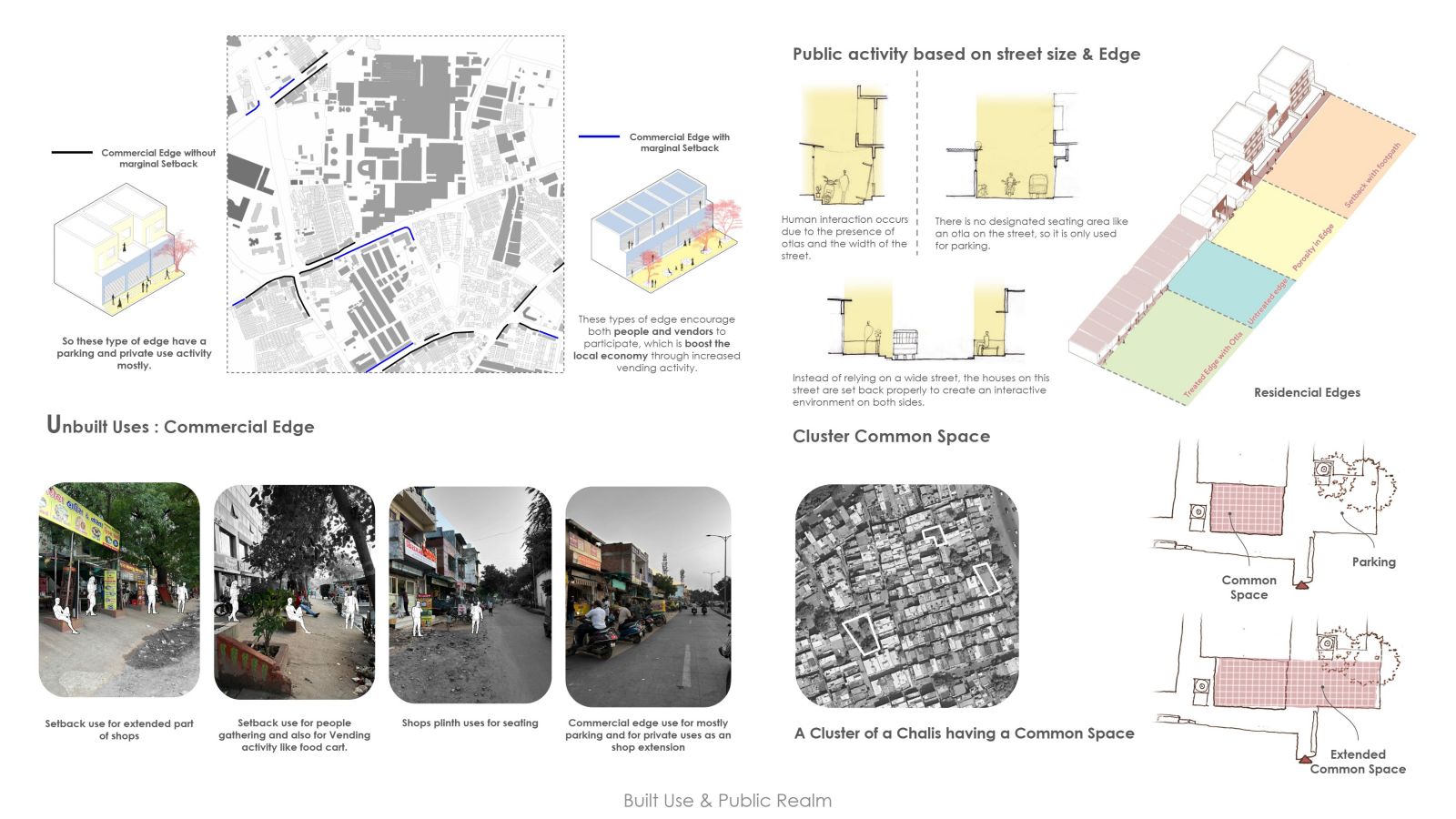
Commercial boundaries with insufficient setbacks lead to incursions and unauthorised private use, while setback plans encourage vending business and public interraction, thus boosting the local economy. Residential boundaries with "otlas" promote community interaction; however, without such boundaries lead to unstructured areas. Shared communal areas of "chalis" play an important role in building social amalgamation; however, require sound planning and upkeep to utilize their full potency.

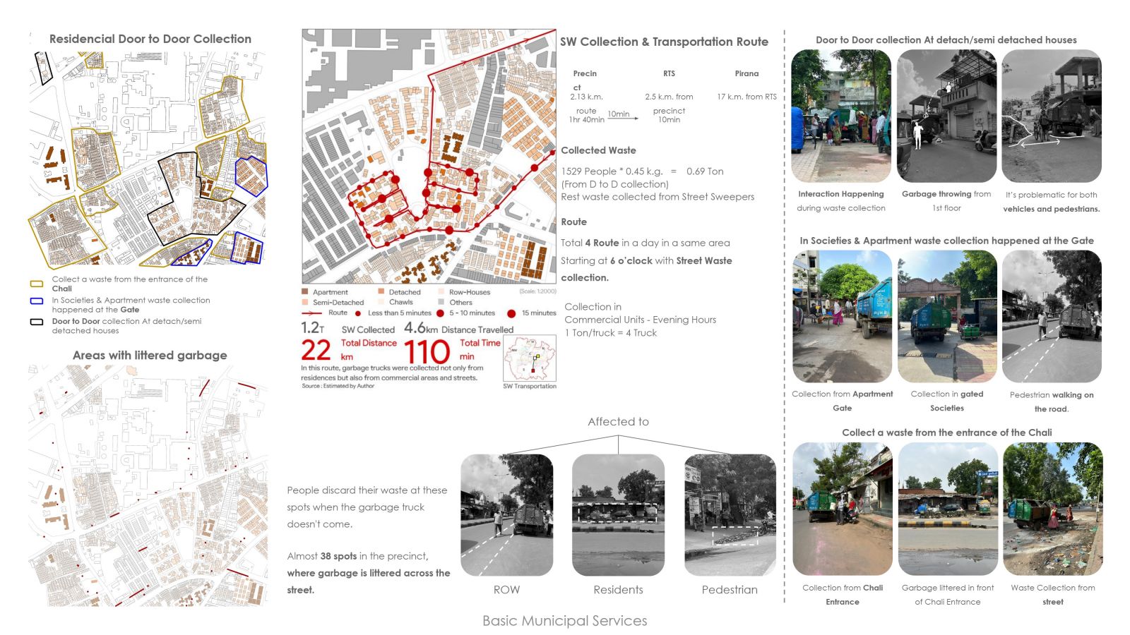
Waste collection systems are not uniform, and thus there is littering and improper garbage disposal in various places. Door-to-door collection is hampered by congestion and inappropriate collection points.

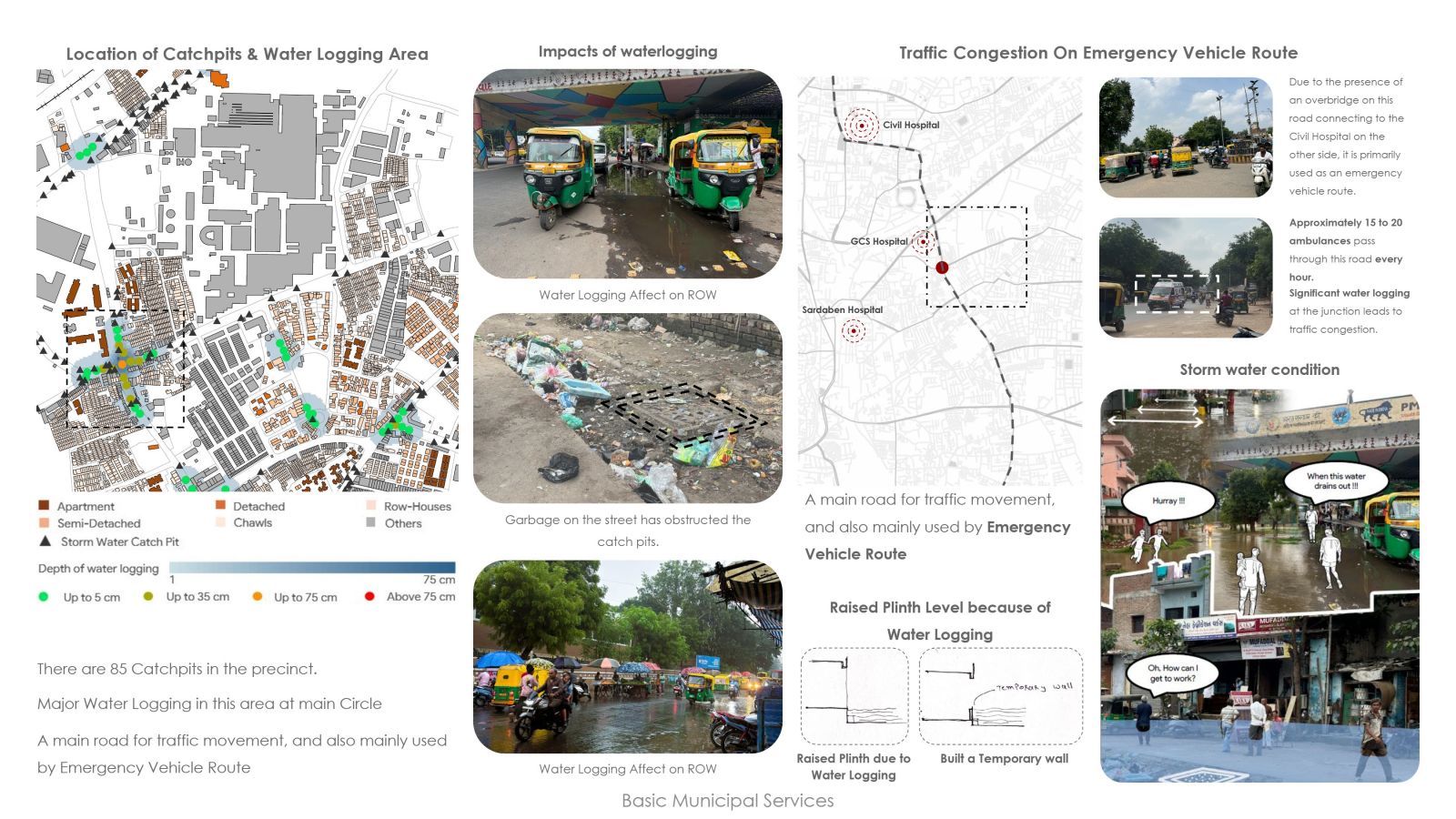
Blocked catchpits and inadequate stormwater drainage rank among the important issues within the precinct, especially waterlogging on the main circle. It causes traffic congestion, especially in routes used by ambulances which operate on emergency routes. Artificial temporary measures like raised plinths are adopted frequently, but sustainable solutions must be implemented urgently.

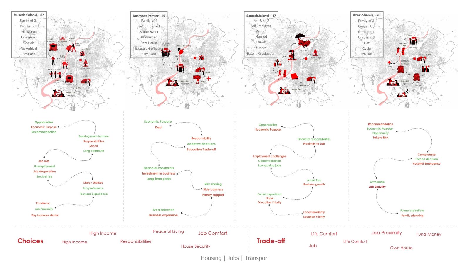
Most of the residents make choices based on the underlying reasons such as economic opportunities, the distance between jobs and responsibilities, with related trade-offs for education compromises or long commutes. Financial factors and job security present reasons to place affordability over comfort or aspirations. Variation in circumstances calls for policies to promote economic stability, mobility, and housing security.

Amdapura has poor connectivity, both first and last mile, with low walkability due to lack of proper footpaths as well as safety concerns about unlit streets and inactive compound walls. Public transport takes 2.3 times longer than private modes, though it is cheaper; hence, it is less preferable. Improved street infrastructure and safer access on pedestrian bodies are warranted to enhance the usability of public transport and overall mobility.